An online project under the direction of the CAPE ANN MUSEUM
Catalogue Entry
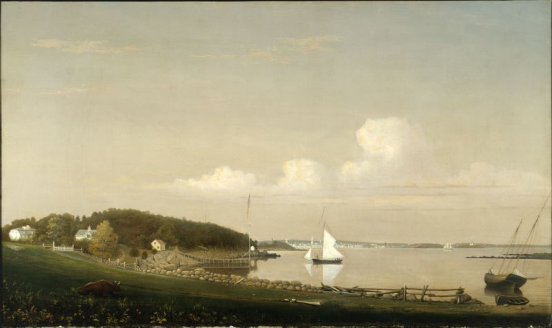
Lane made several paintings of Fresh Water Cove and the ancestral home—Brookbank—of Gloucester businessman Samuel Sawyer. Sawyer was a patron of Lane's and a dedicated supporter of the Gloucester Lyceum, which became the Sawyer Free Library. This painting commonly has been given a date of c. 1856, although Brookbank has architectural changes in this picture which are not evident in a later work, Brookbank, The Sawyer Homestead, 1860 (inv. 216) of 1860, suggesting that this picture was painted closer to 1860. Additionally the smokestack for the Burnham Brothers marine railway appears to be much taller than in Three Master on the Gloucester Railways, 1857 (inv. 29).
Brookbank abutted the public landing at Fresh Water Cove and it was that tract of land on which Lane either sat or stood when he did the drawings that correspond to this painting and others in the series. Although most of the paintings of Brookbank have drawings that directly correspond with them, no such drawing is known to exist for this painting.
As one of the earliest pockets of settlement in Gloucester, Fresh Water Cove was a logical and practical place for a public landing to be located, and indeed one was laid out there by the town’s founders. It was over this tract of land that granite from the upland quarry, located in what is now Ravenswood, was transported to awaiting sloops in the Cove. The landing was also where shore fishermen would access their boats and carry supplies to and from their homes. Public landings were designated across Cape Ann. Public access to the water has gradually constricted in recent decades, but even during Fitz Henry Lane’s lifetime, landowners guarded their property rights fiercely, making public landings all the more important.
– Martha Oaks
Historical Materials
Samuel Sawyer Papers
Cape Ann Museum Library & Archives
Archive Collection exp016
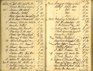
"November 8. Lane. Homestead
Frame at Balch
Museum &c. &c."
Filed under: Balch, William Y. » // Diaries / Ledgers / Etc. » // Sawyer, Samuel »
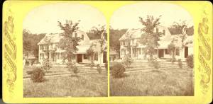
Brookbank was an early eighteenth-century white gambrel-roofed house on Fresh Water Cove which was owned and occupied by Samuel Sawyer and his ancestors. It is possible to trace apparent renovations to the house through Lane's pictures; at first it is depicted as a white house without dormers and a simple brown barn Fresh Water Cove, Gloucester, c.1864 (inv. 112); then dormers appear on the house and the barn is white with a cupola Fresh Water Cove, etc., from Dolliver's Neck, 1850s (inv. 113). In Gloucester from Brookbank, 1848 (inv. 42) a cobb wharf (log cabin-like structure) and boardwalk are visible. By Fresh Water Cove from Dolliver's Neck, Gloucester, Early 1850s (inv. 45) the house seems to have additions.
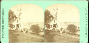
Stereograph card Cape Ann Museum Library & Archive
Stereo view of Brookbank guest house or boathouse.
Also filed under: Historic Photographs »
Published by Frank Rowell Cape Ann Museum Library & Archive
Stereograph card
Also filed under: Historic Photographs »
n.d. Stereographic card Cape Ann Museum Library & Archive
Penciled on reverse: "Mansion House, Brook Bank [sic], Sam'l Sawyer now Hammond, Freshwater Cove"
Also filed under: Historic Photographs » // Sawyer, Samuel »

44 x 34 in.
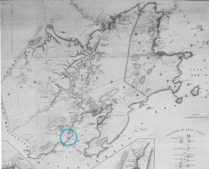
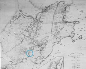
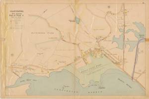
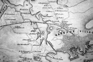
Henry Francis Walling, Map of the Towns of Gloucester and Rockport, Essex Co. Massachusetts. Philadelphia, A. Kollner, 1851
Cape Ann Museum Library & Archive
"Map of the Towns of Gloucester and Rockport, Massachusetts. H.F. Walling, Civil Engineer. John Hanson, Publisher. 1851. Population of Gloucester in 1850: 7,805. Population of Rockport in 1850: 3,213."
Also filed under: Annisquam River » // Dolliver's Neck » // Fresh Water Cove » // Gloucester Harbor, Outer » // Maps » // Norman's Woe » // Stage Rocks / Stage Fort / Stage Head » // Steepbank » // West Gloucester – Little River » // Western Shore »
Samuel Sawyer Papers
Cape Ann Museum Library & Archives
Archive Collection
"August 25. Called to see Mr. Lane to make a sketch of old Homestead for Haughtons."
Also filed under: Diaries / Ledgers / Etc. » // Haughton, James » // Sawyer, Samuel »
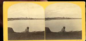
1860s Stereograph card Cape Ann Museum Library & Archive
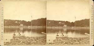
A view of a Cove on the western side of Gloucester Harbor, with the landing at Brookbank. Houses are seen in the woods back. A boat with two men is in the foreground.
Also filed under: American ensign / flag » // Fresh Water Cove » // Historic Photographs »
Stereograph card
Cape Ann Museum Library & Archive
Also filed under: Fresh Water Cove »
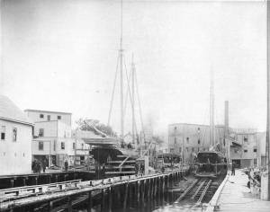
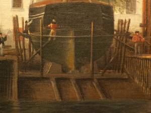
Lane was commissioned by his neighbor John Trask to paint a sign for his shop at the Burnham Brothers' Marine Railway, as seen in Three Master on the Gloucester Railways, 1857 (inv. 29). The railway, built in 1849-50, was a vital component of the ship building and repair trade, allowing large ships to be hauled out of the water to repair and clean the hulls. Originally there was just one railway, but a second was added due to increased demand. It consisted of a heavily reinforced timber structure anchored with iron spikes and topped with pairs of iron rails fitted with cast iron rollers. The vessel was hauled onto a wood cradle using a steam-powered winch, where it remained, blocked to prevent movement, for the duration of the repairs. Upgrades to the steam power plant can be observed when comparing the height of the smokestack in the painting with that in the later print View of Gloucester, 1859 (inv. 446). This may also be visible in drawings such as Gloucester from Fresh Water Cove, 1850s (inv. 144). Burnham’s was probably up-dating its steam power plant, not just to run power saws, but to power the steam winch which pulled the cradle with a ship on it up the rails.
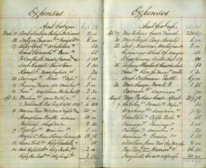
Gloucester City Archives, Valuations for Harbor Parish, East Ward, 1851, 1852, 1853, 1854.
Valuations for wharf facilities and railway, 1851: $3,280; 1852: $4,800; 1853: $6,000; 1854: $9,000.
This steady and substantial growth is hard to explain in any other way than in the form of mechanical improvements, including steam-powered machinery to operate the hauling winch and power saws for a mill building for shipbuilding timber and planking. A note in the 1853 valuation, simply stating “new railway”, probably refers to the addition of a second railway, which would account for the significantly higher valuation in 1854.
Erik Ronnberg
Mounted print
8 x 10 in.
Cape Ann Museum Library & Archive
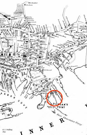
Railway at the tip of Duncan's Point. Vessels on the ways are "Isabell Leighton" and "Hattie B. West."
Also filed under: Duncan's Point »
Wood, cordage, acrylic paste, metal
~40 in. x 30 in.
Erik Ronnberg
Model shows mast of fishing vessel being unstepped.
Also filed under: Fishing » // Schooner (Fishing) »

1851 44 x 34 in. Henry Francis Walling, Map of the Towns of Gloucester and Rockport, Essex Co. Massachusetts. Philadelphia, A. Kollner, 1851 Cape Ann Museum Library & Archive
"Map of the Towns of Gloucester and Rockport, Massachusetts. H.F. Walling, Civil Engineer. John Hanson, Printer. 1851. Population of Gloucester in 1850 7,805. Population of Rockport in 1850 3,213."
Also filed under: Baptist Church (Old, First, 1830) (Pleasant Street) » // Duncan's Point » // Five Pound Island » // Flake Yard » // Gloucester Harbor, Inner / Harbor Cove » // Harbor Methodist Church (Prospect Street) » // Low (Frederick G.) wharves » // Pavilion Hotel » // Procter Brothers » // Ropewalk » // Vincent's Cove » // Western Shore »
Newsprint
From bound volume owned by publisher Francis Procter
Collection of Fred and Stephanie Buck
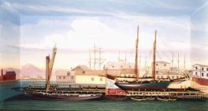
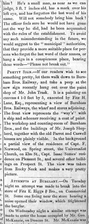
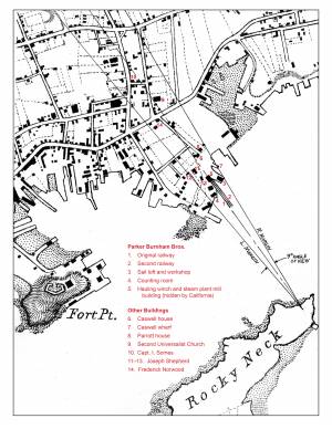
“PRETTY SIGN. – If our readers wish to see something pretty, let them walk down to Burnham Bros. Railway, and take a peep at the new sign recently hung out over the paint shop of Mr. John Trask. It is a painting on canvass 4 1-2 feet by 5, executed by Fitz H. Lane, Esq., representing a view of Burnham Bros. Railways, the wharf and stores adjoining. The front view represents the ‘way’s’ with a ship and schooner receiving a coat of paint. The workshop and counting-room of Burnham Bros., and the buildings of Mr. Joseph Shepherd, together with the old Parrot and Caswell houses are plainly visible. In the background a partial view of the residence of Capt. F. Norwood, on Spring street, the Universalist Church, on Elm St., Capt. Isaac Somes’ residence on Pleasant St., and several other buildings on Prospect St. The view was taken from Rocky Neck and makes a very pretty picture.”
Also filed under: Chronology » // John Trask Paint Store » // Newspaper / Journal Articles » // Trask, John »
Newspaper
Fire in the steam planing mill of Parker Burnham & Bros, foot of Water St. It spread through the block that included Ignatius Winter's sash-and-blind factory and John Trask's paint shop.
Also filed under: Newspaper / Journal Articles » // Trask, John » // Winter, Ignatius »

1865 41 x 29 inches Courtesy of the Massachusetts Archives Maps and Plans, Third Series Maps, v.66:p.1, no. 2352, SC1/series 50X
.
Also filed under: Collins's, William (estate wharf) » // Gloucester Harbor, Inner / Harbor Cove » // Maps » // Rogers's (George H.) wharves »
Newspaper obituary
Obituary of Parker Burnham, Esq.
Sawyer Free Library
Parker Burnham, Esq., the alderman from Ward 5, died at his residence on Spring Street on Thursday morning, of neuralgia of the heart, after a few days’ illness. Mr. Burnham was a native of Essex, son of the venerable Parker Burnham, recently deceased, but settled in Gloucester when quite a young man, and has been closely identified with the business interests of the town and city. On his removal to Gloucester, in connection with his brothers, Joseph B. and Elias, he established a shipyard, and the firm, under the name of Burnham Brothers, were successfully engaged in the building and repairing of vessels. Subsequently they built the first marine railways ever constructed in Gloucester, and in the business connected therewith Mr. Burnham remained to the time of his death. He was a man of marked character, honest in his dealings, kindly in his intercourse with his fellows, correct in his deportment and unassuming in his manners, devoting himself to his business without stepping aside to seek notoriety or distinction from his fellow citizens. In religion he was a Universalist and a regular attendant upon the services of the Independent Christian Church. In politics he was a Republican from the earliest formation of the party, and fully in accord with its principles, although he was elected upon the Board of Aldermen upon a democratic nomination, unsought, by a large majority. Since the organization of the city government Mr. Burnham has devoted a large portion of his time to the interests of the city, being constant in his attendance upon the meetings of the board and taking an active part in its deliberations. As chairman of the joint standing committee upon public property he had the oversight upon the Collins School House and the investigations concerning the remodeling of the City Hall; he was also a member of the committees upon finance and highways. His loss will be deeply felt by his associates in the city council, and by the community generally. His funeral took place on Saturday afternoon, and was attended by the members of the city council in a body.
Newspaper obituary
Obituary of Elias Burnham
Sawyer Free Library
Mr. Elias Burnham, whose severe illness was alluded to in our last issue, died at eleven o’clock on Saturday morning, having been unconscious for several hours before his death. He had been in his usual health until within a little over a week before his departure, when he was taken with an ill turn at the camp of his son, Mr. Elias P. Burnham, at West Gloucester, and grew rapidly worse until the end. Mr. Burnham was a native of Essex, being a son of Parker Burnham of that town. He was a ship carpenter by trade, and came to Gloucester over forty years ago with his brothers Parker and Joseph B., and engaged in the vessel building business on Pearce’s wharf, under the name of Burnham Brothers. Subsequently the firm purchased the Hough wharf, now owned by Walen & Son, and on the flats adjoining built the first marine railway ever constructed in Gloucester. To this business they afterwards added a planing mill, doing an extensive business. Mr. Joseph B. Burnham withdrew from the firm several years ago, carrying on for several years a planing mill on Pearce Street, and Mr. Parker Burnham, the oldest of the brothers, died in 1874, the firm of late years consisting of Elias, Elias P., son of Elias, and Parker H. and Enoch, sons of Parker. Identified for nearly half a century with the business interests of Gloucester, Mr. Burnham won a high place in the regard of his fellow citizens by his industrious habits, by the promptness and honesty which characterized all his business transactions, by his kindly social nature, his unassuming manners, and his respect for the rights and opinions of others. He was a prominent member of and liberal contributor to the support of the First Baptist Church, and his loss will be deeply felt by the members of that communion. He leaves a widow, son and daughter. His funeral took place from his late residence on Elm Street on Wednesday afternoon, his pastor, Rev. Dr. Morris officiating, and was largely attended.
Newspaper obituary
Obituary of Joseph Burnham, Esq.
Sawyer Free Library
Mr. Joseph Burnham, for many years a well known resident of this city, died very suddenly at his residence in West Gloucester on Tuesday, of paralysis, in the 67th year of his age. Although in somewhat feeble health of late years, he was able to keep about, and was out of doors the evening before his death. He was a son of Parker Burnham of Essex, and was formerly a member of the firm of Burnham Brothers (Parker, Joseph B. and Elias), who commenced ship- building in this city some two score years and more ago, and afterwards built the first marine railway in Gloucester and established a planing mill. Subsequently he retired from the firm and carried on a planing mill on Pearce Street for a number of years. He was also engaged in the remeasurement of our fishing fleet when the new tonnage law went into effect. Later, he purchased a farm in Rowley, but after a short residence there returned to Gloucester and took up his permanent residence at his summer camp at West Gloucester, where his death occurred.
He was an ingenious mechanic, steady, honest and industrious, and his sudden death will be deeply deplored by a large circle of friends. Mr. Burnham was a veteran Odd Fellow, having long been a member of Ocean Lodge, and was one of the seven charter members of Cape Ann Encampment, from which he withdrew about five years ago. His death is the second among the seven charter members of the Encampment, Capt. Edward Staten having been the first to depart from the earth life. The funeral of the deceased took place yesterday afternoon, Rev. Wm. H. Rider officiating, and was attended by the brethren of Ocean Lodge.

Detail views: marine railway and hauling cradle for vessel Wood rails, metal rollers, chain; wood cradle. Scale: ½" = 1' (1:24) Original diorama components made, 1892; replacements made, 1993. Cape Ann Museum, from Gloucester Chamber of Commerce, 1925 (2014.071)
A schooner is shown hauled out on a cradle which travels over racks of rollers on a wood and metal track.
Also filed under: Marine Railways » // Schooner (Coasting / Lumber / Topsail / Packet / Marsh Hay) »
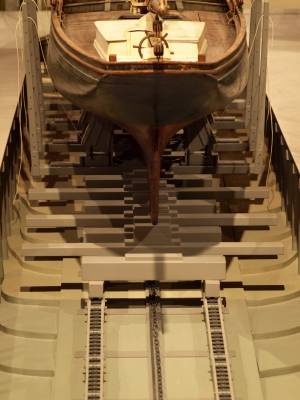
Wood rails, metal rollers, chain; wood cradle. Scale: ½" = 1' (1:24)
Original diorama components made, 1892; replacements made, 1993.
Cape Ann Museum, from Gloucester Chamber of Commerce, 1925 (2014.071)
Close up showing detail of rollers and hauling chain.
Also filed under: Marine Railways »
44 x 34 in.
John Hanson, Publisher
Cape Ann Museum Library & Archive
Also filed under: Marine Railways »
Oil on canvas
39 1/4 x 59 1/4 in.
Detail showing construction of marine railway. Details of the rollers and chain are obscured due to past cleaning efforts.
Also filed under: Marine Railways »
Lane did a remarkable series of paintings from Brookbank, the Sawyer homestead, which overlooks Fresh Water Cove. They show Dolliver’s Neck and how it protects the cove from the harbor. It is also visible in Dolliver's Neck and the Western Shore from Field Beach, 1857 (inv. 3), though somewhat disguised by the rest of the western shore in that view. He did a drawing and painting from Dolliver’s Neck looking west in Fresh Water Cove from Dolliver's Neck, Gloucester, Early 1850s (inv. 45).
Dolliver’s Neck is a small arm of land pointing north off the western shore of the Gloucester’s Outer Harbor. It is the cradling arm that creates Fresh Water Cove, a small cove where Samuel de Champlain found fresh water on his first visit to Gloucester Harbor in 1606. It was named for Samuel Dolliver who came from Marblehead in 1652 and bought a farm there.
In Lane’s time there were a few fishing shacks visible in some of his paintings where onshore fishermen could put their boats in from the pebble beach and salt marsh and be out in the center of the harbor without the long row or sail from the Inner Harbor. Fresh Water Cove itself is not deep enough at low tide for larger vessels to moor there so it has retained its small scale and intimate feel down through the years.
In 1900 a Coast Guard lifesaving station was built and manned on Dolliver’s Neck and many lives were saved along that rocky and treacherous coast between Gloucester and Magnolia.
Newsprint
From bound volume owned by publisher Francis Procter
Collection of Fred and Stephanie Buck
"We visited the studio of Mr. Fitz H. Lane a few days since, and were much pleased in examining some fine paintings from the pencil of this talented artist. Among the collection was a view of Long Beach, in this town, with which we were particularly interested.
The scene is taken immediately after a storm. The waves with their snowy crests are rolling in upon the beach, breaking against the sides of a vessel which has been driven ashore. In the background is seen the residence of Mr. Fessenden, and the surrounding scenery; on the right are visible the high headlands near the residence of Mr. Geo. Hovey, while stretching far away in the distance may be seen Fresh Water Cove, Dolliver's Neck, and the Old Pine Tree, the whole forming a beautiful picture and true to Nature.
Several other paintings were in process of completion, one a beautiful sunset scene, which was really beautiful to gaze upon; also a view of a gale at sea, with a gallant ship plunging madly through the waves, forming a striking contrast to the mild placid scene of the picture at its side.
Mr. Lane's paintings are true to nature, and in viewing them one can but admire the skill and genius of this talented artist, We advise all lovers of the art, who wish to spend an hour pleasantly, to visit the studio of Mr. Lane on Locust St. We can assure them that they will come away highly gratified, and have an earnest desire to call again." (1)
(1) See p. 2, column 3, Courtesy of the American Antiquarian Society
Also filed under: Chronology » // Fessenden, C. B. » // Fresh Water Cove » // Lone Pine » // Newspaper / Journal Articles » // Steepbank » // Studio Descriptions »
44 x 34 in.
Henry Francis Walling, Map of the Towns of Gloucester and Rockport, Essex Co. Massachusetts. Philadelphia, A. Kollner, 1851
Cape Ann Museum Library & Archive
"Map of the Towns of Gloucester and Rockport, Massachusetts. H.F. Walling, Civil Engineer. John Hanson, Publisher. 1851. Population of Gloucester in 1850: 7,805. Population of Rockport in 1850: 3,213."
Also filed under: Annisquam River » // Brookbank » // Fresh Water Cove » // Gloucester Harbor, Outer » // Maps » // Norman's Woe » // Stage Rocks / Stage Fort / Stage Head » // Steepbank » // West Gloucester – Little River » // Western Shore »

Engraving of 1819 survey taken from American Coast Pilot 14th edition
9 1/2 x 8 in.
Cape Ann Museum Library & Archive
D32 FF5
Also filed under: Eastern Point » // Maps » // Norman's Woe » // Ten Pound Island »
Newspaper
"Mr. Lane has just completed a third picture of the Western Shore of Gloucester Harbor, including the distance from 'Norman's Woe Rock' to 'Half Moon Beach.' It was painted for Mr. William E. Coffin of Boston, and will be on exhibition at the artist's rooms for only a few days; we advise all our readers who admire works of art, and would see one of the best pictures Mr. Lane has ever executed..."
"...solitary pine, so many years a familiar object and landmark to the fisherman."

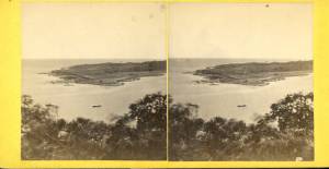
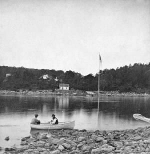
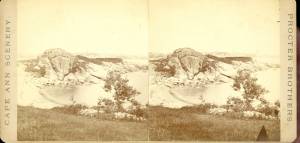
c.1860 Stereograph card Cape Ann Museum Library & Archive
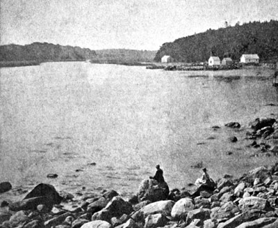
Taken from Steepbank, on the western side of Gloucester Harbor, and showing a small boat at anchor in the cove, then the Neck, and the sea beyond.
Also filed under: Fresh Water Cove » // Historic Photographs » // Lone Pine » // Steepbank »
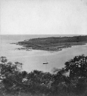
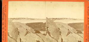
1860s Stereograph card Cape Ann Museum Library & Archive
"Cape Ann Scenery, John S. E. Rogers, Low's Block. #54 Dolliver's Neck. Taken from Steepbank, on the western side of Gloucester Harbor, and showing a small boat at anchor in the cove, then the Neck and the sea beyond."
Also filed under: Historic Photographs »
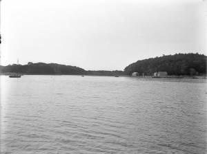
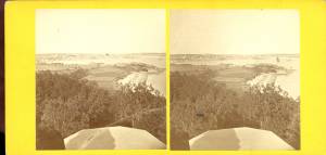
4 x 5 in.
Cape Ann Museum Library & Archive
Freshwater Cove and Dolliver's Neck from the water off Stage Fort.
Also filed under: Fresh Water Cove »
The owner of this flagpole has not been determined, but it is an interesting landmark in Lane's paintings. Often it appears in his drawings and not in his paintings, and Western Shore of Gloucester Outer Harbor, 1857 (inv. 107) contains the only image of a flag actually flying from the pole.
Fresh Water Cove is located on the west side of Gloucester’s Outer Harbor. It is protected from the harbor waters and the south-easterly seas by the arm of Dolliver’s Neck reaching north from the western shore. It’s a small, very still cove, only a few hundred yards from its mouth to the innermost shore.
The cove was visited by Samuel de Champlain in 1606. He was the first known European to enter Gloucester Harbor, which he named Le Beauport. He named Fresh Water Cove for the fresh water springs he found there, one a bit up from the shore, the other flowing below the high tide line and only accessible at half tide.
The cove, while very well protected from the weather, is small and very shallow at low tide and was never suitable for any large vessels, though there were fishing shacks along the shores edge and small boats were easily pulled up on the sand and salt marsh in its inner recesses. There was a wharf built in the early 1800s to service a granite quarry just up the hill from the cove, which could apparently handle larger vessels at high tide.
In Lane’s time, the most significant landmark from the cove was Brookbank, the Sawyer homestead where Samuel E. Sawyer was born in 1818. Sawyer made a fortune in Boston and returned to Brookbank every summer for fifty years. He became one of Gloucester’s first philanthropists. Lane did a series of paintings from the fields in front of Brookbank looking to the east from the house over Fresh Water Cove, the arm of Dolliver’s Neck and the harbor beyond. He also painted the opposite view in Fresh Water Cove from Dolliver's Neck, Gloucester, Early 1850s (inv. 45) looking west from Dolliver’s Neck over the cove to the Sawyer homestead and surrounding shoreline. Each of these paintings captures the perfect serenity of a high summer day in this secluded cove just off the busy harbor.
Stereograph card
Cape Ann Museum Library & Archive
Also filed under: Brookbank »
44 x 34 in.
Henry Francis Walling, Map of the Towns of Gloucester and Rockport, Essex Co. Massachusetts. Philadelphia, A. Kollner, 1851
Cape Ann Museum Library & Archive
"Map of the Towns of Gloucester and Rockport, Massachusetts. H.F. Walling, Civil Engineer. John Hanson, Publisher. 1851. Population of Gloucester in 1850: 7,805. Population of Rockport in 1850: 3,213."
Also filed under: Annisquam River » // Brookbank » // Dolliver's Neck » // Gloucester Harbor, Outer » // Maps » // Norman's Woe » // Stage Rocks / Stage Fort / Stage Head » // Steepbank » // West Gloucester – Little River » // Western Shore »
c.1860 Stereograph card Cape Ann Museum Library & Archive
Taken from Steepbank, on the western side of Gloucester Harbor, and showing a small boat at anchor in the cove, then the Neck, and the sea beyond.
Also filed under: Dolliver's Neck » // Historic Photographs » // Lone Pine » // Steepbank »
Newspaper
"Mr. Lane has just completed a third picture of the Western Shore of Gloucester Harbor, including the distance from 'Norman's Woe Rock' to 'Half Moon Beach.' It was painted for Mr. William E. Coffin of Boston, and will be on exhibition at the artist's rooms for only a few days; we advise all our readers who admire works of art, and would see one of the best pictures Mr. Lane has ever executed..."
"...solitary pine, so many years a familiar object and landmark to the fisherman."
Newsprint
From bound volume owned by publisher Francis Procter
Collection of Fred and Stephanie Buck
"We visited the studio of Mr. Fitz H. Lane a few days since, and were much pleased in examining some fine paintings from the pencil of this talented artist. Among the collection was a view of Long Beach, in this town, with which we were particularly interested.
The scene is taken immediately after a storm. The waves with their snowy crests are rolling in upon the beach, breaking against the sides of a vessel which has been driven ashore. In the background is seen the residence of Mr. Fessenden, and the surrounding scenery; on the right are visible the high headlands near the residence of Mr. Geo. Hovey, while stretching far away in the distance may be seen Fresh Water Cove, Dolliver's Neck, and the Old Pine Tree, the whole forming a beautiful picture and true to Nature.
Several other paintings were in process of completion, one a beautiful sunset scene, which was really beautiful to gaze upon; also a view of a gale at sea, with a gallant ship plunging madly through the waves, forming a striking contrast to the mild placid scene of the picture at its side.
Mr. Lane's paintings are true to nature, and in viewing them one can but admire the skill and genius of this talented artist, We advise all lovers of the art, who wish to spend an hour pleasantly, to visit the studio of Mr. Lane on Locust St. We can assure them that they will come away highly gratified, and have an earnest desire to call again." (1)
(1) See p. 2, column 3, Courtesy of the American Antiquarian Society
Also filed under: Chronology » // Dolliver's Neck » // Fessenden, C. B. » // Lone Pine » // Newspaper / Journal Articles » // Steepbank » // Studio Descriptions »
1860s Stereograph card Cape Ann Museum Library & Archive
A view of a Cove on the western side of Gloucester Harbor, with the landing at Brookbank. Houses are seen in the woods back. A boat with two men is in the foreground.
Also filed under: American ensign / flag » // Brookbank » // Historic Photographs »
4 x 5 in.
Cape Ann Museum Library & Archive
Freshwater Cove and Dolliver's Neck from the water off Stage Fort.
Also filed under: Dolliver's Neck »
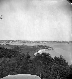
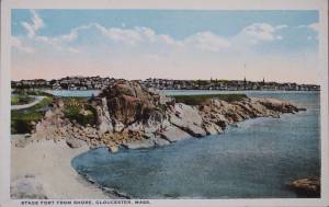
The Stage, as it was known in Lane’s time, now Stage Fort Park, rises from the western shore of the Outer Harbor, just south and west of the Cut and the Blynman Bridge as you leave Gloucester. This was the first settlement of the Massachusetts Bay Colony in 1623 where fourteen men of the Dorchester Company landed and tried in vain to settle and survive through a combination of fishing and farming. They were successful at neither, and in 1626 they moved on and founded Salem.
During the Revolution the Gloucester patriots built a fort on the north side of Half Moon Beach to defend against British invaders which was never needed. The fort was restored for the War of 1812 and again for the Civil War, but again saw no action.
During Lane’s lifetime this area was the Hough farm. Townspeople were generally given free run of the place for strolling and picnics overlooking the harbor. The enormous rounded boulders and ledge outcroppings rose dramatically from the fields above the harbor without the tree cover that partially obscures them today.
Lane did numerous paintings of this area, including many views looking westward from the vantage point onboard a boat in the harbor. In Stage Rocks and the Western Shore of Gloucester Outer Harbor, 1857 (inv. 8) the Stage Rocks frame the west side of Gloucester Harbor and provided a peaceful and bucolic counterpoint to the intense activity of the city waterfront only a mile away across the harbor. Lane also painted the Stage Rocks from the beach just to the north near the Cut and Field Beach, which is on the southern side of the Stage Rocks facing out the harbor entrance to the sea.
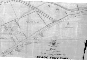
Commonwealth of Massachusetts: Southern Essex District Registry of Deeds
1543 plan 0141_0002
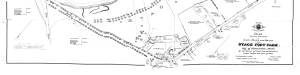
The third of the three plans has the references on it. "Plan showing the taking of land, flats and beach for Stage Fort Park…1898..."
Includes a reference to the home of Mary Turnbull which is Steepbank.
Also filed under: Maps » // Steepbank »
c.1870 Stereograph card Cape Ann Museum Library & Archive
Also filed under: Gloucester – City Views » // Half Moon Beach » // Historic Photographs » // Steepbank »
44 x 34 in.
Henry Francis Walling, Map of the Towns of Gloucester and Rockport, Essex Co. Massachusetts. Philadelphia, A. Kollner, 1851
Cape Ann Museum Library & Archive
"Map of the Towns of Gloucester and Rockport, Massachusetts. H.F. Walling, Civil Engineer. John Hanson, Publisher. 1851. Population of Gloucester in 1850: 7,805. Population of Rockport in 1850: 3,213."
Also filed under: Annisquam River » // Brookbank » // Dolliver's Neck » // Fresh Water Cove » // Gloucester Harbor, Outer » // Maps » // Norman's Woe » // Steepbank » // West Gloucester – Little River » // Western Shore »
c.1870 Stereograph card Cape Ann Museum Library & Archive
Also filed under: Half Moon Beach » // Historic Photographs » // Western Shore »
c.1870 Stereograph card Cape Ann Museum Library & Archive
Also filed under: Gloucester – City Views » // Historic Photographs »
c.1890 Stereograph card Cape Ann Museum Library & Archive
"In the foreground is a clear sheet of water which washes upon the beach beyond. The Pavilion is quite prominent, while upon the rising background can be seen the steeples of the several churchs, the tower of the first Town House, and the Collins School House."
Also filed under: Gloucester – City Views » // Historic Photographs » // Pavilion Hotel »
Cape Ann Museum Library & Archive
Stage Fort from Hough's Farm, showing a panorama of the harbor from Pavilion Beach to Fort Point and Rocky Neck.
Also filed under: Field Beach / Crescent (or Cressy's) Beach / Long Beach »

c.1870 Stereograph card Procter Brothers, Publisher Cape Ann Museum Library & Archive
Also filed under: Gloucester Harbor, Outer » // Historic Photographs »
Commonwealth of Massachusetts. Southern Essex District Registry of Deeds. 1543 plan 0141_0003
salemdeeds.com
The third of the three plans has the references on it “Plan showing the taking of land, flats and beach for Stage Fort Park…1898…"
Includes a reference to the home of “Mary Turnbull” which is Steepbank.
Also filed under: Maps »
Commonwealth of Massachusetts: Southern Essex District Registry of Deeds
1543 plan 0141_0001
The third of the three plans has the references on it “Plan showing the taking of land, flats and beach for Stage Fort Park…1898…”
Includes a reference to the home of Mary Turnbull which is Steepbank.
Also filed under: Field Beach / Crescent (or Cressy's) Beach / Long Beach » // Maps » // Steepbank »
Colored lithograph
Cape Ann Museum Library and Archive
Also filed under: Western Shore »
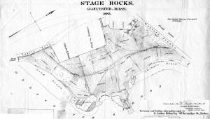
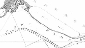
29 x 25 in.
Cape Ann Museum Library & Archive (#089)
Ernest Bowditch was a landscape gardener. This map shows some of the various names of landmarks around Stage Rocks.
Also filed under: Field Beach / Crescent (or Cressy's) Beach / Long Beach » // Half Moon Beach » // Maps »
Ten Pound Island guards the entrance to Gloucester’s Inner Harbor and provides a crucial block to heavy seas running southerly down the Outer Harbor from the open ocean beyond. The rocky island and its welcoming lighthouse is seen, passed, and possibly blessed by every mariner entering the safety of Gloucester’s Inner Harbor after outrunning a storm at sea. Ten Pound Island is situated such that the Inner Harbor is protected from open water on all sides making it one of the safest harbors in all New England.
Legend has it that the island was named for the ten pound sum paid to the Indians for the island, and the smaller Five Pound Island deeper in the Inner Harbor was purchased for that lesser sum. None of it makes much financial sense when the entirety of Cape Ann was purchased for only seven pounds from the Indian Samuel English, grandson of Masshanomett the Sagamore of Agawam in 1700. From approximately 1640 on the island was used to hold rams, and anyone putting female sheep on the island was fined. Gloucester historian Joseph Garland has posited that the name actually came from the number of sheep pens it held, or pounds as they were called, and the smaller Five Pound Island was similarly named.
The island itself is only a few acres of rock and struggling vegetation but is central to the marine life of the harbor as it defines the eastern edge of the deep channel used to turn the corner and enter the Inner Harbor. The first lighthouse was lit there in 1821, and a house was built for the keeper adjacent to the lighthouse.
In the summer of 1880 Winslow Homer boarded with the lighthouse keeper and painted some of his most masterful and evocative watercolor views of the busy harbor life swirling about the island at all times of day. Boys rowing dories, schooners tacking in and out in all weather, pleasure craft drifting in becalmed water, seen together they tell a Gloucester story of light, water and sail much as Lane’s work did only several decades earlier.

Colored lithograph
Cape Ann Museum Library and Archive
Also filed under: Gloucester, Mass. - "Ten Pound Island Light »

Photograph
From The Illustrated Coast Pilot with Sailing Directions. The Coast of New England from New York to Eastport, Maine including Bays and Harbors, N. L. Stebbins, 1891.
Also filed under: Gloucester, Mass. - "Ten Pound Island Light »


Oil on canvas
22 x 36 in.
Cape Ann Museum, Gloucester, Mass., deposited by the Collection of Addison Gilbert Hospital, 1978 (DEP. 201)
Detail of party boat.
Also filed under: Party Boat »
Engraving of 1819 survey taken from American Coast Pilot 14th edition
9 1/2 x 8 in.
Cape Ann Museum Library & Archive
D32 FF5
Also filed under: Dolliver's Neck » // Eastern Point » // Maps » // Norman's Woe »
Newspaper
Gloucester Telegraph
"By the will of the late Fitz H. Lane, Esq., his handsome painting of the Old Fort, Ten Pound Island, etc., now on exhibition at the rooms of the Gloucester Maritime Insurance Co., was given to the town... It will occupy its present position until the town has a suitable place to receive it."

Stereograph card
Cape Ann Museum Library & Archive
View from top of Unitarian Church on Middle Street looking southeast, showing the Fort and Ten Pound Island. Tappan Block and Main Street buildings between Center and Hancock in foreground.
Also filed under: Fort (The) and Fort Point » // Unitarian Church / First Parish Church (Middle Street) »

1860 In John J. Babson, History of the Town Gloucester (Gloucester, MA: Procter Brothers, 1860) Cape Ann Museum Library & Archives, Gloucester, Mass.
See p. 474.
View related catalogue entries (4) »
Also filed under: Babson History of the Town of Gloucester » // Chebacco Boat / Dogbody / Pinky » // Fort (The) and Fort Point » // Gloucester Harbor, Inner / Harbor Cove » // Gloucester, Mass. - "Ten Pound Island Light » // Schooner (Coasting / Lumber / Topsail / Packet / Marsh Hay) »
From Colonial times to the present, Gloucester and other shore-side communities have maintained certain tracts of land as public landings, assuring everyone the right of free access to and from tidal waters. Such ways are carefully delineated in deeds, are to be kept clear of encumbrances and be available for all to pass over. For communities like Gloucester whose economies were based solidly on maritime pursuits throughout the eighteenth and nineteenth centuries, allowing access to navigable waters was essential.
Public landings were designated across Cape Ann including at Folly Cove, the historic Town Green, Done Fudging, Lobster Cove, Cripple Cove and Stanwood Point in West Gloucester. While public access to the water has gradually constricted in recent decades, even during Fitz Henry Lane’s lifetime, landowners guarded their property rights fiercely, making public landings all that more important.
Gloucester's first public landing was on the Annisquam River at the site of the old First Parish (now occupied by the Grant Circle rotary where Route 128 intersects Washington Street). Given the shallows of the river, most goods had to be landed in scows or gundalows—goods such as marsh hay, lumber, livestock, domestic needs, and business wares—in short, everything from the rest of the world.
As one of the earliest pockets of settlement in Gloucester, Fresh Water Cove was another logical and practical place for a public landing to be located and indeed one was laid out there by the town’s founders. It was over that tract of land that granite from the upland quarry, located in what is now Ravenswood, was transported to awaiting sloops in the Cove. The landing was also how shore fishermen would access their boats and carry supplies to and from their homes.
– Martha Oaks
1851 44 x 34 in. Henry Francis Walling, Map of the Towns of Gloucester and Rockport, Essex Co. Massachusetts. Philadelphia, A. Kollner, 1851 Cape Ann Museum Library & Archive
"Map of the Towns of Gloucester and Rockport, Massachusetts. H.F. Walling, Civil Engineer. John Hanson, Publisher. 1851. Population of Gloucester in 1850 7,805. Population of Rockport in 1850 3,213."
Also filed under: Babson House » // Cut, The (Stacy Blvd.) » // White-Ellery House »

1834–35 24 x 38 in. Gloucester City Archives
"Drawn on a scale of one hundred feet to an inch. By John Mason 1834–45 from Actual Survey showing every Lott and building then standing on them giving the actual size of the buildings and width of the streets from the Canal to the head of the Harbour & part of Eastern point as farr as Smith's Cove and the Shore of the same with all the wharfs then in use. Gloucester Harbor 1834–35."
This map is especially helpful in showing the wharves of the inner harbor at the foot of Washington Street.
Also filed under: Dale, Eben B. » // Eastern Railroad » // Flake Yard » // Gloucester Harbor, Inner / Harbor Cove » // Hough, Benjamin Kent » // Maps » // Pavilion (Publick) Beach » // Ropewalk » // Sawyer, Samuel » // Universalist Church (Middle and Church Streets) »

24 x 38 in.
Gloucester City Archives
"Drawn on a scale of one hundred feet to an inch. By John Mason 1834–45 from Actual Survey showing every Lott and building then standing on them giving the actual size of the buildings and width of the streets from the Canal to the head of the Harbour & part of Eastern point as farr as Smith's Cove and the Shore of the same with all the wharfs then in use. Gloucester Harbor 1834–35."
This map is especially useful in showing the Fort.
Also filed under: Flake Yard » // Fort (The) and Fort Point » // Maps » // Mason, John » // Pavilion (Publick) Beach »

44 x 34 in.
John Hanson, Publisher
Cape Ann Museum Library & Archive
"Map of the Towns of Gloucester and Rockport, Massachusetts. H.F. Walling, Civil Engineer. John Hanson, Publisher. 1851. Population of Gloucester in 1850 7,805. Population of Rockport in 1850 3,213."
Also filed under: Fort (The) and Fort Point » // Low (Frederick G.) wharves » // Maps » // Rogers's (George H.) wharves » // Waterfront, Gloucester » // Windmill »
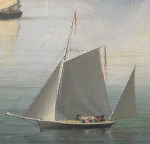
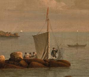
"Party boat" is a colloquial term for any kind of small craft adapted or used for taking guests (customarily for hire) on sightseeing trips or fishing for pleasure. (1) The term survives to this day on Cape Ann and other places for vessels engaged in the same activities. (2) In Lane's time, party boating was a calling of opportunity, and a fisherman's boat might be used in season - regularly or occasionally - to take "rusticators" fishing. Likewise, a boat used for its owner's own pleasure might be hired to take sightseers sailing for an afternoon. The latter use is seen in Lane's 1844 view of Gloucester Harbor from Rocky Neck (see the yawl-rigged sailboat in the foreground of Gloucester Harbor from Rocky Neck, 1844 (inv. 14)).
By the early 1850s, summer visitor activity, encouraged by the building of the Pavilion Hotel on Gloucester's waterfront, led to increased pleasure boating activity, if Lane's painting Gloucester Harbor, 1852 (inv. 38) of Pavilion Beach and Sidney Mason's hotel is any indication. (3) Lane's Gloucester Harbor scenes from this decade show a number of pleasure craft suitable for taking passengers for hire (see Fresh Water Cove from Dolliver's Neck, Gloucester, Early 1850s (inv. 45), Coming Ashore near Brace's Rock, Gloucester, Massachusetts, c.1860 (inv. 60), and View of Gloucester from "Brookbank," the Sawyer Homestead, c.1856 (inv. 95)). Small working craft suitable for this purpose are seen in The Old Fort and Ten Pound Island, Gloucester, 1850s (inv. 30), Gloucester Harbor, 1852 (inv. 38) (right foreground), View of Gloucester, 1859 (inv. 91) (foreground), and Watch House Point, 1860 (inv. 292) (right foreground). In View of Gloucester Harbor, 1848 (inv. 97), we see passengers boarding a small sloop-rigged boat hidden by the rocks at Duncan's Point (left middle ground).
In coastal waters south of Gloucester, a few of Lane's paintings offer pleasure craft as candidates for taking paying passengers. Phantom of Boston, c.1850s (inv. 574) depicts a cruising yawl "Phantom" of Boston, beached with hunting gear unloaded alongside while two of the crew await an approaching party in a rowing boat. The location is unidentified, but a possibility is the barrier beach around the marshes of Lynn, Massachusetts, which were once very popular hunting grounds for migrating waterfowl. A second candidate is a small sloop with a party of four on an evening sail off Halfway Rock in Becalmed Off Halfway Rock, 1860 (inv. 344) (far right).
Lane found similar uses of working watercraft in Maine, where the families of a small coastal community would travel by their workboats to a gathering place for a clambake or similar festive outing (see View of Indian Bar Cove, Brooksville, Maine, 1850 (inv. 61)). The artist became a "rusticator" himself when he, Joseph Stevens, and friends explored Mount Desert Island and vicinity in the "General Gates," a sloop-rigged Maine version of a New England Boat (View of Bar Island and Mount Desert Mountains, from the Bay in Front of Somes Settlement, 1850 (inv. 177) and Castine Harbor and Town, 1851 (inv. 272)).
When Lane traveled to New Bedford in 1856 to observe and sketch a regatta held by the New York Yacht Club, he observed and sketched it while on board an unknown vessel near the starting and finishing line, formed by the race committee boat "Emblem" and her yawl-boat.
Close by was a small party boat with observers on board, probably a fishing sloop, given its work-a-day looks. In the ensuing year, Lane painted four detailed views of this race, the party boat appearing in New York Yacht Club Regatta (1), 1856 (inv. 66) (right foreground); New York Yacht Club Regatta (2), 1856 (inv. 270) (right margin); New York Yacht Club Regatta (3), After 1856 (inv. 396) (center); and New York Yacht Club Regatta (4), 1857 (inv. 397) (left foreground). (4)
– Erik Ronnberg
References:
1. M. H. Parry and others, Aak to Zumbra: A Dictionary of the World's Watercraft (Newport News, VA: The Mariners' Museum, 2000), 436.
2. Ibid.
3. Proctor's Able Sheet (a Gloucester newspaper), January 1857: "Gloucester House reopened—refitted—boats always ready to take parties cruising or fishing..."
4. John Wilmerding, Fitz Henry Lane, 2nd ed. (Cape Ann, MA: Cape Ann Historical Association, 2005), 52–54. Lane's 1852 cruise in the Mount Desert region in the sloop "Superior" was reprinted as an appendix to Wilmerding's essay in Paintings by Fitz Hugh Lane (Washington, DC: National Gallery of Art, 1988), 125–26.
Oil on canvas
34 x 45 3/4 in.
Cape Ann Museum, Gloucester, Mass., Gift of Mrs. Jane Parker Stacy (Mrs. George O. Stacy),1948 (1289.1a)
Detail of party boat.
Also filed under: Gloucester Harbor, Inner / Harbor Cove »
Oil on canvas
22 x 36 in.
Cape Ann Museum, Gloucester, Mass., deposited by the Collection of Addison Gilbert Hospital, 1978 (DEP. 201)
Detail of party boat.
Also filed under: Ten Pound Island »
Newspaper
Ad in Gloucester Telegraph
FISHING AND SAILING PARTIES
"Persons desirous of enjoying a SAILING or FISHING EXCURSION, are informed that the subscriber will be in readiness with the Boat EUREKA, to attend to all who may favor him with their patronage. JOHN J. FERSON"
Also filed under: Gloucester Harbor – Use » // Newspaper / Journal Articles »
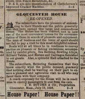
Newsprint
Ad for Gloucester House
Courtesy of the American Antiquarian Society, Worcester, Mass.
See p. 4, column 2.
Also filed under: Brick Houses / Gloucester House Hotel » // Newspaper / Journal Articles »
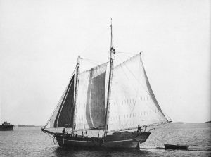
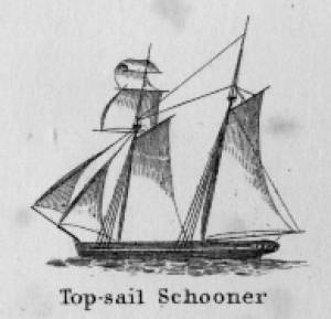
Schooners in Lane’s time were, with few exceptions, two-masted vessels carrying a fore-and-aft rig having one or two jibs, a fore staysail, gaff-rigged fore- and main sails, and often fore- and main topsails. One variant was the topsail schooner, which set a square topsail on the fore topmast. The hulls of both types were basically similar, their rigs having been chosen for sailing close to the wind. This was an advantage in the coastal trade, where entering confined ports required sailing into the wind and frequent tacking. The square topsail proved useful on longer coastwise voyages, the topsail providing a steadier motion in offshore swells, reducing wear and tear on canvas from the slatting of the fore-and-aft sails. (1)
Schooners of the types portrayed by Lane varied in size from 70 to 100 feet on deck. Their weight was never determined, and the term “tonnage” was a figure derived from a formula which assigned an approximation of hull volume for purposes of imposing duties (port taxes) on cargoes and other official levies. (2)
Crews of smaller schooners numbered three or four men. Larger schooners might carry four to six if a lengthy voyage was planned. The relative simplicity of the rig made sail handling much easier than on a square-rigged vessel. Schooner captains often owned shares in their vessels, but most schooners were majority-owned by land-based firms or by individuals who had the time and business connections to manage the tasks of acquiring and distributing the goods to be carried. (3)
Many schooners were informally “classified” by the nature of their work or the cargoes they carried, the terminology coined by their owners, agents, and crews—even sometimes by casual bystanders. In Lane’s lifetime, the following terms were commonly used for the schooner types he portrayed:
Coasting schooners: This is the most general term, applied to any merchant schooner carrying cargo from one coastal port to another along the United States coast (see Bar Island and Mt. Desert Mountains from Somes Settlement, 1850 (inv. 401), right foreground). (4)
Packet schooners: Like packet sloops, these vessels carried passengers and various higher-value goods to and from specific ports on regular schedules. They were generally better-maintained and finished than schooners carrying bulk cargoes (see The Old Fort and Ten Pound Island, Gloucester, 1850s (inv. 30), center; and Gloucester Inner Harbor, 1850 (inv. 240), stern view). (5)
Lumber schooners: Built for the most common specialized trade of Lane’s time, they were fitted with bow ports for loading lumber in their holds (see View of Southwest Harbor, Maine: Entrance to Somes Sound, 1852 (inv. 260)) and carried large deck loads as well (Stage Rocks and the Western Shore of Gloucester Outer Harbor, 1857 (inv. 8), right). Lumber schooners intended for long coastal trips were often rigged with square topsails on their fore masts (see Becalmed Off Halfway Rock, 1860 (inv. 344), left; ; and Lumber Schooner in a Gale, 1863 (inv. 552)). (6)
Schooners in other specialized trades. Some coasting schooners built for carrying varied cargoes would be used for, or converted to, special trades. This was true in the stone trade where stone schooners (like stone sloops) would be adapted for carrying stone from quarries to a coastal destination. A Lane depiction of a stone schooner is yet to be found. Marsh hay was a priority cargo for gundalows operating around salt marshes, and it is likely that some coasting schooners made a specialty of transporting this necessity for horses to urban ports which relied heavily on horses for transportation needs. Lane depicted at least two examples of hay schooners (see Gloucester Harbor, 1850s (inv. 391), left; and Coasting Schooner off Boon Island, c.1850 (inv. 564)), their decks neatly piled high with bales of hay, well secured with rope and tarpaulins.
– Erik Ronnberg
References:
1. Howard I. Chapelle, The History of American Sailing Ships (New York: W.W. Norton & Co., 1935), 258. While three-masted schooners were in use in Lane’s time, none have appeared in his surviving work; and Charles S. Morgan, “New England Coasting Schooners”, The American Neptune 23, no. 1 (DATE): 5–9, from an article which deals mostly with later and larger schooner types.
2. John Lyman, “Register Tonnage and its Measurement”, The American Neptune V, nos. 3–4 (DATE). American tonnage laws in force in Lane’s lifetime are discussed in no. 3, pp. 226–27 and no. 4, p. 322.
3. Ship Registers of the District of Gloucester, Massachusetts, 1789–1875 (Salem, MA: The Essex Institute, 1944). Vessels whose shipping or fishing voyages included visits to foreign ports were required to register with the Federal Customs agent at their home port. While the vessel’s trade or work was unrecorded, their owners and master were listed, in addition to registry dimensions and place where built. Records kept by the National Archives can be consulted for information on specific voyages and ports visited.
4. Howard I. Chapelle, The National Watercraft Collection (Washington, DC: Smithsonian Institution, 1960), 40, 42–43.
5. Ibid., 42–43, 73.
6. Ibid., 74–76.

In R. H. Dana, The Seaman's Friend, 13th ed. (Thomas Groom & Co. Publisher, 1873)
A topsail schooner has no tops at her foremast, and is fore-and-aft rigged at her mainmast. She differs from an hermaphrodite brig in that she is not properly square-rigged at her foremast, having no top, and carrying a fore-and-aft foresail instead of a square foresail and a spencer.
Detail views: marine railway and hauling cradle for vessel Wood rails, metal rollers, chain; wood cradle. Scale: ½" = 1' (1:24) Original diorama components made, 1892; replacements made, 1993. Cape Ann Museum, from Gloucester Chamber of Commerce, 1925 (2014.071)
A schooner is shown hauled out on a cradle which travels over racks of rollers on a wood and metal track.
Also filed under: Burnham Brothers Marine Railway » // Marine Railways »

c. 1900 Glass plate negative Collection of Erik Ronnberg
Also filed under: Lobstering »
"The Maine Register for the Year 1855, embracing State and County Officers, and an abstract of the law and resolves; together with a complete business directory of the state, and a variety of useful information."
Details about Maine's lumber trade in 1855, see pp. 250–52
Also filed under: Castine » // Lumber Industry »
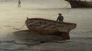
The yawl boat was a ninteenth-century development of earlier ships' boats built for naval and merchant use. Usually twenty feet long or less, they had round bottoms and square sterns; many had raking stem profiles. Yawl boats built for fishing tended to have greater beam than those built for vessels in the coastal trades. In the hand-line fisheries, where the crew fished from the schooner's rails, a single yawl boat was hung from the stern davits as a life boat or for use in port. Their possible use as lifeboats required greater breadth to provide room for the whole crew. In port, they carried crew, provisions, and gear between schooner and shore. (1)
Lane's most dramatic depictions of fishing schooners' yawl-boats are found in his paintings Gloucester Outer Harbor, from the Cut, 1850s (inv. 109) and /entry:311. Their hull forms follow closely that of Chapelle's lines drawing. (2) Similar examples appear in the foregrounds of Gloucester Harbor, 1852 (inv. 38), Ships in Ice off Ten Pound Island, Gloucester, 1850s (inv. 44), and The Fort and Ten Pound Island, Gloucester, Massachusetts, 1847 (inv. 271). A slightly smaller example is having its bottom seams payed with pitch in the foreground of Gloucester Harbor, 1847 (inv. 23). In Gloucester Inner Harbor, 1850 (inv. 240), a grounded yawl boat gives an excellent view of its seating arrangement, while fishing schooners in the left background have yawl boats hung from their stern davits, or floating astern.
One remarkable drawing, Untitled, n.d. (inv. 219) illustrates both the hull geometry of a yawl boat and Lane's uncanny accuracy in depicting hull form in perspective. No hull construction other than plank seams is shown, leaving pure hull form to be explored, leading in turn to unanswered questions concerning Lane's training to achieve such understanding of naval architecture.
– Erik Ronnberg
References:
1. Howard I. Chapelle, American Small Sailing Craft (New York: W.W. Norton & Co., 1951), 222–23.
2. Ibid., 223.
Oil on canvas
12 1/8 x 19 3/4 in.
Museum of Fine Arts, Boston, Bequest of Martha C. Karolik for the M.and M. Karolik Collection of American Paintings, 1815-1865 (48.447)
A schooner's yawl lies marooned in the ice-bound harbor in this detail.

The ensign of the United States refers to the flag of the United States when used as a maritime flag to indentify nationality. As required on entering port, a vessel would fly her own ensign at the stern, but a conventional token of respect to the host country would be to fly the flag of the host country (the United States in Boston Harbor, for example) at the foremast. See The "Britannia" Entering Boston Harbor, 1848 (inv. 49) for an example of a ship doing this. The American ensign often had the stars in the canton arranged in a circle with one large star in the center; an alternative on merchant ensigns was star-shaped constellation. In times of distress a ship would fly the ensign upside down, as can be seen in Wreck of the Roma, 1846 (inv. 250).
The use of flags on vessels is different from the use of flags on land. The importance and history of the flagpole in Fresh Water Cove in Gloucester is still being studied.
The modern meaning of the flag was forged in December 1860, when Major Robert Anderson moved the U.S. garrison from Fort Moultrie to Fort Sumter in Charleston Harbor. Adam Goodheart argues this was the opening move of the American Civil War, and the flag was used throughout northern states to symbolize American nationalism and rejection of secessionism.
Before that day, the flag had served mostly as a military ensign or a convenient marking of American territory, flown from forts, embassies, and ships, and displayed on special occasions like American Independence day. But in the weeks after Major Anderson's surprising stand, it became something different. Suddenly the Stars and Stripes flew—as it does today, and especially as it did after the September 11 attacks in 2001—from houses, from storefronts, from churches; above the village greens and college quads. For the first time American flags were mass-produced rather than individually stitched and even so, manufacturers could not keep up with demand. As the long winter of 1861 turned into spring, that old flag meant something new. The abstraction of the Union cause was transfigured into a physical thing: strips of cloth that millions of people would fight for, and many thousands die for.
– Adam Goodheart, Prologue of 1861: The Civil War Awakening (2011).
1860s Stereograph card Cape Ann Museum Library & Archive
A view of a Cove on the western side of Gloucester Harbor, with the landing at Brookbank. Houses are seen in the woods back. A boat with two men is in the foreground.
Also filed under: Brookbank » // Fresh Water Cove » // Historic Photographs »
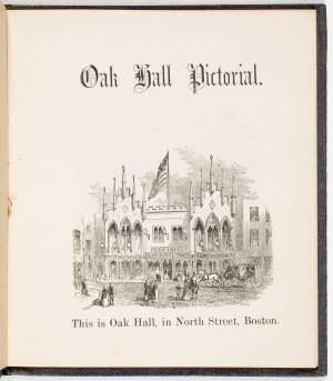
Courtesy American Antiquarian Society, Worcester, Mass. (CL.F9116.011.1854 CL.F9116.011.1854)
Also filed under: Oak Hall »
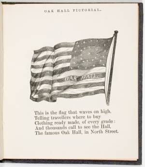
Courtesy American Antiquarian Society, Worcester, Mass. (CL.F9116.011.1854)
Also filed under: Oak Hall »
The Ten Pound Island light was built on a three-and-a-half acre island at the eastern end of Gloucester Harbor. Built as a conical stone tower, the original 20-foot-tall Ten Pound Island Light was first lit in October, 1821 after the Commonwealth of Massachusetts and the Town of Gloucester ceded 1.7 acres to the U.S. Government for the construction of an inner harbor lighthouse to help mariners navigate the harbor. Ten Pound Island light was a popular subject with artists, including Winslow Homer, who boarded with the lighthouse keeper at Ten Pound Island in the summer of 1880. It is frequently featured in Lane's paintings of Gloucester Harbor.
This information has been shared with the Lane project by Jeremy D'Entremont. More information can be found at his website, www.newenglandlighthouses.net or in The Lighthouse Handbook New England. This information has also been summarized from Paul St. Germain's book, Lighthouses and Lifesaving Stations on Cape Ann.


Colored lithograph
Cape Ann Museum Library and Archive
Also filed under: Ten Pound Island »
Photograph
From The Illustrated Coast Pilot with Sailing Directions. The Coast of New England from New York to Eastport, Maine including Bays and Harbors, N. L. Stebbins, 1891.
Also filed under: Ten Pound Island »

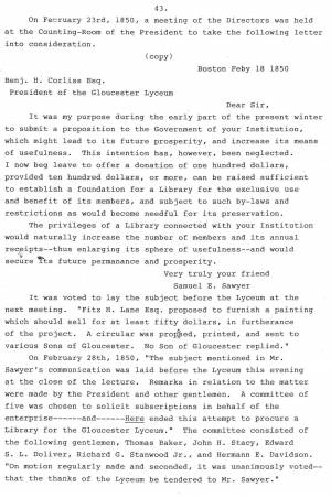
Samuel Elwell Sawyer of Gloucester was a patron of the arts. He visited F. H. Lane’s studio, purchased paintings by him and hired him “to make a sketch of old Homestead for Haughton." (1) Sawyer and Joseph L. Stevens also supported Gloucester artist D. Jerome Elwell in his European studies. We know that in August, 1864, Sawyer ordered two paintings from Lane "to be done [when] he is at leisure," and that he also purchased a painting by Lane for $50 in 1864 at a "Sailors Fare."
Samuel E. Sawyer was born in Gloucester on November 25, 1815 and died at the ancestral homestead in Gloucester on December 15, 1899. He was the fifth generation of Sawyers to occupy Brookbank, an early eighteenth-century gambrel-roofed house located at Freshwater Cove. The Sawyer family history goes back to William Sawyer, who came to New England about 1640.
Samuel's wife was Abigail (Abbie) Ingersoll Meads - they married in Boston on October 30, 1845. They had no children but lived an idyllic life, spending November through March in Boston, and April through October at the family homestead in Gloucester. They spent many years enjoying an accumulated wealth which was generously shared with others. However, life was not always easy for Samuel Sawyer, as he started at the bottom and suffered several financial reversals along the way before becoming financially secure.
Sawyer began his business career as a clerk in Samuel Stevens' dry goods store on Main Street in Gloucester. (2) He soon went to Boston, where he secured a job as a salesman with the firm Kimball and Jewett. He then entered the field of shipping and commerce, and became a partner in the firm of Haughton, Sawyer and Adams. This position took him to all parts of the world, and from it he amassed a fortune as a merchant.
Although a good deal of Sawyer's earlier life was spent in Boston and in travel, nothing could entice him away from the scenes of his childhood. At their Freshwater Cove home, he and Mrs. Sawyer enjoyed their middle age and later years. It was during this period of his life that Samuel Sawyer became one of Gloucester's leading philanthropists. His many gifts and bequests ranged from schoolhouse fences to the present clock in the City Hall tower, and from substantial contributions to the Female Charitable Association to a fund that made it possible to introduce music into the public schools. His most memorable gifts were funds for medals to be given annually to students for scholastic excellence, provision of the building and endowment fund for the Sawyer Free Library, and the land now known as Ravenswood Park.
Mr. Sawyer died from pneumonia at the homestead in Gloucester on December 15, 1889 at the age of seventy-four. Mrs. Sawyer had passed away the preceding year, also from pneumonia.
– Mary Rhinelander McCarl and Stephanie Buck
(1) August 25, 1864 in Samuel Sawyer, Diaries: 1854-1874, trans. Mary Rhinelander McCarl.
(2) Obituary of Joseph L. Stevens, Jr., Gloucester Daily Times, September 21, 1908. Samuel Stevens was Joseph L. Stevens, Jr.’s uncle. When Joseph L. Stevens, Jr. came to Gloucester from Maine in 1840, he first worked in his uncle Samuel’s store.
n.d. Stereographic card Cape Ann Museum Library & Archive
Penciled on reverse: "Mansion House, Brook Bank [sic], Sam'l Sawyer now Hammond, Freshwater Cove"
Also filed under: Brookbank » // Historic Photographs »
1834–35 24 x 38 in. Gloucester City Archives
"Drawn on a scale of one hundred feet to an inch. By John Mason 1834–45 from Actual Survey showing every Lott and building then standing on them giving the actual size of the buildings and width of the streets from the Canal to the head of the Harbour & part of Eastern point as farr as Smith's Cove and the Shore of the same with all the wharfs then in use. Gloucester Harbor 1834–35."
This map is especially helpful in showing the wharves of the inner harbor at the foot of Washington Street.
Typescript
Sawyer Free Library, Gloucester, Mass.
Also filed under: Gloucester Lyceum » // Sawyer Free Library »
Cape Ann Museum Library & Archives
Also filed under: Diaries / Ledgers / Etc. »
Samuel Sawyer Papers
Cape Ann Museum Library & Archives
Archive Collection exp013
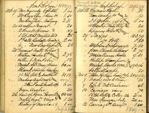
"November 27. Engraving. Arch of Triumph (To James 1/53)
Engraving. Pharaoh’s Horses Painting. Seaview
Traveller & milkmaid. Companions. Hogarth. $2."
Also filed under: Diaries / Ledgers / Etc. » // Lithography (Sales & Exhibitions) »
Samuel Sawyer Papers
Cape Ann Museum Library & Archives
Archive Collection exp014
"November 12. Village Festival
Banck. Sunrise 3.25, Sunset Backhuysen. Sea view, Power of Fashion, Cattle piece. 3 gilt frames"
Also filed under: Diaries / Ledgers / Etc. »
Samuel Sawyer Papers
Cape Ann Museum Library & Archives
Archive Collection exp015
"June 6. 2 Dutch coast scenes & frames. Fremart(?) (One Haughton)"
Also filed under: Diaries / Ledgers / Etc. » // Haughton, James »
Samuel Sawyer Papers
Cape Ann Museum Library & Archives
Archive Collection exp016
"November 8. Lane. Homestead
Frame at Balch
Museum &c. &c."
Also filed under: Balch, William Y. » // Diaries / Ledgers / Etc. »
Samuel Sawyer Papers
Cape Ann Museum Library & Archives
Archive Collection exp017
"June 4. Interior. Peter Neefs
Landscape. Mireveldt Amsterdam. A. Storck
Flower piece. Unknown
Female head. L. Baker
Flowers, bird’s nest.
Schlesinger Flemish peasants. Unknown"
Also filed under: Diaries / Ledgers / Etc. »
Newsprint
From bound volume owned by publisher Francis Procter
Collection of Fred and Stephanie Buck
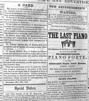
"A CARD. – The Ladies of Gloucester who are interested in the Lyceum Library, and who projected the recent Festival in its behalf, take this method of returning their sincere acknowledgements;
To Messrs. F. H. Lane, Addison Center and John Trask for their arduous and truly artistic labors in the preparation of Tableaux; . . .
To Robert Fears, Esq., who gratuitously opened his large and commodious Sail Loft for their use and exerted himself to make their occupancy of it agreeable;...
To Samuel Sawyer, Esq. of Boston, for his generous and unexpected donation of fifty dollars, thereby laying the Library under still another obligation to him;...
Also filed under: Center, Addison » // Fears, Robert » // Gloucester Lyceum » // Newspaper / Journal Articles » // Trask, John »
Samuel Sawyer Papers
Cape Ann Museum Library & Archives
Archive Collection exp018
"November 12. Winter scene, Scotch boy
Landscape. Griggs Rising by Frost
Chip off the Old Block, Infant Saviour
St. John Dilemma. Rondel
Departure"
Also filed under: Diaries / Ledgers / Etc. »
Samuel Sawyer Papers
Cape Ann Museum Library & Archives
Archive Collection exp020
"Marine View Mt. Desert Light Lane $41.00"
Also filed under: Diaries / Ledgers / Etc. » // Mount Desert, Maine – Mount Desert Rock Light »
Samuel Sawyer Papers
Cape Ann Museum Library & Archives
Archive Collection
"After dinner went to the Athanaum[sic]."
Also filed under: Boston – Boston Athenaeum » // Diaries / Ledgers / Etc. »
Samuel Sawyer Papers
Cape Ann Museum Library & Archives
Archive Collection
"February 4. Went to the artists reception this evening. There was a large company. Haven (?) Fields Whipple & Co. We enjoyed the occasion very much. Our invitation came from Mr. Scott, Mr. Bartlett & Lottie also went, Mrs. Haughton did not."
Also filed under: Diaries / Ledgers / Etc. » // Haughton, James » // Scott, John W. A. »
Samuel Sawyer Papers
Cape Ann Museum Library & Archives
Archive Collection
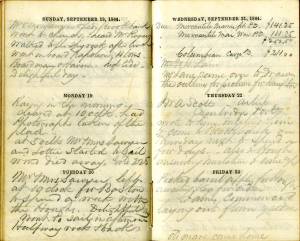
"November 17. Went to Gloucester. Pleasant morning, rainy evening.
Called upon Mr. Lane artist."
Also filed under: Diaries / Ledgers / Etc. »
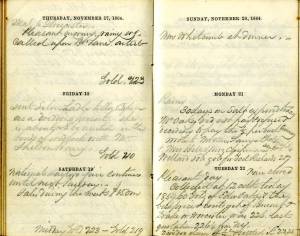
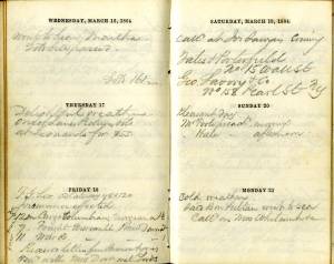
"November 23. Cool & pleasant. Went to Gloucester.
Size of Haughton's pictures 2. 18 x 30 & 1. 10 x 15. [Lane?]"
Also filed under: Diaries / Ledgers / Etc. » // Haughton, James »
Samuel Sawyer Papers
Cape Ann Museum Library & Archives
Archive Collection A#63
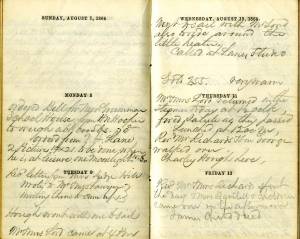
"Got painting. Lane's $50. For Mrs. Cowes. National Sailors Fair."
Also filed under: Boston – 1864 Sailors' Fair » // Cores [Cowes?] Mrs. » // Diaries / Ledgers / Etc. »
Samuel Sawyer Papers
Cape Ann Museum Library & Archives
Archive Collection
"December 2. Went out to call upon J. W. A. Scott East Cambridge artist. He had many sketches. Some of them taken at Gloucester."
Also filed under: Diaries / Ledgers / Etc. » // Scott, John W. A. »
Samuel Sawyer Papers
Cape Ann Museum Library & Archives
Archive Collection
"March 17. Delightful weather.
One of Lane’s Pictures sold at Leonard’s for $55"
Also filed under: Boston – 1864 Joseph Leonard & Co. » // Diaries / Ledgers / Etc. »
Samuel Sawyer Papers
Cape Ann Museum Library & Archives
Archive Collection
"Rosa Bonheur called" [According to Mary McCarl, this was the name of Sawyer's cow]
Also filed under: Diaries / Ledgers / Etc. »
Samuel Sawyer Papers
Cape Ann Museum Library & Archives
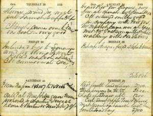
Archive Collection
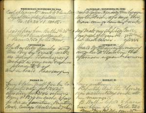
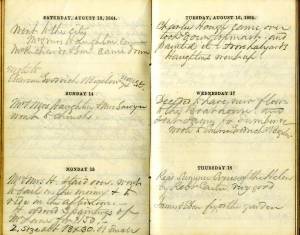
"August 15. Mr. & Mrs. H.(Haughton) staid over, went to sail in the morning & to ride in the afternoon. H. ordered 3 paintings of Mr. Lane for $150, 2 size about 18 x 30, & 1 small."
Also filed under: Diaries / Ledgers / Etc. » // Haughton, James »
Samuel Sawyer Papers
Cape Ann Museum Library & Archives
Archive Collection
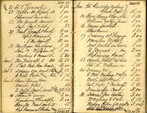
"August 25. Called to see Mr. Lane to make a sketch of old Homestead for Haughtons."
Also filed under: Brookbank » // Diaries / Ledgers / Etc. » // Haughton, James »
Samuel Sawyer Papers
Cape Ann Museum Library & Archives
Archive Collection
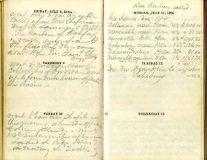
"Monday 8th
Ordered from F. H. Lane 2 Pictures 14 x 21 to be done when he is at leisure. One moonlight $25-$30. . .
Tuesday 9th
Called at Lane's studio"
Also filed under: Diaries / Ledgers / Etc. »
Samuel Sawyer Papers
Cape Ann Museum Library & Archives
Archive Collection
"Mr. [F.H. Lane - crossed out] Lane came over to draw the outline for picture for Haughton"
Also filed under: Diaries / Ledgers / Etc. » // Haughton, James »
Samuel Sawyer Papers
Cape Ann Museum Library & Archives
Archive Collection A#63
"Lane Picture Mrs. Cowes $50
Frame for same $18"
Also filed under: Boston – 1864 Sailors' Fair » // Cores [Cowes?] Mrs. » // Diaries / Ledgers / Etc. »
Samuel Sawyer Papers
Cape Ann Museum Library & Archives
Archive Collection
"Met Mr. Tuckerman the artist walking with Jos. Stevens."
Also filed under: Diaries / Ledgers / Etc. » // Stevens, Joseph, Jr. » // Tuckerman, Stephen Salisbury »