An online project under the direction of the CAPE ANN MUSEUM
Catalogue Entry
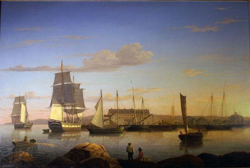
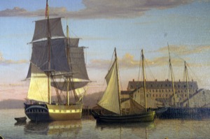
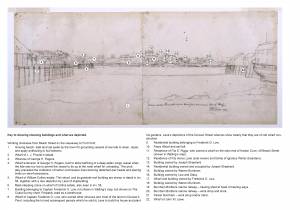
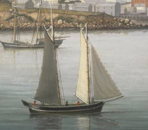
From the boulder-strewn south west corner of Duncan’s Point and looking west south west toward Fort Point, this view captures the completion of George H. Rogers’ wharf on Fort Point’s east side, which dates the painting to 1852 at the earliest. This painting completes the progression of shore side harbor development chronicled in Lane’s remarkable series of at least eight Inner Harbor paintings dating from 1847-52 (see Gloucester Harbor, 1847 (inv. 23), The Old Fort and Ten Pound Island, Gloucester, 1850s (inv. 30), The Fort and Ten Pound Island, Gloucester (Harbor Scene), 1848 (inv. 58), View of Gloucester Harbor, 1848 (inv. 97), The Fort and Ten Pound Island, Gloucester, Massachusetts, 1847 (inv. 271), Gloucester Inner Harbor, 1850 (inv. 240)).
More wharves and buildings were to appear along the south east shore in the following decade; this suggests that the picture was painted soon after the completion of the east side facilities, and it further suggests that Rogers, or one of his associates, was involved in its commission.
Beyond Fort Point lies Gloucester Harbor’s western shoreline with Norman’s Woe Cove and Norman’s Woe Rock at the painting’s left margin. In the right background the wooded hills of West Gloucester rise above Fort Point’s sandy causeway with its flake yards and wharves. Beyond, at far right, rises Sidney Mason’s Pavilion Hotel, built in 1849 to serve a growing tourist trade. This work shares the same crystalline light of the other works in the series; here Lane depicts a moment just before sunset with the sun casting strong shadows in the foreground and highlighting the half brig’s mizzen sail and gun ports leading the eye to Rogers’ large new building in the distance.
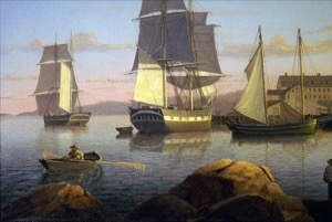
Afloat is a variety of watercraft reflecting aspects of Gloucester’s transition from a harbor of mixed trades to a port focused on a growing fishing industry. Most prominent is a brig (1), most likely used in the Surinam Trade, in which Rogers was heavily involved. Ever larger vessels used in this trade probably spurred Rogers to build his new wharf in deeper water at the entrance to Harbor Cove, but this move couldn’t keep up with the trend in vessel size. Along with other Gloucester merchants, Rogers moved his ships, warehouses, and office to Boston, leaving his new wharf to serve a growing fishing fleet.
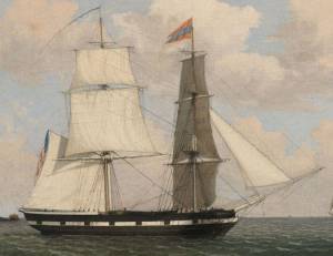
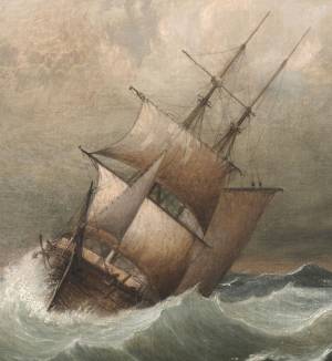
At left is a hermaphrodite brig (2), or “half brig” in New England nautical parlance, a type commonly used for longer passages in the coastal trade and with West Indian ports. The stern galleries (a row of windows across the transom) indicate a vessel of higher class, fitted for carrying passengers and cargos of higher value.
To the right of the brig is a “jigger”(3), a Chebacco boat converted to a schooner rig by adding a bowsprit and setting a jib. This example is of particular interest, her square stern indicating that she was a Chebacco boat variant called a “dog body” prior to her rig conversion. In The Old Fort and Ten Pound Island, Gloucester, 1850s (inv. 30), Lane has shown a similar conversion of a pink-stern Chebacco boat. By the 1850s, this type was no longer built, but those which survived were of durable construction and still active in coastal fisheries and fishing banks in the Gulf of Maine.
Just beyond the jigger, tied up at Rogers’ wharf, is a banks hand-lining schooner (4), its bluff bow and stern davits for shipping a yawl boat proclaiming a life of hard work and few comforts for its crew. Near the right margin is a newcomer to the fishing fleet—a sharpshooter fishing schooner also fitted for hand-lining, but with a more finely-modeled hull to increase speed. The 1840s and ‘50s saw the development of fast-sailing schooners capable of returning to port with the catch on ice for shipment and sale of fresh fish to distant inland markets. Thanks to the railroads, a wider market welcomed Gloucester’s fish while Gloucester’s growing tourist industry welcomed summer visitors.
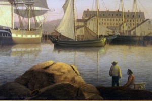
Lane was no less observant of humbler small craft, as seen in the painting’s foreground. Approaching from the right—under sail instead of being rowed—is a yawl boat (5), seemingly headed for a sailor who is seated on his sea chest. Is this a Gloucester version of a water taxi? At sea, yawl boats served as a fishing schooner’s lifeboat or for visiting other vessels; in port it was used to convey the captain to and from shore for official business, or to bring crew to and from the schooner for visits ashore or departure. Yawl boats retired from fishing filled useful roles in the shore fisheries, transportation about the harbor, or as “party boats” for sightseeing and sport fishing.
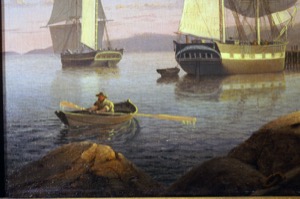
At left, a man in a dory (6) is rowing toward Rogers’ wharf, his mission indiscernible. In this period, dories were used in the shore fisheries; “dory trawling” using long lines with multiple hooks was then in its infancy and so far no record of its use has been found in Lane’s work.
– Erik Ronnberg
Historical Materials
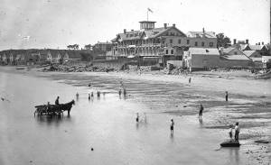
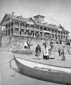
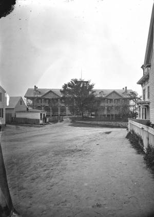
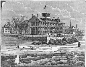
The Pavilion, built in 1849 for Sidney Mason, was Gloucester's first summer resort hotel. Mason was a patron of Lane, and he commissioned him to paint three views of scenes of his mercantile successes: New York Harbor, San Juan [Saint John] Harbor, and Gloucester Harbor, 1852 (inv. 38), in which the hotel, with all its porches, towers and tracery, is a prominent feature. Mason himself helped the architect S. Charles Bugbee design the building, that was then constructed by White and Winchester. A grist windmill, originally owned by Ignatius Webber and then by Sidney Mason's father, John Mason, had stood on the hill since 1814, but, in preparation for the Pavilion Hotel, was moved to the inner-harbor side of the old Fort and eventually burned in 1877. Both the windmill and the Fort can be seen in several Lane harbor paintings and drawings.
Sidney Mason lived in New York City at this time but was closely connected to his home town of Gloucester and owned another, traveler's hotel, the Gloucester House. But the Pavilion brought in an entirely new and different type of visitor to the fishing and trading town of Gloucester. The railroad from Boston had reached Salem in 1839 and Gloucester in November 1847. This not only led to Lane's return to Gloucester after his fifteen year residence in Boston, it also facilitated an influx of summer people. Before this time, a combination of stagecoaches, ferries, steamers and trains was needed to make the trip. Now, the wealthy from New York and Philadelphia could travel easily to Gloucester, as well as to other North Shore communities.
The hotel was not isolated from the business of the town. Next door to the west was one of the several long ropewalks in town. It was built by Ignatius Webber in 1803 and produced many of the miles of hemp rope and twine needed in the maritime trading and fishing trades. To the east, along the beach, were flake yards, where acres of split cod and other fish were laid out to dry in the sun. Lane did not include these in his painting. Nor is there any sign of tension between the tourist hotel and the local inhabitants and industries.
The Pavilion Hotel offered spectacular views and walks, both coastal and inland, and bathing was available all along the public beach that stretched to the Fort. The hotel itself was advertised as elegant, with luxurious sitting rooms, gas lighting and modern conveniences. Its first years were not entirely successful under the management of Dr. H.T. Haughey, once manager of Delaware's Brandywine Springs. But in 1852, Col. Abijah Peabody, manager of Mason's other hotel, the Gloucester House, took over the Pavilion and it flourished.
The Pavilion Hotel grounds were used during the Civil War as a recruiting office. It became the Surfside Hotel, and burned on Saturday, October 17, 1914. It was soon replaced by the Tavern, and that building still exists although no longer as a hotel and without the elegance and architectural flare of the original Pavilion.
Current address: 28–30 Western Avenue, The Tavern.
– Sarah Dunlap (September, 2013)
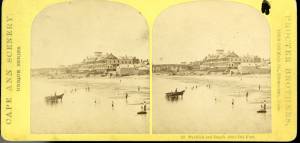
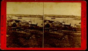
Stereograph card
Cape Ann Museum Library & Archive
Pavilion Hotel and the beach looking west from the Fort, Beach Court and Western Avenue.
Also filed under: Pavilion (Publick) Beach »
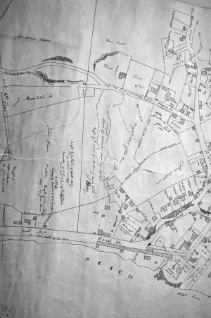
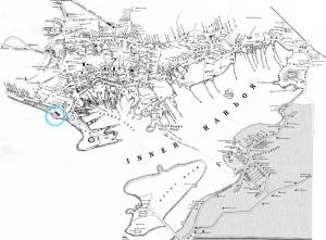
1834–35 Lithograph 24 x 38 in. Gloucester City Archives
"Drawn on a scale of one hundred feet to an inch. By John Mason 1834–45 from Actual Survey showing every Lott and building then standing on them giving the actual size of the buildings and width of the streets from the Canal to the head of the Harbour & part of Eastern point as farr as Smith's Cove and the Shore of the same with all the wharfs then in use. Gloucester Harbor 1834–1835."
This section of the map shows the location of the Pavilion Hotel and ropewalk along the beach.
Also filed under: Maps » // Mason, John » // Pavilion (Publick) Beach » // Ropewalk » // Windmill »

1851 44 x 34 in. Henry Francis Walling, Map of the Towns of Gloucester and Rockport, Essex Co. Massachusetts. Philadelphia, A. Kollner, 1851 Cape Ann Museum Library & Archive
"Map of the Towns of Gloucester and Rockport, Massachusetts. H.F. Walling, Civil Engineer. John Hanson, Printer. 1851. Population of Gloucester in 1850 7,805. Population of Rockport in 1850 3,213."
Also filed under: Baptist Church (Old, First, 1830) (Pleasant Street) » // Burnham Brothers Marine Railway » // Duncan's Point » // Five Pound Island » // Flake Yard » // Gloucester Harbor, Inner / Harbor Cove » // Harbor Methodist Church (Prospect Street) » // Low (Frederick G.) wharves » // Procter Brothers » // Ropewalk » // Vincent's Cove » // Western Shore »
Newspaper
Gloucester Telegraph p. 2 col. 2
Boston Public Library
Accession # G587
"Charlotte Cushman leaves for Europe today in steamship Asia, from New York,– She takes with her two of Lane's finest marine paintings, which she purchased on Monday."
Also filed under: Cushman, Charlotte » // Newspaper / Journal Articles »
1854 Newspaper "Letters on Art. - No. IV"
"In that space [four years] the town has grown greatly . . . a great ugly, yellow "Pavilion" suns itself on the rocks . . . I said there are only two stone buildings in this town of Gloucester: one is "the Bank," the other belongs to Mr. F. H. Lane, whose name ought to be known from Maine to Georgia as the best marine painter in the country.
If Mr. Lane is not as well known as he ought to be, he has at least no reason to complain of neglect or want of appreciation. He has been painting only fifteen years, and his pictures are in great demand; hitherto chiefly among sea-faring men, but now winning way in other circles. In former times I used to be often in Mr. Lane's painting-room, and it was with real pleasure that I found my way to his new house, built from his own design, of native granite, as I mentioned, handsome, peculiar, stable, and commanding a wide sweep of land and ocean from its ample windows. The house is the best that has been built in Gloucester for fifty years. . .
Mr. Lane has put few pictures in his studio at present; for he is very industrious, and sends his canvases off as fast as they are filled. If you were to meet him in the street, you would hardly take him for an artist. A man apparently of forty years, walking with difficulty, supported by crutches, hard-handed, browned by the sun and exposure, with a nose indicating less the artist sensibility than the artist resolution . . .
His early pictures had something in them too hard and practical to permit enthusiastic admiration; the water was salt, the ships sailed, the waves moved, but it was the sea before the Spirit of God moved upon the face of the deep.
His pictures early delighted sailors by their perfect truth. Lane knows the name and place of every rope on a vessel; he knows the construction, the anatomy, the expression – and to a seaman every thing that sails has expression and individuality . . . [Lane] has earned his money thus far mostly by painting "portraits" of vessels for sailors and ship-owners. It is owing to this necessity, perhaps, that he has fallen into the fault of too great literalness of treatment, which I have mentioned as characterizing some of his earlier works; but with the rapid advance he has made in the past four years, there is no longer any fear that he is incapable of treating a subject with genuine imagination . . .
He has indulged in no tricks and no vagaries; he has slighted nothing, despised nothing. If I appear to think less of his early pictures than they deserve, it is not because they are carefully even painfully studied, and because no detail has escaped his eye or brush; it is not that he has too much conscience; but simply because I missed in them the creative imagination of the artist. But it may well be a question whether at this day, when slight and untruthful work prevails, when artists will not paint with conscience, and the public does not strenuously demand it, conscience and love are not higher needs than imagination, and whether Mr. Lane's early pictures, the landmarks on his toilsome, earnest journey to his present place, have not a great value of their own. There is not one of them that I have seen, without some valuable passage, showing acute observation and careful, studious execution.
A sea-piece, "Off the coast of Maine, with Desert-Island in the distance," is the finest picture that Mr. Lane has yet painted. The time is sunset after a storm. The dun and purple clouds roll away to the south-west, the sun sinks in a glory of yellow light, flooding the sea with transparent splendor. Far away in the offing, hiding the sun, sails a brig fully rigged . . . I urged Mr. Lane to send this picture to New-York for exhibition . . ."
Also filed under: Newspaper / Journal Articles » // Residences »
Newsprint
Gloucester Telegraph
Cape Ann Museum Library & Archive
At a Sanitary Fair held at the Pavilion "obtained through the favor and generosity of the owner, Mr. SIDNEY MASON, of New York, and to whom many thanks are due." "... hangs a fine picture, the generous gift of our own Artist, Mr. Lane. The Subject is "Coffin's Beach," as seen from the "Loaf." This is the most costly article on sale in the rooms, and is valued at $100. It will be disposed of by tickets $1 each."
Two paintings by Lane, Little Good Harbor Beach and View from the Loaf were on sale at the Fair.
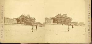
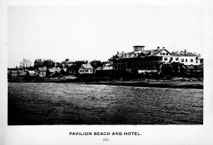
c.1870s Stereograph card Cape Ann Museum Library & Archive
Stereo view of the Pavilion from the southern or sea side.
Also filed under: Historic Photographs » // Pavilion (Publick) Beach »
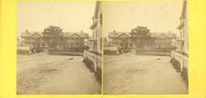
Stereograph card Hervey Friend, Gloucester, Mass., Publisher Cape Ann Museum Library & Archive
Stereo view of the Pavilion Hotel from the street side.
Also filed under: Historic Photographs »
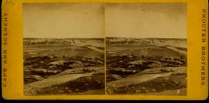
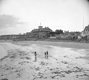
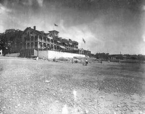
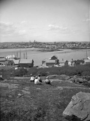
c.1890 Stereograph card Cape Ann Museum Library & Archive
"In the foreground is a clear sheet of water which washes upon the beach beyond. The Pavilion is quite prominent, while upon the rising background can be seen the steeples of the several churchs, the tower of the first Town House, and the Collins School House."
Also filed under: Gloucester – City Views » // Historic Photographs » // Stage Rocks / Stage Fort / Stage Head »
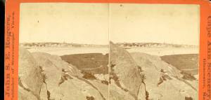
c.1880 Stereograph card Cape Ann Museum Library & Archive
"Bond's Hill is a high eminence on the west side of Gloucester Harbor. The foreground is very rocky and shows a portion of the old road to West Gloucester and Essex, used before the road was built across the marsh, which is to be seen in the center of the picture. Beyond the marsh road is the canal with its dyke. Then the ground rises and dwelling houses appear, till Lookout Hill (or Mount Vernon Street.) can be seen on the left of the background. On the right of the picture is the 'Cut' road, the only carriage entrance into the main part of the town. Beyond it is to be seen 'Crescent Beach,' with the Pavilion and 'old Fort' and a portion of East Gloucester in the background. In the centre of the picture can be seen the unfinished tower of the Town House, and in the distance is the open sea, with Thatcher's Island and its lighthouses just discernible."
Also filed under: Gloucester – City Views » // Historic Photographs »
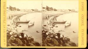
c.1870s Stereograph card Cape Ann Museum Library & Archive
Also filed under: Historic Photographs » // Pavilion (Publick) Beach »
c.1870s Stereograph card Cape Ann Museum Library & Archive
Also filed under: Historic Photographs » // Pavilion (Publick) Beach »
c.1870 Cape Ann Museum Library & Archive
Taken from Fort Point looking west. Ropewalk just to west of hotel.
Also filed under: Historic Photographs » // Pavilion (Publick) Beach » // Ropewalk »
c.1900.
Also filed under: Pavilion (Publick) Beach »
The northeast quarter of Gloucester Harbor is an inlet bounded by Fort Point and Rocky Neck at its entrance. It is further indented by three coves: Harbor Cove and Vincent’s Cove on its north side, and Smith’s Cove on its south side. The shallow northeast end is called Head of the Harbor. Collectively, this inlet with its coves and shallows is called Inner Harbor.
The entrance to Inner Harbor is a wide channel bounded by Fort Point and Duncan’s Point on its north side, and by Rocky Neck on its south side. From colonial times to the late nineteenth century, it was popularly known as “the Stream” and served as anchorage for deeply loaded vessels for “lightering” (partial off-loading). Subsequently it was known as “Deep Hole.”
Of Inner Harbor’s three coves, Harbor Cove (sometimes called “Old Harbor” in later years) was the deepest and most heavily used by fishing vessels in the Colonial Period, and largely dominated by the foreign trade in the first half of the nineteenth century. Its shallow bottom was the undoing of the foreign trade, as larger vessels became too deep to approach its wharves, and the cove returned to servicing a growing fishing fleet in the 1850s.
Vincent’s Cove, a smaller neighbor to Harbor Cove, was bare ground at low tide, and mostly useless for wharfage. Its shoreline was well suited for shipbuilding, and the cove was deep enough at high tide for launching. Records of shipbuilding there prior to the early 1860s have to date not been found.Smith’s Cove afforded wharfage for fishing vessels at its east entrance, as seen in Lane’s lithograph View of the Town of Gloucester, Mass., 1836 (inv. 86). The rest of the cove saw little use until the expansion of the fisheries after 1865.
The Head of the Harbor begins at the shallows surrounding Five Pound Island, extending to the harbor’s northeast end. Lane’s depiction of this area in Gloucester Harbor, 1847 (inv. 23) shows the problems faced by vessel owners at low tide. Despite the absence of deep water, this area saw rapid development after 1865 when a thriving fishing industry needed waterfront facilities, even if they were accessible only at high tide.
– Erik Ronnberg

c.1870 Cape Ann Museum Library & Archive (2013.068)
Schooner fleet anchored in the inner harbor. Looking east from Rocky Neck, Duncan's Point wharves and Lane house (at far left), Sawyer School cupola on Friend Street.
Also filed under: Duncan's Point » // Historic Photographs » // Schooner (Fishing) » // Waterfront, Gloucester »
1876 Photograph Cape Ann Museum Library & Archive
Also filed under: Historic Photographs » // Schooner (Fishing) » // Waterfront, Gloucester »
1851 44 x 34 in. Henry Francis Walling, Map of the Towns of Gloucester and Rockport, Essex Co. Massachusetts. Philadelphia, A. Kollner, 1851 Cape Ann Museum Library & Archive
"Map of the Towns of Gloucester and Rockport, Massachusetts. H.F. Walling, Civil Engineer. John Hanson, Printer. 1851. Population of Gloucester in 1850 7,805. Population of Rockport in 1850 3,213."
Also filed under: Baptist Church (Old, First, 1830) (Pleasant Street) » // Burnham Brothers Marine Railway » // Duncan's Point » // Five Pound Island » // Flake Yard » // Harbor Methodist Church (Prospect Street) » // Low (Frederick G.) wharves » // Pavilion Hotel » // Procter Brothers » // Ropewalk » // Vincent's Cove » // Western Shore »

4 x 6 in.
Cape Ann Museum, Benham Collection
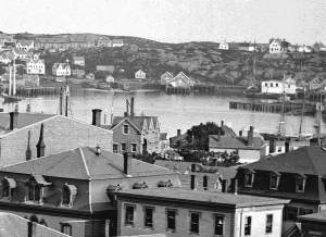
George Steele sail loft, William Jones spar yard, visible across harbor. Photograph is taken from high point on the Fort, overlooking business buildings on the Harbor Cove side.
Also filed under: Fort (The) and Fort Point » // Town House » // Universalist Church (Middle and Church Streets) » // Waterfront, Gloucester »


1834–35 Lithograph 24 x 38 in. Gloucester City Archives
"Drawn on a scale of one hundred feet to an inch. By John Mason 1834–45 from Actual Survey showing every Lott and building then standing on them giving the actual size of the buildings and width of the streets from the Canal to the head of the Harbour & part of Eastern point as farr as Smith's Cove and the Shore of the same with all the wharfs then in use. Gloucester Harbor 1834–35."
This map shows the location of F. E. Low's wharf and the ropewalk. Duncan's Point, the site where Lane would eventually build his studio, is also marked.
The later notes on the map are believed to be by Mason.
Also filed under: Duncan's Point » // Low (Frederick G.) wharves » // Low, Capt. Frederick Gilman » // Maps » // Mason, John » // Residences » // Ropewalk » // Somes, Capt. John »
44 x 34 in.
Henry Francis Walling, Map of the Towns of Gloucester and Rockport, Essex Co. Massachusetts. Philadelphia, A. Kollner, 1851
Cape Ann Museum Library & Archive
"Map of the Towns of Gloucester and Rockport, Massachusetts. H.F. Walling, Civil Engineer. John Hanson, Publisher. 1851. Population of Gloucester in 1850 7,805. Population of Rockport in 1850 3,213."
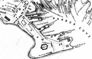
Segment of Harbor Village portion of map showing Collins' and other wharves in the Inner Harbor.
Also filed under: Graving Beach »

Collection of Erik Ronnberg
View related catalogue entries (2) »
Also filed under: Dolliver's Neck » // Fresh Water Cove » // Gloucester Harbor, Outer » // Maps »

1865 41 x 29 inches Courtesy of the Massachusetts Archives Maps and Plans, Third Series Maps, v.66:p.1, no. 2352, SC1/series 50X
.
Also filed under: Burnham Brothers Marine Railway » // Collins's, William (estate wharf) » // Maps » // Rogers's (George H.) wharves »
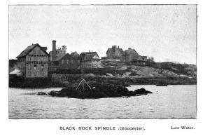
Photograph in The Illustrated Coast Pilot with Sailing Directions. The Coast of New England from New York to Eastport, Maine including Bays and Harbors, published by N. L. Stebbins, Boston
Also filed under: Beacons / Monuments / Spindles »
Stereograph card Cape Ann Museum Library & Archive
Also filed under: Gloucester – City Views » // Historic Photographs »
c.1870s Stereograph card Cape Ann Museum Library & Archive
From East Gloucester looking towards Gloucester.
Also filed under: Gloucester – City Views » // Historic Photographs »
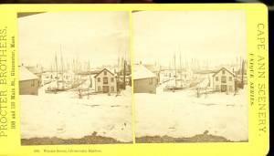
1876 Stereograph card Cape Ann Museum Library & Archive
Stereo view showing Gloucester Harbor after a heavy snowfall
Also filed under: Historic Photographs » // Waterfront, Gloucester »
Cape Ann Museum Library & Archive
Five Pound Island and Gloucester inner harbor taken from the top of Hammond Street building signs in foreground are for Severance, Carpenter and Crane, and Cooper at Clay Cove.
Also filed under: Five Pound Island »
1852
Oil on canvas
28 x 48 1/2 in.
Cape Ann Museum, Gloucester, Mass., Deposited by the City of Gloucester, 1952. Given to the city by Mrs. Julian James in memory of her grandfather Sidney Mason, 1913 (DEP. 200)
Detail of fishing schooner.
Also filed under: Schooner (Fishing) »
Oil on canvas
34 x 45 3/4 in.
Cape Ann Museum, Gloucester, Mass., Gift of Mrs. Jane Parker Stacy (Mrs. George O. Stacy),1948 (1289.1a)
Detail of party boat.
Also filed under: Party Boat »
c.1869 Glass plate negative Cape Ann Museum Library & Archive Detail from CAHA#00279
The magnificent views of Gloucester Harbor and the islands from the top floor of the stone house at Duncan's Point where Lane had his studio were the inspiration for many of his paintings.
From Buck and Dunlop, Fitz Henry Lane: Family, and Friends, pp. 59–74.
Also filed under: Duncan's Point » // Lane's Stone House, Duncan's Point » // Residences »
Glass plate negative
3 x 4 in.
Cape Ann Museum Library & Archive
#10112
Also filed under: Chebacco Boat / Dogbody / Pinky »

1876 Photograph Cape Ann Museum Library & Archive
Ignatius Weber's windmill (now defunct) is shown.
Also filed under: Flake Yard » // Fort (The) and Fort Point » // Historic Photographs » // Rogers's (George H.) wharves » // Schooner (Fishing) » // Waterfront, Gloucester » // Windmill »

1860 In John J. Babson, History of the Town Gloucester (Gloucester, MA: Procter Brothers, 1860) Cape Ann Museum Library & Archives, Gloucester, Mass.
See p. 474.
View related catalogue entries (4) »
Also filed under: Babson History of the Town of Gloucester » // Chebacco Boat / Dogbody / Pinky » // Fort (The) and Fort Point » // Gloucester, Mass. - "Ten Pound Island Light » // Schooner (Coasting / Lumber / Topsail / Packet / Marsh Hay) » // Ten Pound Island »
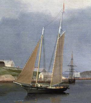
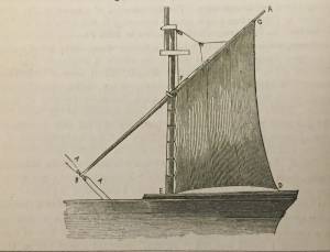
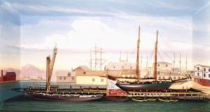
In general, brigs were small to medium size merchant vessels, generally ranging between 80 and 120 feet in hull length. Their hull forms ranged from sharp-ended (for greater speed; see Brig "Antelope" in Boston Harbor, 1863 (inv. 43)) to “kettle-bottom” (a contemporary term for full-ended with wide hull bottom for maximum cargo capacity; see Ships in Ice off Ten Pound Island, Gloucester, 1850s (inv. 44) and Boston Harbor, c.1850 (inv. 48)). The former were widely used in the packet trade (coastwise or transoceanic); the latter were bulk-carriers designed for long passages on regular routes. (1) This rig was favored by Gloucester merchants in the Surinam Trade, which led to vessels so-rigged being referred to by recent historians as Surinam brigs (see Brig "Cadet" in Gloucester Harbor, late 1840s (inv. 13) and Gloucester Harbor at Dusk, c.1852 (inv. 563)). (2)
Brigs are two-masted square-rigged vessels which fall into three categories:
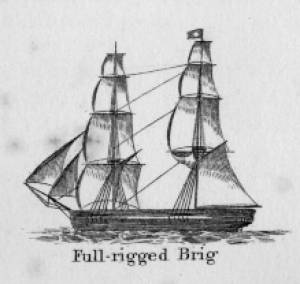
Full-rigged brigs—simply called brigs—were fully square-rigged on both masts. A sub-type—called a snow—had a trysail mast on the aft side of the lower main mast, on which the spanker, with its gaff and boom, was set. (3)
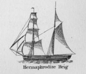
Brigantines were square-rigged on the fore mast, but set only square topsails on the main mast. This type was rarely seen in America in Lane’s time, but was still used for some naval vessels and European merchant vessels. The term is commonly misapplied to hermaphrodite brigs. (4)
Hermaphrodite brigs—more commonly called half-brigs by American seamen and merchants—were square-rigged only on the fore mast, the main mast being rigged with a spanker and a gaff-topsail. Staysails were often set between the fore and main masts, there being no gaff-rigged sail on the fore mast.
– Erik Ronnberg
References:
1. Howard I. Chapelle, The National Watercraft Collection (Washington, DC: Smithsonian Institution, 1960), 64–68.
2. Alfred Mansfield Brooks, Gloucester Recollected: A Familiar History (Gloucester, MA: Peter Smith, 1974), 62–74. A candid and witty view of Gloucester’s Surinam Trade, which employed brigs and barks.
3. R[ichard] H[enry] Dana, Jr., The Seaman's Friend (Boston: Thomas Groom & Co., 1841. 13th ed., 1873), 100 and Plate 4 and captions; and M.H. Parry, et al., Aak to Zumbra: A Dictionary of the World's Watercraft (Newport News, VA: The Mariners’ Museum, 2000), 95.
4. Parry, 95, see Definition 1.
Oil on canvas
17 1/4 x 25 3/4 in.
Cape Ann Museum, Gloucester, Mass., Gift of Isabel Babson Lane, 1946 (1147.a)
Photo: Cape Ann Museum
Detail of brig "Cadet."
Also filed under: "Cadet" (Brig) »
Painting on board
72 x 48 in.
Collection of Erik Ronnberg
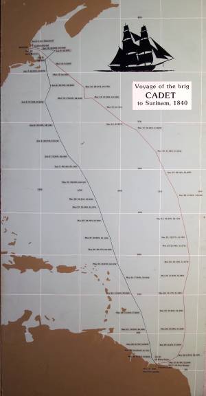
Chart showing the voyage of the brig Cadet to Surinam and return, March 10–June 11, 1840.
Also filed under: "Cadet" (Brig) » // Surinam Trade »

Hermaphrodite brigs—more commonly called half-brigs by American seamen and merchants—were square-rigged only on the fore mast, the main mast being rigged with a spanker and a gaff-topsail. Staysails were often set between the fore and main masts, there being no gaff-rigged sail on the fore mast. (1)
The half-brig was the most common brig type used in the coasting trade and appears often in Lane’s coastal and harbor scenes. The type was further identified by the cargo it carried, if it was conspicuously limited to a specialized trade. Lumber brigs (see Shipping in Down East Waters, 1854 (inv. 212) and View of Southwest Harbor, Maine: Entrance to Somes Sound, 1852 (inv. 260)) and hay brigs (see Lighthouse at Camden, Maine, 1851 (inv. 320)) were recognizable by their conspicuous deck loads. Whaling brigs were easily distinguished by their whaleboats carried on side davits (see ). (2)
– Erik Ronnberg
References:
1. M.H. Parry, et al., Aaak to Zumbra: A Dictionary of the World's Watercraft Newport News, VA: The Mariners’ Museum, 2000), 268, 274; and A Naval Encyclopaedia (L.R. Hamersly & Co., 1884. Reprint: Detroit, MI: Gale Research Company, 1971), 93, under "Brig-schooner."
2. W.H. Bunting, An Eye for the Coast (Gardiner, ME: Tilbury House: 1998), 52–54, 68–69; and W.H. Bunting, A Day's Work, part 1 (Gardiner, ME: Tilbury House: 1997), 52.
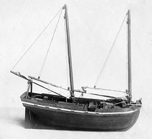
The colonial American shallop is the ancestor of many regional types of New England fishing craft found in Lane's paintings and drawings, including "New England Boats" (known as "boats" and discussed elsewhere), and later descendents, such as "Chebacco Boats," "Dogbodies," and "Pinkies."
These boats were very common work boat types on Cape Ann throughout the 1800s. They were primarily used for inshore coastal fishing, which included lobstering, gill-netting, fish-trapping, hand-lining, and the like. They were usually sailed by one or two men, sometimes with a boy, and could be rowed as well as sailed. An ordinary catch would include rock cod, flounder, fluke, dabs, or other small flat fish. The catch would be eaten fresh, or salted and stored for later consumption, or used as bait fish. Gill-netting would catch herring and alewives when spawning. Wooden lobster traps were marked with buoys much as they are today, and hauled over the low sides of the boat, emptied of lobsters and any by-catch, re-baited and thrown back.
CHEBACCO BOATS AND PINKIES
In the Chebacco Parish of the Ipswich Colony, a larger version of the colonial shallop evolved to a heavily built two-masted boat with either a sharp or square stern. This development included partial decking at bow and stern, the former as a cuddy which was fitted with crude bunks and a brick fireplace for cooking. Further development provided midship decking over a fish hold with standing rooms fore and aft for fishing. At this stage, low bulwarks replaced simple rails and in the double-enders were extended aft beyond the rudderhead to form a “pinched,” or “pink“ stern. Some time in the second half of the eighteenth century, boats with these characteristics became known as Chebacco Boats. The squarestern versions were called Dogbodies, for reasons now forgotten. (1)
Chebacco Boats became the vessels of choice for Cape Ann fishermen working coastal grounds for cod, mackerel, herring, and groundfish with hook and line or with nets. This did not prevent them from venturing further, particularly in pursuit of migrating schools of mackerel. The “Bashalore,” a corruption of the Bay of Chaleur in the Gulf of St. Lawrence, was a favorite destination for Cape Ann Fishermen who fished for mackerel in that region. (2)
Lane undoubtedly saw Chebacco Boats in the years prior to his move to Boston, but if he made drawings or paintings of them in that period, none have come to light. A small lithograph, titled “View of the Old Fort and Harbor 1837,” is attributed to him, but the vessels and wharf buildings are too crudely drawn to warrant this undocumented claim. (3) Lane did see and render accurately the Chebacco Boat’s successor the Pinky—which was larger and had a schooner rig (two masts, main sail, fore sail, jib, and main topmast staysail).
Schooners with pinksterns were recorded early in the 18th century later that there were models and graphic representations of hull form and rig (Ref. 4). By then, the pinky was very similar in hull form to Chebacco Boats, and some Chebacco Boats were converted to pinkies by giving them schooner rigs. A pinky in Lane’s The Old Fort and Ten Pound Island, Gloucester, 1850s (inv. 30) (misdated 1850s, more likely mid-1840s) is quite possibly an example of such a conversion.
Lane’s depictions of pinkies in Massachusetts waters are numerous and sometimes very informative. Examples in his views of Gloucester Harbor portray them at various angles, from broadside (see Gloucester Harbor from Rocky Neck, 1844 (inv. 14), The Old Fort and Ten Pound Island, Gloucester, 1850s (inv. 30), and View of the Town of Gloucester, Mass., 1836 (inv. 86)) to stern (see The Western Shore with Norman's Woe, 1862 (inv. 18), The Old Fort and Ten Pound Island, Gloucester, 1850s (inv. 30), and Gloucester Harbor, 1850s (inv. 391)), but few, if any, bow views. His portrayals of pinkies in Boston Harbor and vicinity are more in the foreground and more generous in detail. The earliest of these, from 1845, shows a pinky getting underway in a hurry as the yacht "Northern Light" bears down on her in The Yacht "Northern Light" in Boston Harbor, 1845 (inv. 268). A late harbor view (id ) offers a rare bow view.
Like the Chebacco Boat, the pinky was primarily a fishing vessel, doing much the same kind of fishing in coastal waters, but large enough to venture further offshore to work on the banks in the Gulf of Maine in pursuit of the cod. By the 1820s, pinkies reached their largest size: 50 to 60 feet on deck. Beyond that size called for a different deck arrangement and higher rails, so men could stand on deck and fish from the rails – an arrangement offered by the banks fishing schooner. (5)
What is perhaps Lane’s most detailed and narrative view of a pinky appears in Becalmed Off Halfway Rock, 1860 (inv. 344) and dominates the right foreground. Fitted-out for mackerel gillnetting, she has a dory and a wherry in tow, the latter with the net in the stern. The crew is relaxed, enjoying the evening calm as the vessel heads for port. The barrels on deck are filled with freshly caught mackerel, which will be sold as such when landed, most likely at Gloucester. This pinky was probably fishing on Stellwagen Bank or Cape Cod Bay, which were good fishing grounds for mackerel, and close enough to Gloucester to make trips in smaller vessels worthwhile. To judge from his paintings, Lane found only a few pinkies in the parts of the Maine Coast he explored. Only one drawing (Southwest Harbor, Mount Desert, 1852 (inv. 184)) and two widely published paintings (Entrance of Somes Sound, Mount Desert, Maine, 1855 (inv. 347) and Bar Island and Mt. Desert Mountains from Somes Settlement, 1850 (inv. 401)) illustrate this type, and then at a distance. What is apparent is that pinkies in southern Maine did not differ markedly from those on the Massachusetts coast. Had Lane ventured further Down East, he might have found modifications to the type that reflected Canadian influences. (6)
– Erik Ronnberg
References:
1. William A. Baker, Sloops & Shallops (Barre, MA: Barre Publishing Co., 1966), 82–91; and Howard I. Chapelle, The American Fishing Schooners, 1825–1935 (New York: W.W. Norton & Co., 1973), 25–27.
2. G. Brown Goode, The Fisheries and Fishery Industries of the United States, Section V, Vol. I (Washington, DC: Government Printing Office, 1884–87), 275, 287, 298–300, 419–21, 425–32, 459–63.
3. John J. Babson, History of the Town of Gloucester, Cape Ann (Procter Bros., 1860, reprint: Gloucester, MA: Peter Smith, 1972), see lithograph facing p. 474.
4. Goode, 275–77, 280, 294–96.
5. Chapelle, 36–37.
6. Ibid., 45–54.
Glass plate negative
3 x 4 in.
Cape Ann Museum Library & Archive
#10112
Also filed under: Gloucester Harbor, Inner / Harbor Cove »
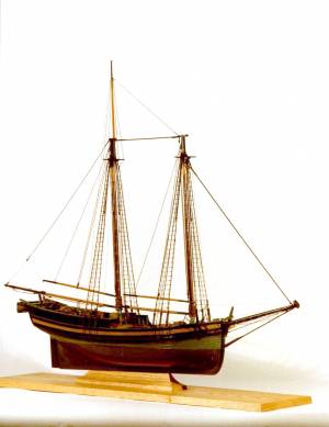
Also filed under: Ship Models »
Also filed under: Ship Models »
Also filed under: Ship Models » // Small Craft – Wherries, and Dories »
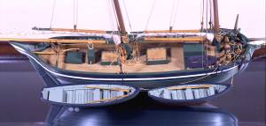
20" l. x 19" h. x 3 3/4" w. [not to scale]
Cape Ann Museum. Gift of Mr. J. Hollis Griffin, 1940 (891)
"Pinkys" were early nineteenth-century schooner-rigged derivations of Chebacco boats. This model is a good example of a traditional “sailor’s model,” or in this case, a sailmaker’s model, Mr. Nickerson having been a sailmaker.
Also filed under: Ship Models »
1860 In John J. Babson, History of the Town Gloucester (Gloucester, MA: Procter Brothers, 1860) Cape Ann Museum Library & Archives, Gloucester, Mass.
See p. 474.
View related catalogue entries (4) »
Also filed under: Babson History of the Town of Gloucester » // Fort (The) and Fort Point » // Gloucester Harbor, Inner / Harbor Cove » // Gloucester, Mass. - "Ten Pound Island Light » // Schooner (Coasting / Lumber / Topsail / Packet / Marsh Hay) » // Ten Pound Island »
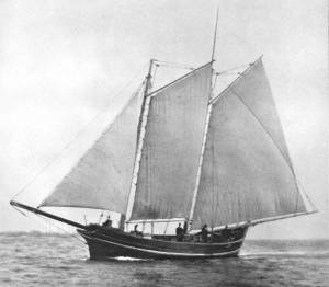
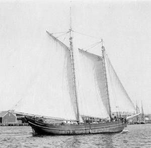
Schooners in Lane’s time were, with few exceptions, two-masted vessels carrying a fore-and-aft rig having one or two jibs, a fore staysail, gaff-rigged fore- and main sails, and often fore- and main topsails. One variant was the topsail schooner, which set a square topsail on the fore topmast. The hulls of both types were basically similar, their rigs having been chosen for sailing close to the wind. This was an advantage in the coastal trade, where entering confined ports required sailing into the wind and frequent tacking. The square topsail proved useful on longer coastwise voyages, the topsail providing a steadier motion in offshore swells, reducing wear and tear on canvas from the slatting of the fore-and-aft sails. (1)
Schooners of the types portrayed by Lane varied in size from 70 to 100 feet on deck. Their weight was never determined, and the term “tonnage” was a figure derived from a formula which assigned an approximation of hull volume for purposes of imposing duties (port taxes) oncargoes and other official levies. (2)
Crews of smaller schooners numbered three or four men. Larger schooners might carry four to six if a lengthy voyage was planned. The relative simplicity of the rig made sail handling much easier than on a square-rigged vessel. Schooner captains often owned shares in their vessels, but most schooners were majority-owned by land-based firms or by individuals who had the time and business connections to manage the tasks of acquiring and distributing the goods to be carried. (3)
Many schooners were informally “classified” by the nature of their work or the cargoes they carried, the terminology coined by their owners, agents, and crews—even sometimes by casual bystanders. In Lane’s lifetime, the following terms were commonly used for the schooner types he portrayed:
Fishing Schooners: While the port of Gloucester is synonymous with fishing and the schooner rig, Lane depicted only a few examples of fishing schooners in a Gloucester setting. Lane’s early years coincided with the preeminence of Gloucester’s foreign trade, which dominated the harbor while fishing was carried on from other Cape Ann communities under far less prosperous conditions than later. Only by the early 1850s was there a re-ascendency of the fishing industry in Gloucester Harbor, documented in a few of Lane’s paintings and lithographs. Depictions of fishing schooners at sea and at work are likewise few. Only A Smart Blow, c.1856 (inv. 9), showing cod fishing on Georges Bank (4), and At the Fishing Grounds, 1851 (inv. 276), showing mackerel jigging on Georges Bank, are known examples. (5)
– Erik Ronnberg
References:
1. Howard I. Chapelle, The History of American Sailing Ships (New York: W.W. Norton & Co., 1935), 258. While three-masted schooners were in use in Lane’s time, none have appeared in his surviving work; and Charles S. Morgan, “New England Coasting Schooners”, The American Neptune 23, no. 1 (DATE): 5–9, from an article which deals mostly with later and larger schooner types.
2. John Lyman, “Register Tonnage and its Measurement”, The American Neptune V, nos. 3–4 (DATE). American tonnage laws in force in Lane’s lifetime are discussed in no. 3, pp. 226–27 and no. 4, p. 322.
3. Ship Registers of the District of Gloucester, Massachusetts, 1789–1875 (Salem, MA: The Essex Institute, 1944). Vessels whose shipping or fishing voyages included visits to foreign ports were required to register with the Federal Customs agent at their home port. While the vessel’s trade or work was unrecorded, their owners and master were listed, in addition to registry dimensions and place where built. Records kept by the National Archives can be consulted for information on specific voyages and ports visited.
4. Howard I. Chapelle, The National Watercraft Collection (Washington, DC: Smithsonian Institution, 1960), 74–76.
5. Howard I. Chapelle, The American Fishing Schooners (New York: W.W. Norton & Co., 1973), 58–75, 76–101.
1852
Oil on canvas
28 x 48 1/2 in.
Cape Ann Museum, Gloucester, Mass., Deposited by the City of Gloucester, 1952. Given to the city by Mrs. Julian James in memory of her grandfather Sidney Mason, 1913 (DEP. 200)
Detail of fishing schooner.
Also filed under: Gloucester Harbor, Inner / Harbor Cove »
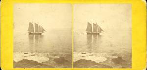
c.1865 Stereograph card Frank Rowell, Publisher stereo image, "x " on card, "x" Cape Ann Museum Library & Archive
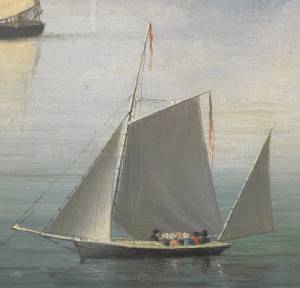
View showing a sharpshooter fishing schooner, circa 1850. Note the stern davits for a yawl boat, which is being towed astern in this view.
Also filed under: Historic Photographs »
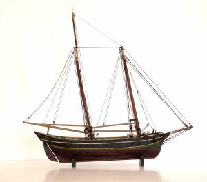
Model made for marine artist Thomas M. Hoyne
scale: 3/8" = 1'
Thomas M. Hoyne Collection, Mystic Seaport, Conn.
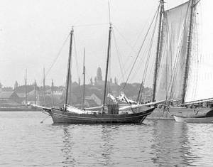
While this model was built to represent a typical Marblehead fishing schooner of the early nineteenth century, it has the basic characteristics of other banks fishing schooners of that region and period: a sharper bow below the waterline and a generally more sea-kindly hull form, a high quarter deck, and a yawl-boat on stern davits.
The simple schooner rig could be fitted with a fore topmast and square topsail for making winter trading voyages to the West Indies. The yawl boat was often put ashore and a "moses boat" shipped on the stern davits for bringing barrels of rum and molasses from a beach to the schooner.
– Erik Ronnberg
References:
Jeffrey Bolster, Black Jacks: African American Seafarers in the Age of Sail (Cambridge, MA: Harvard University Press, 1997).
Howard I. Chapelle, American Small Sailing Craft (New York: W.W. Norton & Co., 1951), 29–31.
Also filed under: Hand-lining » // Ship Models »

20 x 14 in.
Cape Ann Museum Library & Archive, Gloucester, Mass.
The image, as originally drafted, showed only spars and sail outlines with dimensions, and an approximate deck line. The hull is a complete overdrawing, in fine pencil lines with varied shading, all agreeing closely with Lane's drawing style and depiction of water. Fishing schooners very similar to this one can be seen in his painting /entry:240/.
– Erik Ronnberg
Newspaper
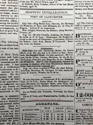
"Shipping Intelligence: Port of Gloucester"
"Fishermen . . . The T. [Tasso] was considerably injured by coming in contact with brig Deposite, at Salem . . ."
Also filed under: Newspaper / Journal Articles »
Newsprint
From bound volume owned by publisher Francis Procter
Collection of Fred and Stephanie Buck
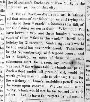
"A Prize Race—We have heard it intimated that some of our fishermen intend trying the merits of their "crack" schooners this fall, after the fishing season is done. Why not! . . .Such a fleet under full press of sail, would be worth going many a mile to witness; then for the witchery of Lane's matchless pencil to fix the scene upon canvass. . ."
Also filed under: Fishing » // Newspaper / Journal Articles »
Also filed under: Cape Ann Advertiser Masthead »

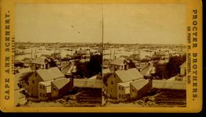
c.1870 Stereograph card Procter Brothers, Publisher Cape Ann Museum Library & Archive
"Gloucester Harbor from Rocky Neck, Looking Southwest. This gives a portion of the Harbor lying between Ten Pound Island and Eastern Point. At the time of taking this picture the wind was from the northeast, and a large fleet of fishing and other vessels were in the harbor. In the range of the picture about one hundred vessels were at anchor. In the small Cove in the foreground quite a number of dories are moored. Eastern Point appears on the left in the background."
Southeast Harbor was known for being a safe harbor.
Also filed under: Gloucester Harbor, Outer » // Historic Photographs » // Rocky Neck » // Small Craft – Wherries, and Dories »
1870s Stereograph card Cape Ann Museum Library & Archive
"Said schooner was captured about the first of September, 1871, by Capt. Torry, of the Dominion Cutter 'Sweepstakes,' for alleged violation of the Fishery Treaty. She was gallantly recaptured from the harbor of Guysboro, N.S., by Capt. Harvey Knowlton., Jr., (one of her owners,) assisted by six brave seamen, on Sunday night, Oct. 8th. The Dominion Government never asked for her return, and the United States Government very readily granted her a new set of papers."
Also filed under: Fishing » // Historic Photographs » // Waterfront, Gloucester »
1876 Photograph Cape Ann Museum Library & Archive
Also filed under: Gloucester Harbor, Inner / Harbor Cove » // Historic Photographs » // Waterfront, Gloucester »
c.1870 Cape Ann Museum Library & Archive (2013.068)
Schooner fleet anchored in the inner harbor. Looking east from Rocky Neck, Duncan's Point wharves and Lane house (at far left), Sawyer School cupola on Friend Street.
Also filed under: Duncan's Point » // Gloucester Harbor, Inner / Harbor Cove » // Historic Photographs » // Waterfront, Gloucester »
See p. 254.
As Erik Ronnberg has noted, Lane's engraving follows closely the French publication, Jal's "Glossaire Nautique" of 1848.
Also filed under: Babson History of the Town of Gloucester »
Wood, cordage, acrylic paste, metal
~40 in. x 30 in.
Erik Ronnberg
Model shows mast of fishing vessel being unstepped.
Also filed under: Burnham Brothers Marine Railway » // Fishing »

Watercolor on paper
8 3/4 x 19 3/4 in.
Cape Ann Museum, Gloucester, Mass., Gift of Rev. and Mrs. A. A. Madsen, 1950
Accession # 1468
Fishing schooners in Gloucester's outer harbor, probably riding out bad weather.
Also filed under: Elwell, D. Jerome » // Gloucester Harbor, Outer »
1876 Photograph Cape Ann Museum Library & Archive
Ignatius Weber's windmill (now defunct) is shown.
Also filed under: Flake Yard » // Fort (The) and Fort Point » // Gloucester Harbor, Inner / Harbor Cove » // Historic Photographs » // Rogers's (George H.) wharves » // Waterfront, Gloucester » // Windmill »
Print from bound volume of Gloucester scenes sent to the Philadelphia Centennial Exhibition.
11 x 14 in.
Cape Ann Museum Library & Archives
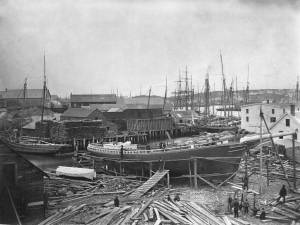
Schooner "Grace L. Fears" at David A. Story Yard in Vincent's Cove.
Also filed under: Historic Photographs » // Shipbuilding / Repair » // Vincent's Cove »
George Homans Rogers (1808–70) was the owner of at least four of Fitz H. Lane’s paintings. At a May 1871 auction, these four were sold: “A coast scene, representing the beach at Newport just above Manchester, to John J. Babson, Esq. for $51.25; a scene in Gloucester Harbor representing the old Fort and its surroundings, with one of the Surinam fleet at anchor, to Capt. David Plumer, for $154; a harbor view, embracing Ten Pound Island, to Mr. Nath’l Webster, for $89.00; a ship working off a lee shore, to the same purchaser for $135.00.” (1)
Rogers was born in Gloucester, Massachusetts, the second child and eldest son of the six children of Daniel Rogers Jr. & Phoebe Homans. In 1834, he married Lucy Davis (1814–1907), who was born in Gloucester, the second child of the four children of Elias Davis & Abigail Somes. Lucy Davis Rogers' parents built and owned the Captain Davis House that forms part of the Cape Ann Museum. George and Lucy Rogers had no children.
George H. Rogers began his adult life as an apothecary, and then became involved in the Surinam trade. Between 1831 and 1868, he was owner or part-owner of one ship, four schooners, eight barques, and sixteen brigs, and his homes (Gloucester in summer and Boston in winter) were filled with the spoils of this trade: silver candelabra, plates, tea and coffee services, Delft china tea and dinner sets, and bowls of brightly and realistically painted plaster fruits of the tropics (pomegranates, mangoes, plantains).
Rogers was also heavily involed in real estate and became known as "the great conveyancer" because of the number of properties he bought and sold. He was also called "the great remover" for the number of buildings he moved both into and around town. He is quoted as saying: “I believe in spot cash, many deals, no mortgages because they are a damned nuisance, do your own surveying, get there first, and give quitclaim deeds only and let the Lord take care of the rest.” (2)
Nonetheless, George H. Rogers was a generous man. When the town decided to construct a new street along the wharves in the harbor, and his land was taken for the road, he refused to accept compensation, and in appreciation the street was named for him—Rogers Street. He was a Unitarian, although an infrequent churchgoer, but his religious curiosity spread wide, leading him to finance investigations into spiritualism in his later years.
At the time of Rogers' death, he owned property at the Fort, including wharves, a windmill, a sail loft, freight and packing stores, a hoop-skirt factory, and a block of stone buildings on the south side of Front Street, and several houses in the vicinity of Bass Rocks. The buildings on Front Street later became the Cape Ann Savings Bank. Rogers also ran a working farm with more than two hundred and fifty acres of pasture, tillage and marsh land, cows, horses, pigs, and chickens. He also owned six pews in the Unitarian Church, his residences in Gloucester and Boston, a billiard table, a piano, and his Lane paintings.
(1) Cape Ann Weekly Advertiser, 12 May 1871, as in undated newspaper clipping in Sawyer Free Library Scrapbook.
(2) Alfred Mansfield Brooks and Ruth Steele Brooks, Gloucester Recollected: A Familiar History (Gloucester, Massachusetts, n.d.), Reprinted as Gloucester Recollected: A Familiar History, ed. Joseph E. Garland, (Gloucester, Massachusetts: Peter Smith Publishers, 1974), 62–64.
Book excerpt
Joseph E. Garland, "Gloucester Recollected: A Familiar History," (Gloucester, Massachusetts, Peter Smith Publishers. 1974), 69, n. 9.
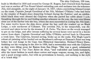
Also filed under: "California" (Full-Rigged Ship) » // "R. B. Forbes" (Tow Boat) »