An online project under the direction of the CAPE ANN MUSEUM
Historical Materials: Gloucester Buildings & Businesses
Historical Materials » Gloucester Buildings & Businesses » Low (Frederick G.) wharves
You have navigated to this pages from catalog entry: The Fort and Ten Pound Island, Gloucester (Harbor Scene), 1848 (inv. 58)
Low (Frederick G.) wharves
View related Fitz Henry Lane catalog entries (6) »
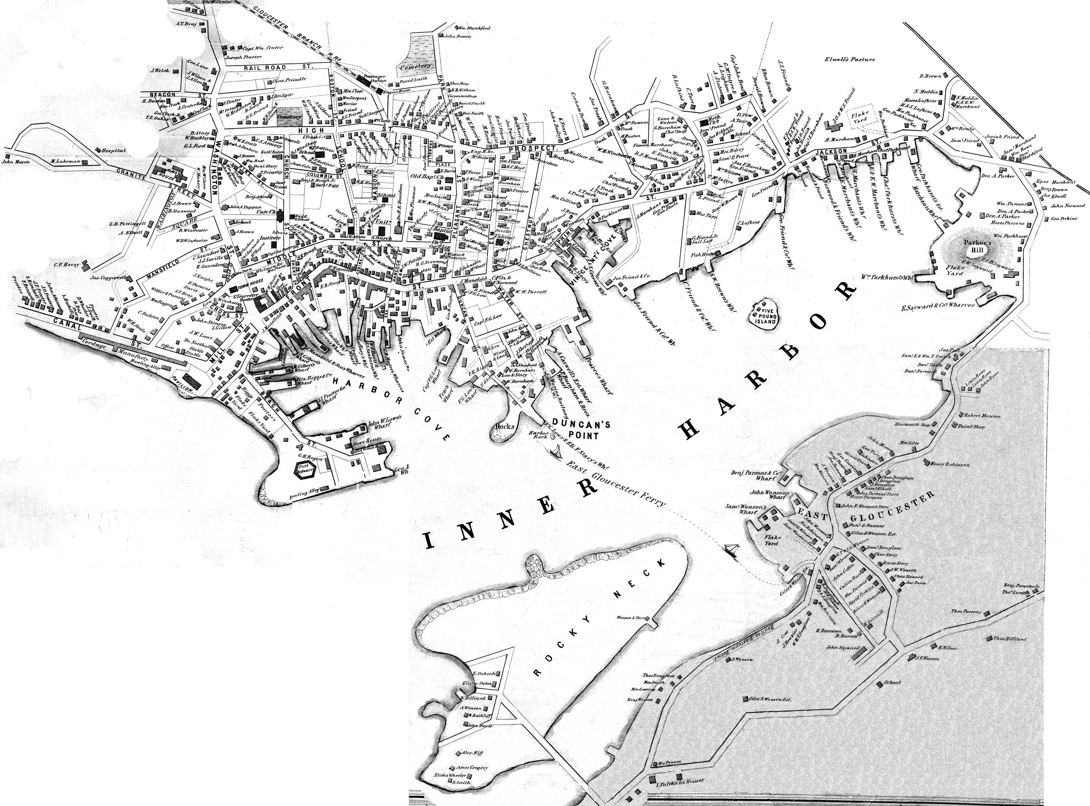
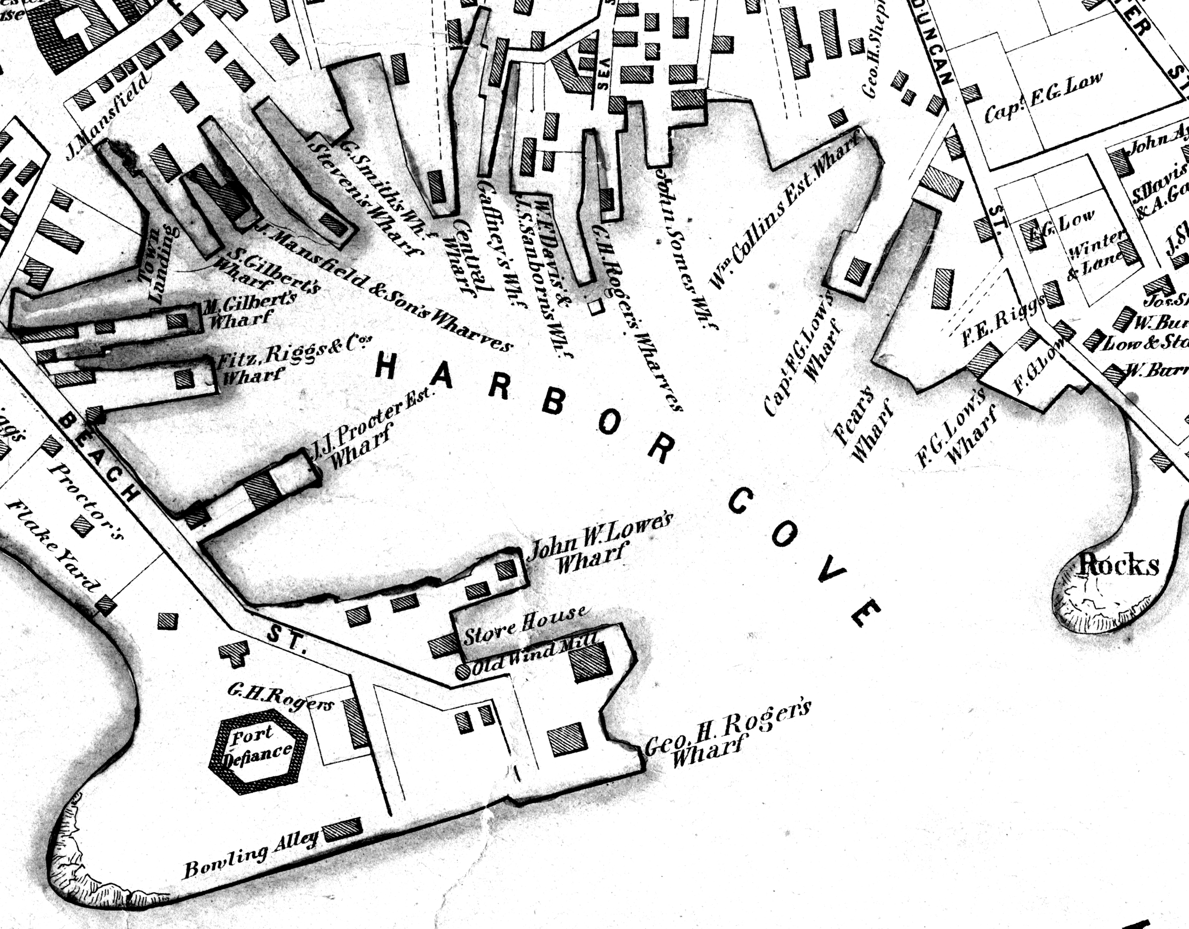
In the 1850s, Captain Frederick G. Low owned fully one-third of the land comprising Duncan's point, including the lot purchased by Lane for his home and studio. Much of his property fronted the Inner Harbor, including two wharves in Harbor Cove and a third jutting southeast from the point toward Harbor Rock (see Walling & Hanson map below.)
Low's wharves are not conspicuous in any of Lane's depictions of Gloucester Harbor, which is ironic because many of his harbor scenes were sketched from Low's property. In The Fort and Ten Pound Island, Gloucester (Harbor Scene), 1848 (inv. 58), his wharf adjacent to the Collins estate wharf is obscured by a building on the Collins wharf and a ship tied up to his own wharf. In Gloucester Harbor, 1852 (inv. 38), his wharf extending to Harbor Rock is concealed by the rocks off Fort Point with only a bark to mark the head of the wharf to which it is tied up.
Gloucester Harbor from Rocky Neck, 1844 (inv. 14), depicting the town from Rocky Neck, is the only painting which shows the shore line where Lowe's wharves were located (or to be located, given the early, 1844, date of this work). Lane's lithograph of 1846 (View of Gloucester, (From Rocky Neck), 1846 (inv. 57)) is similarly problematic, and his 1859 version (View of Gloucester, Mass., 1859 (not published)) shows so many changes that the earlier wharves are no longer discernible.
– Erik Ronnberg
Related tables: Waterfront, Gloucester »
Watercolor on paper
Cape Ann Museum Library & Archive
Also filed under: Maps » // Unitarian Church / First Parish Church (Middle Street) »
44 x 34 in.
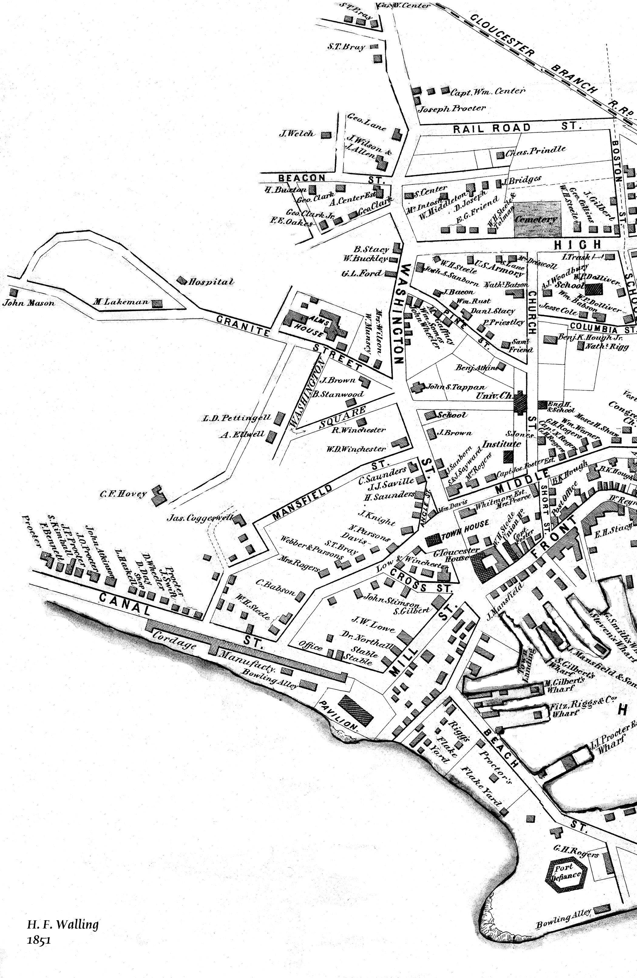
Henry Francis Walling, Map of the Towns of Gloucester and Rockport, Essex Co. Massachusetts. Philadelphia, A. Kollner, 1851
Cape Ann Museum Library & Archive
"Map of the Towns of Gloucester and Rockport, Massachusetts. H.F. Walling, Civil Engineer. John Hanson, Printer. 1851. Population of Gloucester in 1850 7,805. Population of Rockport in 1850 3,213."
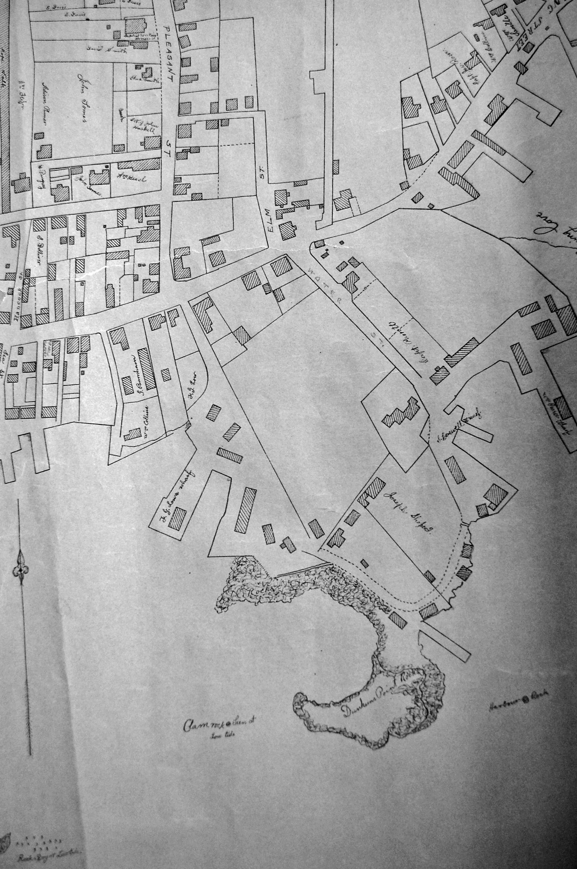
Also filed under: Baptist Church (Old, First, 1830) (Pleasant Street) » // Burnham Brothers Marine Railway » // Duncan's Point » // Five Pound Island » // Flake Yard » // Gloucester Harbor, Inner / Harbor Cove » // Harbor Methodist Church (Prospect Street) » // Pavilion Hotel » // Procter Brothers » // Ropewalk » // Vincent's Cove » // Western Shore »
Lithograph
24 x 38 in.
Gloucester City Archives
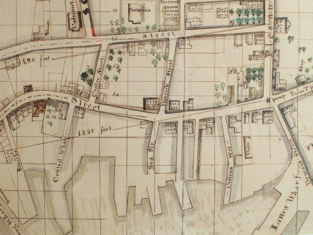
"Drawn on a scale of one hundred feet to an inch. By John Mason 1834–45 from Actual Survey showing every Lott and building then standing on them giving the actual size of the buildings and width of the streets from the Canal to the head of the Harbour & part of Eastern point as farr as Smith's Cove and the Shore of the same with all the wharfs then in use. Gloucester Harbor 1834–35."
This map shows the location of F. E. Low's wharf and the ropewalk. Duncan's Point, the site where Lane would eventually build his studio, is also marked.
The later notes on the map are believed to be by Mason.
Also filed under: Duncan's Point » // Gloucester Harbor, Inner / Harbor Cove » // Low, Capt. Frederick Gilman » // Maps » // Mason, John » // Residences » // Ropewalk » // Somes, Capt. John »
44 x 34 in.
Henry Francis Walling, Map of the Towns of Gloucester and Rockport, Essex Co. Massachusetts. Philadelphia, A. Kollner, 1851
Cape Ann Museum Library & Archive
"Map of the Towns of Gloucester and Rockport, Massachusetts. H.F. Walling, Civil Engineer. John Hanson, Publisher. 1851. Population of Gloucester in 1850 7,805. Population of Rockport in 1850 3,213."
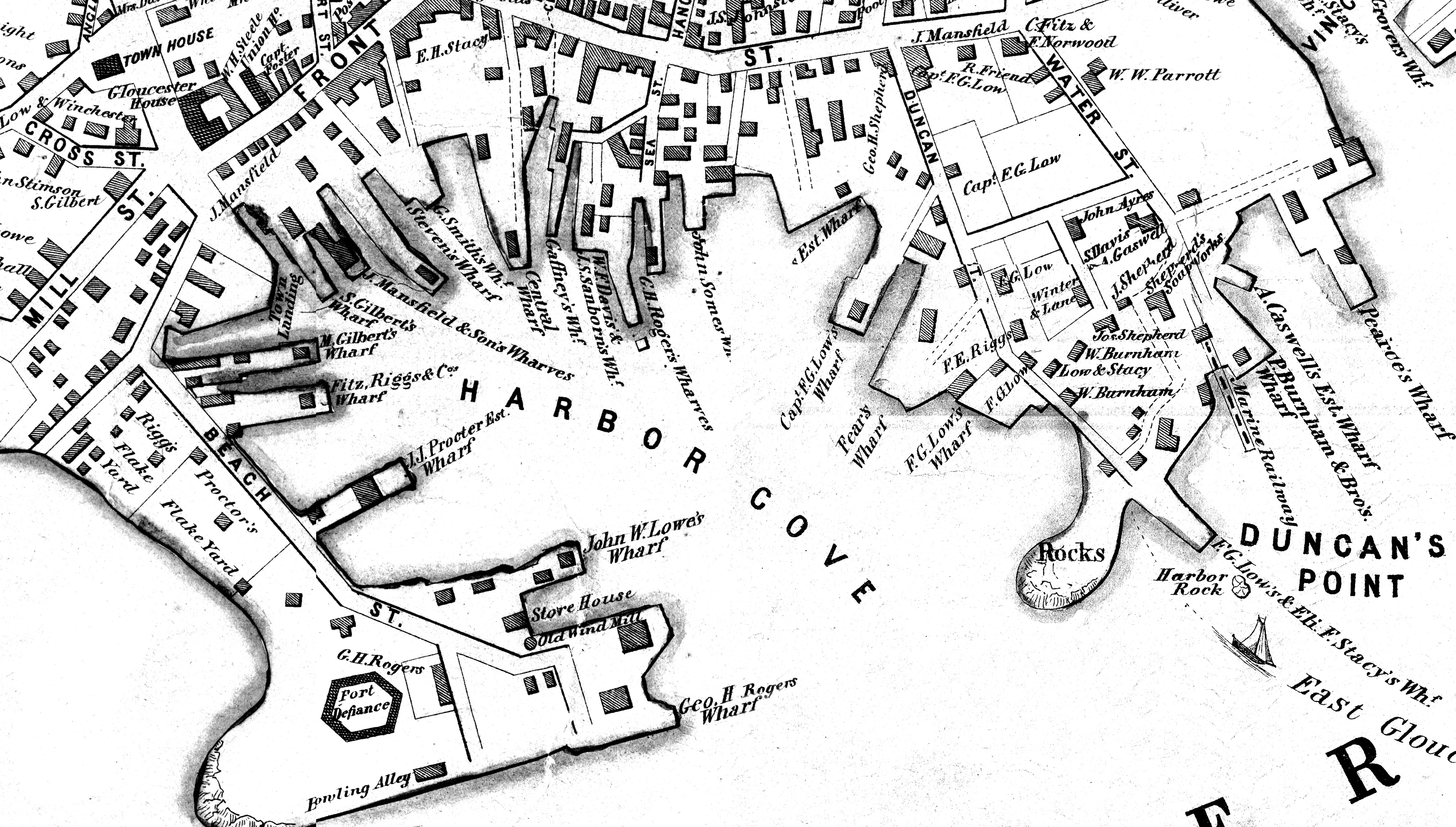
Segment of Harbor Village portion of map showing Low's, Rogers', and other wharves in the Inner Harbor.
44 x 34 in.
Henry Francis Walling, Map of the Towns of Gloucester and Rockport, Essex Co. Massachusetts. Philadelphia, A. Kollner, 1851
Cape Ann Museum Library & Archive
"Map of the Towns of Gloucester and Rockport, Massachusetts. H.F. Walling, Civil Engineer. John Hanson, Publisher. 1851. Population of Gloucester in 1850 7,805. Population of Rockport in 1850 3,213."
44 x 34 in.
John Hanson, Publisher
Cape Ann Museum Library & Archive
"Map of the Towns of Gloucester and Rockport, Massachusetts. H.F. Walling, Civil Engineer. John Hanson, Publisher. 1851. Population of Gloucester in 1850 7,805. Population of Rockport in 1850 3,213."
Also filed under: Fort (The) and Fort Point » // Maps » // Rogers's (George H.) wharves » // Town / Public Landings » // Waterfront, Gloucester » // Windmill »