An online project under the direction of the CAPE ANN MUSEUM
Historical Materials: Gloucester Buildings & Businesses
Historical Materials » Gloucester Buildings & Businesses » Windmill
You have navigated to this pages from catalog entry: Gloucester Inner Harbor, 1850 (inv. 240)
Windmill
View related Fitz Henry Lane catalog entries (7) »
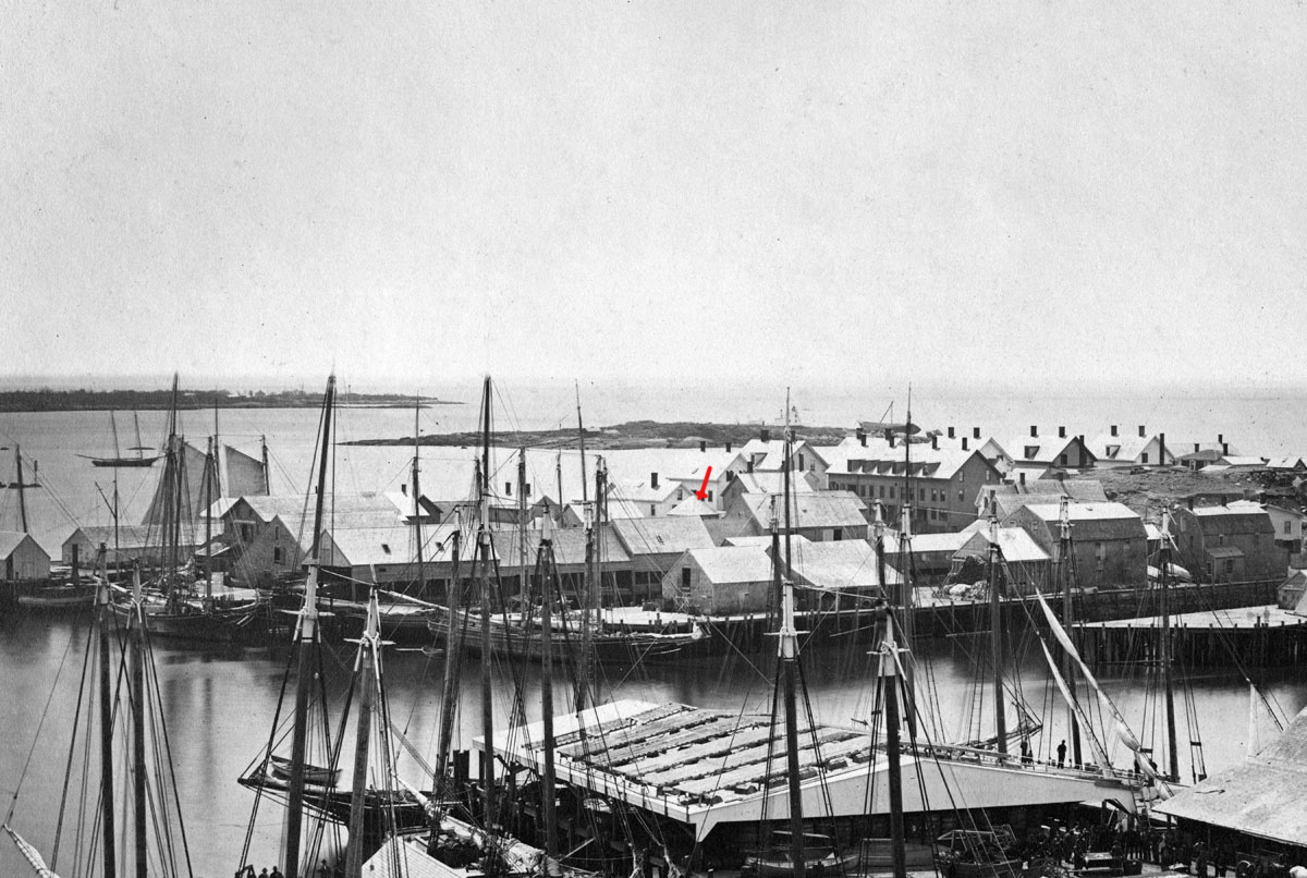
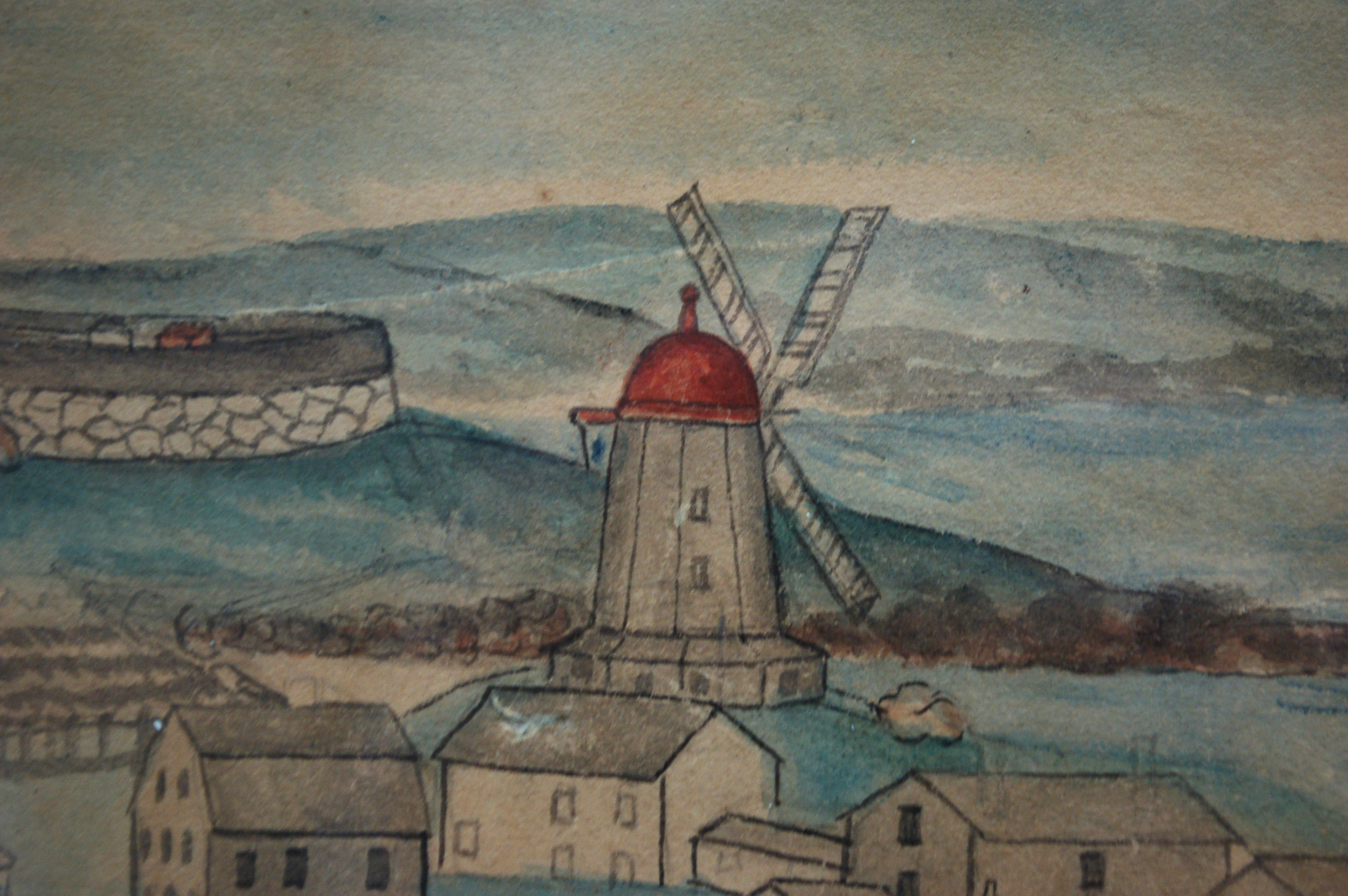
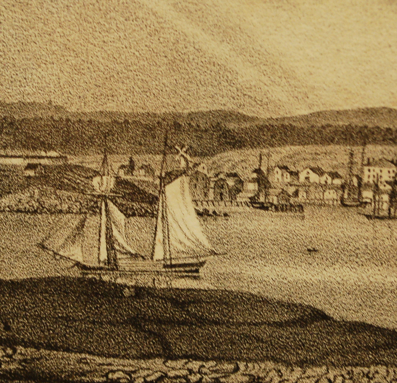
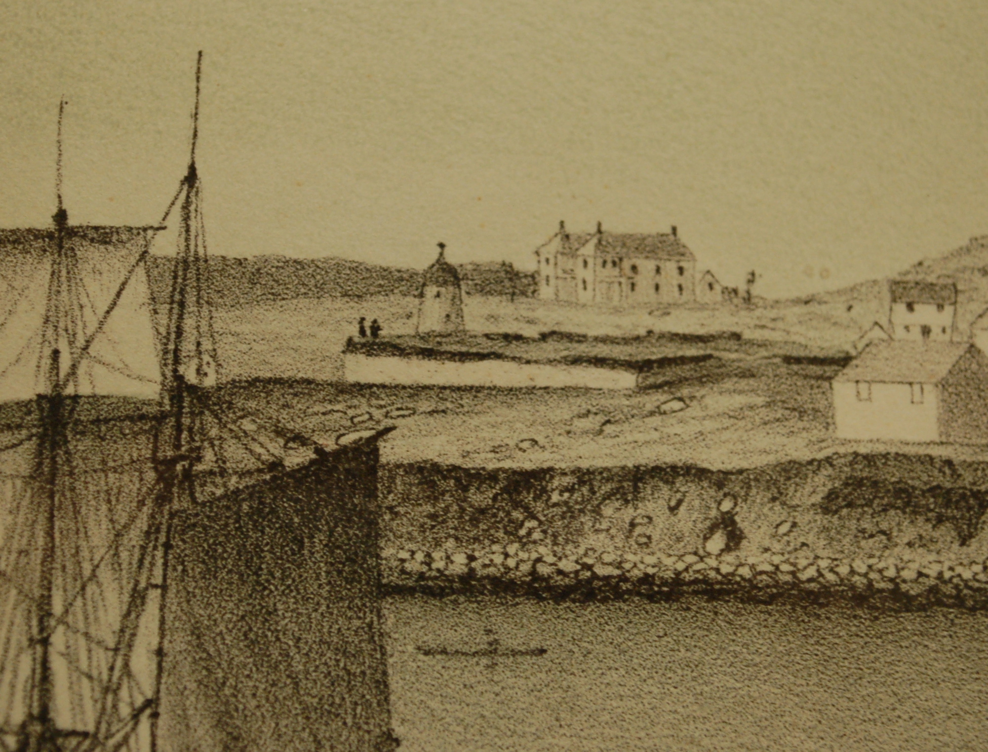
A grist windmill, originally owned by Ignatius Webber and then by Sidney Mason's father, John Mason, had stood on the hill since 1814, but, in preparation for the Pavilion Hotel, was moved to the inner-harbor side of the old Fort and eventually burned in 1877. Lot on which it stood by the water was sold to Sidney Mason in 1846. The windmill can be seen in several Lane harbor paintings and drawings.
Ignatius Webber’s windmill in its original location appears in View of the Town of Gloucester, Mass., 1836 (inv. 437) (far left, very small, with vanes), and View of Gloucester, (From Rocky Neck), 1846 (inv. 92) (also far left, a bit larger, but without vanes). After its move to Fort Point, it appears in the drawing of Gloucester Inner Harbor, (sitting on George H. Rogers’ Wharf), just behind the foremast of the two-masted New England boat), View in Gloucester Harbor, 1850s (inv. 143). In the derivative painting owned by the Mariners’ Museum Gloucester Inner Harbor, 1850 (inv. 240), this time it shows up just abaft the same boat’s main mast. The drawing and painting just show the building without vanes.
Related tables: Pavilion Hotel »
Lithograph
24 x 38 in.
Gloucester City Archives
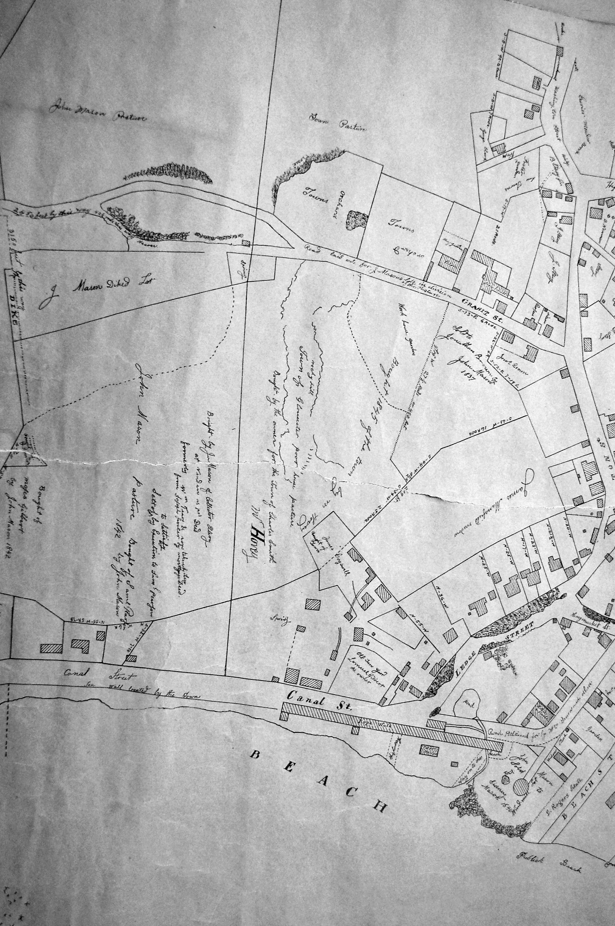
"Drawn on a scale of one hundred feet to an inch. By John Mason 1834–45 from Actual Survey showing every Lott and building then standing on them giving the actual size of the buildings and width of the streets from the Canal to the head of the Harbour & part of Eastern point as farr as Smith's Cove and the Shore of the same with all the wharfs then in use. Gloucester Harbor 1834–1835."
This section of the map shows the location of the Pavilion Hotel and ropewalk along the beach.
Also filed under: Maps » // Mason, John » // Pavilion (Publick) Beach » // Pavilion Hotel » // Ropewalk »
44 x 34 in.
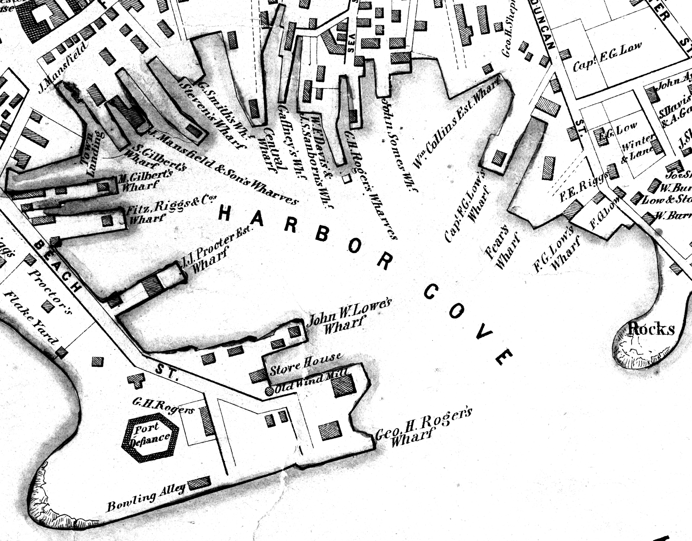
John Hanson, Publisher
Cape Ann Museum Library & Archive
"Map of the Towns of Gloucester and Rockport, Massachusetts. H.F. Walling, Civil Engineer. John Hanson, Publisher. 1851. Population of Gloucester in 1850 7,805. Population of Rockport in 1850 3,213."
Also filed under: Fort (The) and Fort Point » // Low (Frederick G.) wharves » // Maps » // Rogers's (George H.) wharves » // Town / Public Landings » // Waterfront, Gloucester »