An online project under the direction of the CAPE ANN MUSEUM
Historical Materials: Gloucester Buildings & Businesses
Historical Materials » Gloucester Buildings & Businesses » Universalist Church (Middle and Church Streets)
You have navigated to this pages from catalog entry: Gloucester from Fresh Water Cove, 1850s (inv. 144)
Universalist Church (Middle and Church Streets)
View related Fitz Henry Lane catalog entries (6) »
This large steepled building is Gloucester's Universalist Church. Universalism had found fertile ground here in Gloucester before the Revolution under the leadership of John Murray, who brought the teachings of James Relly from England in 1774. With adherents among the town's leaders such as Winthrop Sargent and his daughter, Judith Sargent Stevens Murray, it spread and flourished. The Gloucester adherents to Universalism refused to support quasi-governmental parish churches, specifically the First Parish in the Harbor district, and, speaking as well for all other non-parish churches, their dissent led to the Constitutional separation of Church and State. The first Universalist meetings were held on Sargent property at what was then Spring and Water Streets, now near the corner of Main and Duncan Streets. In 1805, under a new minister, Thomas Jones, this towering structure of the Universalist Church was erected by the local architect and builder, Jacob Smith.
The church's interior and foundation have been changed slightly since Lane's 1852 painting: in the 1860s, the foundation was raised seven feet to allow for a hall in the basement, and the lovely curved vestry staircases were installed. But the steeple remains as Smith, and Lane, saw it. It still houses a Paul Revere bell—for many years the only large bell in town. In 1852, this was the tallest structure on the skyline and a beacon to returning vessels. Its height was increased by the addition of a 'blind story' to the stack of belfry, lantern and cupola.
In 1852, the minister of the church was Amory D. Mayo, but in three years William R.G. Mellen would occupy the pulpit. He and his brother Charles Mellen were both Universalist ministers. Charles' wife was Mary Blood Mellen, Lane's student and copyist, but Charles was never a minister in Gloucester.
Current address: 50 Middle Street.
– Sarah Dunlap (May, 2014)
Related tables: Mellen, Mary Blood » // Unitarian Church / First Parish Church (Middle Street) » // Universalist (Original) Meeting House (Sargent) »
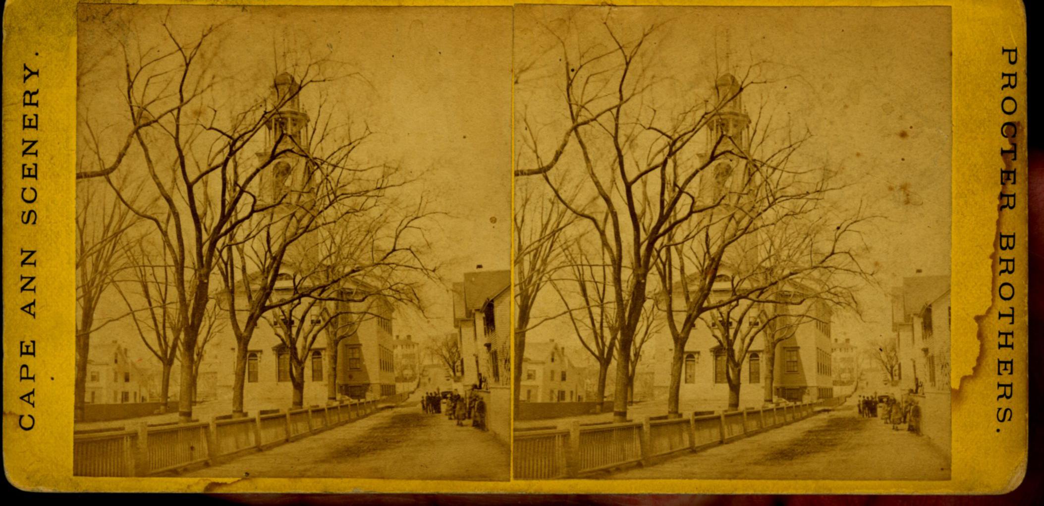
Stereo view of a front and side view of the Church, taken when there was no foliage upon the trees. Church street is also given throughout its length.
Also filed under: Historic Photographs »
Stereograph card
Cape Ann Museum Library & Archive
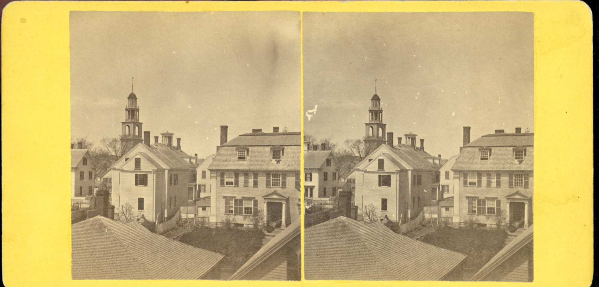
Also filed under: Historic Photographs »
44 x 34 in.
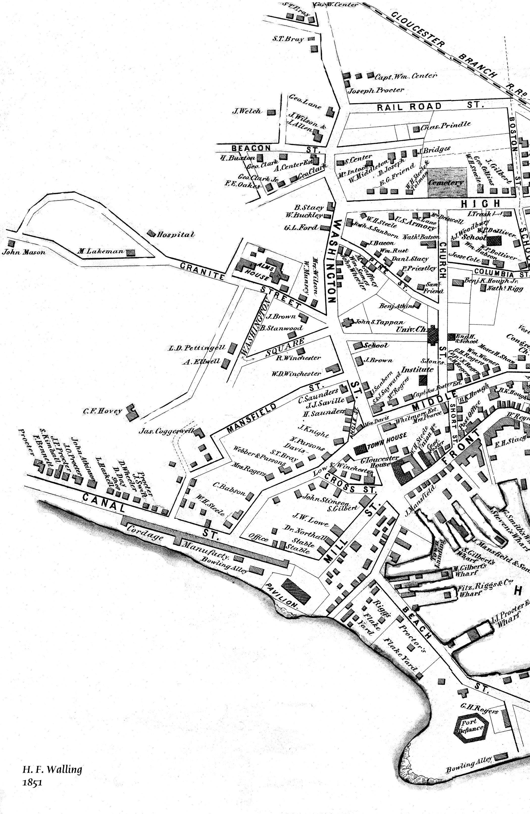
Henry Francis Walling, Map of the Towns of Gloucester and Rockport, Essex Co. Massachusetts. Philadelphia, A. Kollner, 1851
Cape Ann Museum Library & Archive
"Map of the Towns of Gloucester and Rockport, Massachusetts. H.F. Walling, Civil Engineer. John Hanson, Publisher. 1851. Population of Gloucester in 1850 7,805. Population of Rockport in 1850 3,213."
24 x 38 in.
Gloucester City Archives
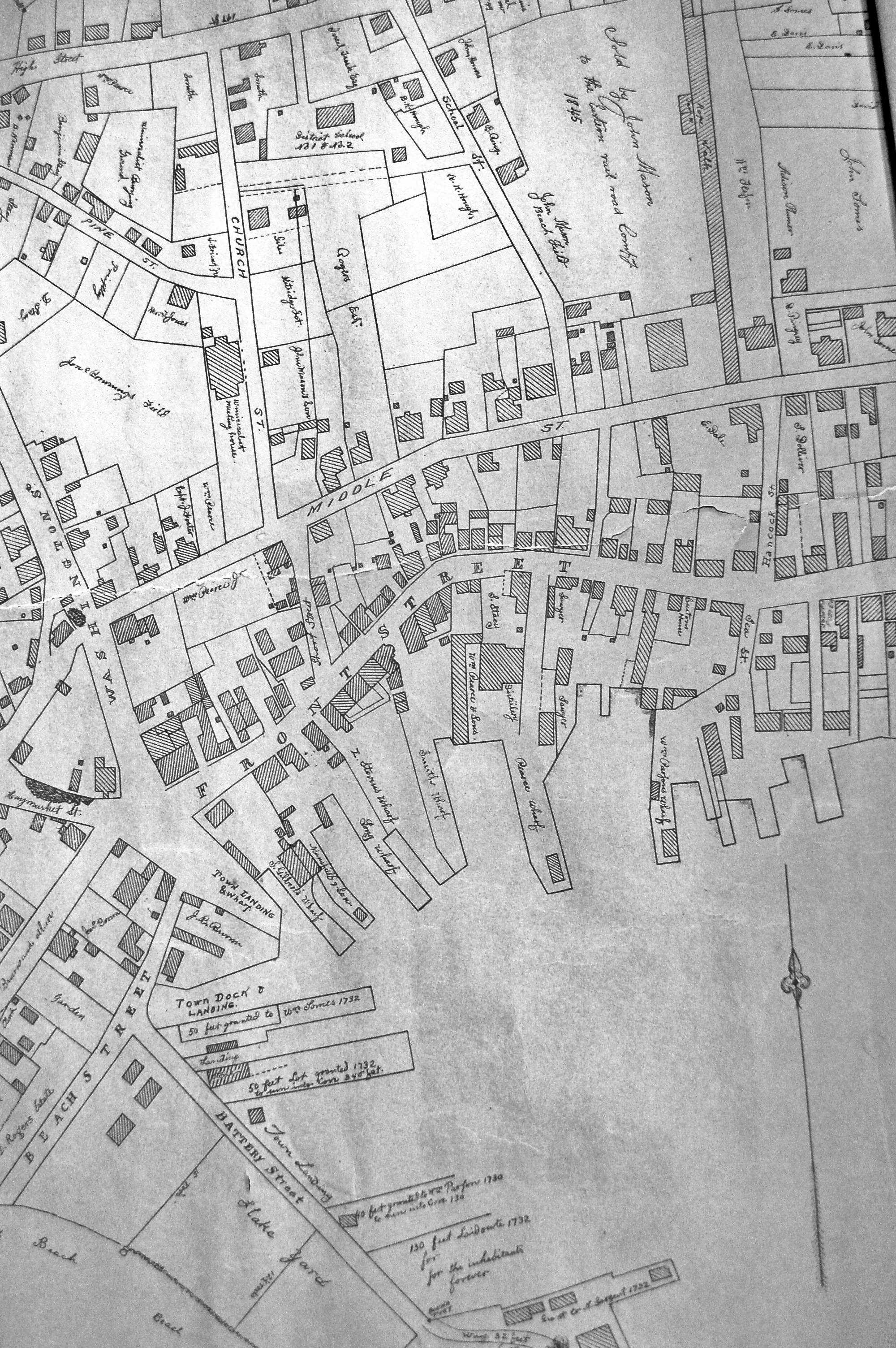
"Drawn on a scale of one hundred feet to an inch. By John Mason 1834–45 from Actual Survey showing every Lott and building then standing on them giving the actual size of the buildings and width of the streets from the Canal to the head of the Harbour & part of Eastern point as farr as Smith's Cove and the Shore of the same with all the wharfs then in use. Gloucester Harbor 1834–35."
This map is especially helpful in showing the wharves of the inner harbor at the foot of Washington Street.
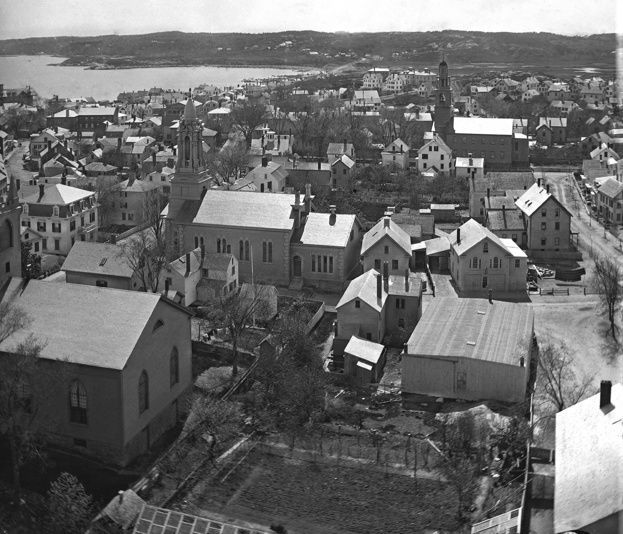
4 x 6 in.
Cape Ann Museum, Benham Collection
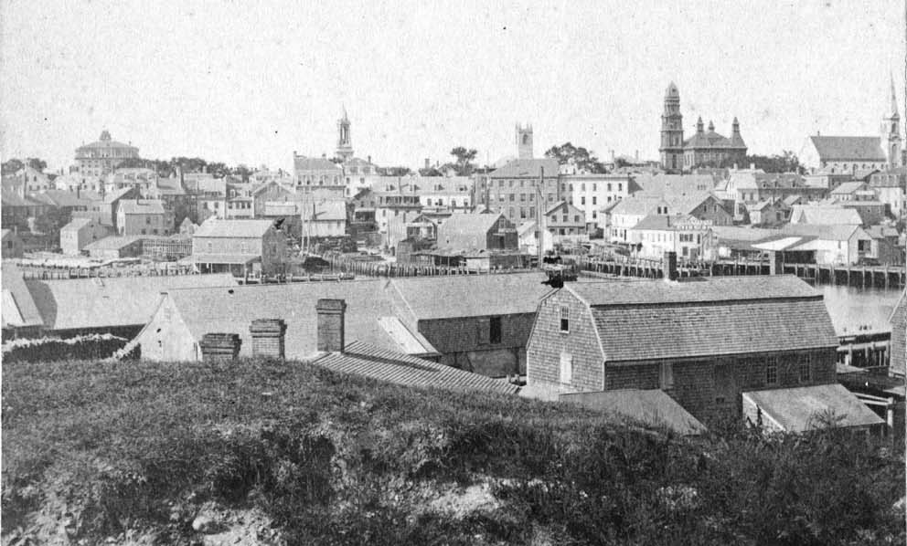
George Steele sail loft, William Jones spar yard, visible across harbor. Photograph is taken from high point on the Fort, overlooking business buildings on the Harbor Cove side.
Also filed under: Fort (The) and Fort Point » // Gloucester Harbor, Inner / Harbor Cove » // Town House » // Waterfront, Gloucester »