An online project under the direction of the CAPE ANN MUSEUM
Historical Materials: Gloucester Buildings & Businesses
Historical Materials » Gloucester Buildings & Businesses » Flake Yard
You have navigated to this pages from catalog entry: The Fort and Ten Pound Island, Gloucester, Massachusetts, 1847 (inv. 271)
Flake Yard
View related Fitz Henry Lane catalog entries (5) »
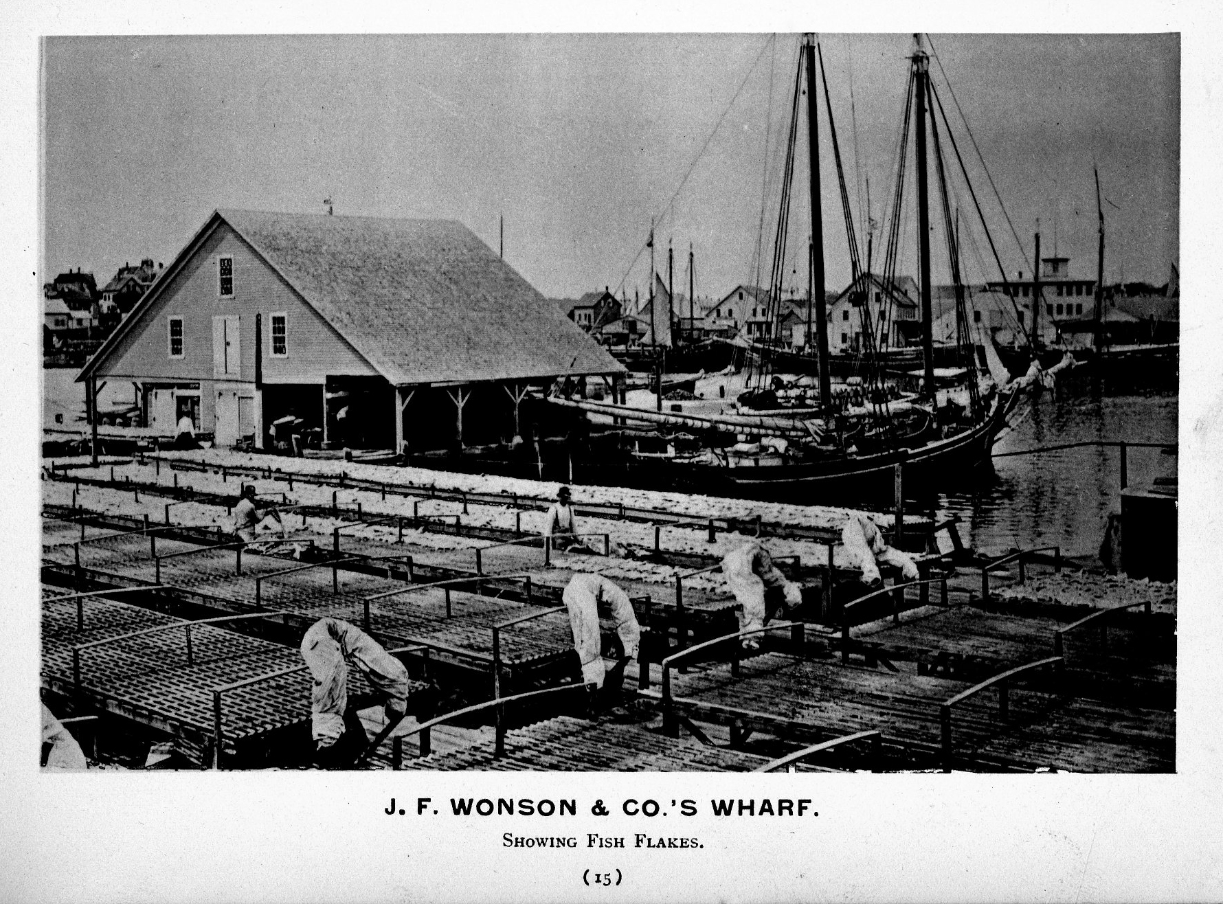
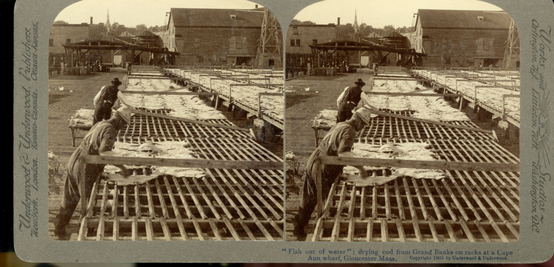
In the days prior mechanical refrigeration, salting and drying were the most common methods of preserving fish. Split cod were spread out on wooden racks, called "fish flakes," to dry. Drying time could take days, depending on weather and temperature. Warm, sunny weather could speed up the drying time, but also "burn" the fish, spoiling its texture and flavor. To prevent this, canvas awnings were stretched over wooden frames built onto the flakes. In wet weather, wooden boxes were placed over the flakes to protect them.
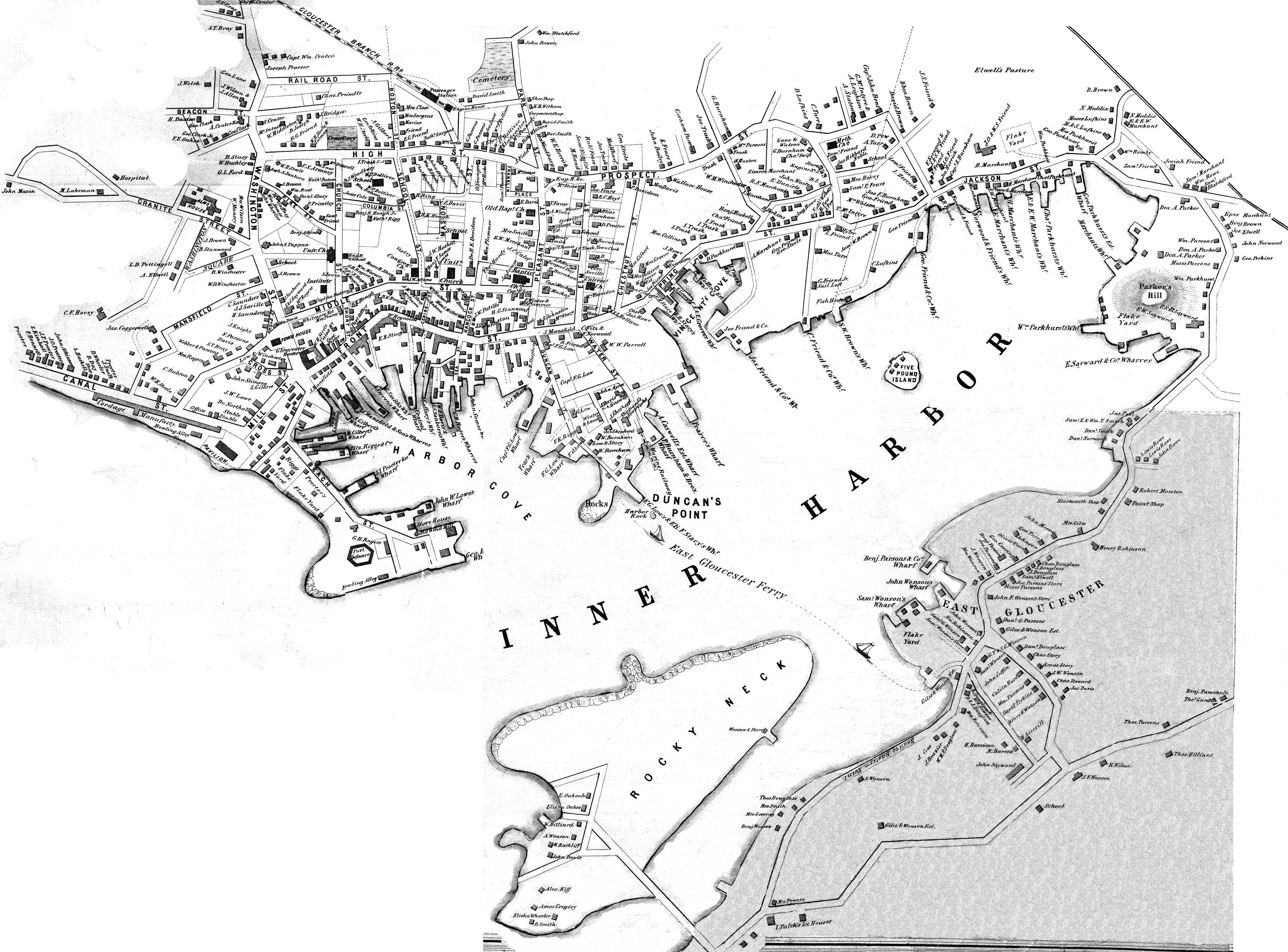
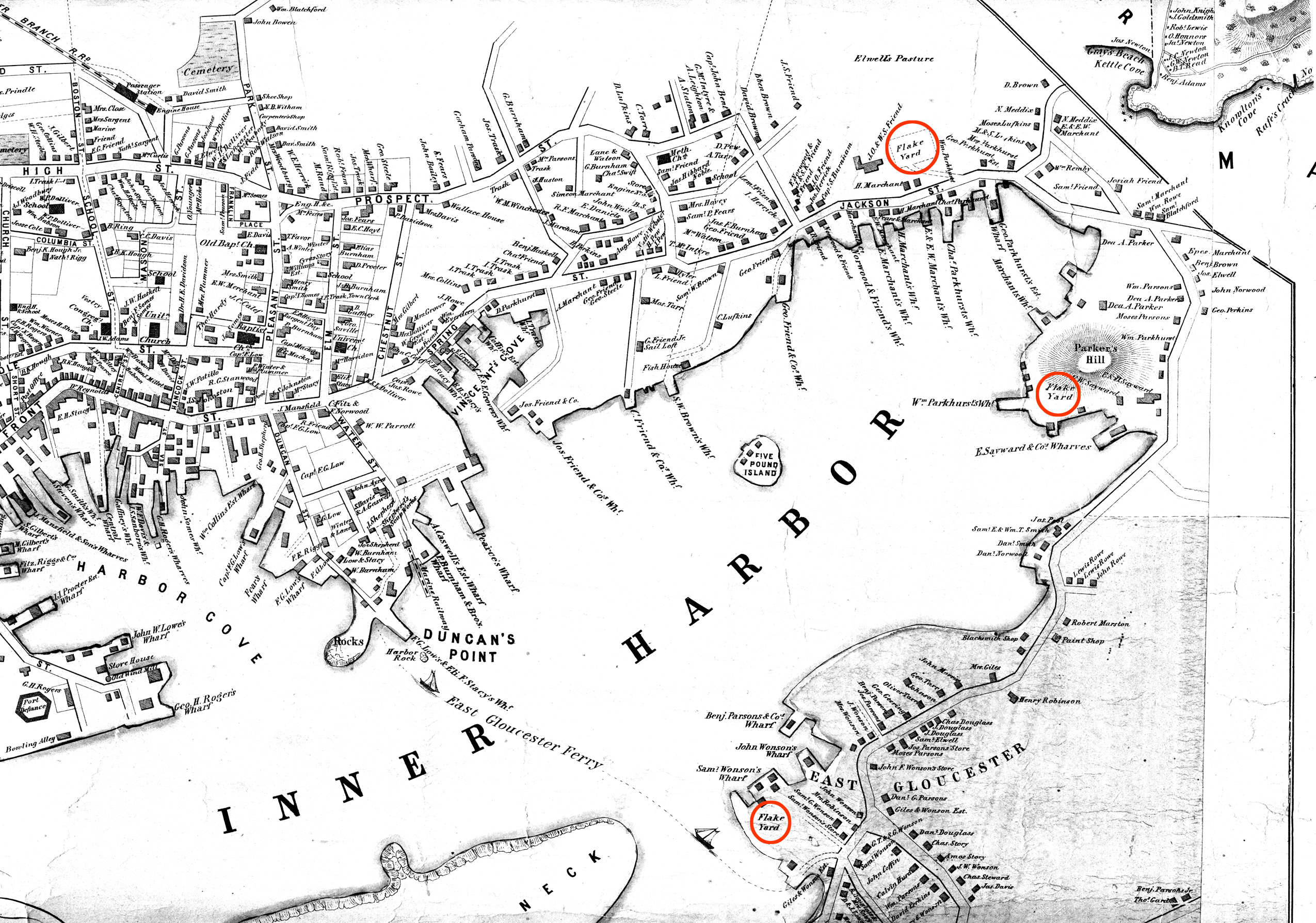
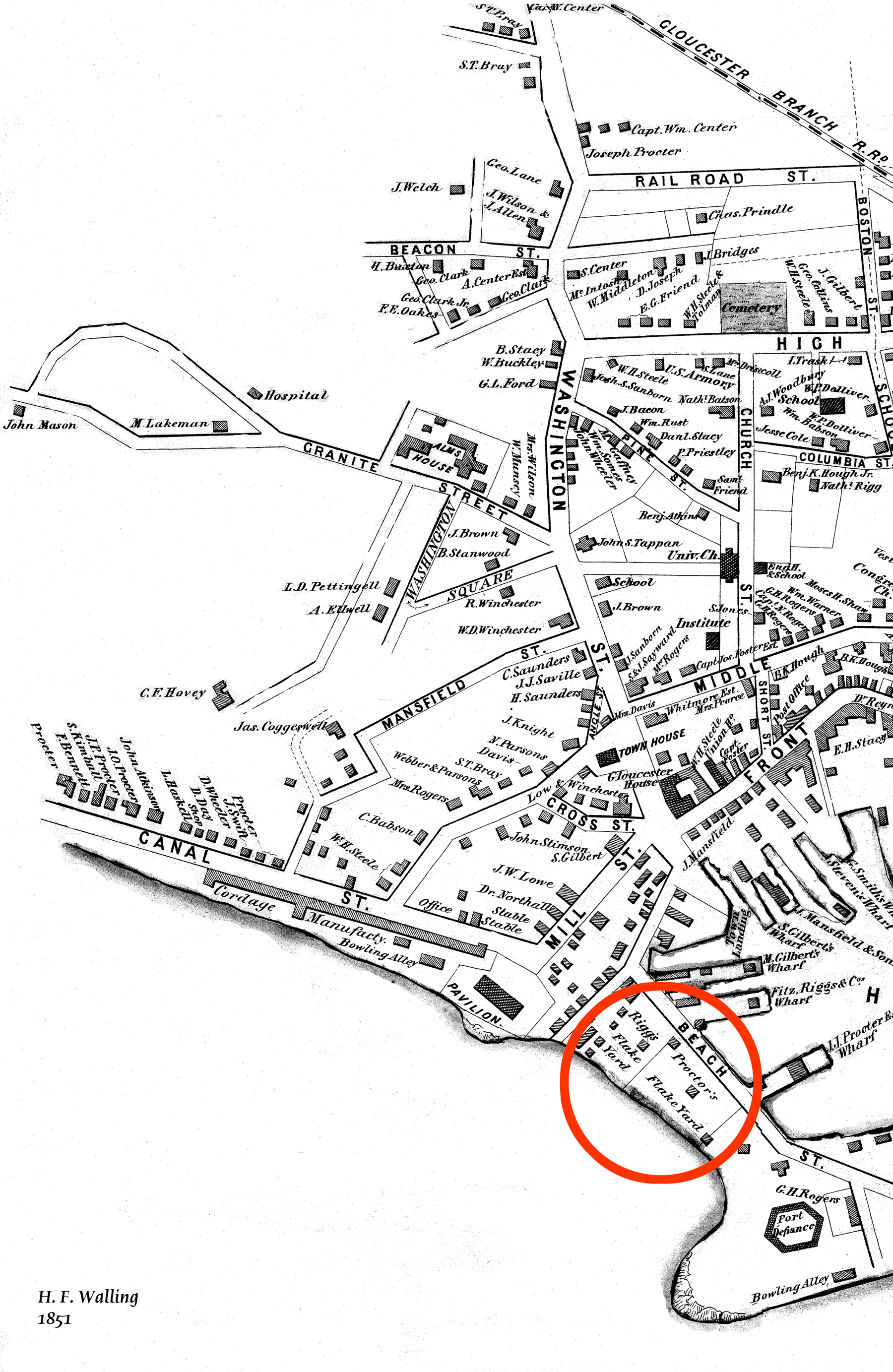
There were several large flake yards in Gloucester in Lane's day. One was situated between Battery Street and the beach, on the long point of land leading to the Fort, and is clearly shown in the 1851 Walling map.
Related tables: Drying Fish » // Waterfront, Gloucester »
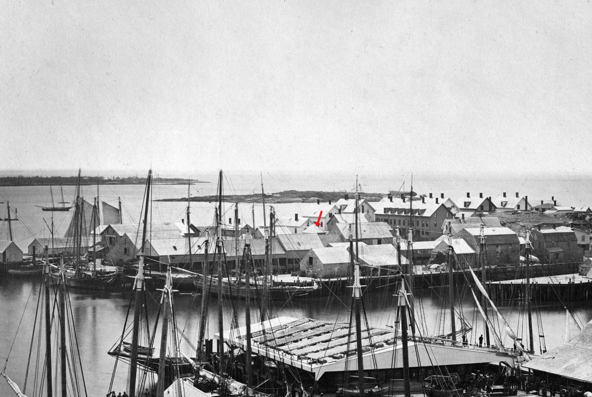
c.1900.
Also filed under: Drying Fish »
Cape Ann Museum Library & Archive
Also filed under: Cod / Cod Fishing » // Drying Fish » // Historic Photographs »
44 x 34 in.
Henry Francis Walling, Map of the Towns of Gloucester and Rockport, Essex Co. Massachusetts. Philadelphia, A. Kollner, 1851
Cape Ann Museum Library & Archive
"Map of the Towns of Gloucester and Rockport, Massachusetts. H.F. Walling, Civil Engineer. John Hanson, Printer. 1851. Population of Gloucester in 1850 7,805. Population of Rockport in 1850 3,213."
Also filed under: Baptist Church (Old, First, 1830) (Pleasant Street) » // Burnham Brothers Marine Railway » // Duncan's Point » // Five Pound Island » // Gloucester Harbor, Inner / Harbor Cove » // Harbor Methodist Church (Prospect Street) » // Low (Frederick G.) wharves » // Pavilion Hotel » // Procter Brothers » // Ropewalk » // Vincent's Cove » // Western Shore »
24 x 38 in.
Gloucester City Archives
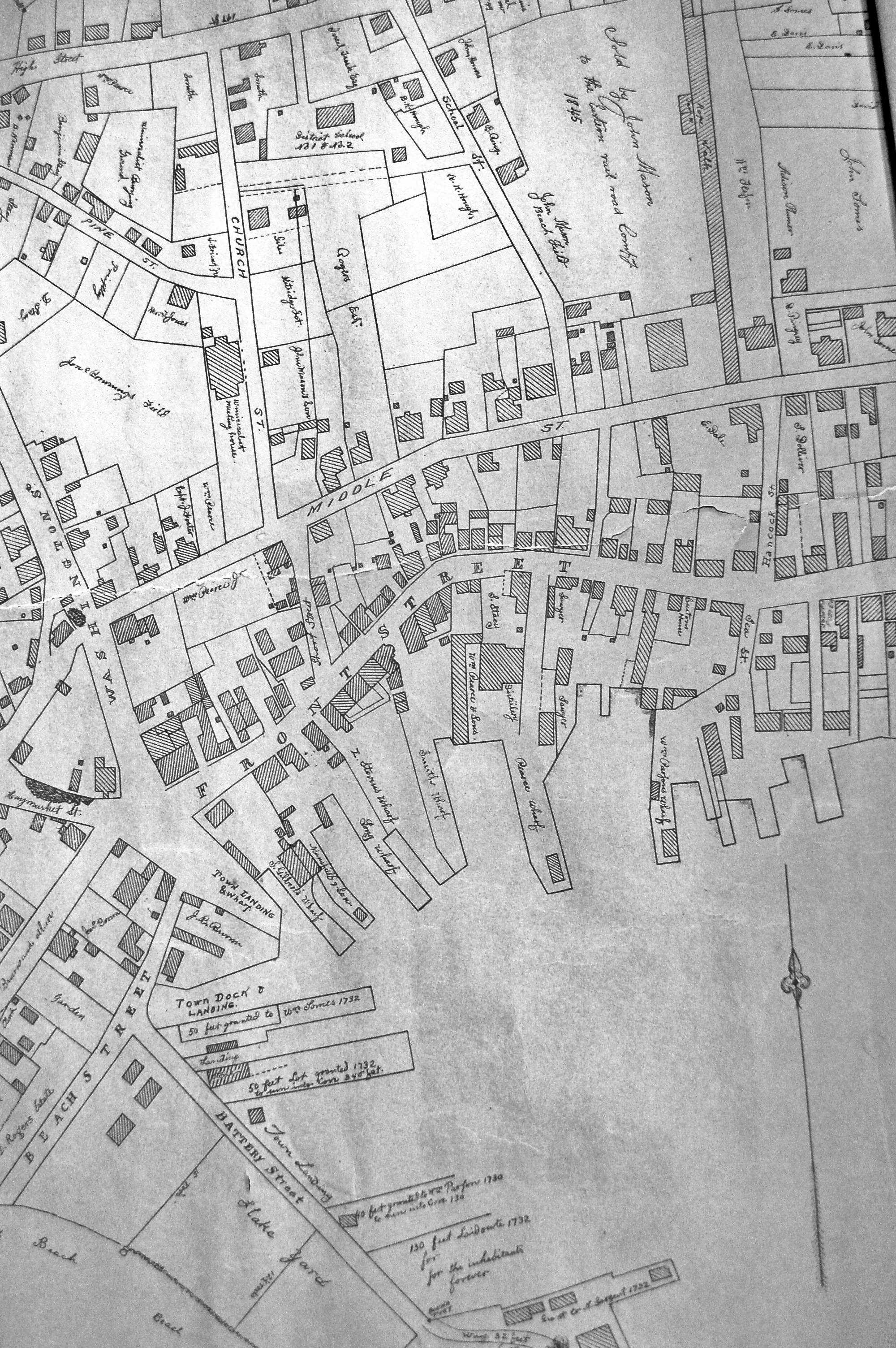
"Drawn on a scale of one hundred feet to an inch. By John Mason 1834–45 from Actual Survey showing every Lott and building then standing on them giving the actual size of the buildings and width of the streets from the Canal to the head of the Harbour & part of Eastern point as farr as Smith's Cove and the Shore of the same with all the wharfs then in use. Gloucester Harbor 1834–35."
This map is especially helpful in showing the wharves of the inner harbor at the foot of Washington Street.
View related Fitz Henry Lane catalog entries (1) »
Also filed under: Dale, Eben B. » // Eastern Railroad » // Gloucester Harbor, Inner / Harbor Cove » // Hough, Benjamin Kent » // Maps » // Pavilion (Publick) Beach » // Ropewalk » // Sawyer, Samuel » // Town / Public Landings » // Universalist Church (Middle and Church Streets) »
24 x 38 in.
Gloucester City Archives
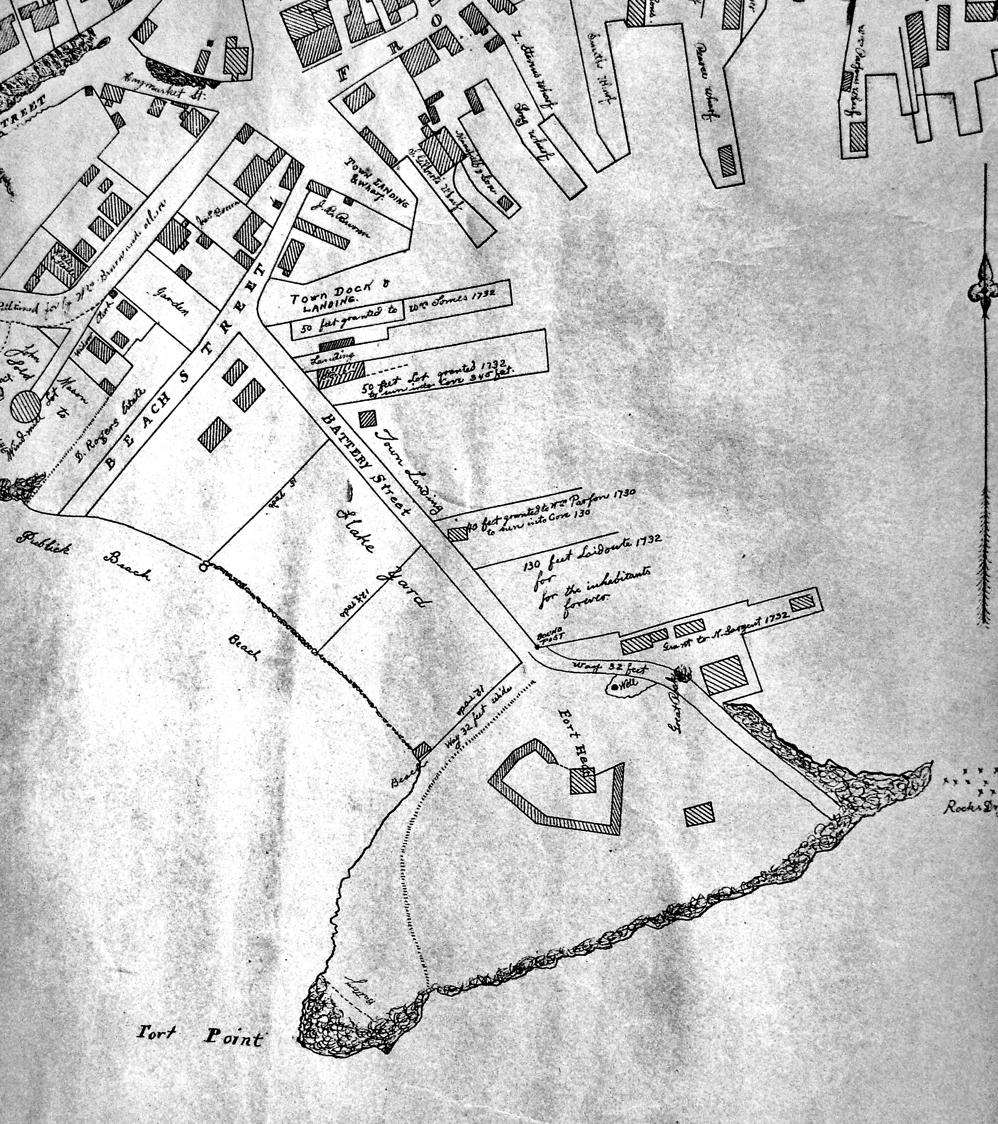
"Drawn on a scale of one hundred feet to an inch. By John Mason 1834–45 from Actual Survey showing every Lott and building then standing on them giving the actual size of the buildings and width of the streets from the Canal to the head of the Harbour & part of Eastern point as farr as Smith's Cove and the Shore of the same with all the wharfs then in use. Gloucester Harbor 1834–35."
This map is especially useful in showing the Fort.
Also filed under: Fort (The) and Fort Point » // Maps » // Mason, John » // Pavilion (Publick) Beach » // Town / Public Landings »
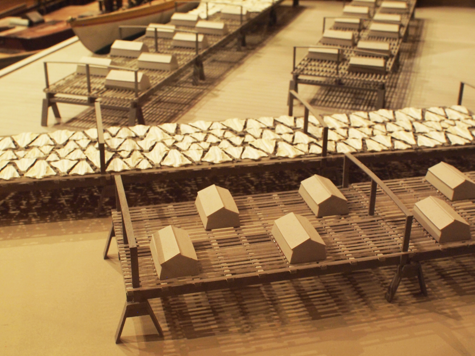
Wood drying racks, metal split salt fish. Scale: ½" = 1' (1:24)
Original diorama components made, 1892; replacements made 1993.
Cape Ann Museum, from Gloucester Chamber of Commerce, 1925 (2014.071)
Fish flakes are wood drying racks for salt codfish, and have been used for this purpose in America since colonial times.
Also filed under: Drying Fish »
44 x 34 in.
John Hanson, Publisher
Cape Ann Museum Library & Archive
"Map of the Towns of Gloucester and Rockport, Massachusetts. H.F. Walling, Civil Engineer. John Hanson, Publisher. 1851. Population of Gloucester in 1850 7,805. Population of Rockport in 1850 3,213."
Also filed under: Maps »