An online project under the direction of the CAPE ANN MUSEUM
Maps
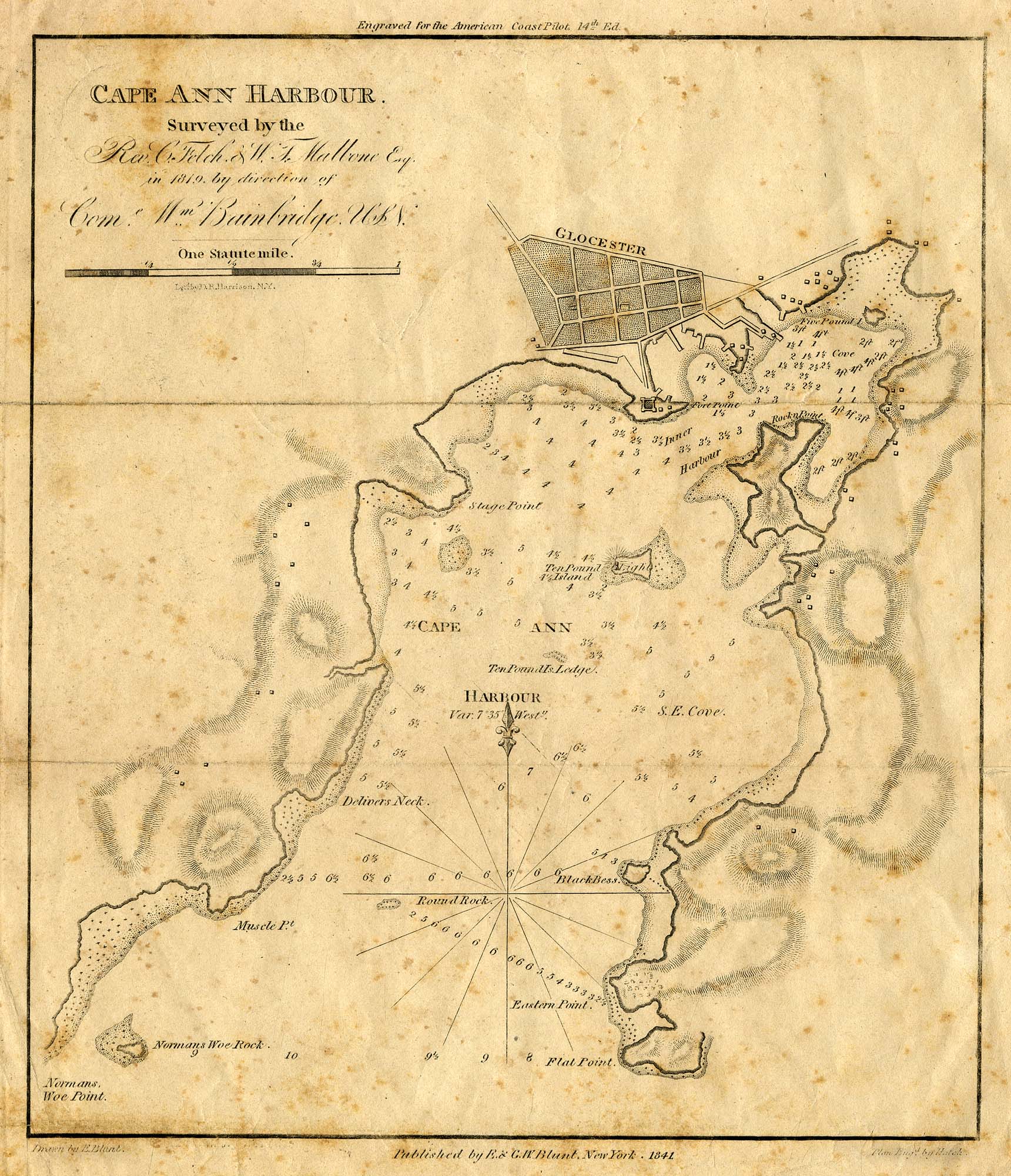
Engraving of 1819 survey taken from American Coast Pilot 14th edition
9 1/2 x 8 in.
Cape Ann Museum Library & Archive
D32 FF5
Also filed under: Dolliver's Neck » // Eastern Point » // Norman's Woe » // Ten Pound Island »
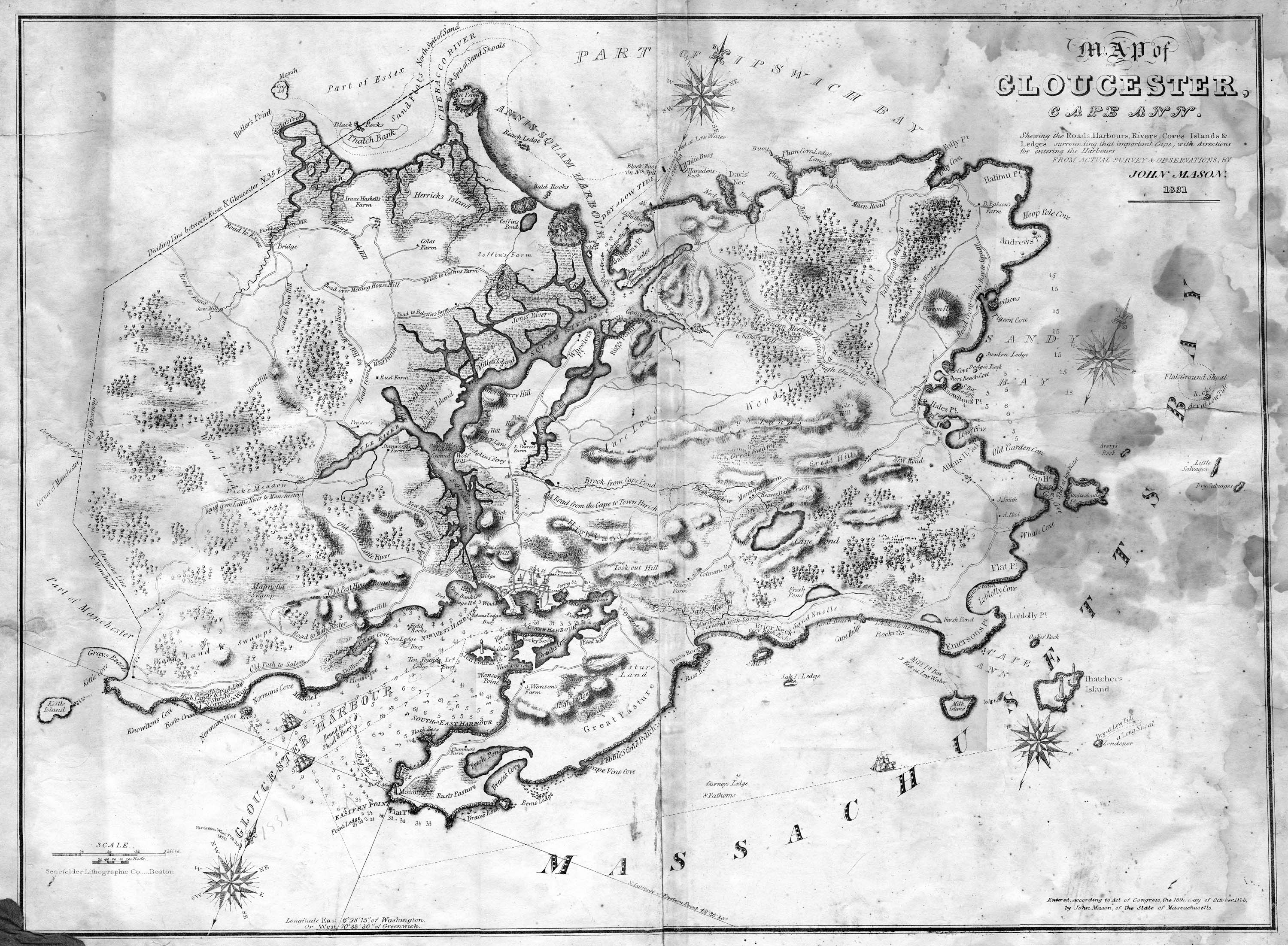
Lithograph
28.5 x 21 in.
Cape Ann Museum Library & Archive
When Massachusetts decreed that each town be mapped, John Mason drew the map of Cape Ann in 1830. This drawing was sent to the Senefelder Lithographic Company of Boston (owned by William Pendleton) to be printed, and then sold in Gloucester by W.E.P. Rogers, whose Gloucester Telegraph of February 12, 1831 announced, "A few specimen copies of the map, uncolored, have reached the town" and that they cost $1.25. Perhaps this business arrangement between Pendleton and Rogers provided Lane with his introduction to Pendleton.
Also filed under: Folly Cove » // Good Harbor Beach / Bass Rocks » // Mason, John » // Meetinghouse Green » // Pendleton's, Lith. – Boston » // Salt Island » // Thacher Island »
44 x 34 in.
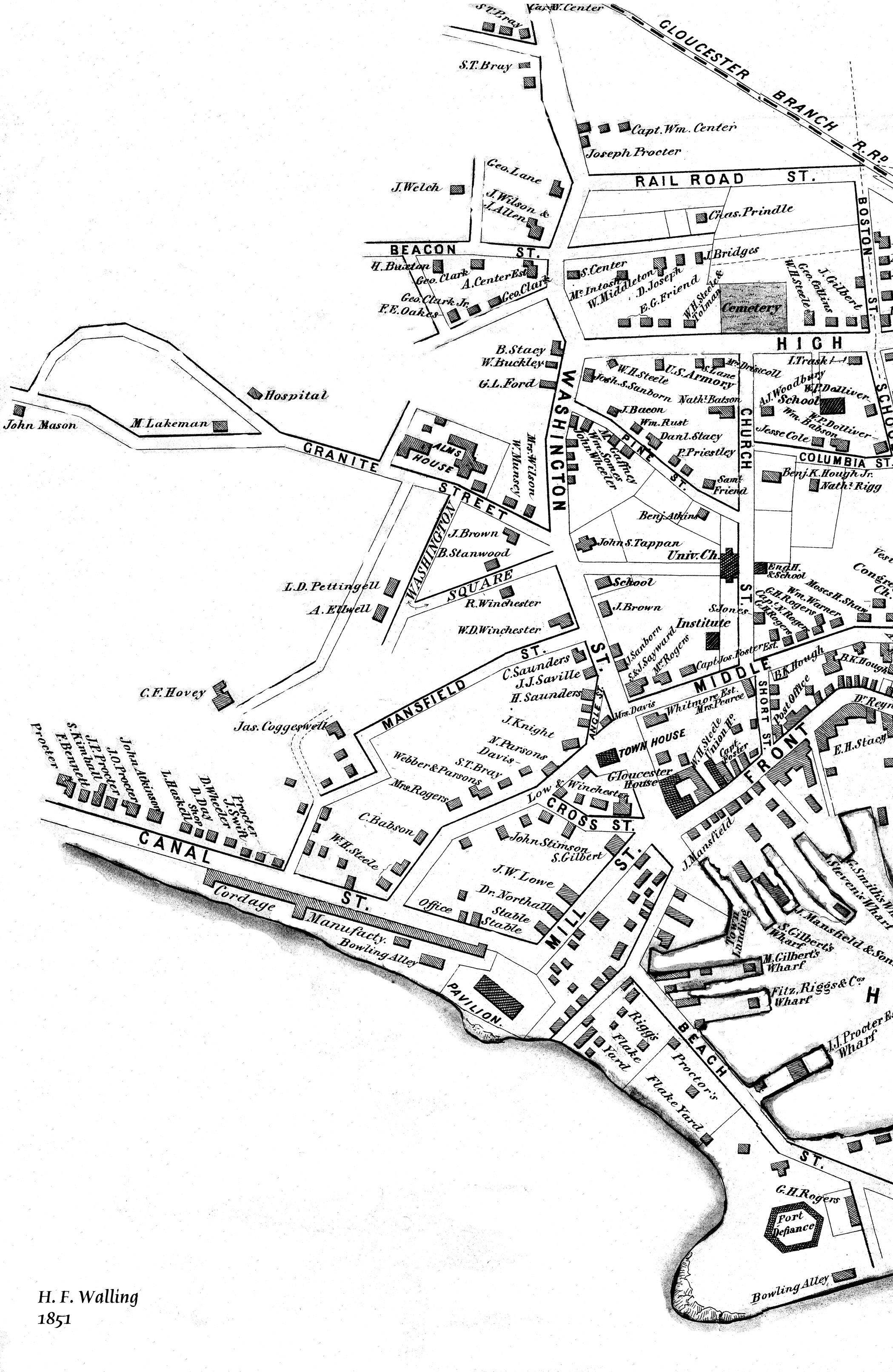
Henry Francis Walling, Map of the Towns of Gloucester and Rockport, Essex Co. Massachusetts. Philadelphia, A. Kollner, 1851
Cape Ann Museum Library & Archive
"Map of the Towns of Gloucester and Rockport, Massachusetts. H.F. Walling, Civil Engineer. John Hanson, Publisher. 1851. Population of Gloucester in 1850 7,805. Population of Rockport in 1850 3,213."
Segment of Harbor Village portion of map showing Lane-Winter property on Duncan's Point.
Also filed under: Duncan's Point » // Union School » // Winter, Ignatius »
44 x 34 in.
Henry Francis Walling, Map of the Towns of Gloucester and Rockport, Essex Co. Massachusetts. Philadelphia, A. Kollner, 1851
Cape Ann Museum Library & Archive
"Map of the Towns of Gloucester and Rockport, Massachusetts. H.F. Walling, Civil Engineer. John Hanson, Publisher. 1851. Population of Gloucester in 1850: 7,805. Population of Rockport in 1850: 3,213."
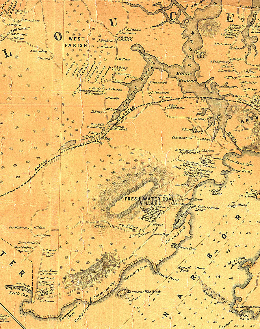
Also filed under: Annisquam River » // Brookbank » // Dolliver's Neck » // Fresh Water Cove » // Gloucester Harbor, Outer » // Norman's Woe » // Stage Rocks / Stage Fort / Stage Head » // Steepbank » // West Gloucester – Little River » // Western Shore »
Cape Ann Museum Library & Archive
Grayscale version of color original
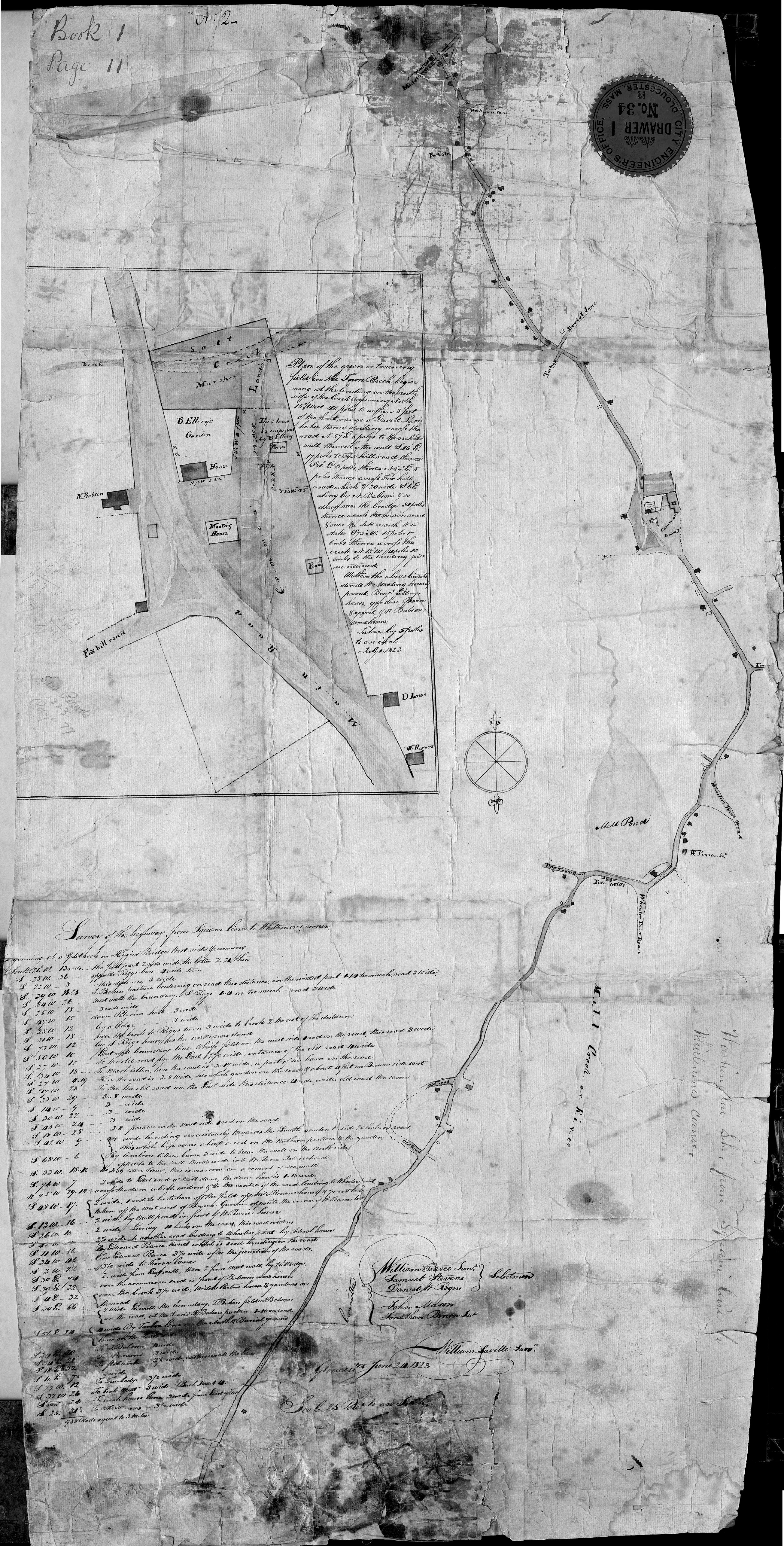
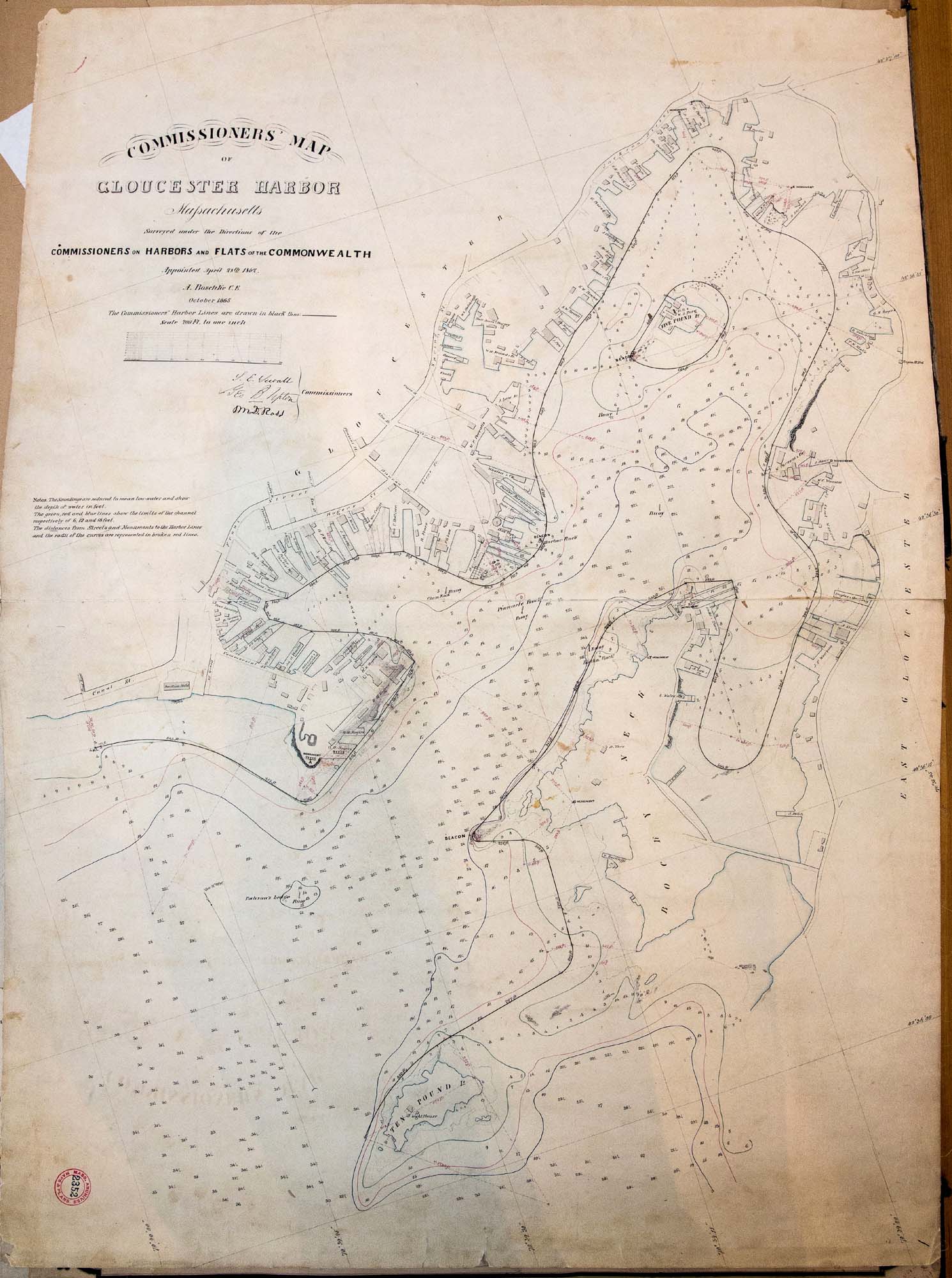
Map of Riverdale from the Mills to the Whittemore House at Middle and Washington Streeets ordered by a committee of selectmen, William Pearce, Samuel Stevens, Daniel H. Rogers with John Mason and Anthony Presson. Map drawn by surveyor William Saville and present to the committee in June, 1823. It contains a enlarged view of The Green, including the Ellery and Babson houses painted by Lane.
Also filed under: Babson House » // Low (David) House » // Meetinghouse Green » // Riverdale / Town Parish » // Riverdale Mills »
Series Maps. v. 13: p. 17
SC1 / series 48X
Massachusetts Archives, Boston
View related Fitz Henry Lane catalog entries (1) »
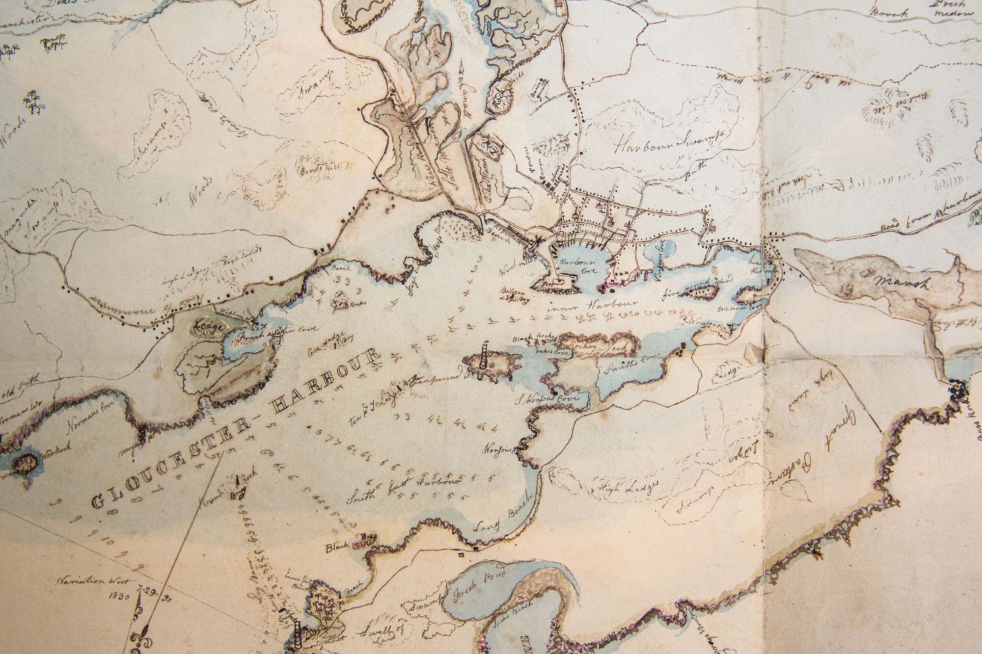
Also filed under: Beacons / Monuments / Spindles » // Gloucester Harbor, Inner / Harbor Cove » // Gloucester Harbor, Outer » // Gloucester, Mass. - "Ten Pound Island Light » // Gloucester, Mass. – Eastern Point Light » // Mason, John » // Norman's Woe » // Pavilion (Publick) Beach » // Ropewalk »
Lithograph
24 x 38 in.
Gloucester City Archives
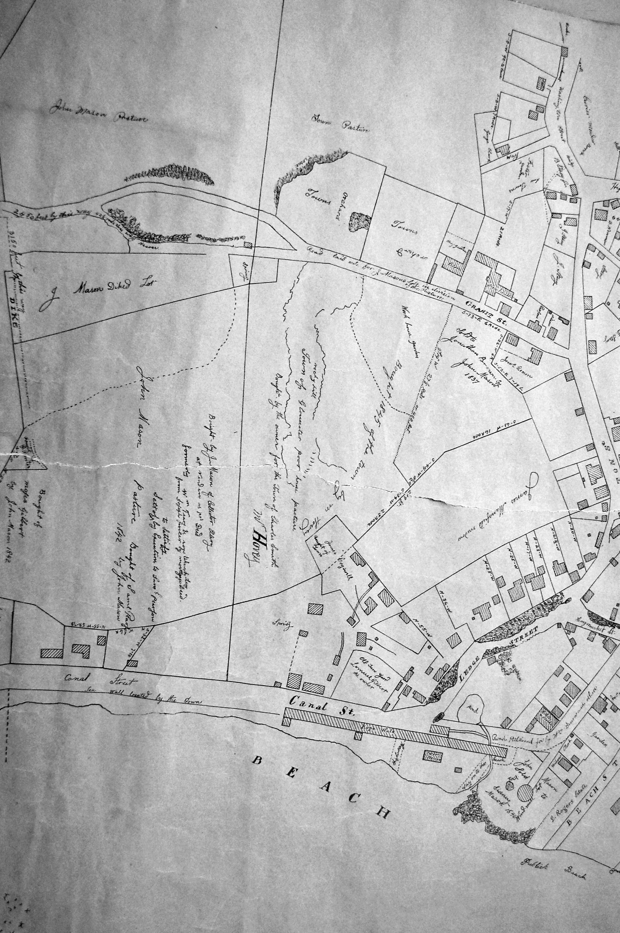
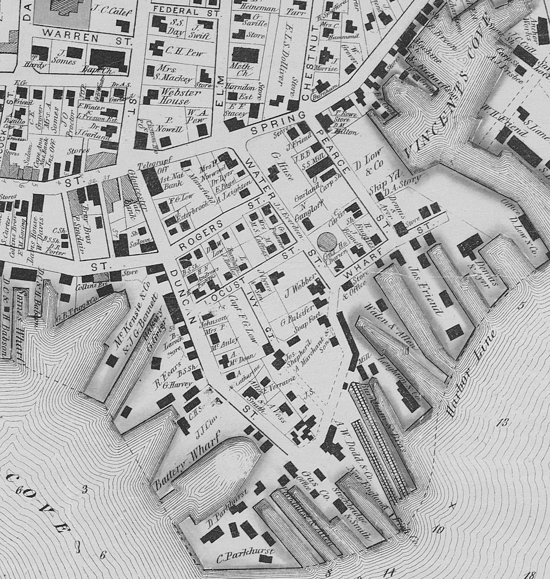
"Drawn on a scale of one hundred feet to an inch. By John Mason 1834–45 from Actual Survey showing every Lott and building then standing on them giving the actual size of the buildings and width of the streets from the Canal to the head of the Harbour & part of Eastern point as farr as Smith's Cove and the Shore of the same with all the wharfs then in use. Gloucester Harbor 1834–1835."
This section of the map shows the location of the Pavilion Hotel and ropewalk along the beach.
Also filed under: Mason, John » // Pavilion (Publick) Beach » // Pavilion Hotel » // Ropewalk » // Windmill »
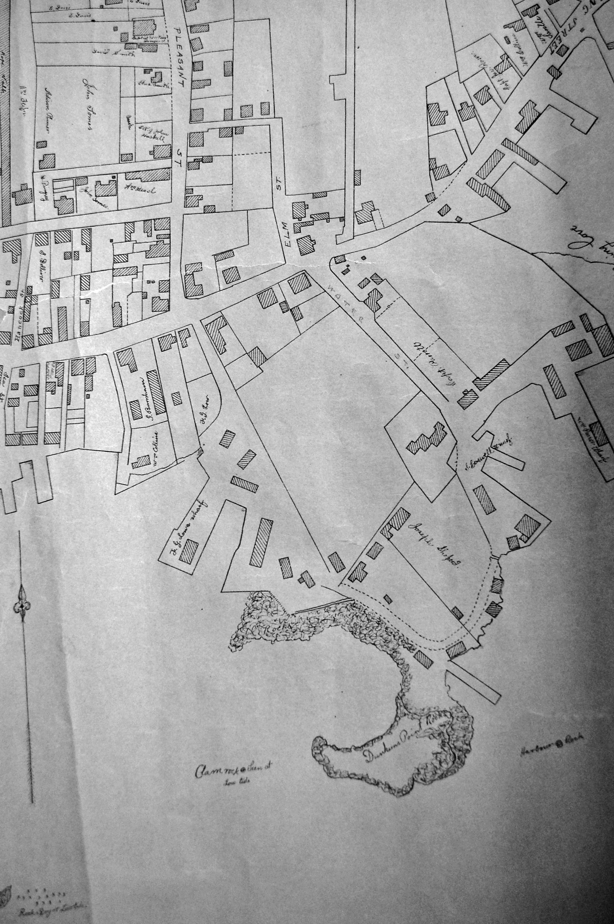
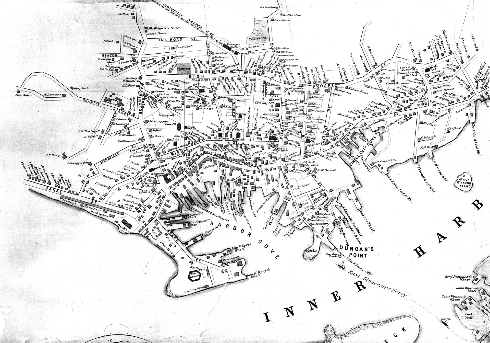
Lithograph
24 x 38 in.
Gloucester City Archives
"Drawn on a scale of one hundred feet to an inch. By John Mason 1834–45 from Actual Survey showing every Lott and building then standing on them giving the actual size of the buildings and width of the streets from the Canal to the head of the Harbour & part of Eastern point as farr as Smith's Cove and the Shore of the same with all the wharfs then in use. Gloucester Harbor 1834–35."
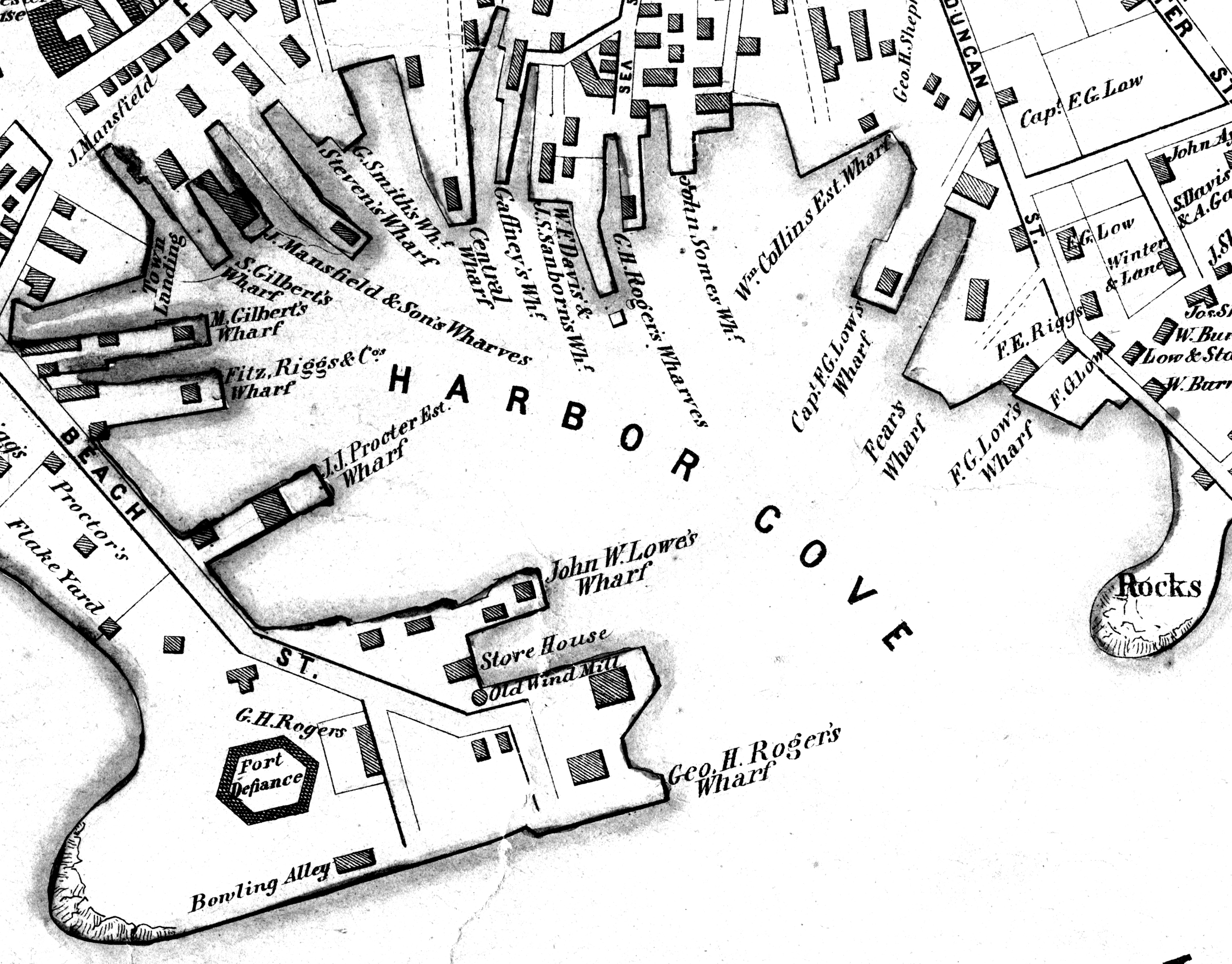
This map shows the location of F. E. Low's wharf and the ropewalk. Duncan's Point, the site where Lane would eventually build his studio, is also marked.
The later notes on the map are believed to be by Mason.
Also filed under: Duncan's Point » // Gloucester Harbor, Inner / Harbor Cove » // Low (Frederick G.) wharves » // Low, Capt. Frederick Gilman » // Mason, John » // Residences » // Ropewalk » // Somes, Capt. John »
24 x 38 in.
Gloucester City Archives
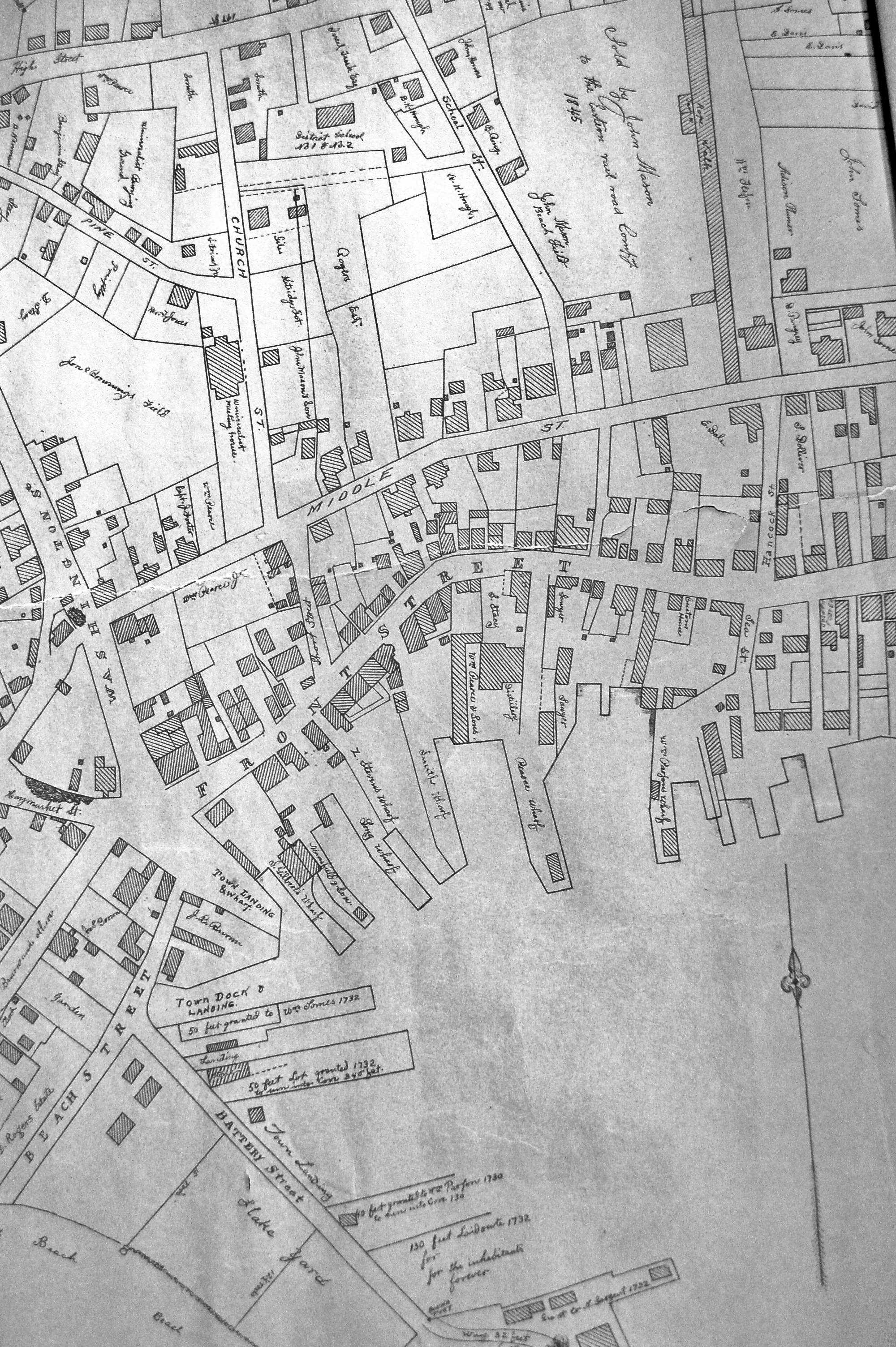
"Drawn on a scale of one hundred feet to an inch. By John Mason 1834–45 from Actual Survey showing every Lott and building then standing on them giving the actual size of the buildings and width of the streets from the Canal to the head of the Harbour & part of Eastern point as farr as Smith's Cove and the Shore of the same with all the wharfs then in use. Gloucester Harbor 1834–35."
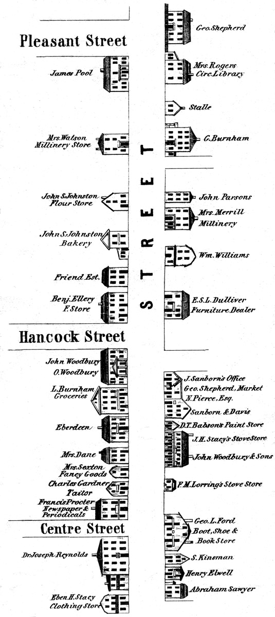
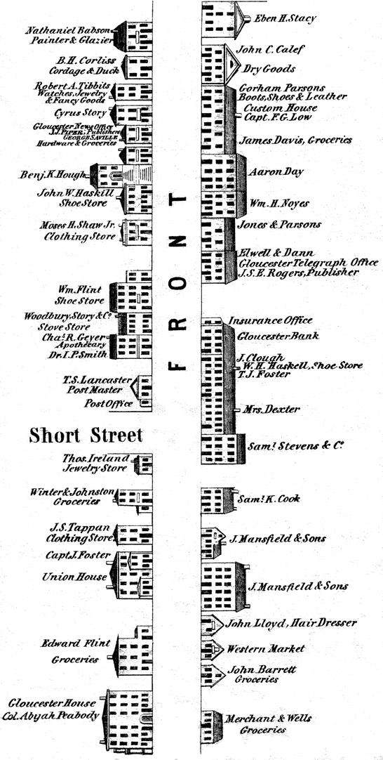
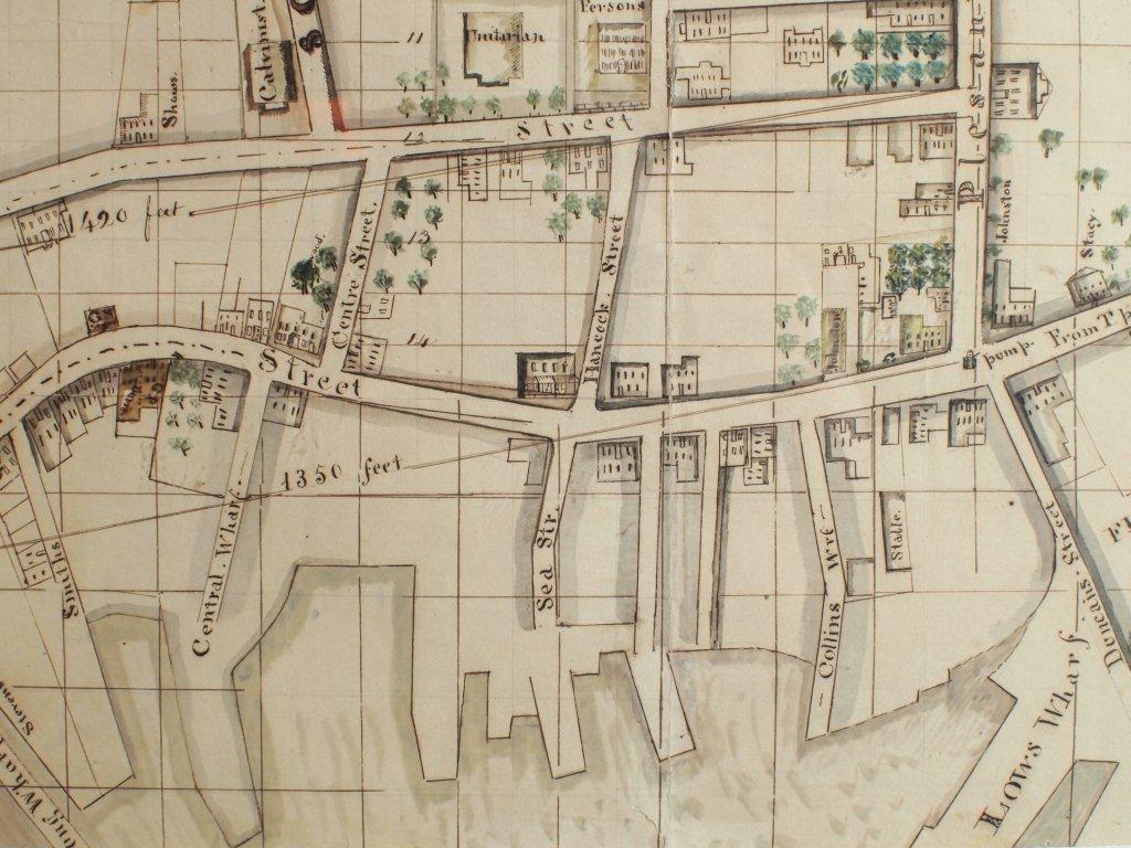
This map is especially helpful in showing the wharves of the inner harbor at the foot of Washington Street.
View related Fitz Henry Lane catalog entries (1) »
Also filed under: Dale, Eben B. » // Eastern Railroad » // Flake Yard » // Gloucester Harbor, Inner / Harbor Cove » // Hough, Benjamin Kent » // Pavilion (Publick) Beach » // Ropewalk » // Sawyer, Samuel » // Town / Public Landings » // Universalist Church (Middle and Church Streets) »
24 x 38 in.
Gloucester City Archives
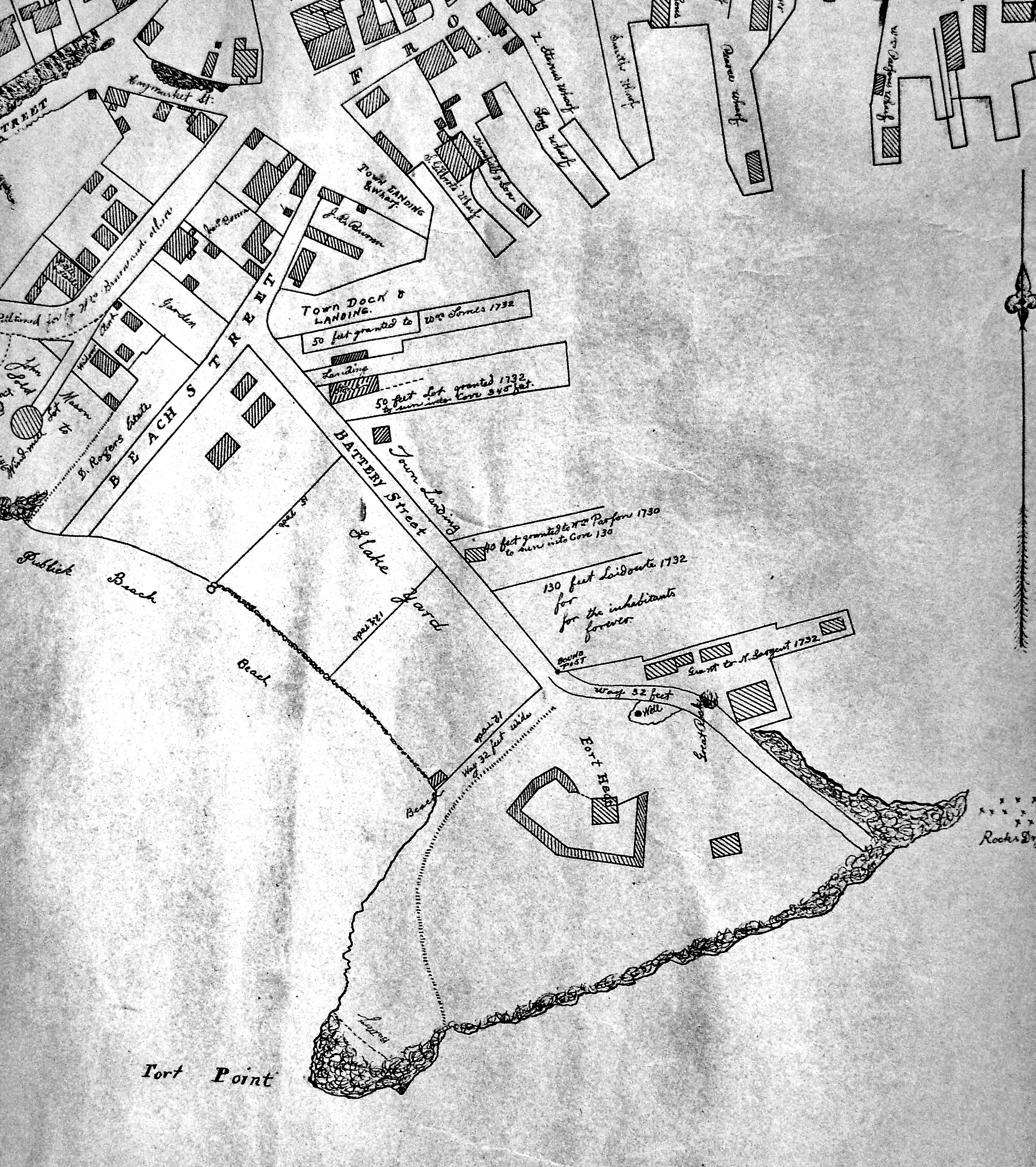
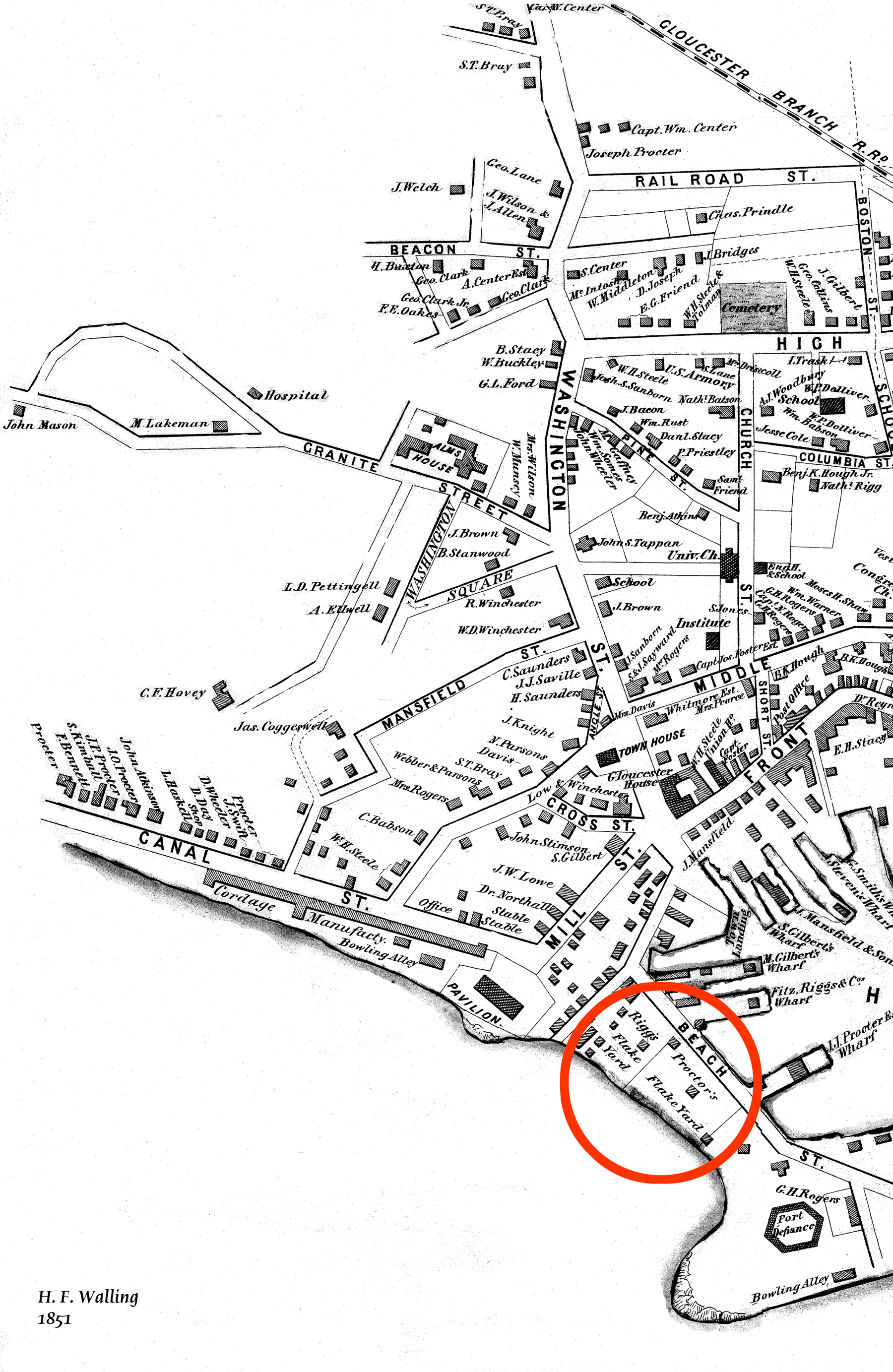
"Drawn on a scale of one hundred feet to an inch. By John Mason 1834–45 from Actual Survey showing every Lott and building then standing on them giving the actual size of the buildings and width of the streets from the Canal to the head of the Harbour & part of Eastern point as farr as Smith's Cove and the Shore of the same with all the wharfs then in use. Gloucester Harbor 1834–35."
This map is especially useful in showing the Fort.
Also filed under: Flake Yard » // Fort (The) and Fort Point » // Mason, John » // Pavilion (Publick) Beach » // Town / Public Landings »
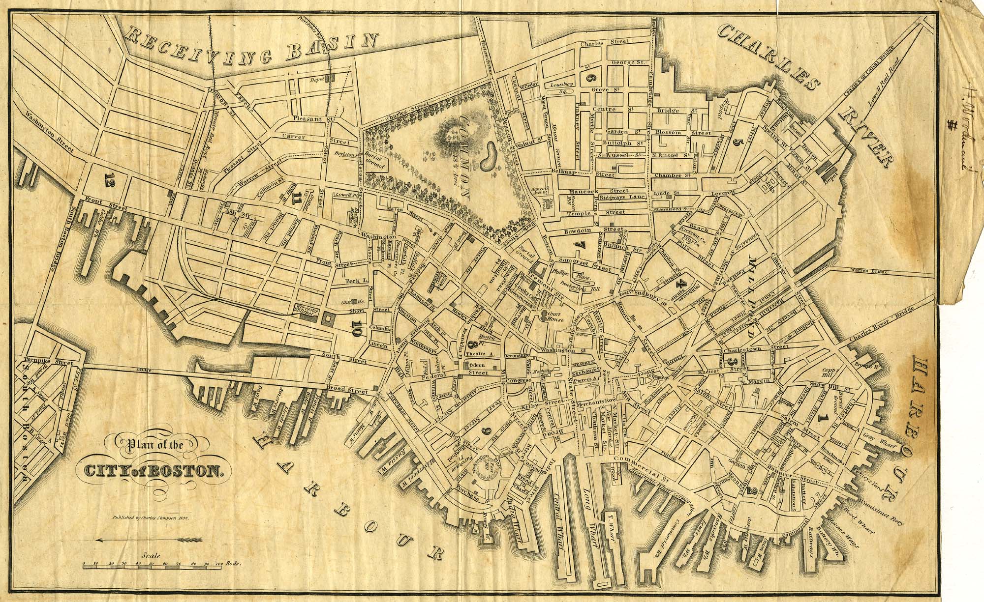
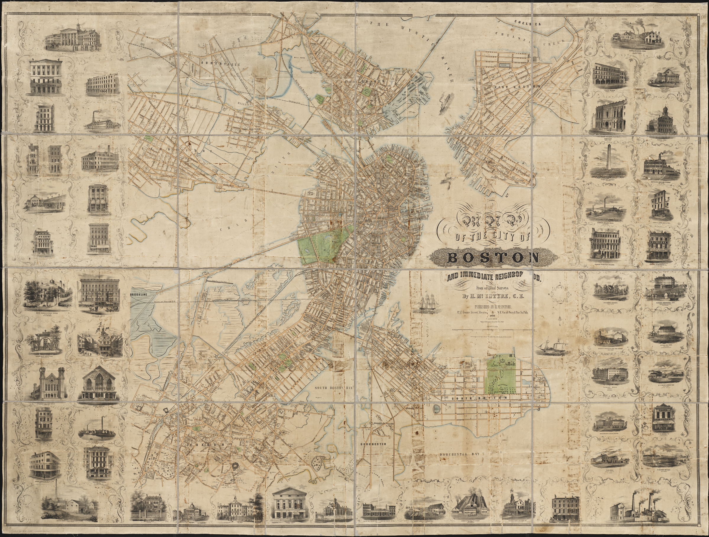
9 x 14 in.
Cape Ann Museum Library & Archive
Showing Lane's neighborhood while working in Boston. Lane had studios at the intersection of Washington and State Streets, Summer, Tremont and School Streets.
Also filed under: Boston City Views » // Lane & Scott's, Lith. – Boston » // Professional » // Residences » // Tremont Temple »
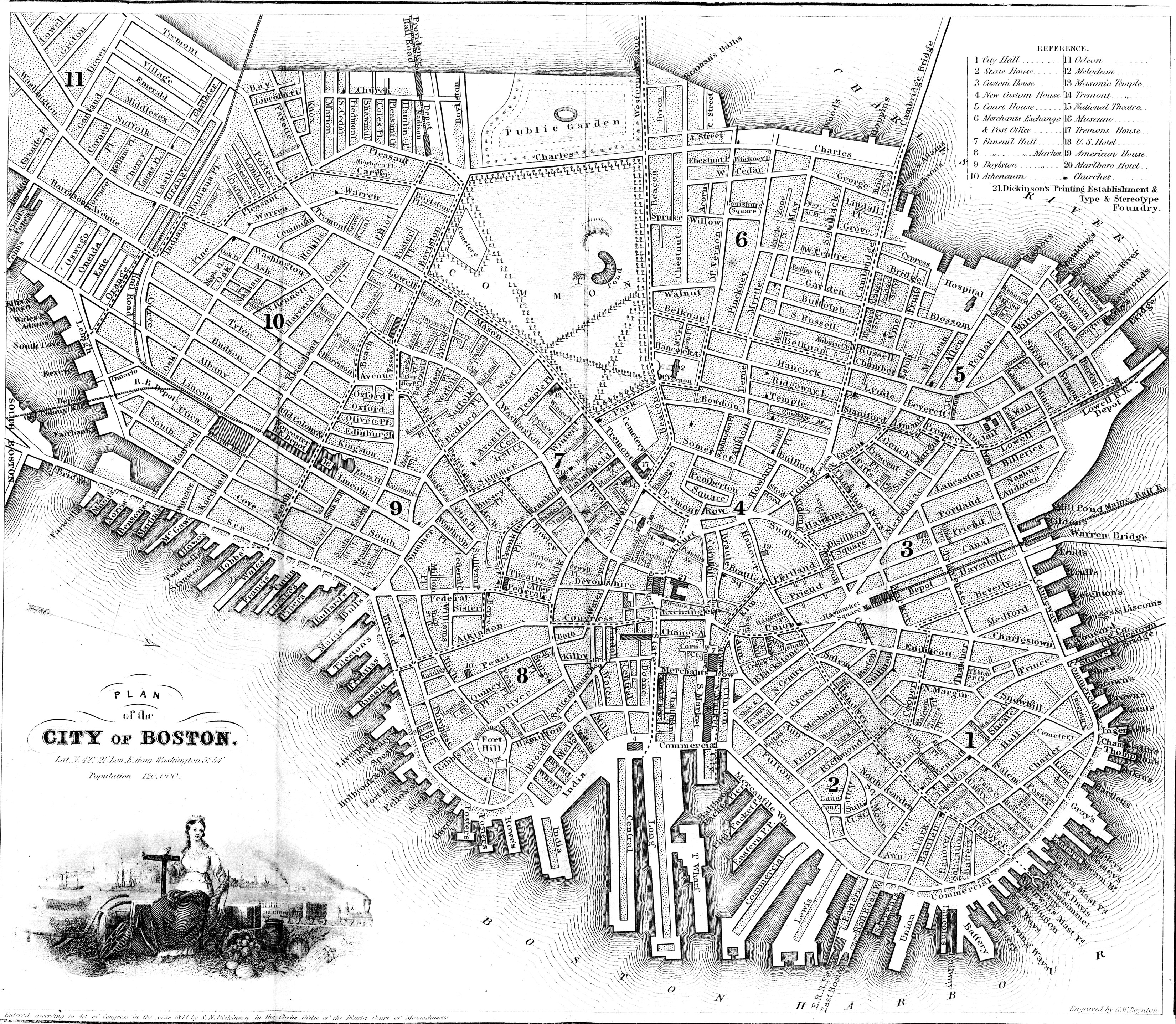
Map insert to Boston Almanac and Directory
Cape Ann Museum Library & Archive
Also filed under: Boston City Views » // Residences » // Tremont Temple »
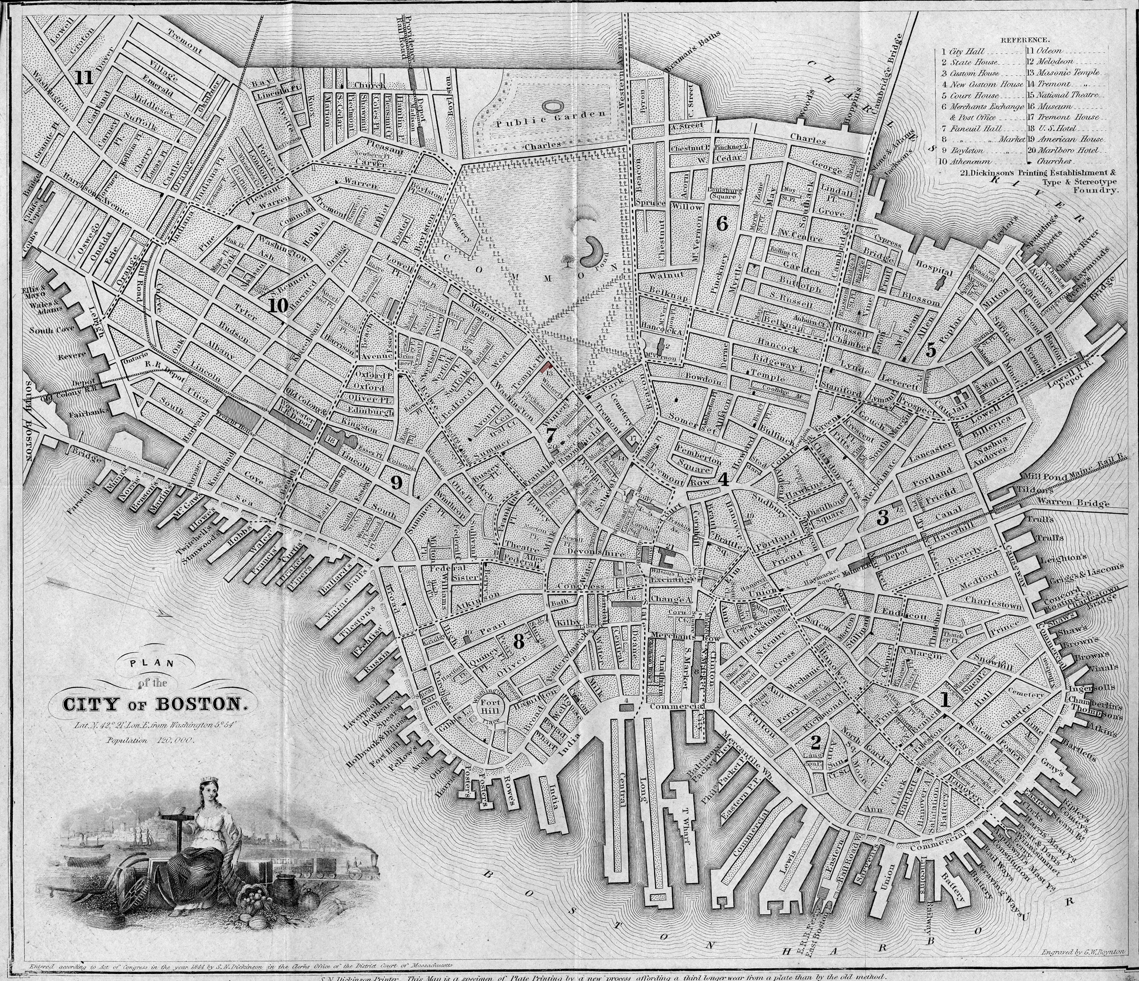
Printed map inside Boston Almanac
Published by B. B. Mussey & Co. and Thomas Groom, Boston
Cape Ann Museum Library & Archive (R910.45 B65 1848)
Map at front of almanac with Tremont Temple highlighted.
Also filed under: Boston City Views » // Boston Harbor » // Tremont Temple »
44 x 34 in.
Henry Francis Walling, Map of the Towns of Gloucester and Rockport, Essex Co. Massachusetts. Philadelphia, A. Kollner, 1851
Cape Ann Museum Library & Archive
"Map of the Towns of Gloucester and Rockport, Massachusetts. H.F. Walling, Civil Engineer. John Hanson, Publisher. 1851. Population of Gloucester in 1850 7,805. Population of Rockport in 1850 3,213."
View related Fitz Henry Lane catalog entries (1) »
Also filed under: Annisquam River » // Babson House » // Coffin's Beach » // Eastern Railroad » // Gloucester, Mass. – Annisquam Harbor Lighthouse » // Granite Quarrying / Shipping » // Loaf, The » // Low (David) House » // Old First Parish / Subsequent Fourth Parish Church (at the Green) » // Riverdale Methodist Church (Washington Street) » // White-Ellery House »
44 x 34 in.
Henry Francis Walling, Map of the Towns of Gloucester and Rockport, Essex Co. Massachusetts. Philadelphia, A. Kollner, 1851
Cape Ann Museum Library & Archive
"Map of the Towns of Gloucester and Rockport, Massachusetts. H.F. Walling, Civil Engineer. John Hanson, Publisher. 1851. Population of Gloucester in 1850 7,805. Population of Rockport in 1850 3,213."
Also filed under: Gloucester – City Views » // Procter Brothers »
44 x 34 in.
Henry Francis Walling, Map of the Towns of Gloucester and Rockport, Essex Co. Massachusetts. Philadelphia, A. Kollner, 1851
Cape Ann Museum Library & Archive
"Map of the Towns of Gloucester and Rockport, Massachusetts. H.F. Walling, Civil Engineer. John Hanson, Publisher. 1851. Population of Gloucester in 1850 7,805. Population of Rockport in 1850 3,213."
Also filed under: Gloucester Bank » // Gloucester – City Views » // Low, Capt. Frederick Gilman » // Stacy, Eben Hough »
44 x 34 in.
John Hanson, Publisher
Cape Ann Museum Library & Archive
"Map of the Towns of Gloucester and Rockport, Massachusetts. H.F. Walling, Civil Engineer. John Hanson, Publisher. 1851. Population of Gloucester in 1850 7,805. Population of Rockport in 1850 3,213."
Also filed under: Fort (The) and Fort Point » // Low (Frederick G.) wharves » // Rogers's (George H.) wharves » // Town / Public Landings » // Waterfront, Gloucester » // Windmill »
Boston
Boston Public Library: Norman B. Leventhal Map Center
Call Number: G3764.B6 1852.M35
Also filed under: Boston City Views » // Residences »
Cape Ann Museum Library & Archive
Segment shows Lane's home on Duncan's Point (as F. G. Low property) and neighboring businesses about five years after his death.
Also filed under: Duncan's Point »
Electrotype impression
Collection of Erik Ronnberg
Also filed under: Gloucester Harbor, Inner / Harbor Cove » // Gloucester Harbor, Outer »
page 13
From salemdeeds.com
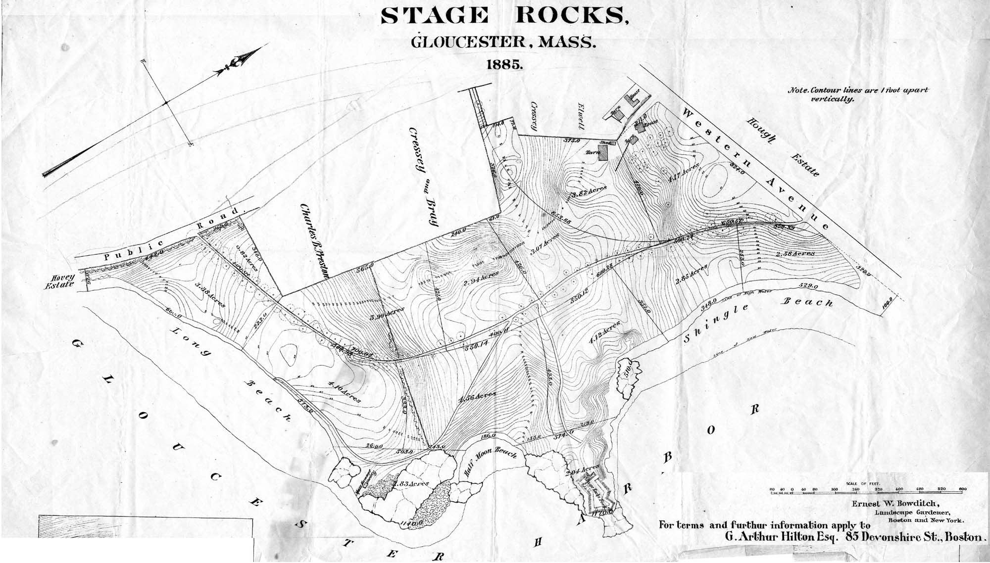
Also filed under: Stage Rocks / Stage Fort / Stage Head »
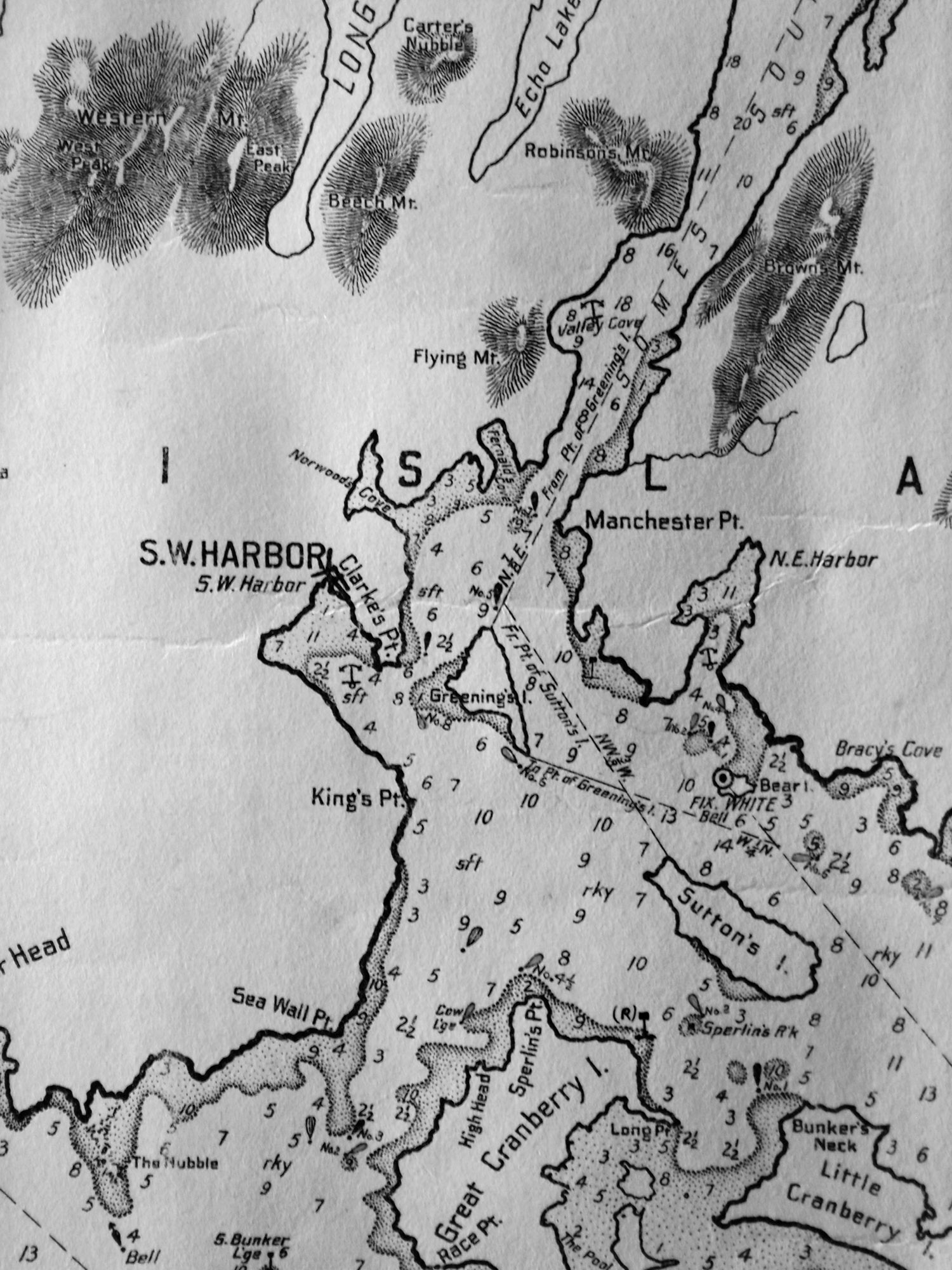
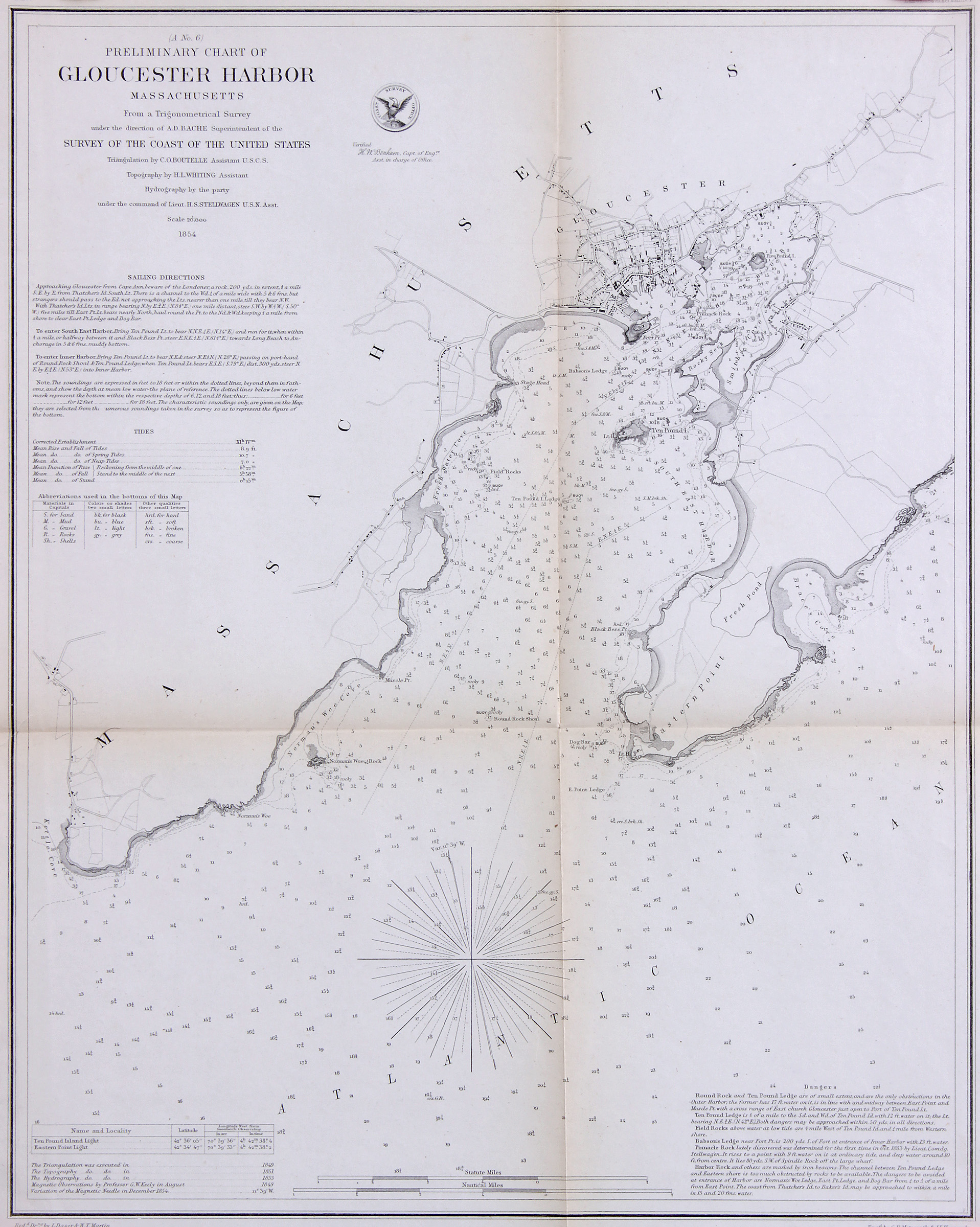
Chart G
Charles G. Hutchinson, Publisher
Private Collection
George W. Eldridge was a Boston-based publisher of charts, pilot books, and tide tables for yachtsmen cruising in the New York–New England region. Detail of the Mount Desert portion of a much larger chart.
Also filed under: Mount Desert Island & Rock » // Northeast Harbor » // Somes Sound »
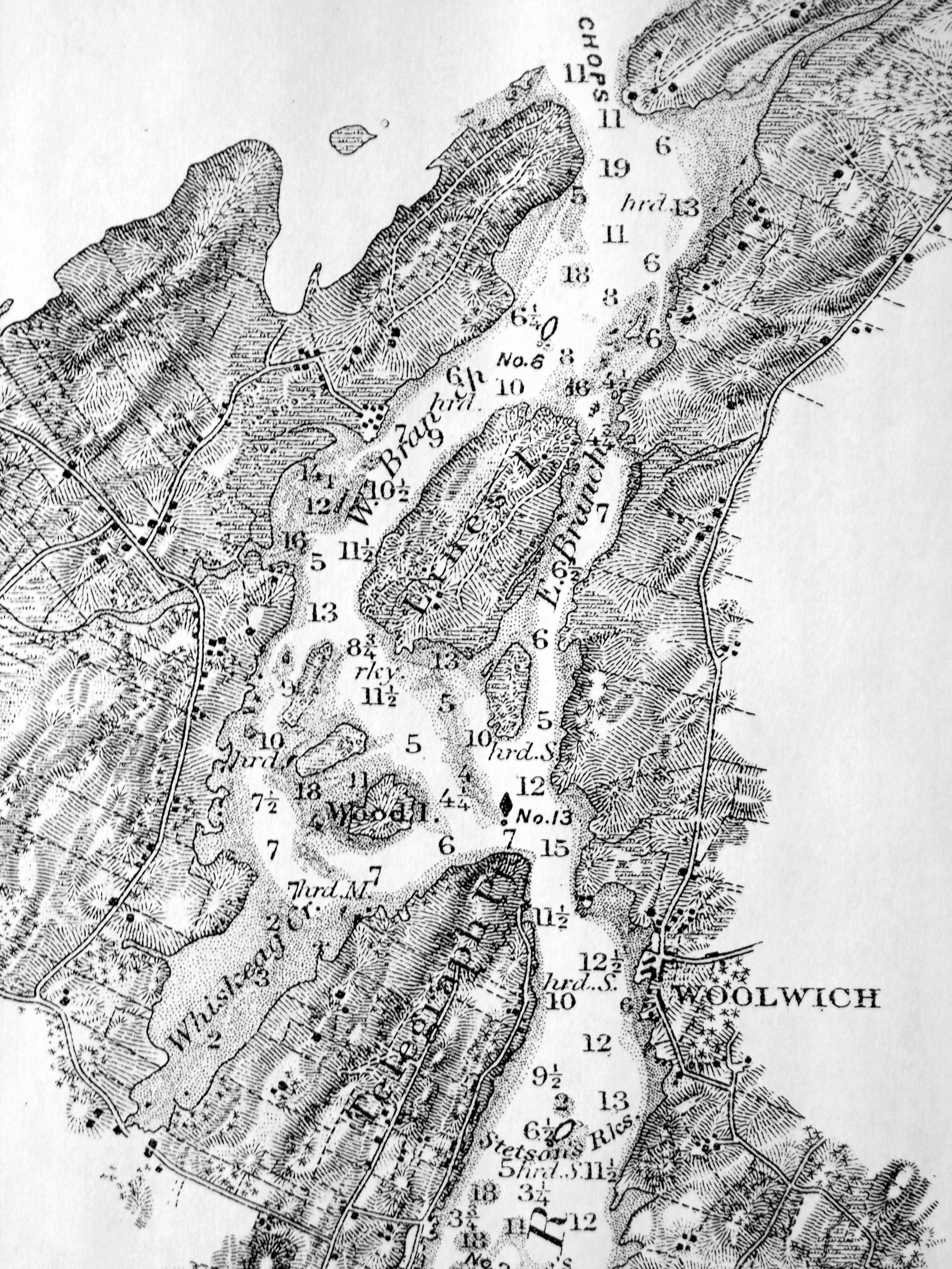
Atlantic Coast Pilot, Subdivision 4
Washington GPO
Plate No. 1477, between pp. 372 and 373.
Also filed under: Kennebec River »

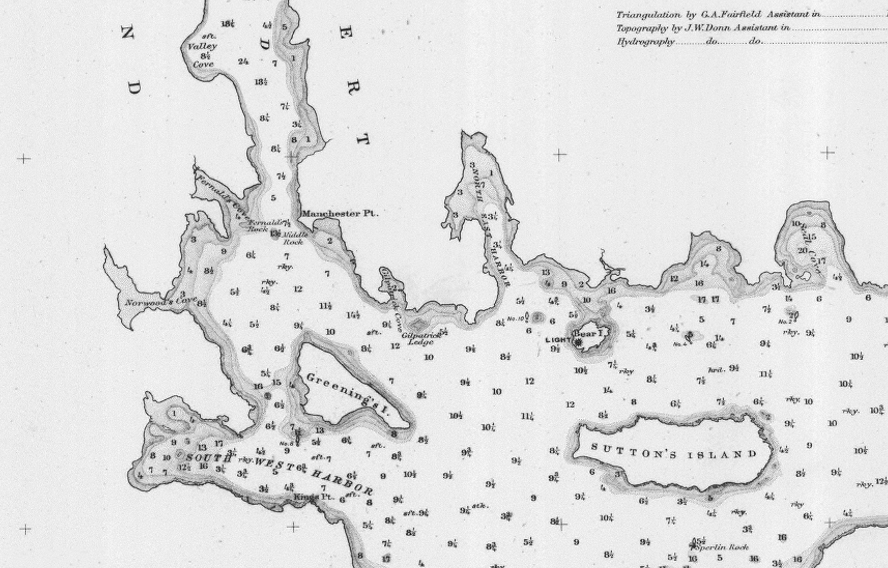
Illustration
"U.S. Coast Pilot, Atlantic Coast, Parts I–II." First edition. Published by Washington GPO, 1891
Folded plate between pp. 62 and 63
Also filed under: Bear Island » // Mount Desert Island & Rock » // Northeast Harbor, Maine – Bear Island Lighthouse » // Southwest Harbor »
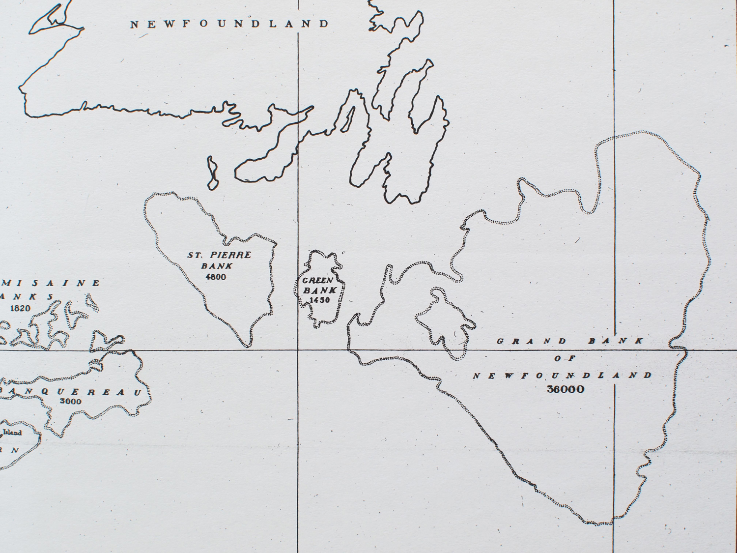
U.S. Bureau of Fisheries Mem. S-244
16 x 8 1/2 (original probably larger)
Private collection (published source unidentified)
Chart outlines principal fishing grounds. This section shows the location of the Grand Bank (of Newfoundland) relative to the southern coast of Newfoundland.
Also filed under: Grand Bank, Newfoundland, Canada »
U.S. Bureau of Fisheries, Mem. S-244
16 x 8 3/4 in. (original probably larger)
Private collection
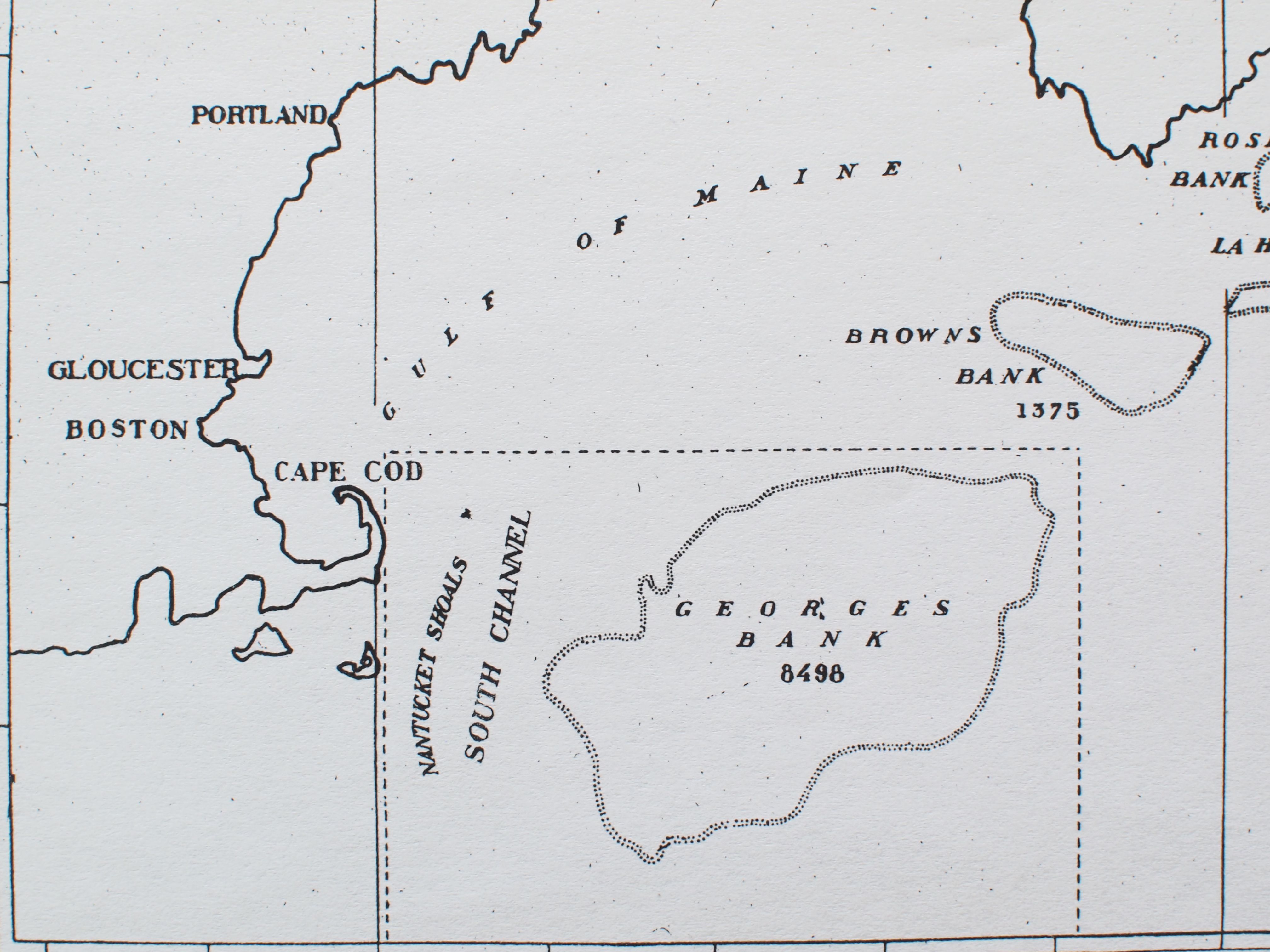
Chart outlines principal fishing grounds, showing location of Georges Bank relative to southern New England.
Also filed under: Georges Bank, Mass. »
Whole chart 13 x 9 1/4 in.
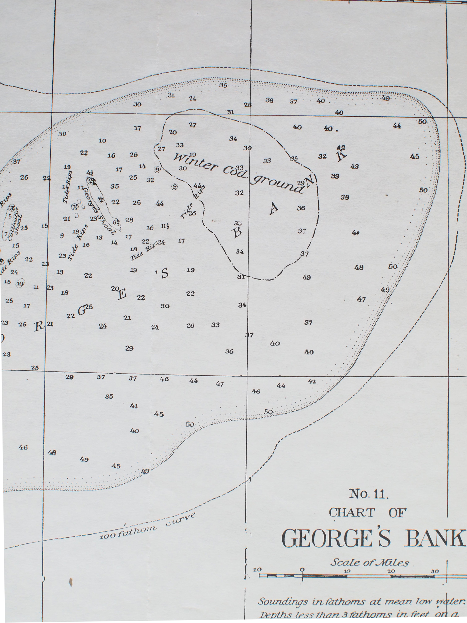
Cape Ann Museum Library & Archive
This section of the chart shows the eastern end of Georges Bank and the winter codfishing ground. Note the locations of tide rips and shoals which posed particular hazards in easterly winter storms.
– Erik Ronnberg
Also filed under: Georges Bank, Mass. »
Watercolor on paper
Cape Ann Museum Library & Archive
Also filed under: Low (Frederick G.) wharves » // Unitarian Church / First Parish Church (Middle Street) »

44 x 34 in.
John Hanson, Publisher
Cape Ann Museum Library & Archive
"Map of the Towns of Gloucester and Rockport, Massachusetts. H.F. Walling, Civil Engineer. John Hanson, Publisher. 1851. Population of Gloucester in 1850 7,805. Population of Rockport in 1850 3,213."
Also filed under: Flake Yard »
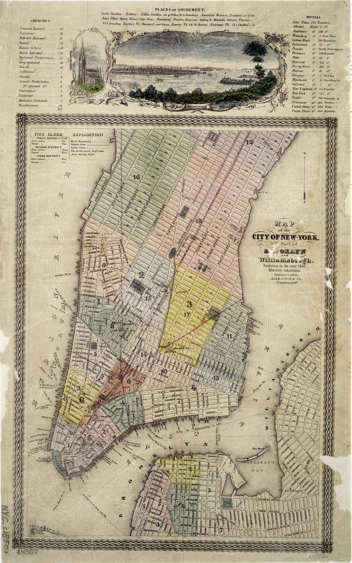
Hand-colored lithograph
35 x 25 cm. on sheet 48 x 30 cm.
Published by Magnus & Co.
New York Public Library
Covers Manhattan up to 34th Street on the west side and 51st Street on the east side. Includes views of New York City and Harbor, and Trinity Church above the upper neat line. Also includes list of churches, hotels, and places of amusement.
Also filed under: Castle Garden » // New York Harbor »
Commonwealth of Massachusetts. Southern Essex District Registry of Deeds. 1543 plan 0141_0003
salemdeeds.com
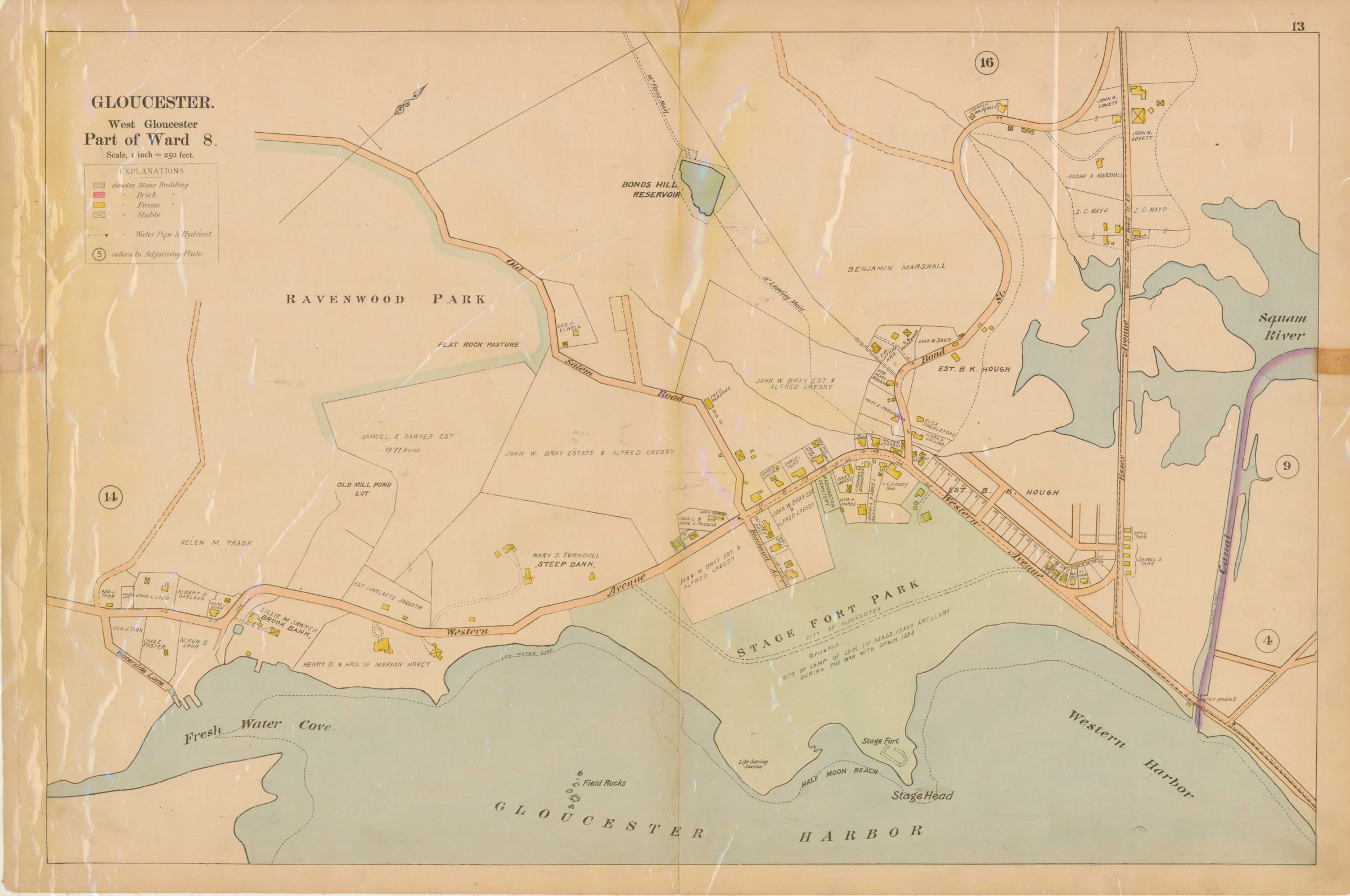
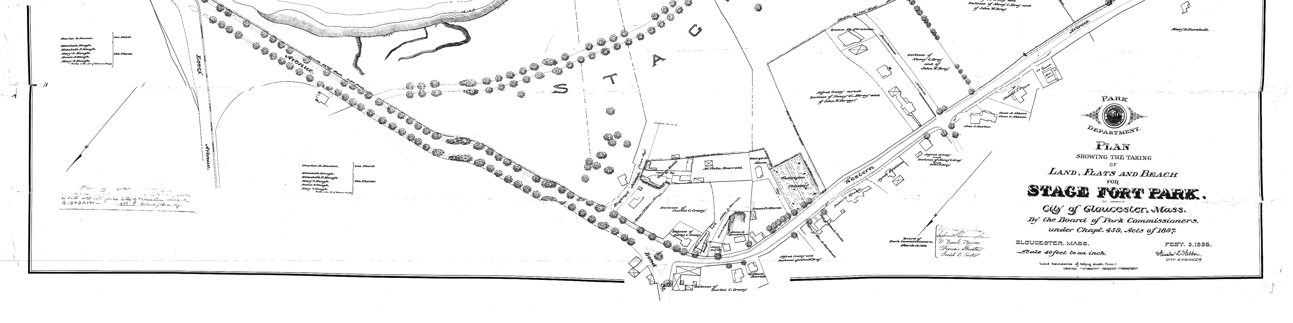
The third of the three plans has the references on it “Plan showing the taking of land, flats and beach for Stage Fort Park…1898…"
Includes a reference to the home of “Mary Turnbull” which is Steepbank.
Also filed under: Stage Rocks / Stage Fort / Stage Head »

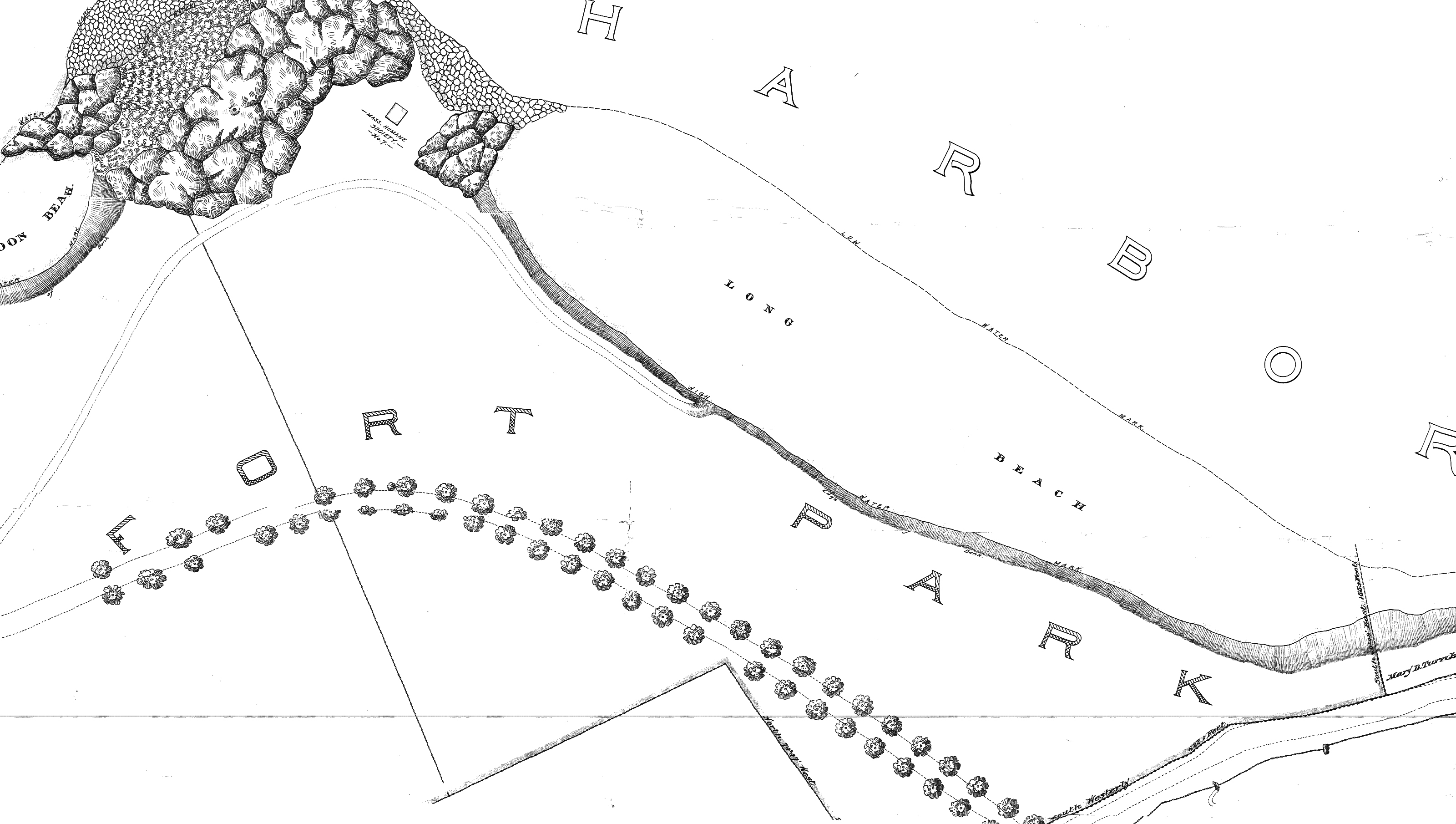
Commonwealth of Massachusetts: Southern Essex District Registry of Deeds
1543 plan 0141_0002
The third of the three plans has the references on it. "Plan showing the taking of land, flats and beach for Stage Fort Park…1898..."
Includes a reference to the home of Mary Turnbull which is Steepbank.
Also filed under: Stage Rocks / Stage Fort / Stage Head » // Steepbank »
Commonwealth of Massachusetts: Southern Essex District Registry of Deeds
1543 plan 0141_0001
The third of the three plans has the references on it “Plan showing the taking of land, flats and beach for Stage Fort Park…1898…”
Includes a reference to the home of Mary Turnbull which is Steepbank.
Wilson Museum, Castine, Maine.
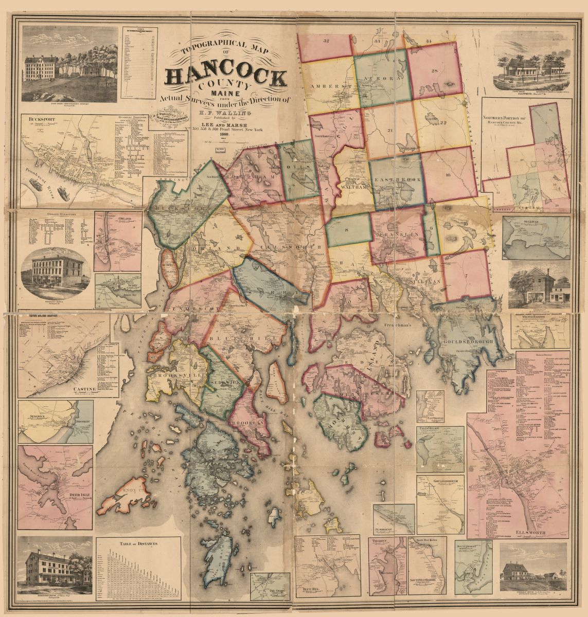
Library of Congress Catalog Number 2011588006
1860 map, including census of towns.
Also filed under: Castine » // Mount Desert Island & Rock » // Penobscot Bay »
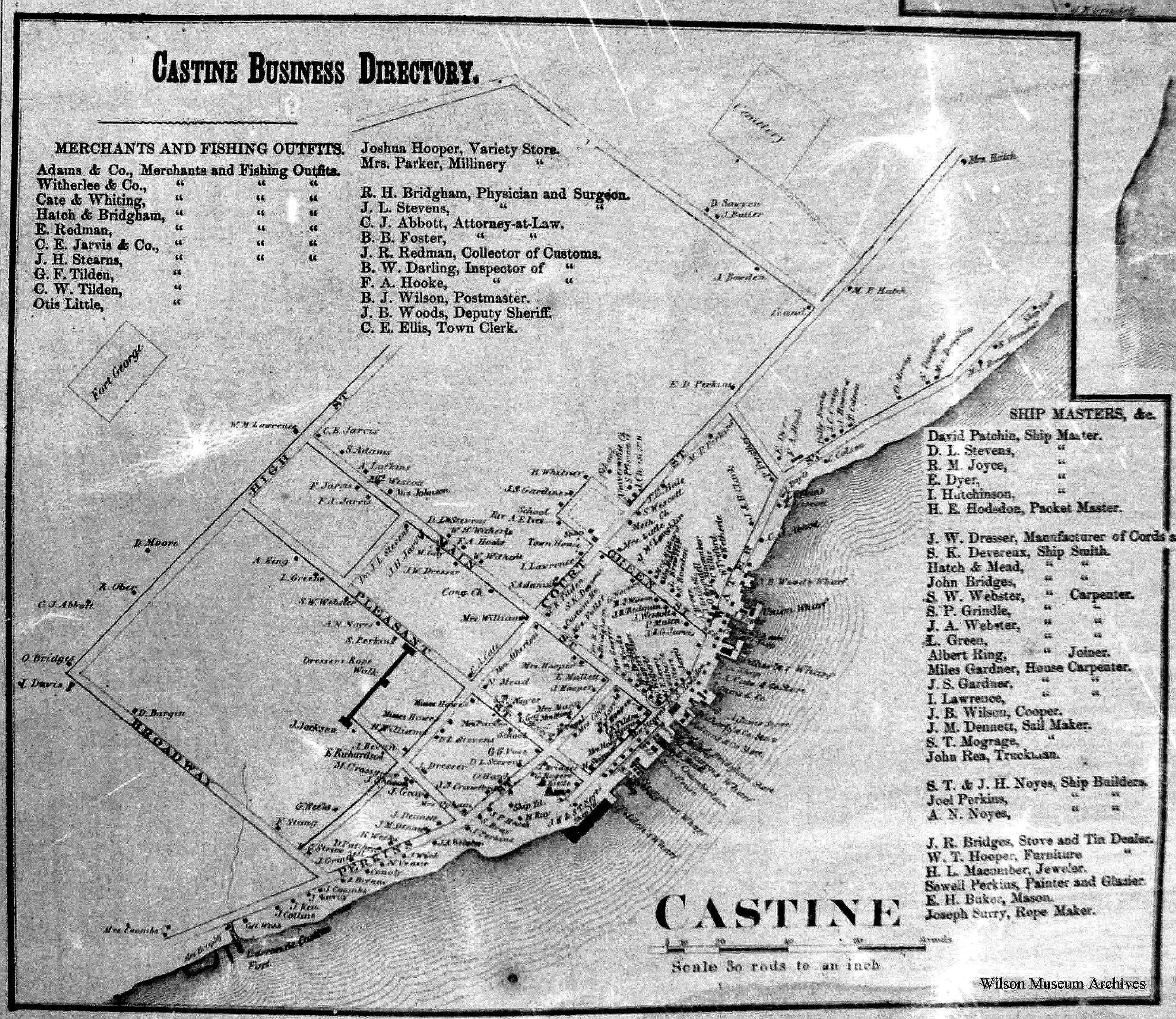
1860
Also filed under: Castine »
Library of Congress catalog number 2011588006
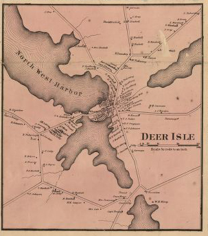
Wilson Museum, Castine, Maine also has a copy of the map
Also filed under: Castine »
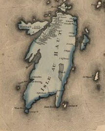
Wilson Museum, Castine, Maine also has a copy of the map
Library of Congress catalog number 2011588006
Also filed under: Castine »
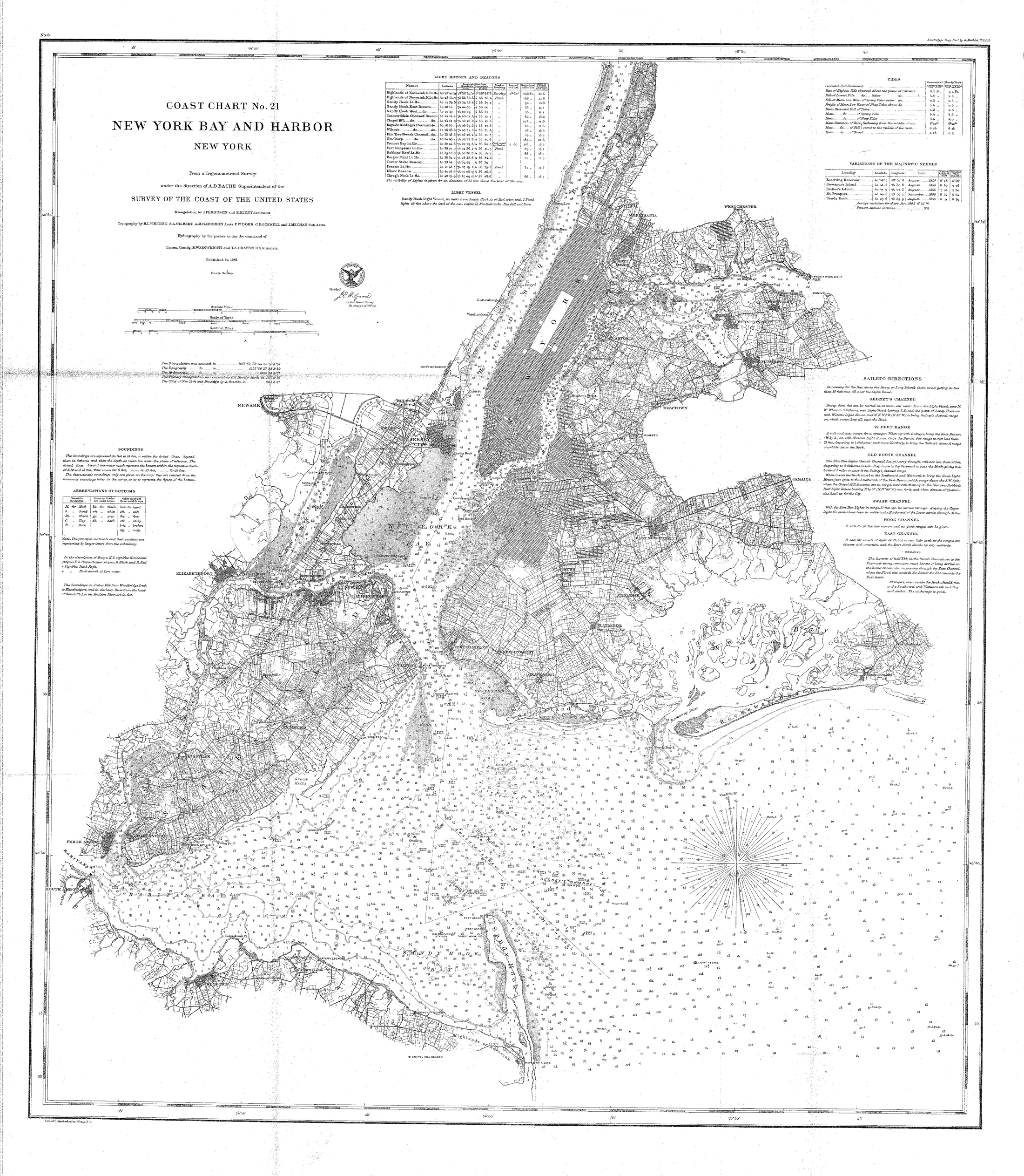
Survey of the Coast of the United States, New York Harbors, Washington, D.C.
Collection of Erik Ronnberg.
Also filed under: New York Harbor »
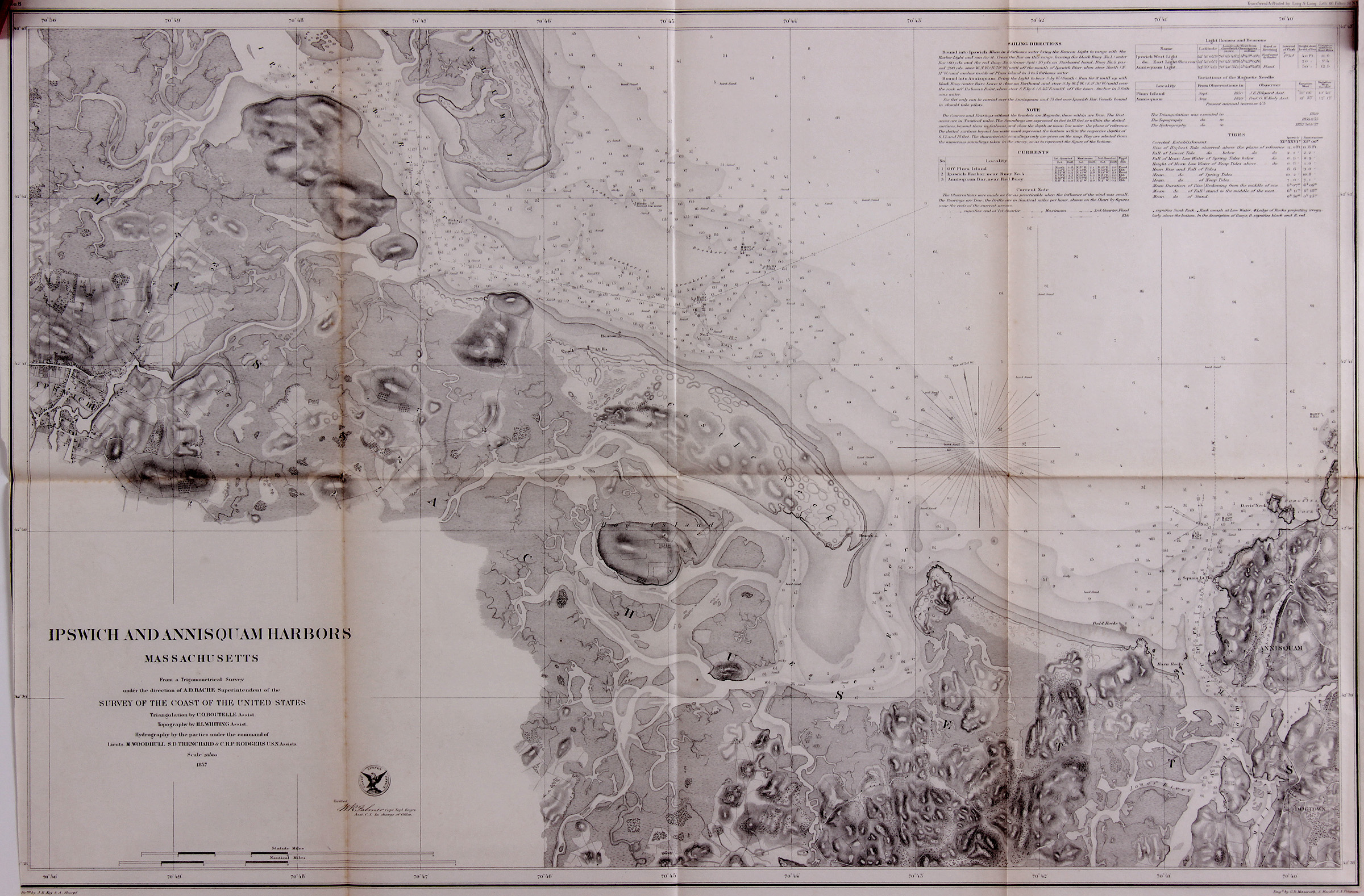
Survey of the Coast of the United States, Washington, D.C.
Collection of Erik Ronnberg
Also filed under: Annisquam River »
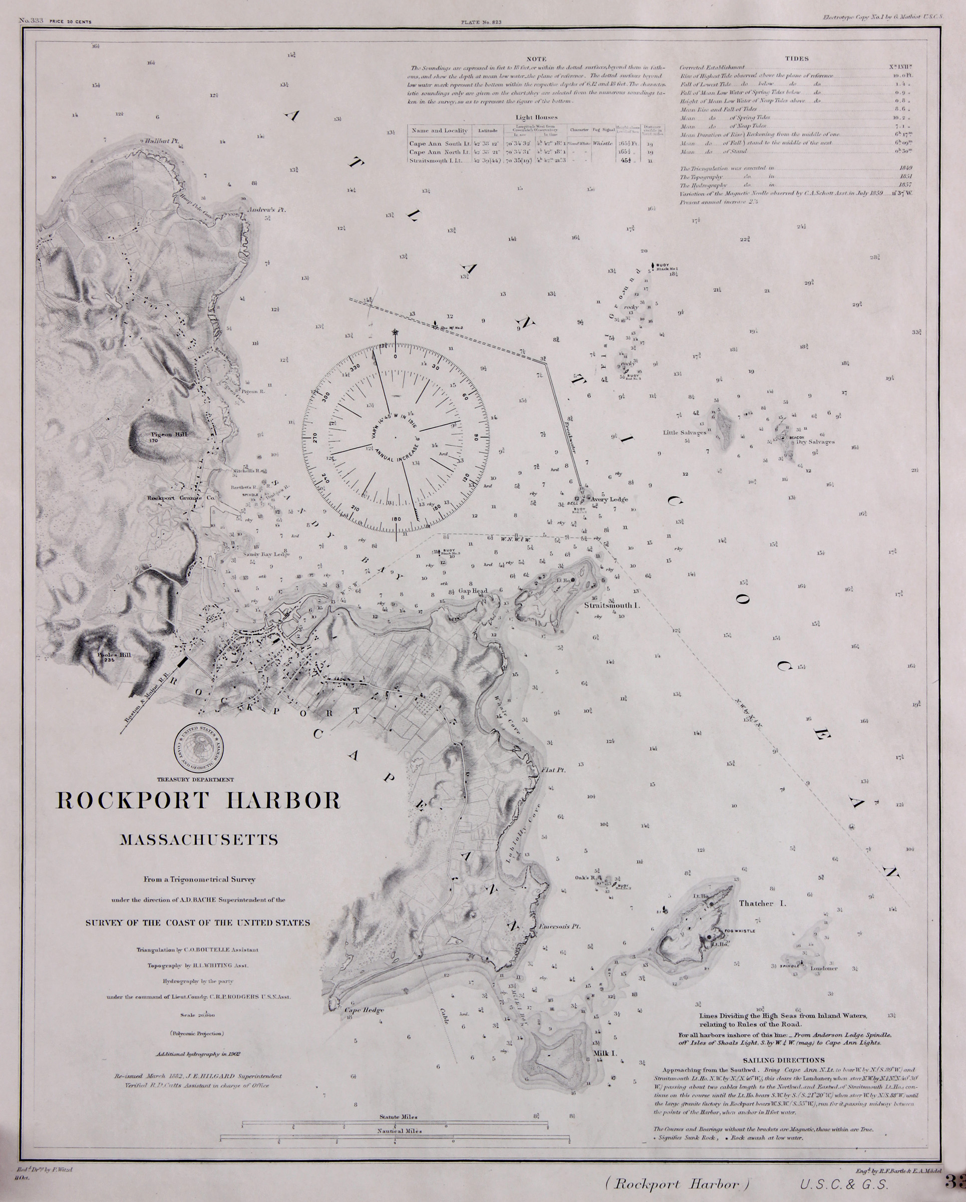
Survey of the Coast of the United States, Washington, D.C.
Collection of Erik Ronnberg
Also filed under: Thacher Island »