An online project under the direction of the CAPE ANN MUSEUM
Duncan's Point
View related Fitz Henry Lane catalog entries (7) »
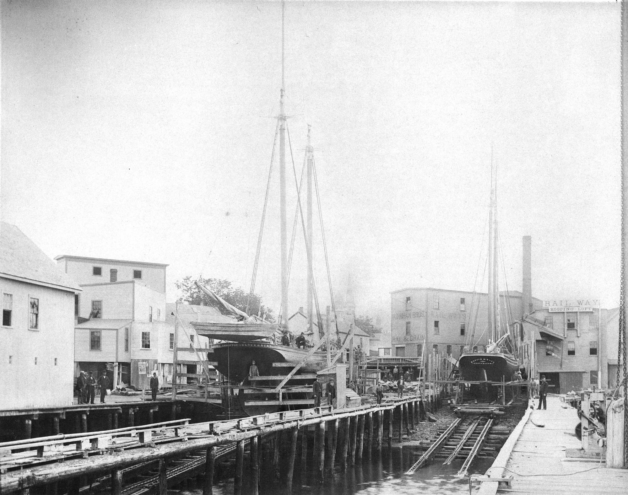
In 1849, Lane bought a small lot of land on top of a hill that jutted into Gloucester Inner Harbor. The name Duncan's Point refers alternatively to the entire hill, or only to the rocks that form a point beneath the current Coast Guard Station. The hilltop was vacant when Lane bought the property. He designed and built a gabled stone house on the hill, the northwest room of which was his studio. He lived there with his sister Sarah and her husband, Ignatius Winter, until he died in 1865, having bequeathed the house to his friend, Joseph L. Stevens, Jr. (1)
Reference:
1. Sarah Dunlop and Stephanie Buck, Fitz Henry Lane: Family and Friends (Gloucester, MA: Church & Mason Publishing; in association with the Cape Ann Historical Museum, 2007), 59–74, 150–55.
Related tables: Lane's Stone House, Duncan's Point » // Low, Capt. Frederick Gilman »
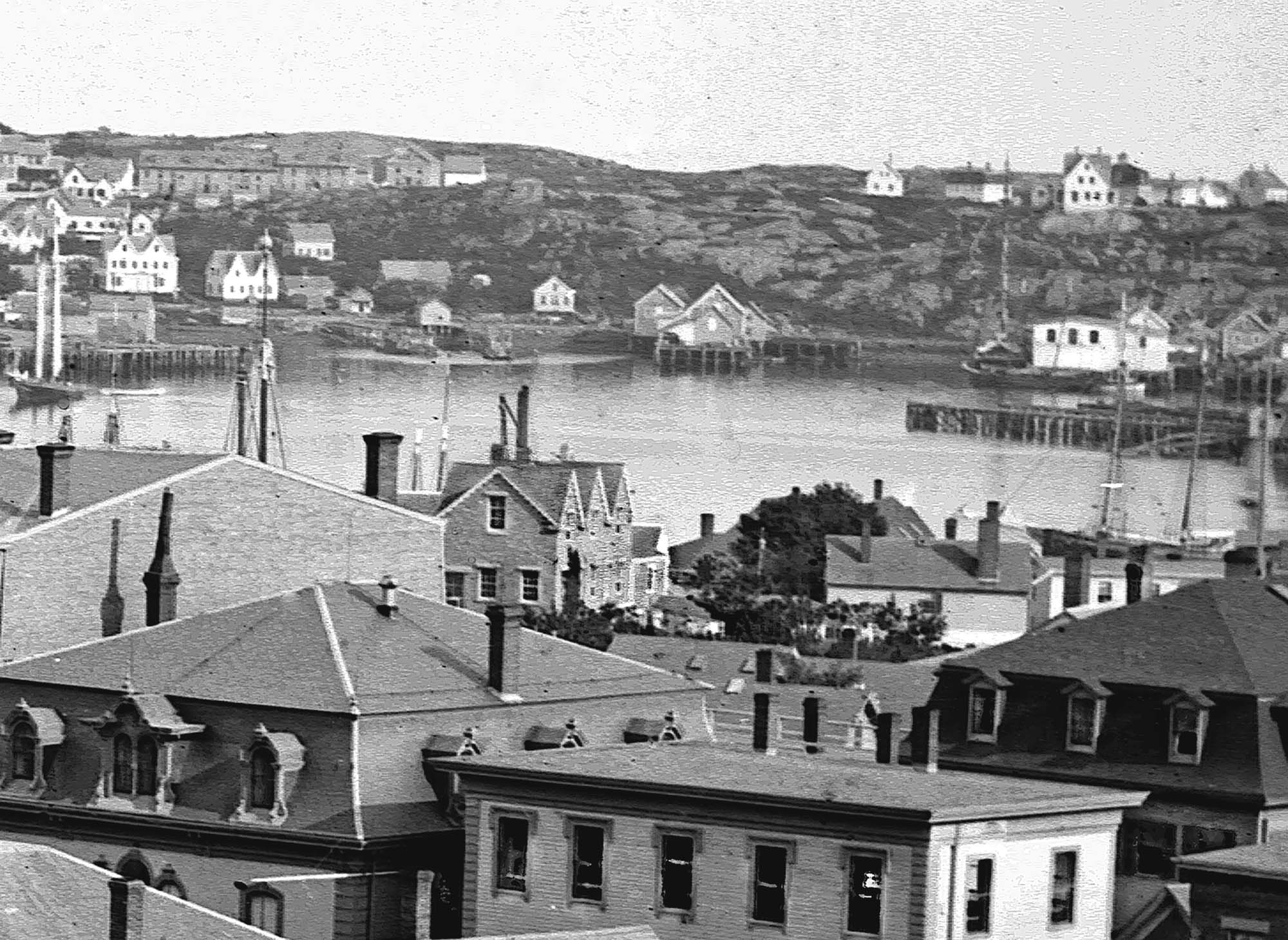
Glass plate negative
Cape Ann Museum Library & Archive
Detail from CAHA#00279
The magnificent views of Gloucester Harbor and the islands from the top floor of the stone house at Duncan's Point where Lane had his studio were the inspiration for many of his paintings.
From Buck and Dunlop, Fitz Henry Lane: Family, and Friends, pp. 59–74.
Also filed under: Gloucester Harbor, Inner / Harbor Cove » // Lane's Stone House, Duncan's Point » // Residences »
44 x 34 in.
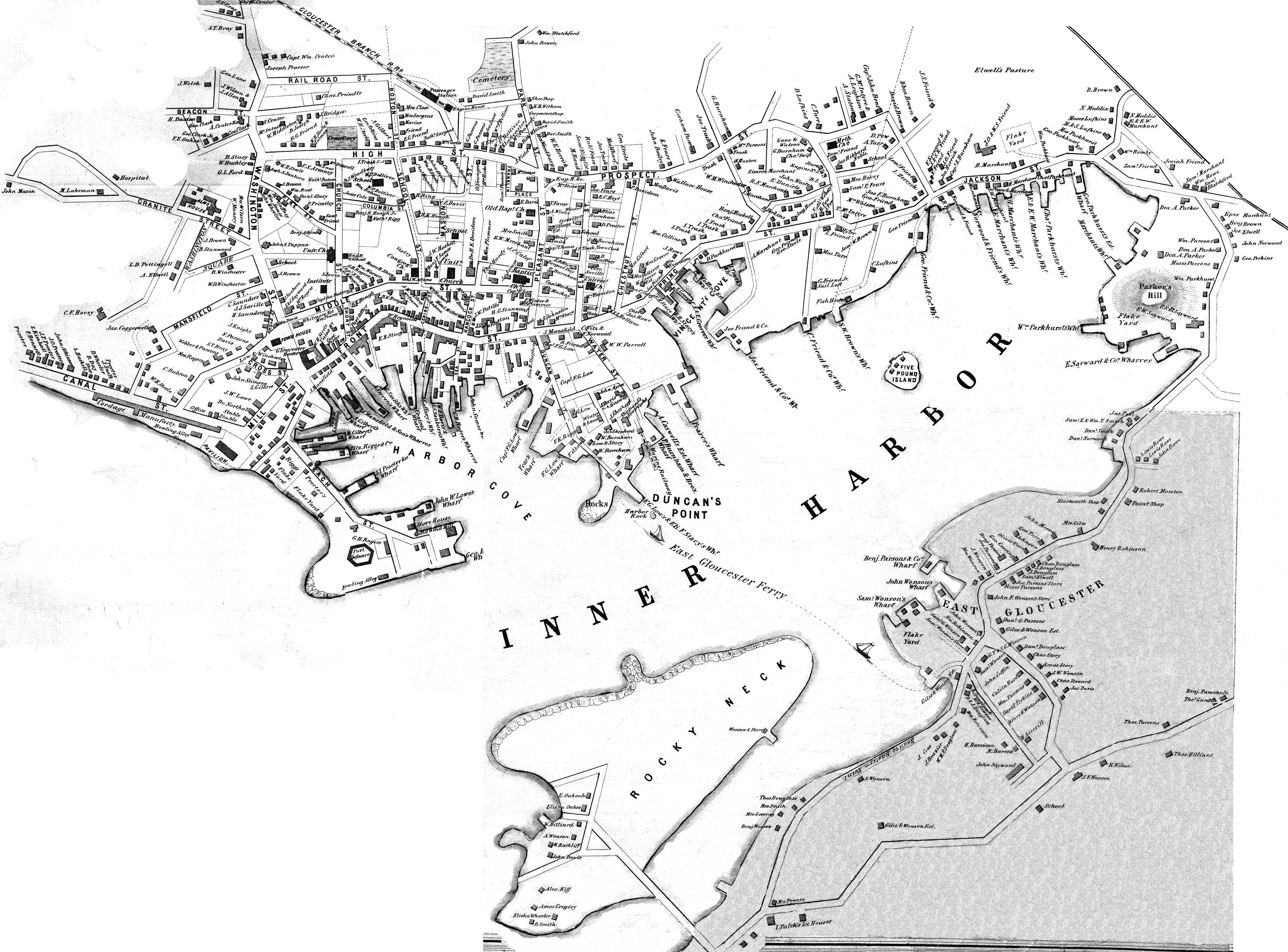
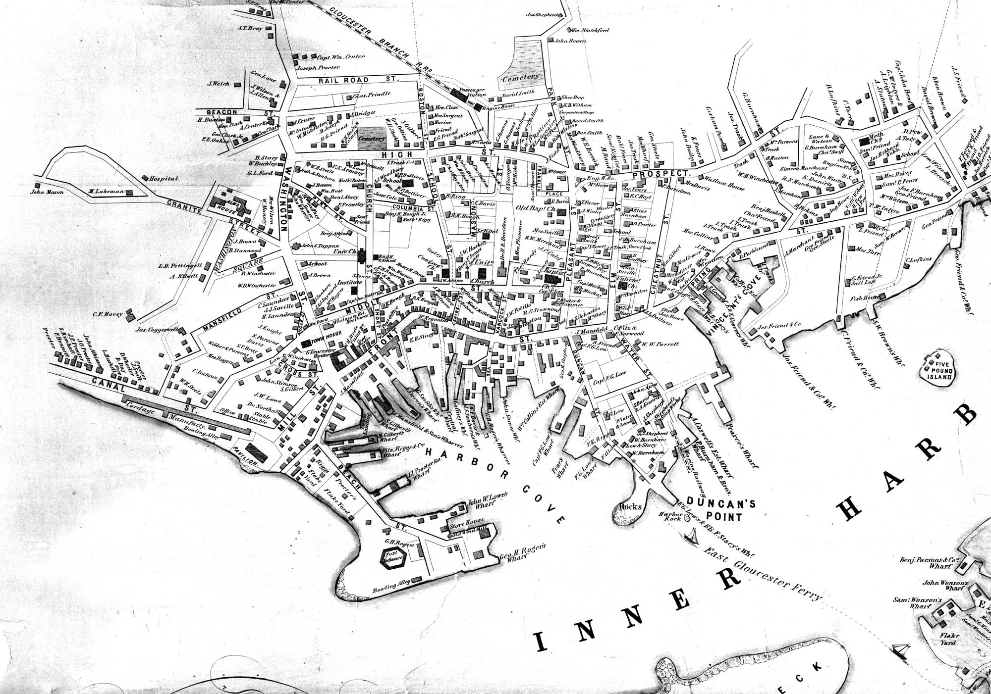
Henry Francis Walling, Map of the Towns of Gloucester and Rockport, Essex Co. Massachusetts. Philadelphia, A. Kollner, 1851
Cape Ann Museum Library & Archive
"Map of the Towns of Gloucester and Rockport, Massachusetts. H.F. Walling, Civil Engineer. John Hanson, Printer. 1851. Population of Gloucester in 1850 7,805. Population of Rockport in 1850 3,213."
Also filed under: Baptist Church (Old, First, 1830) (Pleasant Street) » // Burnham Brothers Marine Railway » // Five Pound Island » // Flake Yard » // Gloucester Harbor, Inner / Harbor Cove » // Harbor Methodist Church (Prospect Street) » // Low (Frederick G.) wharves » // Pavilion Hotel » // Procter Brothers » // Ropewalk » // Vincent's Cove » // Western Shore »
Lithograph
24 x 38 in.
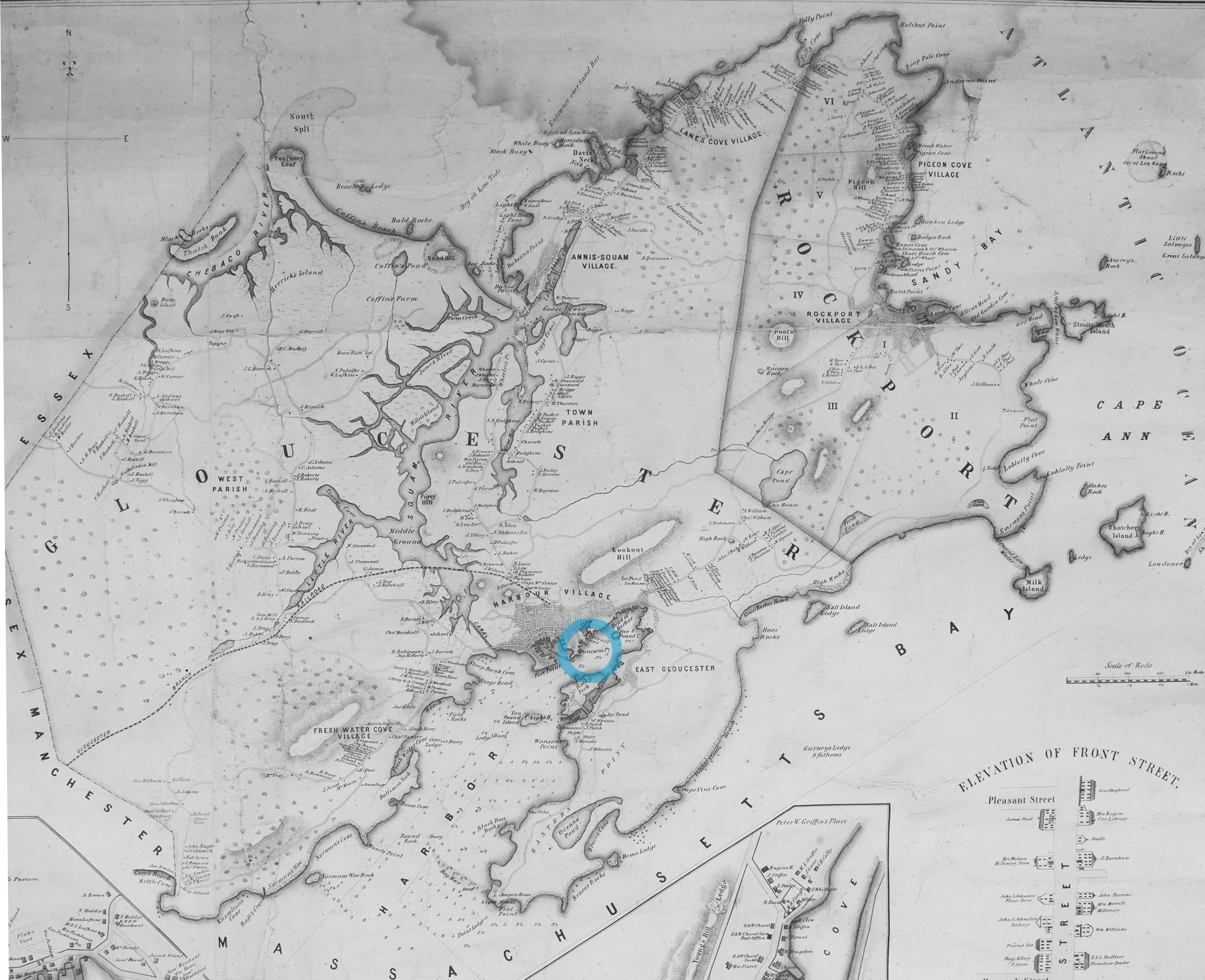
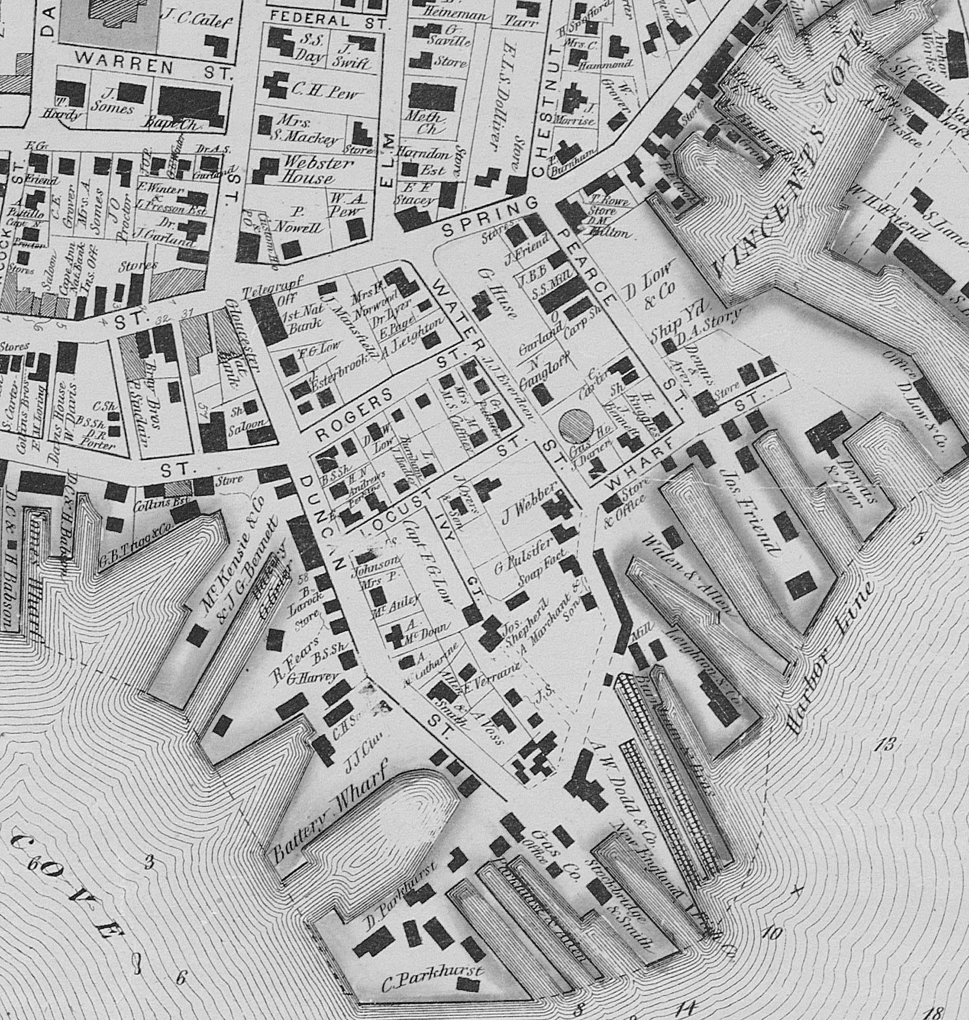
Gloucester City Archives
"Drawn on a scale of one hundred feet to an inch. By John Mason 1834–45 from Actual Survey showing every Lott and building then standing on them giving the actual size of the buildings and width of the streets from the Canal to the head of the Harbour & part of Eastern point as farr as Smith's Cove and the Shore of the same with all the wharfs then in use. Gloucester Harbor 1834–35."
This map shows the location of F. E. Low's wharf and the ropewalk. Duncan's Point, the site where Lane would eventually build his studio, is also marked.
The later notes on the map are believed to be by Mason.
Also filed under: Gloucester Harbor, Inner / Harbor Cove » // Low (Frederick G.) wharves » // Low, Capt. Frederick Gilman » // Maps » // Mason, John » // Residences » // Ropewalk » // Somes, Capt. John »
44 x 34 in.
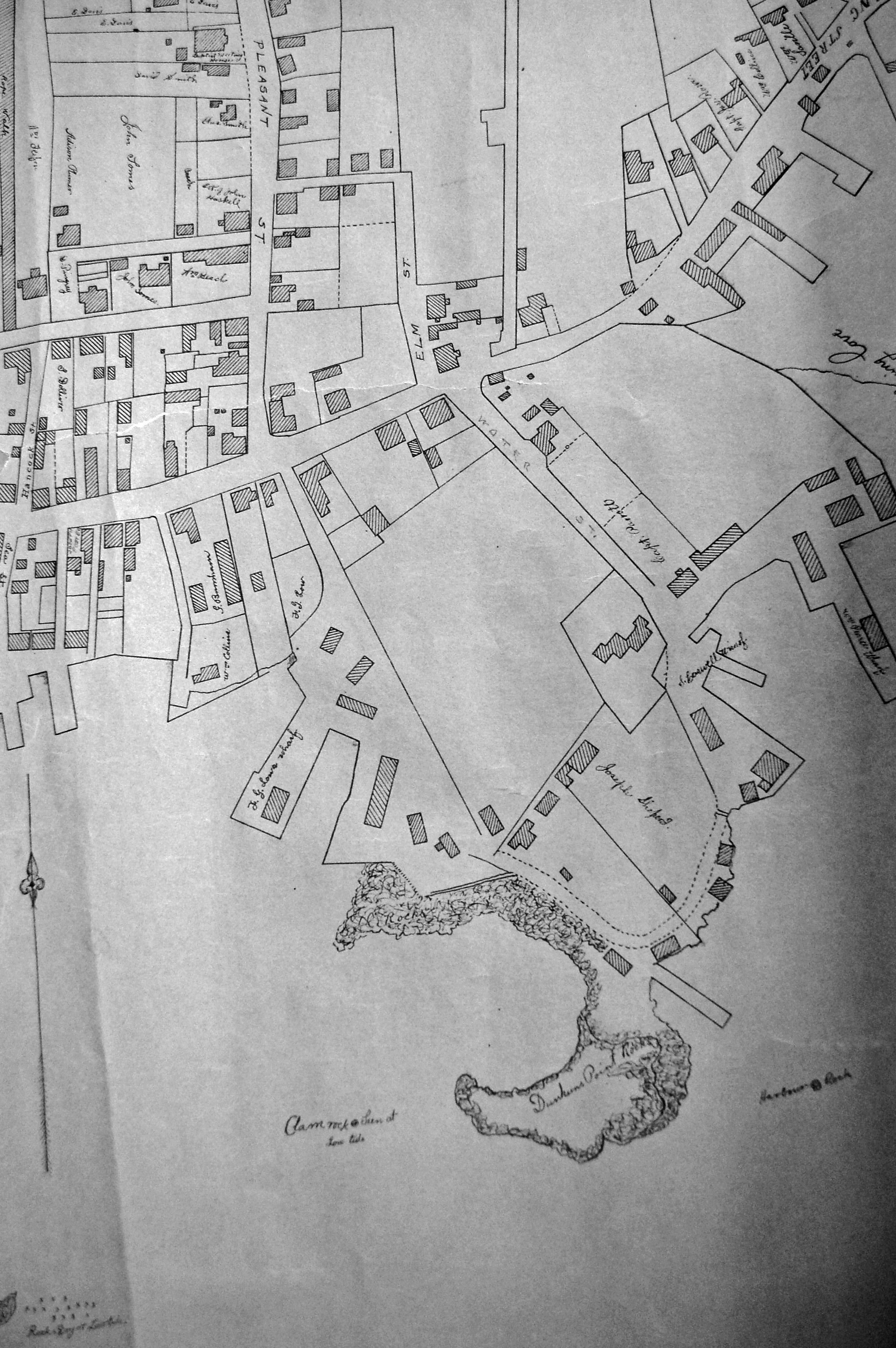
Henry Francis Walling, Map of the Towns of Gloucester and Rockport, Essex Co. Massachusetts. Philadelphia, A. Kollner, 1851
Cape Ann Museum Library & Archive
"Map of the Towns of Gloucester and Rockport, Massachusetts. H.F. Walling, Civil Engineer. John Hanson, Publisher. 1851. Population of Gloucester in 1850 7,805. Population of Rockport in 1850 3,213."
Segment of Harbor Village portion of map showing Lane-Winter property on Duncan's Point.
Also filed under: Maps » // Union School » // Winter, Ignatius »
Cape Ann Museum Library & Archive
Segment shows Lane's home on Duncan's Point (as F. G. Low property) and neighboring businesses about five years after his death.
Also filed under: Maps »
Cape Ann Museum Library & Archive (2013.068)
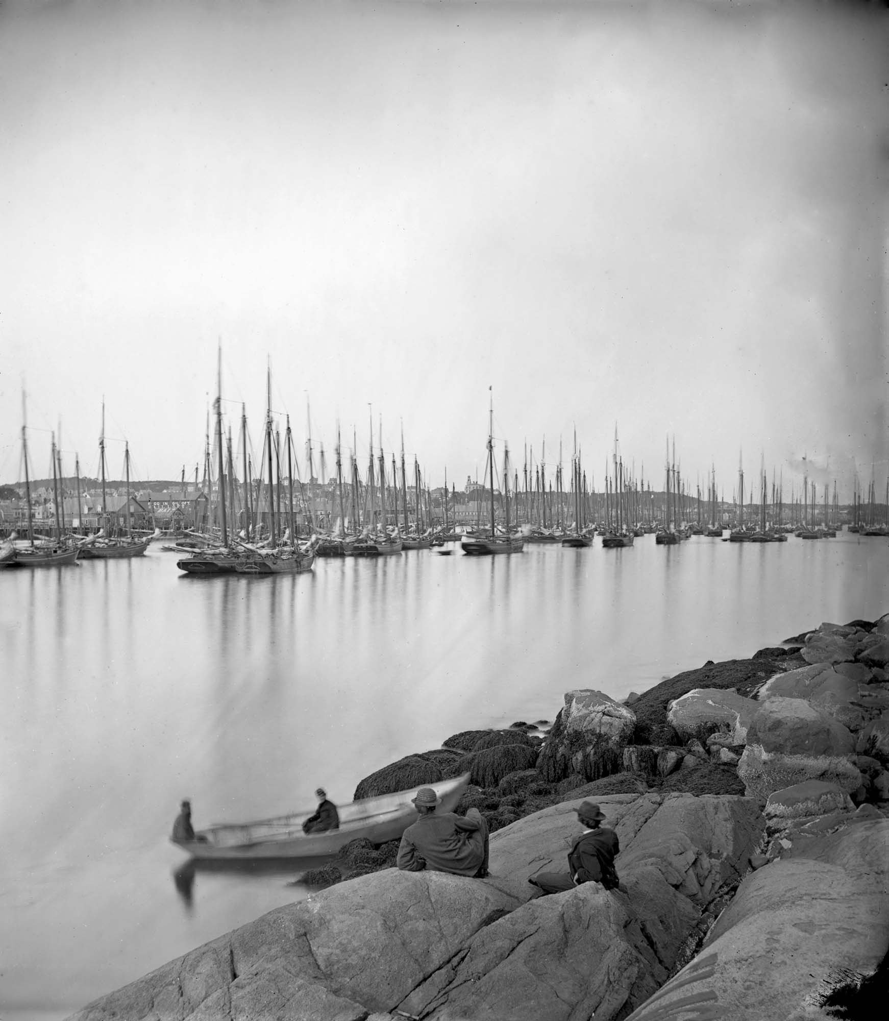
Schooner fleet anchored in the inner harbor. Looking east from Rocky Neck, Duncan's Point wharves and Lane house (at far left), Sawyer School cupola on Friend Street.
Also filed under: Gloucester Harbor, Inner / Harbor Cove » // Historic Photographs » // Schooner (Fishing) » // Waterfront, Gloucester »