An online project under the direction of the CAPE ANN MUSEUM
Historical Materials: Gloucester Buildings & Businesses
Historical Materials » Gloucester Buildings & Businesses » Unitarian Church / First Parish Church (Middle Street)
You have navigated to this pages from catalog entry: Gloucester from Fresh Water Cove, 1850s (inv. 144)
Unitarian Church / First Parish Church (Middle Street)
View related Fitz Henry Lane catalog entries (8) »
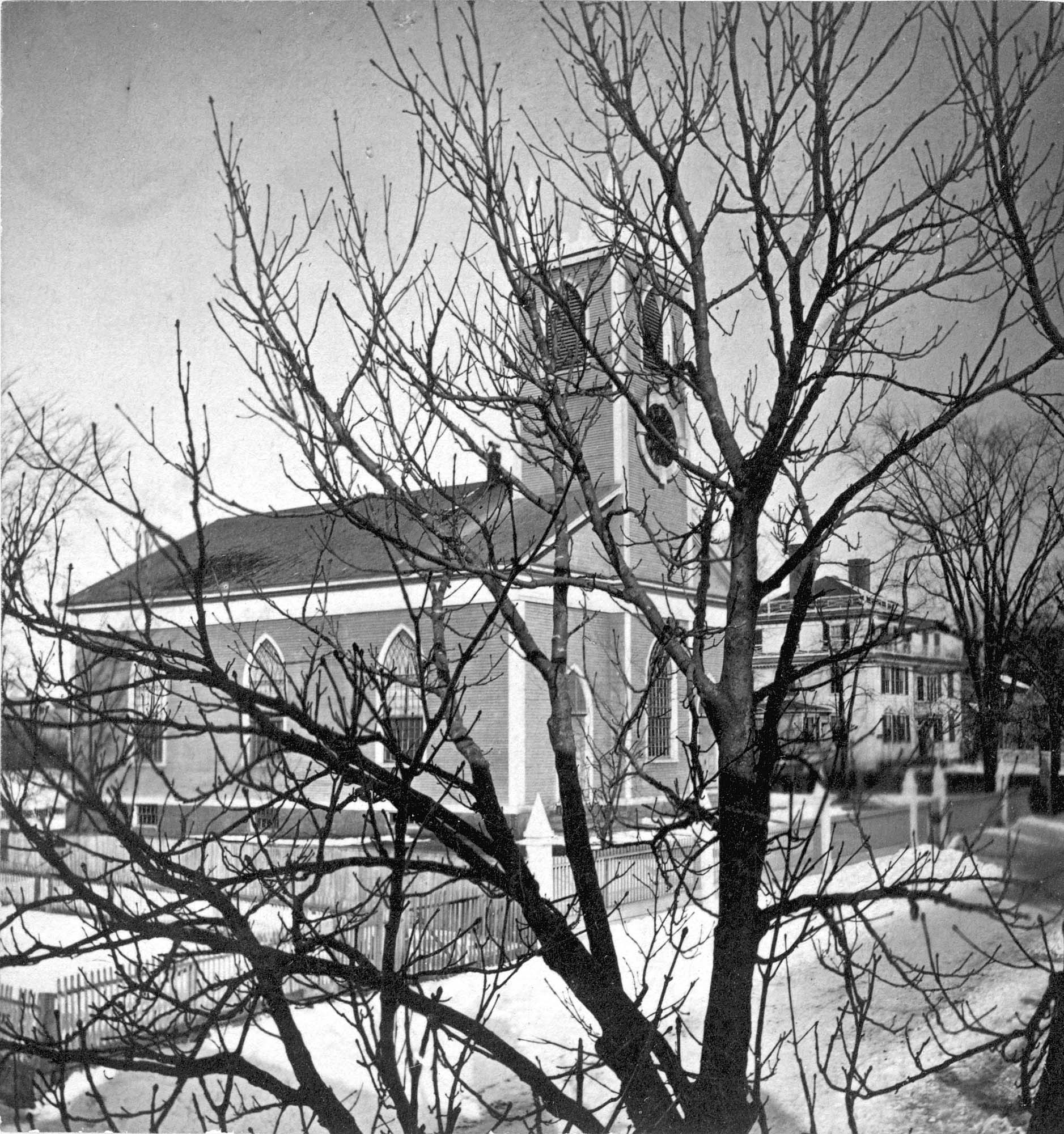
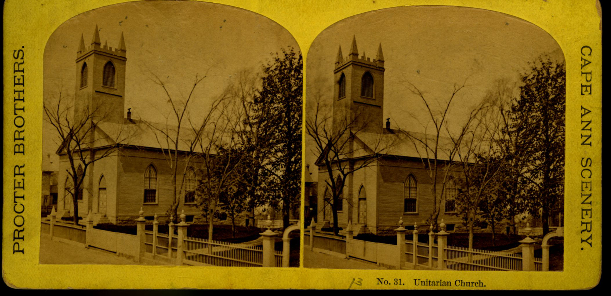
The First Parish (Unitarian) meeting house, located on Middle Street, was a wooden framed, clapboard-sheathed structure with a distinctive four-pointed neo-Gothic inspired tower. It was built in 1828, as the First Parish Church, replacing an earlier structure built on the site in 1738, when the "first" parish moved to the Harbor from its original location on the Annisquam River near where the Rte. 128 Grant Circle now is laid out. The parish system dated from the Massachusetts Bay Colony times, when both religious and civic business was conducted in the parish meetinghouses. This 1828 building was a descendant of that system. It became the Unitarian Church gradually in the 1830s, when more traditional members separated, formed their own society and built the Congregational/Trinitarian Church two doors to the west on Middle Street. The Universalists, Methodists, and Baptists had already seceded and formed their own congregations, and the parish system was at an end.
The Unitarian William Mountford, newly arrived from England, preached in this church from 1850 to 1853. In 1852, a new organ was dedicated on July 4, and Rev. Mountford was installed formally on August 3. (1) It is not known if Lane himself was a member of this or any church, but he shared several traits with Mountford: they both walked with a limp, and they were both interested in Spiritualism. Mountford moved to Boston in 1853 to pursue Transcendentalism and Spiritualism, and seldom returned to Gloucester. But he did come back in August, 1865, to officiate at Fitz Henry Lane's funeral, although Rev. Robert P. Rogers was minister at the time. It was from this church that Lane's body made its final journey to the Oak Grove Cemetery, where he was buried in the family plot of Joseph L. Stevens, Jr.
This building remained the Unitarian Church through the 1940s; however, the congregation had dwindled significantly and was no longer able to maintain the structure. The Gothic steeple was removed during this time. By 1950, the few remaining congregants were meeting with the Universalists further along Middle Street and the assets of the church were divided up: the church silver, made by Paul Revere, went to the Cape Ann Museum; endowment funds went to the Unitarian headquarters in Boston and the meeting house was sold to the local Jewish community who transformed it into Temple Ahavat Achim. Another victim of fire, it was destroyed in the conflagration that began in the next-door Lorraine Apartments on a wintry night of December, 2007.
Current Address: 86 Middle Street, site of Temple Ahavat Achim.
– Sarah Dunlap
Reference:
1. Babson, History of Gloucester, p. 497.
Related tables: Funeral & Burial » // Mayo, Reverend Amory Dwight » // Mountford, William » // Rogers, Rev. Richard P. » // Trinity Congregational Church (Middle Street at School) » // Universalist Church (Middle and Church Streets) »
Watercolor on paper
Cape Ann Museum Library & Archive
Also filed under: Low (Frederick G.) wharves » // Maps »
Glass plate negative
Also filed under: Lane's Stone House, Duncan's Point » // Residences »
Cape Ann Museum Library & Archive
Also filed under: Historic Photographs » // Procter Brothers »
44 x 34 in.
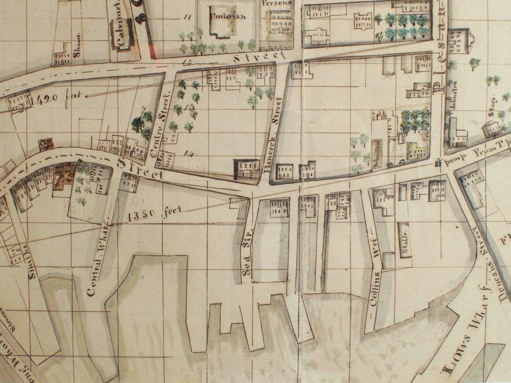
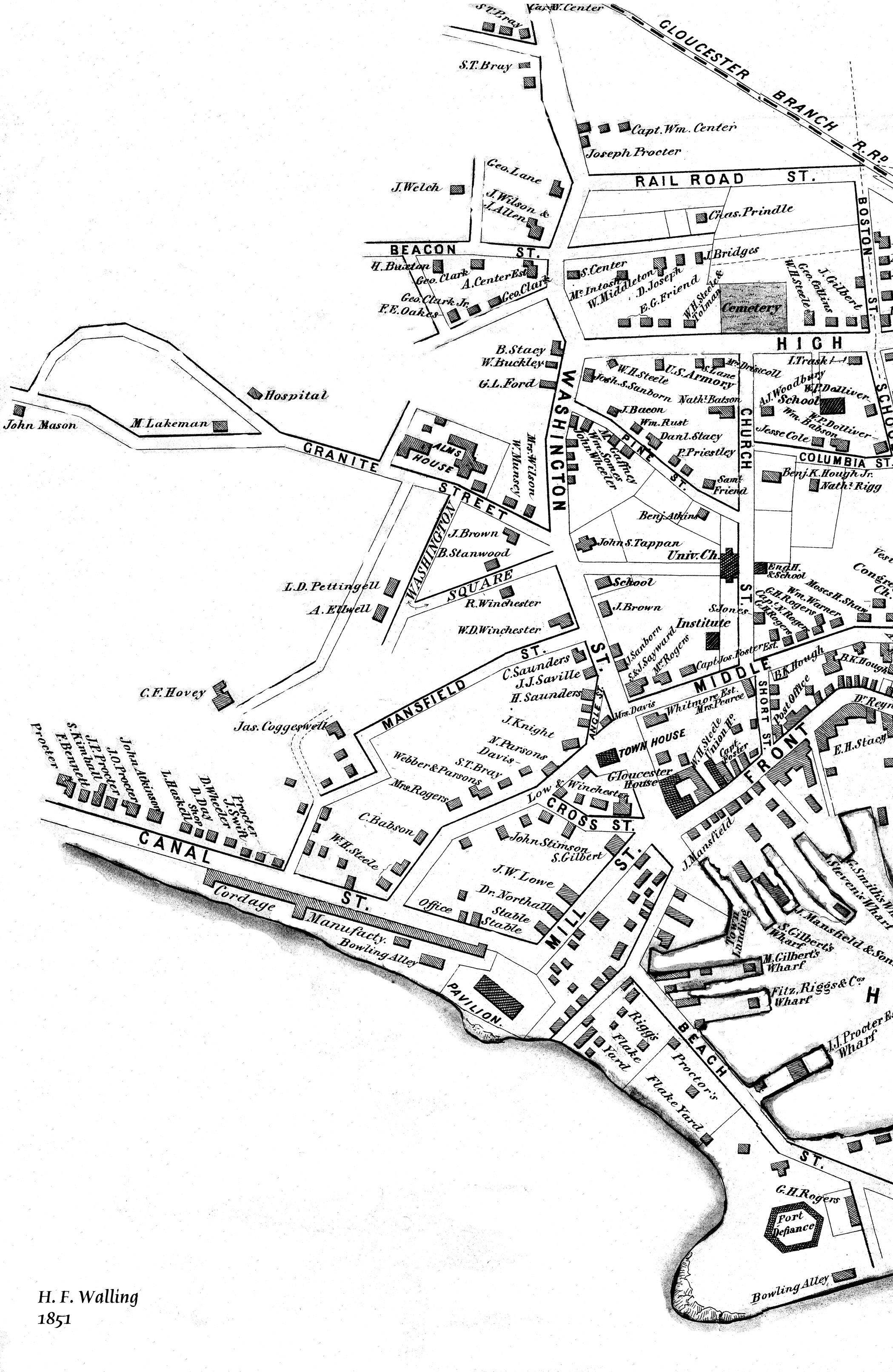
Henry Francis Walling, Map of the Towns of Gloucester and Rockport, Essex Co. Massachusetts. Philadelphia, A. Kollner, 1851
Cape Ann Museum Library & Archive
"Map of the Towns of Gloucester and Rockport, Massachusetts. H.F. Walling, Civil Engineer. John Hanson, Publisher. 1851. Population of Gloucester in 1850 7,805. Population of Rockport in 1850 3,213."
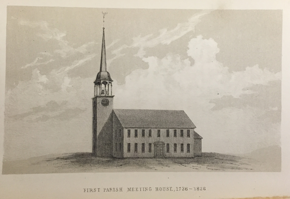
See p. 498. This shows the First Parish Meeting House before it was rebuilt in 1828.
Also filed under: Babson History of the Town of Gloucester »
Stereograph card
Cape Ann Museum Library & Archive
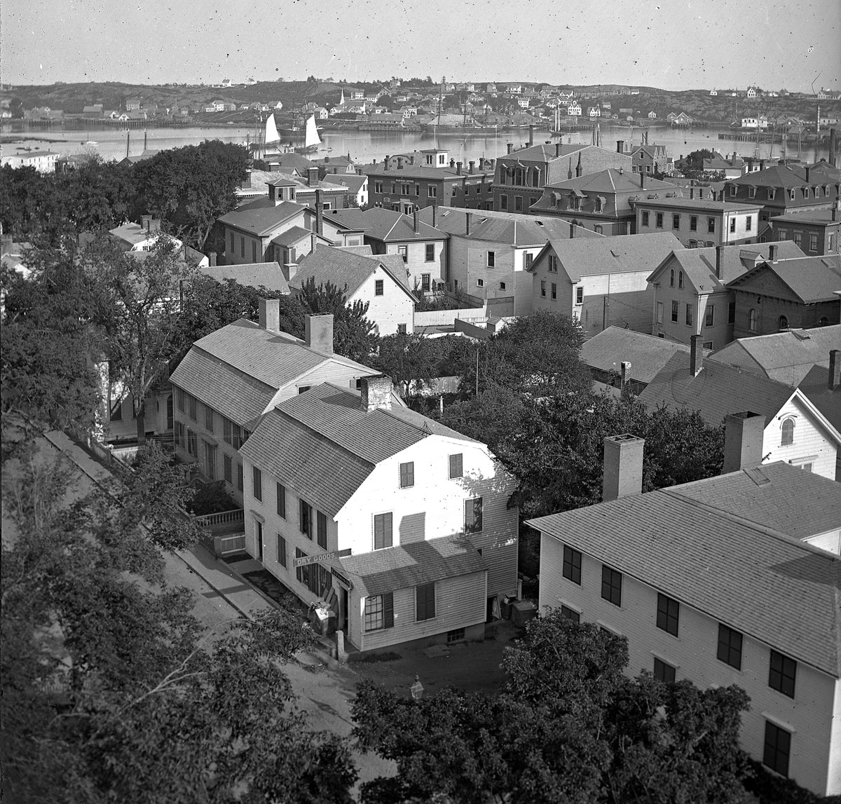
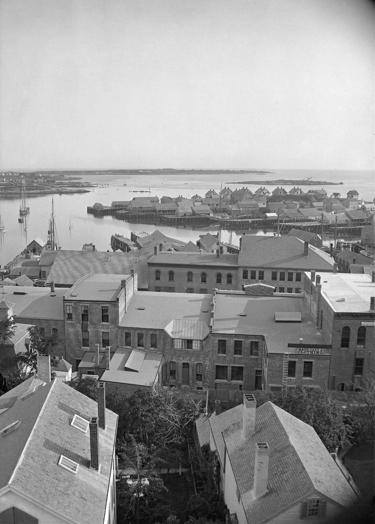
View from top of Unitarian Church on Middle Street looking southeast, showing the Fort and Ten Pound Island. Tappan Block and Main Street buildings between Center and Hancock in foreground.
Also filed under: Fort (The) and Fort Point » // Ten Pound Island »
Cape Ann Museum Library & Archive
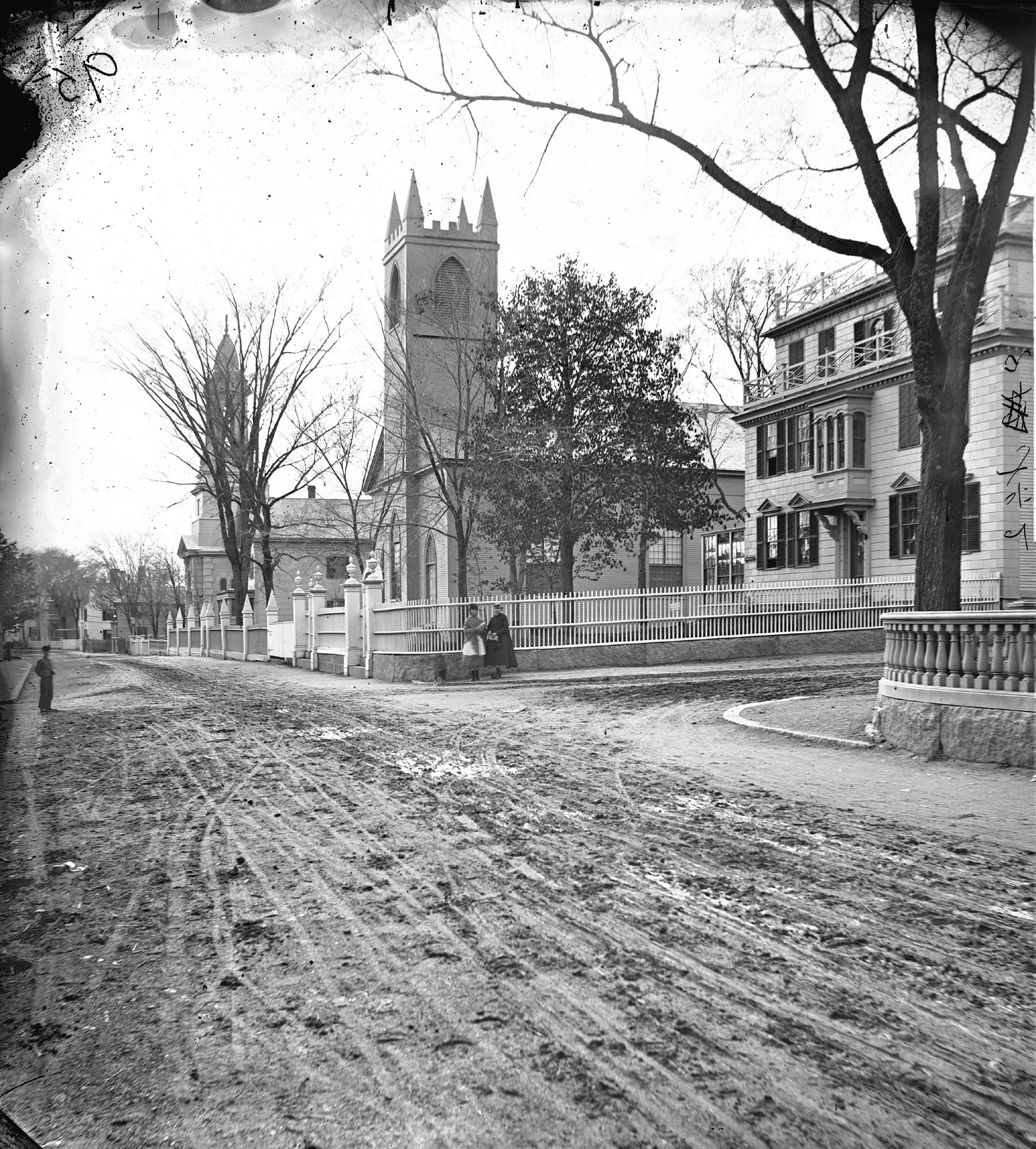
Middle Street looking west. At the corner of Dale Avenue is the Sanders-Davidson house, later Sawyer Free Library. Also shown: Unitarian Church, Congregational Church.
Also filed under: Sanders-Davidson House »