An online project under the direction of the CAPE ANN MUSEUM
Historical Materials: Cape Ann Locales
Historical Materials » Cape Ann Locales » Norman's Woe
You have navigated to this pages from catalog entry: The Western Shore with Norman's Woe, 1862 (inv. 18)
Norman's Woe
View related Fitz Henry Lane catalog entries (8) »
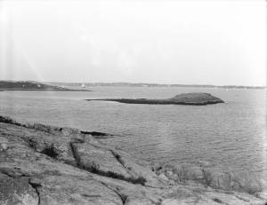
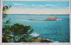
Norman’s Woe is a large rock sitting a few hundred feet off the western shore of Gloucester harbor. It lies between Gloucester and Magnolia and is just outside the confines of the harbor, if Eastern Point is used as the defining southern extent of the protected water. It can be reached from the shore at low tide over the rocks and is an island at high tide.
Tradition has it that a man named Norman was shipwrecked and lost there, but there is no historical record to substantiate it. Henry Wadsworth Longfellow memorialized it in his famous poem "The Wreck of the Hesperus" in 1840 though he never laid eyes on the rock until many years after he wrecked the Hesperus on it. His inspiration may have come from the wreck of the ship "Favorite" from Wiscasset, Maine on Norman’s Woe during the great blizzard of 1839. All hands were lost, one of whom was a woman who was found dead still tied to the mast which had floated ashore.
Because it lies outside the protection of the easterly arm of Eastern Point, Norman’s Woe and the surrounding rocky coast take the brunt of huge waves rolling in from the open ocean to the east, particularly after a storm. The high hills behind that western shore act as a wind block while tide and waves push a craft shoreward making Norman’s Woe the site of numerous shipwrecks and much loss of life through the years.
Lane did a drawing and some number of paintings of the site. He drew the rock from the shore looking to the south. Instead of the violent seas for which that shore is known he depicted it in a glassy calm. One of his landmark late paintings The Western Shore with Norman's Woe, 1862 (inv. 18) shows a boat drifting idly in the still late afternoon light in the cove just to the north of the rock of Norman’s Woe.
Related tables: Beacons / Monuments / Spindles » // Blizzard of 1839 » // Rafe's Chasm »
Stereograph card
Cape Ann Museum Library & Archive
Stereo View: "Geography – Norman's Woe is a headland on the mainland of Massachusetts just south of Gloucester Harbor, which is directly before us here. That very small island, to the left of the cliff, is called Norman's Woe Rock. Both places are so named because of the shipwreck of some member of the Norman family,who were among the early settlers in this locality.
Geology – The irregular jointing shows very clearly along the face of this cliff, where the action of the wind and weathering have cleared away the loose particles between the joints. The reason these rocks have withstood the destructive action of the erosion and weathering is because they are formed cheifly of felspar; in fact, this is a dike of that material.
Literature - Longfellow's poem, "The Wreck of the Hesperus," has immortalized the traditions that centre about these shores. The pounding of the waves uon this rock-bound promontory, and the dismal howling of the wind at this point, furnished him with the inspiration needed for his most favored masterpiece.
People and Homes - Seated upon our left is a very typical New England gentlemen, a real "down east Yankee." He exhibits all the qualities that made his ancestors so staunch in their determination to defend their adopted land."
Also filed under: Historic Photographs »
44 x 34 in.
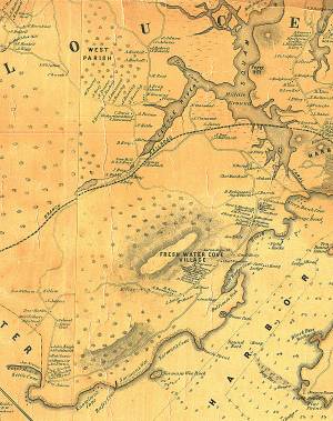
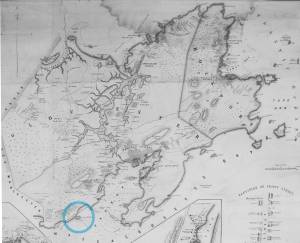
Henry Francis Walling, Map of the Towns of Gloucester and Rockport, Essex Co. Massachusetts. Philadelphia, A. Kollner, 1851
Cape Ann Museum Library & Archive
"Map of the Towns of Gloucester and Rockport, Massachusetts. H.F. Walling, Civil Engineer. John Hanson, Publisher. 1851. Population of Gloucester in 1850: 7,805. Population of Rockport in 1850: 3,213."
Also filed under: Annisquam River » // Brookbank » // Dolliver's Neck » // Fresh Water Cove » // Gloucester Harbor, Outer » // Maps » // Stage Rocks / Stage Fort / Stage Head » // Steepbank » // West Gloucester – Little River » // Western Shore »
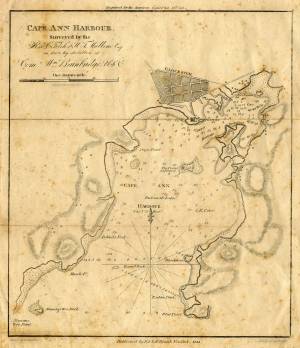
Engraving of 1819 survey taken from American Coast Pilot 14th edition
9 1/2 x 8 in.
Cape Ann Museum Library & Archive
D32 FF5
Also filed under: Dolliver's Neck » // Eastern Point » // Maps » // Ten Pound Island »
Series Maps. v. 13: p. 17
SC1 / series 48X
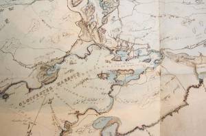
Massachusetts Archives, Boston
View related Fitz Henry Lane catalog entries (1) »
Also filed under: Beacons / Monuments / Spindles » // Gloucester Harbor, Inner / Harbor Cove » // Gloucester Harbor, Outer » // Gloucester, Mass. - "Ten Pound Island Light » // Gloucester, Mass. – Eastern Point Light » // Maps » // Mason, John » // Pavilion (Publick) Beach » // Ropewalk »
Newspaper
Gloucester Telegraph
In this article, a moonlight view of the harbor of Cape Ann by Lane is described in detail by a viewer and his skill in depicting the Cape Ann coastline is praised. Lane's associates, Salmon and Birch, are mentioned, but as comparisons to Lane. "Those who visited his room, were highly pleased with the skill he manifested in portraying the beauties of our coast."
Also filed under: Newspaper / Journal Articles » // Salmon, Robert » // Studio Descriptions »
Newspaper
"Mr. Lane has just completed a third picture of the Western Shore of Gloucester Harbor, including the distance from 'Norman's Woe Rock' to 'Half Moon Beach.' It was painted for Mr. William E. Coffin of Boston, and will be on exhibition at the artist's rooms for only a few days; we advise all our readers who admire works of art, and would see one of the best pictures Mr. Lane has ever executed..."
"...solitary pine, so many years a familiar object and landmark to the fisherman."
Newspaper clipping
Cape Ann Advertiser
Cape Ann Museum Library & Archive
"F.H. Lane, Esq., has recently finished a splendid painting of Norman's Woe, and scenery in the vicinity. It is a sunset scene, and gorgeous to the extreme."
Also filed under: Newspaper / Journal Articles »
A Narrative poem based on the Blizzard of 1839 off Norman's Woe of Gloucester, in which many ships sank and many lives lost, including that of a woman whose body washed up on shore, still tied to a mast. There was also a real vessel "Hesperus" which wrecked off of Boston.
The Wreck of the Hesperus
