An online project under the direction of the CAPE ANN MUSEUM
Historical Materials: Gloucester Buildings & Businesses
Historical Materials » Gloucester Buildings & Businesses » Eastern Railroad
You have navigated to this pages from catalog entry: New England Inlet with Self-Portrait, 1848 (inv. 77)
Eastern Railroad
View related Fitz Henry Lane catalog entries (3) »
The construction of the Gloucester branch of the Eastern Railroad from Salem in 1848 transformed Cape Ann from a sleepy rural area to a bustling metropolis, with summer visitors from Boston and New York arriving daily and tons of fish and other goods being shipped back and forth to and from points west. New England Inlet with Self-Portrait, 1848 (inv. 77) shows the train, but it is omitted in two sketches of the area. The 1834–35 Mason map notes that John Mason sold a large area of land to the railroad company in 1845.
Related tables: Tourist Industry »
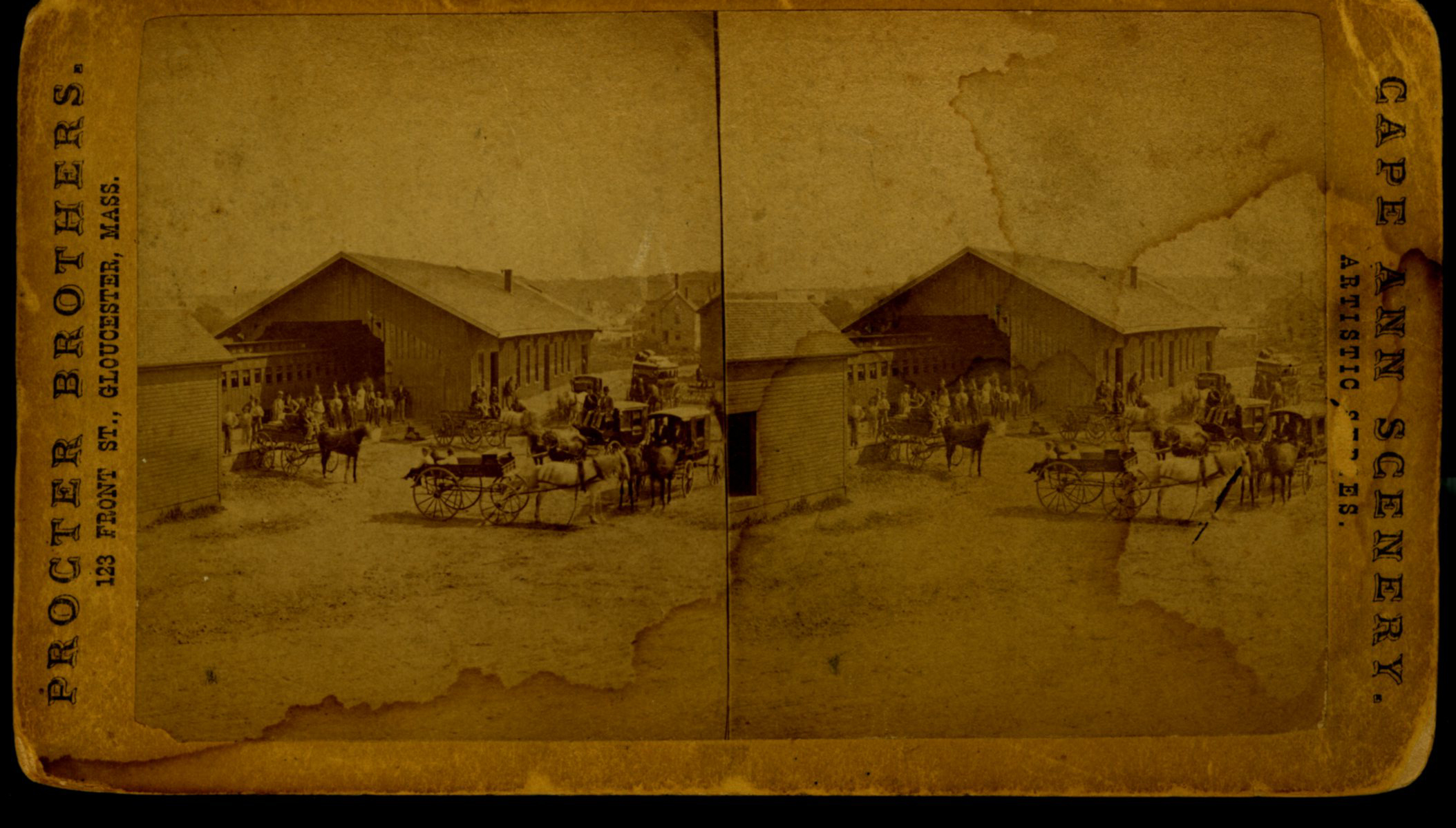
Stereograph card of Eastern Railroad Depot with 9:30 up train, August 11, 1874.
Also filed under: Historic Photographs »
24 x 38 in.
Gloucester City Archives
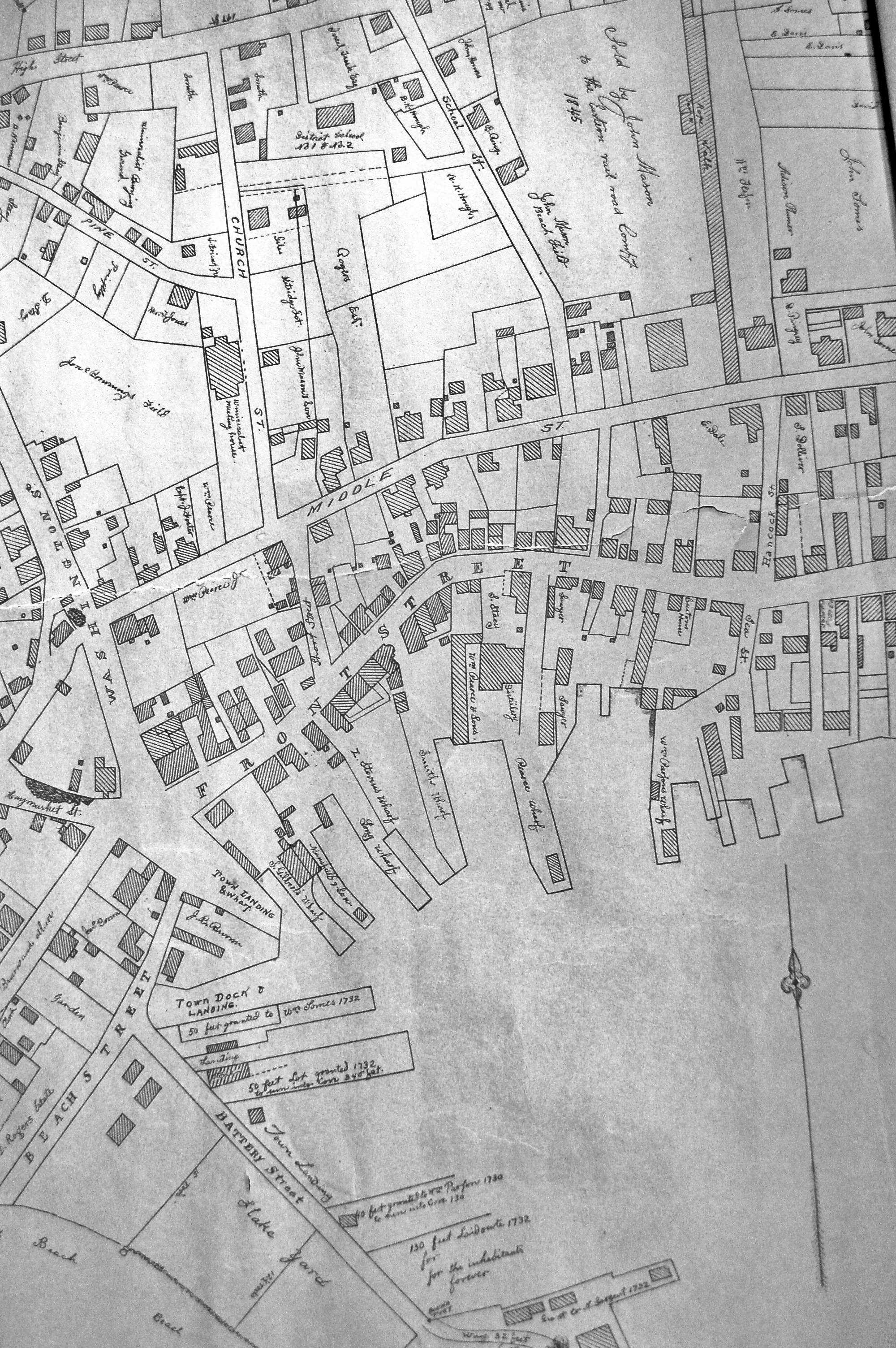
"Drawn on a scale of one hundred feet to an inch. By John Mason 1834–45 from Actual Survey showing every Lott and building then standing on them giving the actual size of the buildings and width of the streets from the Canal to the head of the Harbour & part of Eastern point as farr as Smith's Cove and the Shore of the same with all the wharfs then in use. Gloucester Harbor 1834–35."
This map is especially helpful in showing the wharves of the inner harbor at the foot of Washington Street.
View related Fitz Henry Lane catalog entries (1) »
Also filed under: Dale, Eben B. » // Flake Yard » // Gloucester Harbor, Inner / Harbor Cove » // Hough, Benjamin Kent » // Maps » // Pavilion (Publick) Beach » // Ropewalk » // Sawyer, Samuel » // Town / Public Landings » // Universalist Church (Middle and Church Streets) »
44 x 34 in.
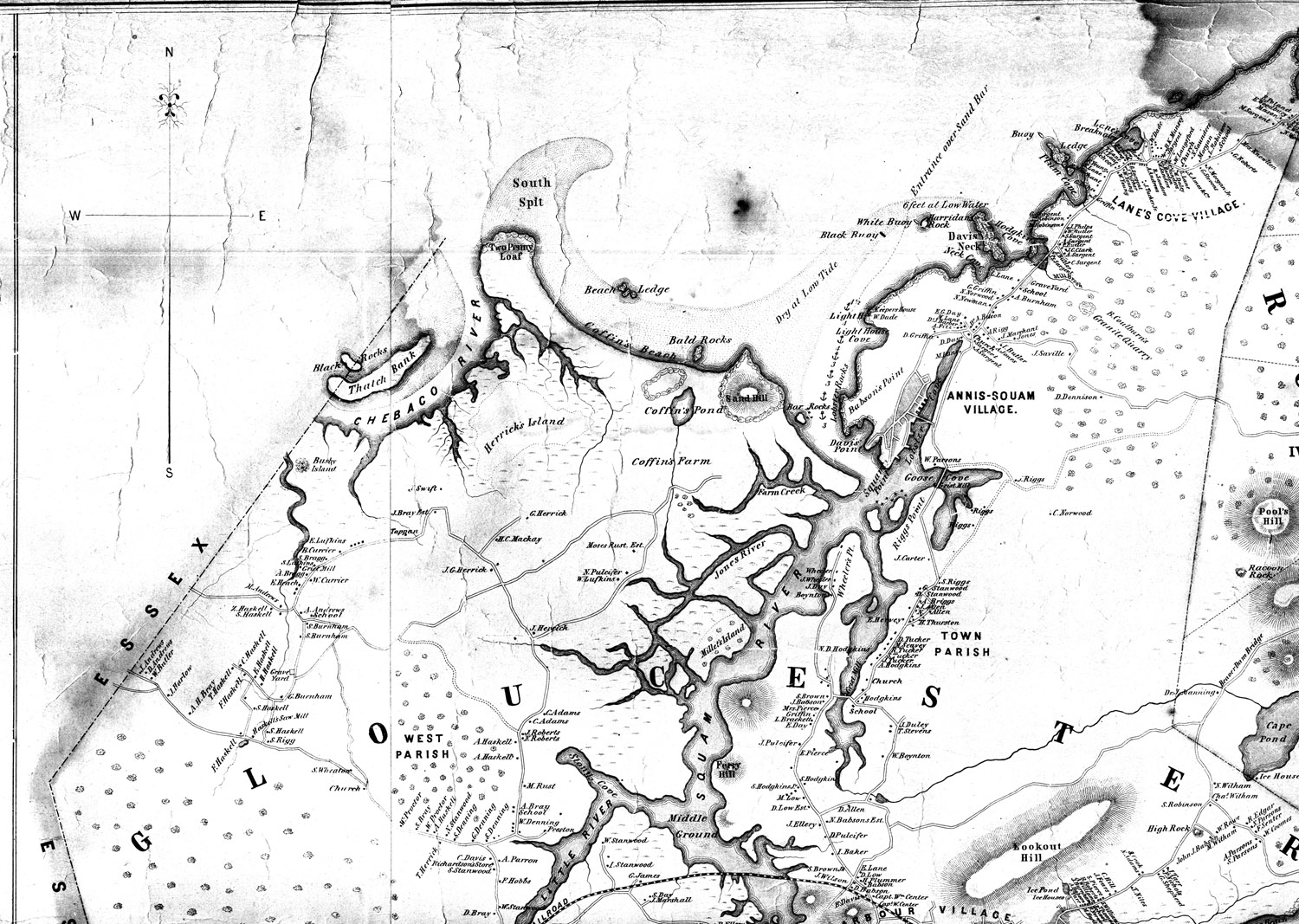
Henry Francis Walling, Map of the Towns of Gloucester and Rockport, Essex Co. Massachusetts. Philadelphia, A. Kollner, 1851
Cape Ann Museum Library & Archive
"Map of the Towns of Gloucester and Rockport, Massachusetts. H.F. Walling, Civil Engineer. John Hanson, Publisher. 1851. Population of Gloucester in 1850 7,805. Population of Rockport in 1850 3,213."
View related Fitz Henry Lane catalog entries (1) »
Also filed under: Annisquam River » // Babson House » // Coffin's Beach » // Gloucester, Mass. – Annisquam Harbor Lighthouse » // Granite Quarrying / Shipping » // Loaf, The » // Low (David) House » // Maps » // Old First Parish / Subsequent Fourth Parish Church (at the Green) » // Riverdale Methodist Church (Washington Street) » // White-Ellery House »