An online project under the direction of the CAPE ANN MUSEUM
Historical Materials: Gloucester Buildings & Businesses
Historical Materials » Gloucester Buildings & Businesses » Brookbank
You have navigated to this pages from catalog entry: Fresh Water Cove from Dolliver's Neck, Gloucester, Early 1850s (inv. 45)
Brookbank
View related Fitz Henry Lane catalog entries (10) »
Brookbank was an early eighteenth-century white gambrel-roofed house on Fresh Water Cove which was owned and occupied by Samuel Sawyer and his ancestors. It is possible to trace apparent renovations to the house through Lane's pictures; at first it is depicted as a white house without dormers and a simple brown barn Fresh Water Cove, Gloucester, c.1864 (inv. 112); then dormers appear on the house and the barn is white with a cupola Fresh Water Cove, etc., from Dolliver's Neck, 1850s (inv. 113). In Gloucester from Brookbank, 1848 (inv. 42) a cobb wharf (log cabin-like structure) and boardwalk are visible. By Fresh Water Cove from Dolliver's Neck, Gloucester, Early 1850s (inv. 45) the house seems to have additions.
Related tables: Fresh Water Cove » // Sawyer, Samuel »
Cape Ann Museum Library & Archive
Stereo view of Brookbank guest house or boathouse.
Also filed under: Historic Photographs »
Cape Ann Museum Library & Archive
Stereograph card
Also filed under: Historic Photographs »
Stereographic card
Cape Ann Museum Library & Archive
Penciled on reverse: "Mansion House, Brook Bank [sic], Sam'l Sawyer now Hammond, Freshwater Cove"
Also filed under: Historic Photographs » // Sawyer, Samuel »
44 x 34 in.
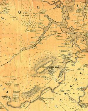
Henry Francis Walling, Map of the Towns of Gloucester and Rockport, Essex Co. Massachusetts. Philadelphia, A. Kollner, 1851
Cape Ann Museum Library & Archive
"Map of the Towns of Gloucester and Rockport, Massachusetts. H.F. Walling, Civil Engineer. John Hanson, Publisher. 1851. Population of Gloucester in 1850: 7,805. Population of Rockport in 1850: 3,213."
Also filed under: Annisquam River » // Dolliver's Neck » // Fresh Water Cove » // Gloucester Harbor, Outer » // Maps » // Norman's Woe » // Stage Rocks / Stage Fort / Stage Head » // Steepbank » // West Gloucester – Little River » // Western Shore »
Stereograph card
Cape Ann Museum Library & Archive
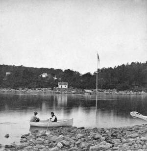
A view of a Cove on the western side of Gloucester Harbor, with the landing at Brookbank. Houses are seen in the woods back. A boat with two men is in the foreground.
Also filed under: American ensign / flag » // Fresh Water Cove » // Historic Photographs »
Stereograph card
Cape Ann Museum Library & Archive
Also filed under: Fresh Water Cove »


