An online project under the direction of the CAPE ANN MUSEUM
Catalog entry
inv. 168
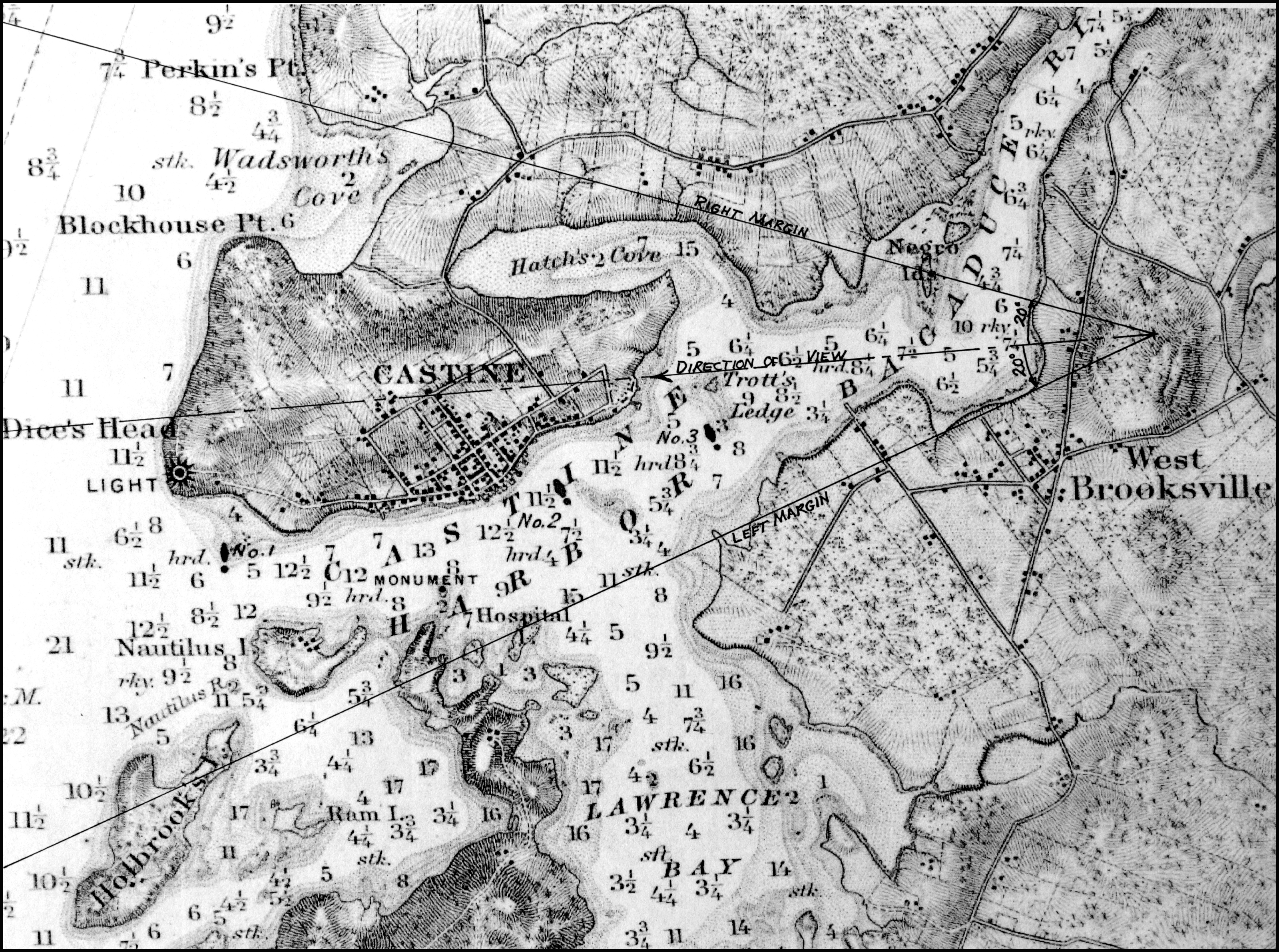
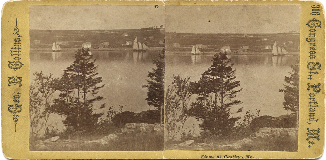
Castine from Heights East of Negro Island
1855 Graphite on paper (3 sheets) 6 5/8 x 19 1/2 in. (16.8 x 49.5 cm) Inscribed across bottom (in pencil): Castine from Heights East of Negro Island Sept. 1855 F.H.Lane del.; Inscribed lower right (in pencil): F.H.Lane / Joseph L. Stevens / Joseph L. Stevens Jr.; Inscribed on left (in pencil): Nautilus Islands / Long Islands / Camden Mts / Water
|
Supplementary Images
Explore catalog entries by keywords view all keywords »
Historical Materials
Below is historical information related to the Lane work above. To see complete information on a subject on the Historical Materials page, click on the subject name (in bold and underlined).
The Camden Mountains, also called the Camden Hills, are located just northeast of the town of Camden. The range includes Mount Megunticook, upon whose shoulders Mount Battie sits, Cameron Mountain, and Bald Rock Mountain. They stand high above West Penobscot Bay between Camden and Lincolnville, looking east toward Mount Desert and the rising sun. The Wabenaki, loosely defined as the "people of the dawn," greeted their maritime world, "the dawn land," from the Camden Hills, and other high points, including Mount Wallamatogus in Penobscot (460 feet), Awan-adjo (at Bluehill), Caterpillar Hill in Sedgwick (with its panoramic sweep which stretches from the Camden Hills to Mount Desert and far out into Penobscot Bay), and atop Cadillac Mountain, Mount Desert. It is from the same peaks that artists and pilgrims alike still climb to view Penobscot Bay.
Mad-kam-ig-os'-sek, "big high land," is the Wabenaki word for Camden, and Meg-un-ti-cook, "big mountain harbor," the name for the harbor, is now used for Mount Megunticook. The inner harbor, quiet and safe, would have been the ideal place for a large, oceangoing canoe to lay up when the sea was rough. Capt. John Smith visited this place in 1614, during the Beaver Wars, and noted that the high mountains were used as a refuge from the Mik'maq of the Maritimes who fought the Wabenaki of Penobscot Bay to maintain their place as middlemen in the fur trade. These raiders would travel along the Downeast coast in their shallops. Mount Battie, of many spellings, was noted as Mount Betty in documents dating from 1757. It is a European corruption of a word borrowed from another place, the Madambettox Hills of Rockland.
-Mark Honey
References:
Eckstorm, Fannie Hardy, "Indian Place-Names of the Penobscot Valley and the Maine Coast," University of Maine Studies, 2nd Series, #55, November 1941, reprinted 1960 by the University of Maine Press. DeLorme's Atlas. Frank G Speck's "Penobscot Man," University Of Pennsylvania Press, 1940.
Newsprint
Gloucester Telegraph
"The Reef of Norman's Woe ... is now commemorated in painting too, one of the finest pictures from Lane's easel. ... The sketch was made at the pretty spot commonly called, we believe, Master Moore's Cove. Being some little way off the main track to Rafe's Chasm, it is seldom visited, except by the more inquisitive lovers of nature who leave the beaten road to pry out such pleasant places. ... We wish it might find a home buyer, rather than go off to enrich another community." Flowery description follows, then "There is another and larger work in the artist's studio, which, happily, is to be retained. It received much well deserved notice and commendation. The subject is a view southward from the 'Cut,' with the picturesque promontory commonly known as 'Stage Fort,' and historically interesting as the supposed spot of the 'Landing at Cape Ann' in the middle distance, and Eastern Point on the extreme left." More description follows, "Among other attractions of the studio, and particularly worthy of mention, is a cabinet picture with an effect similar to the Norman's Woe. The subject is chosen from the many sketches of the grand scenery of the Maine sea-coast with which the artist's portfolio is rich. It is a view of the Camden mountains sketches from the Graves, a jagged ledge far out in the bay, which is accessible in only the smoothest water."
Also filed under: Cut, The (Stacy Blvd.) » // Newspaper / Journal Articles » // The Graves »
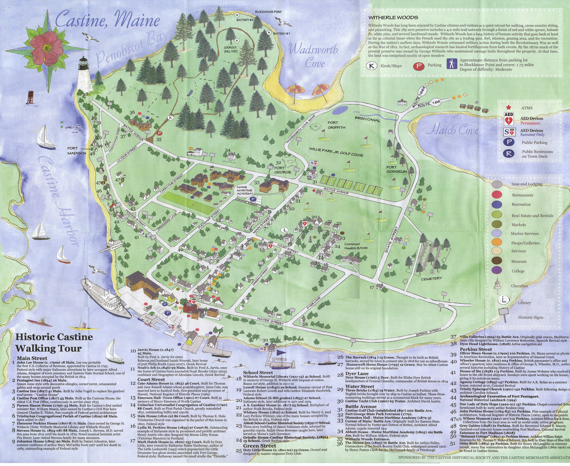
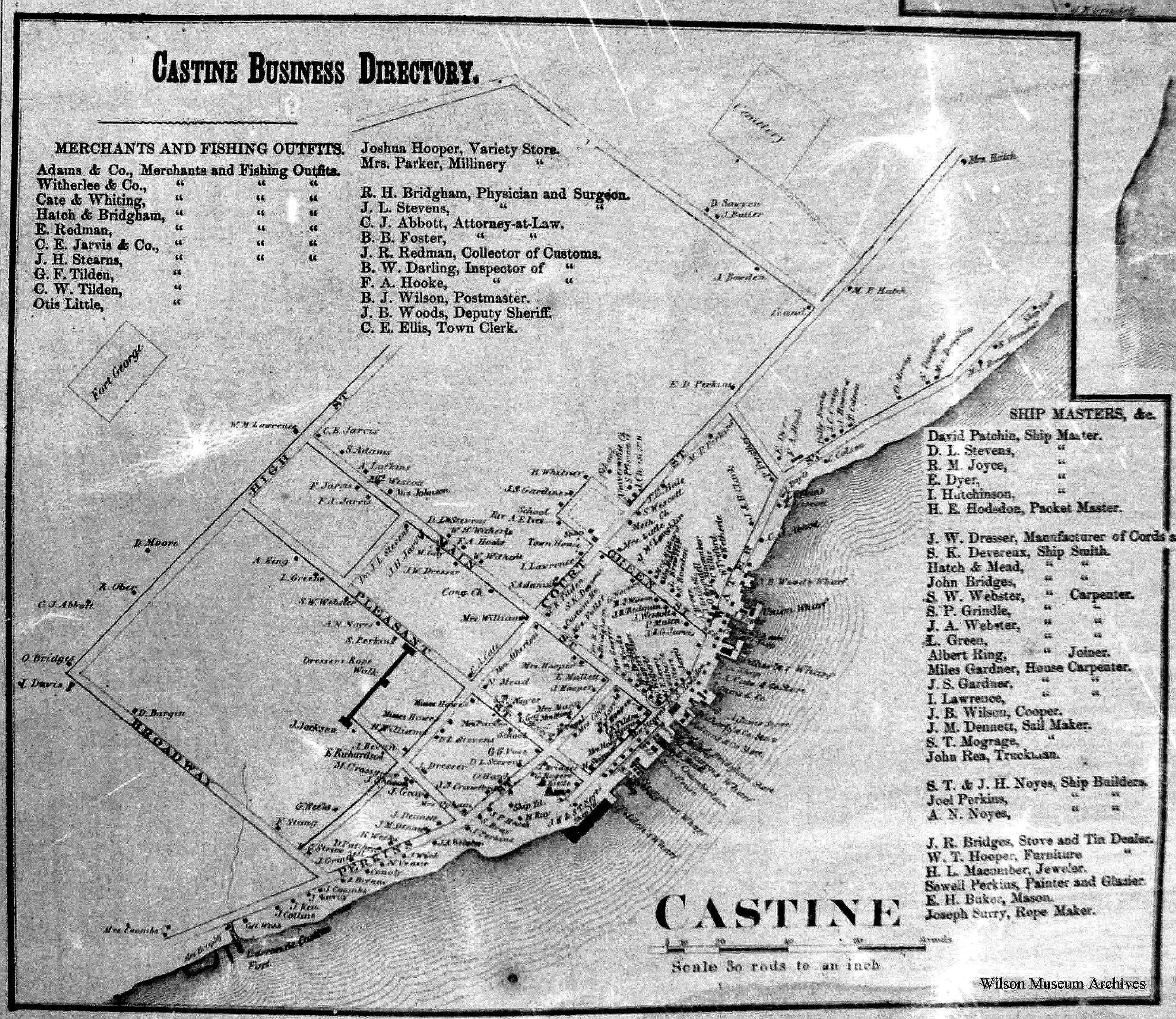
Castine is a town located on a sheltered harbor in Maine's Penobscot Bay. According to the Maine Register of 1850 it had a population of 1260.
Castine, as the seat of customs, registered 31.4% of Maine's sea fisheries tonnage in 1850. Castine's merchants serviced the needs of Penobscot Bay's fishermen, fitting up supplies and salt, and offering both employment and opportunities for investment in the cod fisheries. Beginning about 1824 Castine fitted out at least 300 vessels with more than two thousand men in a year. (1) Castine's shipyards built both fishing schooners and large ships, ships which carried cotton from New Orleans to the cotton mills of Great Britain, and returned with salt from Liverpool and Cadiz. Castine was at the height of its economic power in the 1850s, the commercial hub for the broader community of Penobscot Bay. (2)
In Gloucester, some aspects of the fishing industry were changing. The fishing vessels of Penobscot Bay tended to be smaller in size, more democratic in ownership, and more intimate with regard to crew, who were more often than not members of an extended family or from the same communities.
The steamboat lines began connecting Maine to Boston in 1824. In 1845 Captain Sanford's Independent Line tried his "Penobscot I" on the route that would become standard, an overnight route to Boston. He also initiated in 1846 "the Blue Hill line" which used the 130-foot "T. F.Secor" to connect with the Boston boat at Belfast and run up to Bangor and as far east as Blue Hill with landings both ways. During the 1850s steamers became larger and more luxurious, with competing steamer lines, and steamships also used in the lumber trade. (3)
References:
1.W.H. Bunting, A Day's Work: A Sampler of Historic Maine Photographs (Portland, ME: Maine Preservation), p.56.
2. Roger F. Duncan, "Coastal Maine, A Maritime History," WW Norton & Company, New York, 1992. Mark Honey, "King Pine, Queen Spruce, Jack Tar," An Intimate History of Lumbering on the Union River, Volumes 1-5. This source, in its entirety, lays down the foundation of Downeast Maine's unique culture which was built upon pine lumber and timber, the cod fisheries, coasting, shipbuilding, and the interrelationships of family and community.
3. Allie Ryan, Penobscot Bay Mount Desert, and Eastport Steamboat Album (Camden, ME: Downeast Magazine, 1972).
Honey, Mark E, "Abigail & Sarah Hawes of Castine," Navigators & Educators, with Lois Moore Cyr, 1996.
Honey, Mark E, "Before the Mast," Volume IV, articles 7-9, Holbrook Island and the Holbrook family, and in particular, Robert Applebee, "Vessels of the Penobscot Customs District," Stephan Phillips Memorial Library, Penobscot Marine Museum, Searsport, which source also has the diaries of Capt. Jonathan Holbrook and the genealogy of the Holbrook family in the Priscilla Jones collection. The "Before the Mass" series can be found in the collections of the Castine Historical Society and the Wilson Museum, both in Castine.
McLane, Charles B, and McLane, Carol Evarts, "Islands of the Mid-Maine Coast," Penobscot Bay, Volume 1, Revised Edition, Tilbury House, Publishers, Gardiner, Maine, and the Island Institute, Rockland, Maine.
McLane, Charles B, and McLane, Carol Evarts, "Islands of the Mid-Maine Coast," Mount Desert to Machias Bay, Volume 2, The Kennebec River club Press, Incorporated, Falmouth, 1989.
O'Leary, Wayne M, "Maine Sea Fisheries," The Rise and Fall of a Native Industry, 1830-1890, Northeastern University Press, Boston, 1996, pages 350-351, for the percentage of sea fisheries in 1850.
Personal journal
Wilson Museum, Castine, Maine
Box 2, F1 (A00772)
John Stevens was the younger brother of Joseph Stevens, and acquainted with Lane, spending time with him in Gloucester and at the family home in Castine. His journal, quoted below, includes reference to hunting plover and teal, school, sailing, local events. Mentions Castine mill, lighthouse, and block house.
"Friday [September] 17th: Cloudy all day. Wind N. blowing quite hard. A British Rig loaded with salt from Liverpool came into port last night. She run way up by the Monument and got aground. They kedged her off this P.M. and came down. She came in with one of these old English charts as her guide. They have the town set down on the Brooksville side, two miles + three quarters from the lighthouse."
"Wednesday [September] 22. . .Went down to the Indians Camp on the Back Cove. There were five camps of them."
Visits Gloucester from Castine:
"Wednesday [October] 27th. . .Left for Gloucester [from Boston] at 5 o'clock this P.M. arrived there safe + sound at 6 1/2 o'clock; went right down to the store and saw Joe. We then went up to his house and got supper.
"Thursday [October] 28th. At. Gloucester. Pleasant day. Went down to the "Cut" a gunning this morning before breakfast but saw no birds. Went out in the harbor this forenoon alone, had a fine sail but couldn't get a chance at any birds. Went out again this P.M. got down to East Point Light and the wind died all away, so I had to scull home."
"Friday 29th. Very pleasant day, went out in the harbor this morning with Joe. Took a walk this A.M. with "Lina", called on Mr. Lane + Doct. Hildreth. Joe + I went out in the harbor this P.M. I fired at some birds several times, but didn't get any. . . ."
Also filed under: Biographical information » // Bird Hunting » // Castine – School » // Chronology » // Cut, The (Stacy Blvd.) » // Diaries / Ledgers / Etc. » // Stevens, Joseph, Jr. »
Newspaper
"Mr. F. H. Lane of Gloucester . . .visits here nearly every summer"
Also filed under: Chronology » // Newspaper / Journal Articles »
Personal diary
Castine Historical Society
From July 25-August 16,1848, Castine native Noah Brooks made a return visit to his hometown. He was eighteen at the time, and had been living in Boston. In his diary, there is no mention of Lane, but he recounts Castine gossip, and writes about visits with the Stevens and Witherle familes, accounts of swimming in Back Cove, and reading Wuthering Heights. The daily arrival of "the boat" (the "T.F.S." or the "Secor")—the way it was anticipated and observed by Castine residents—is notable.
Also filed under: "T. F. Secor" (Steamboat) » // Brooks, Noah » // Diaries / Ledgers / Etc. » // Steamers » // Stevens, Joseph, Sr. and Dorothy Little » // Witherle, William Howe »
Castine Historical Society Collections (1996.1)
Also filed under: Historic Photographs »
Castine Historical Society Collections (1998.34)
Also filed under: Historic Photographs »
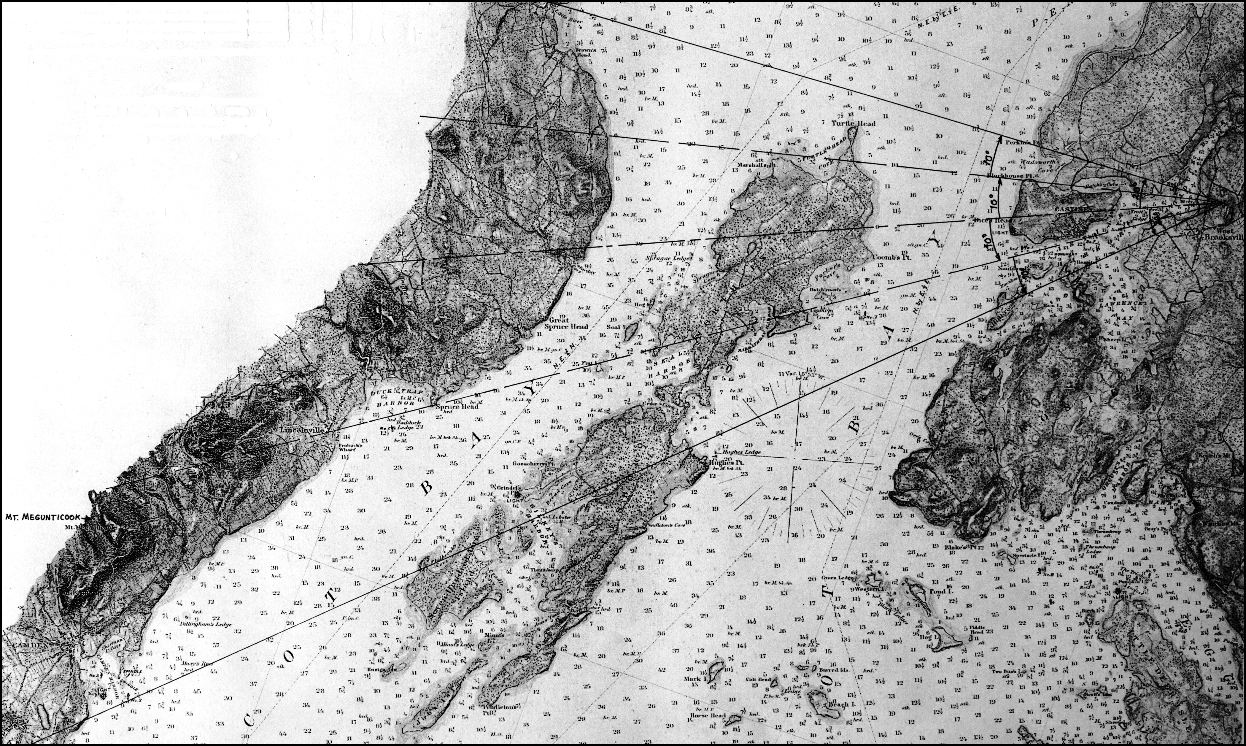
Chart
U.S. Coast Survey
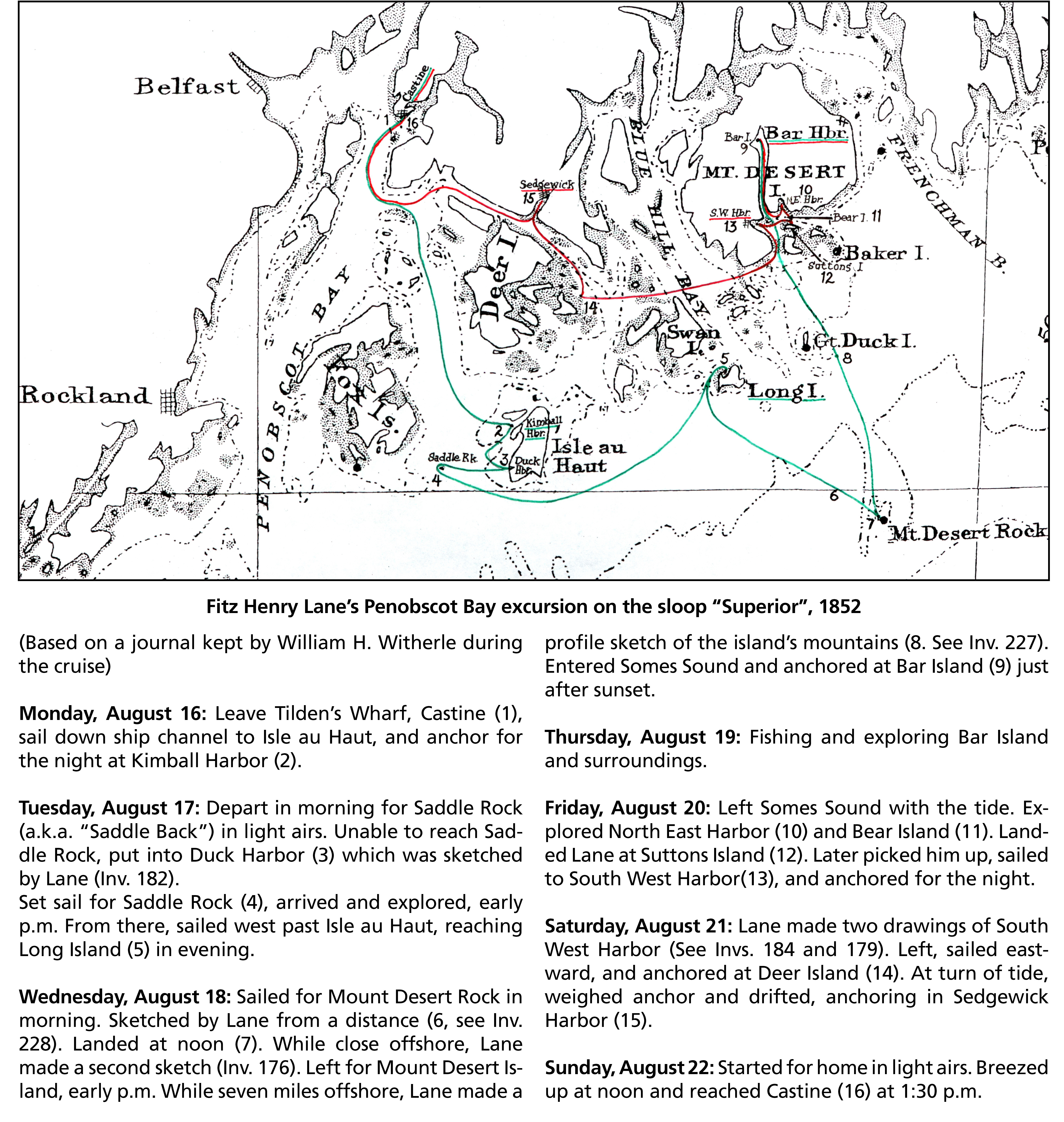
Chart with key showing the route of an excursion on the sloop "Superior" out of Castine made by William H. Witherle, Lane, Stevens and friends during which Lane made several sketches of Mt. Desert scenery. The trip was chronicled by Witherle in his diary of 1852.
Handwritten list
Wilson Museum, Castine, Maine (A00787-1a-1d)
Also filed under: Castine – Witherle & Co.'s Store » // Lithography (Sales & Exhibitions) » // Noyes, Samuel » // Publications » // Stevens, Joseph, Jr. » // Witherle, William Howe »
Castine Historical Society Collections (1996.1)
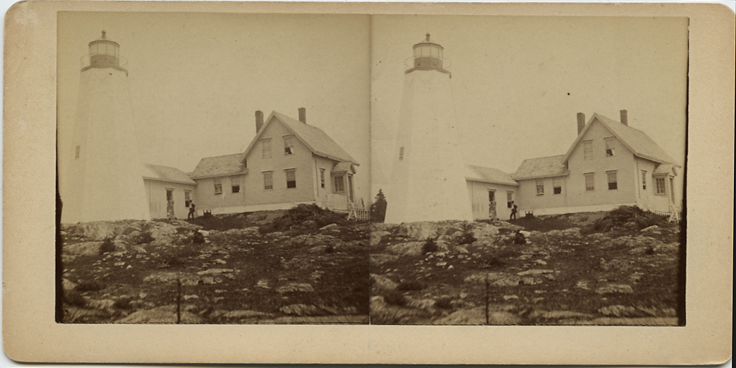
Also filed under: Castine, Maine – Dice (Dyce) Head Lighthouse » // Historic Photographs »

Photograph
In The Illustrated Coast Pilot with sailing directions. The Coast of New England from New York to Eastport, Maine including Bays and Harbors, published by N. L. Stebbins, Boston, Mass.
Also filed under: Castine, Maine – Dice (Dyce) Head Lighthouse »
Letter
Cape Ann Museum, Gloucester, Mass.
Also filed under: "General Gates" (New England Boat; Casco Bay Boat) » // Chronology » // Letters » // Stevens, Joseph, Sr. and Dorothy Little »
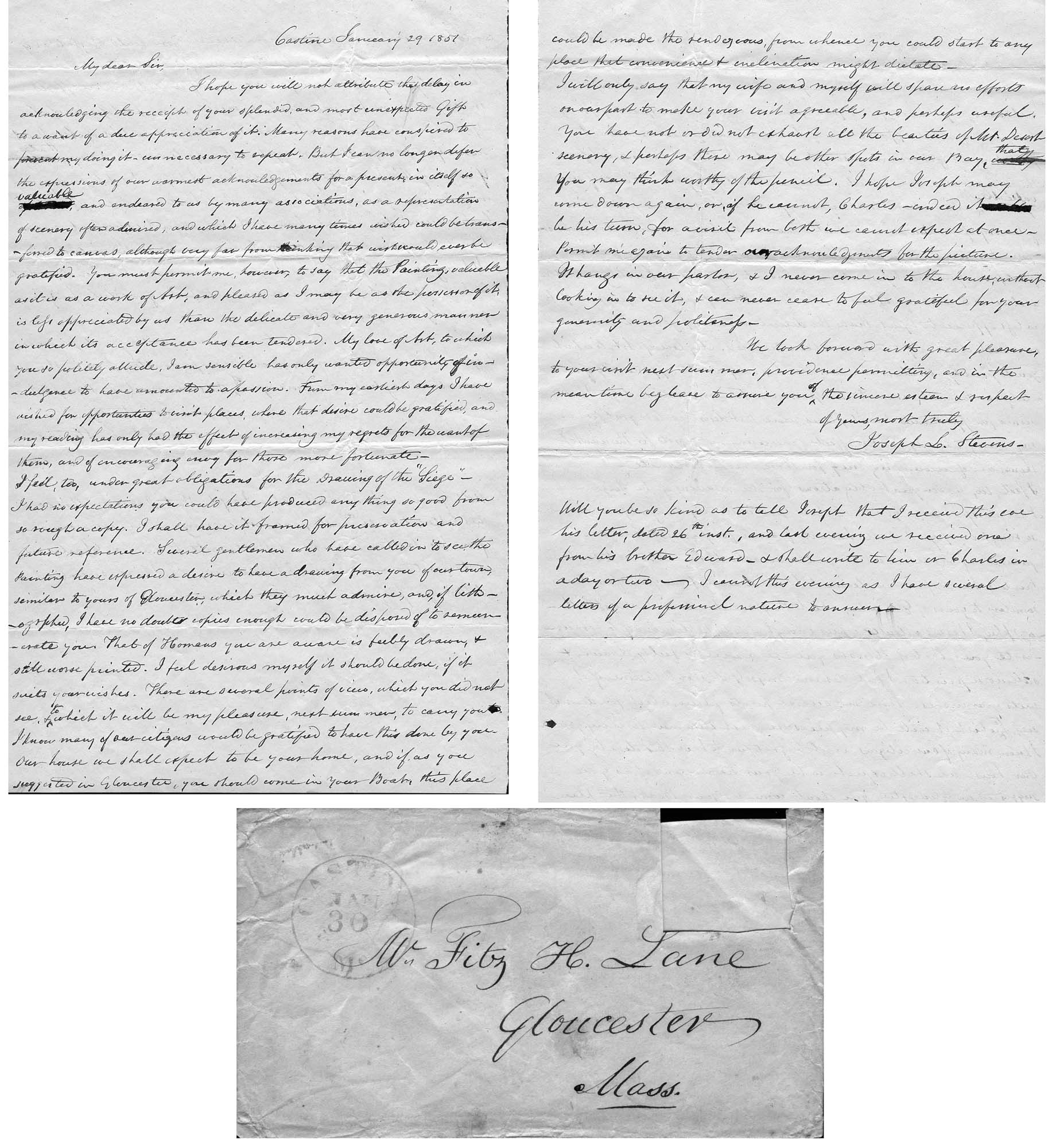
Four-page letter
Collection of the Cape Ann Museum Library & Archive, Gloucester, Mass.
"[The painting] is offered you for $150 on as long time and in as many notes at 3% interest as you choose. . . I believe this to be the only important painting of Gloucester Harbor that Lane never duplicated. . . .Returning from a Gloucester visit while I was still under the roof there, father brought a print of Lane's first Gloucester view, bought of the artist at his Tremont Temple studio in Boston. An extra dollar had been paid for coloring it. For a few years it was a home delight.. . .I had been a few years in Gloucester when Lane began to come, for part of the time a while, if I remember rightly. He painted in his brother's house, "up in town" it then was. I recall visits there to see his pictures. But it was long after, that I could claim more than a simple speaking acquaintance. The Stacys were very kind, aiding him as time went on in selling paintings by lot. I invested in a view of Gloucester from Rocky Neck, thus put on sale at the old reading room, irreverently called "Wisdom Hall." And they bought direct of him to some extent, before other residents. Lane was much my senior and yet we gradually drifted together. Our earliest approach to friendship was after his abode began in Elm Street as an occupant of the old Prentiss [sic-corrected Stacy] house, moved there from Pleasant. I was a frequenter of this studio to a considerable extent, yet little compared with my intimacy at the next and last in the new stone house on the hill. Lane's art books and magazines were always at my service and a great inspiration and delight—notably the London Art Journal to which he long subscribed. I have here a little story to tell you. A Castine man came to Gloucester on business that brought the passing of $60 through my hands at 2 1/2 % commission. I bought with the $1.50 thus earned Ruskin's Modern Painters, my first purchase of an artbook. I dare say no other copy was then owned in town. . . .Lane was frequently in Boston, his sales agent being Balch who was at the head of his guild in those days. So in my Boston visits – I was led to Balch's fairly often – the resort of many artists and the depot of their works. Thus through, Lane in various ways I was long in touch with the art world, not only of New England but of New York and Philadelphia. I knew of most picture exhibits and saw many. The coming of the Dusseldorf Gallery to Boston was an event to fix itself in one's memory for all time. What talks of all these things Lane and I had in his studio and by my fireside!
For a long series of years I knew nearly every painting he made. I was with him on several trips to the Maine coast where he did much sketching, and sometimes was was [sic] his chooser of spots and bearer of materials when he sketched in the home neighborhood. Thus there are many paintings whose growth I saw both from brush and pencil. For his physical infirmity prevented his becoming an out-door colorist."
Single sheet, writing both sides
Cape Ann Museum Library & Archives, Gloucester, Mass.
"My dear Sir,
I hope you will not attribute the delay in acknowledging the receipt of your splendid, and most unexpected Gift to a want of a due appreciation of it. Many reasons have consipired to prevent my doing it – unnecessary to repeat. But I can no longer defer the expressions of our warmest acknowledgements for a present in itself so valuable, and endeared to us by many associations, as a representation of scenery often admired, and which I have many times wished could be transferred to canvas, although vary far from thinking that wish would ever be gratified. You must premit me, however, to say that the Painting, valuable as it is as a work of Art, and pleased as I may be as the possessor of it, is less appreciated by us than the delicate and very generous manner in which its acceptance has been tendered. My love of Art, to which you do politely allude, I am sensible has only wanted opportunity of indulgence to have amounted to a passion. From my earliest days I have wished for opportunities to visit places, where that desire could be gratified, and my reading has only had the effect of increasing my regrets for the want of them, and of encouraging envy for those more fortunate - I feel, too, under great obligations for the Drawing of the "Siege"(1) – I had no expectations you could have produced anything so good from so rough a copy. I shall have it framed for presentation and future reference. Several gentlemen who have called in to see the painting have expressed a desire to have a drawing from you of our town, similar to yours of Gloucester, which they much admire, and of lithographs, I have no doubts copies enough could be disposed of to remunerate you. That of Homans you are aware is feebly drawn, & still worse printed. I feel desirous myself it should be done, if it suits your wishes. There are several points of view, which you did not see, & to which it will be my pleasure, next summer, to carry you. I know many of our citizens would be gratified to have this done by you. Our house we shall expect to be your home, and if, as you suggested in Gloucester, you should come in your Boat, this place could be made the rendezvous, from whence you could start to any place that convenience & inclination might dictate – . . . Permit me again to tender acknowledgements for the picture. It hangs in our parlor, & I never come in to the house, without looking in to see it, & can never cease to feel grateful for your generosity and politeness. "
(1) Joseph Stevens was very interested the Revolutionary war event known as the "Penobscot Expedition" or the "Siege of Castine" by the British on July 25, 1779. In 1852 he handwrote an account of it and many articles are in the family's scrapbook at the Wilson Museum in Castine.
Details about Maine's fishing industry, see pp. 256–57.
Also filed under: Grand Bank, Newfoundland, Canada » // Statistics »
Details about Maine's lumber trade in 1855, see pp. 250–52
Also filed under: Lumber Industry » // Schooner (Coasting / Lumber / Topsail / Packet / Marsh Hay) »
Details about Maine's shipbuilding industry, see pp. 252–57.
Also filed under: Shipbuilding / Repair »
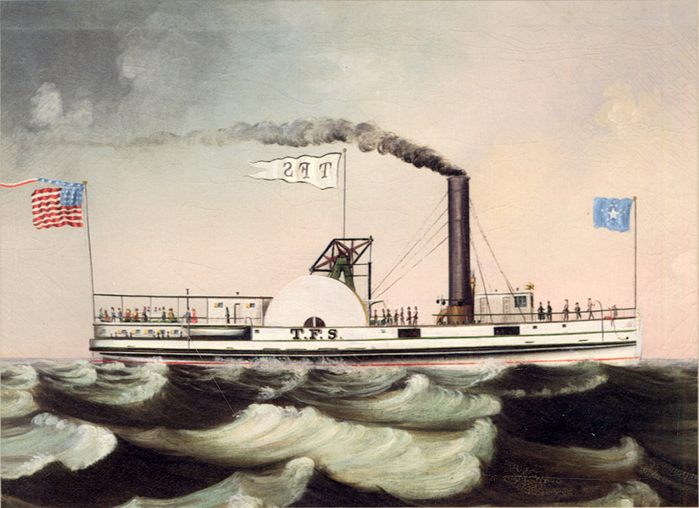
Oil on canvas
Maine Maritime Museum
Also filed under: Steamship / Engine-Powered Vessel / Coastal Steamer »
Steamer schedules for 1855, including the schedule for the steamer, "T. F. Secor" which served Castine, see pp. 234–35.
Also filed under: "T. F. Secor" (Steamboat) » // Publications » // Steamers » // Steamship / Engine-Powered Vessel / Coastal Steamer »
Wilson Museum, Castine, Maine.
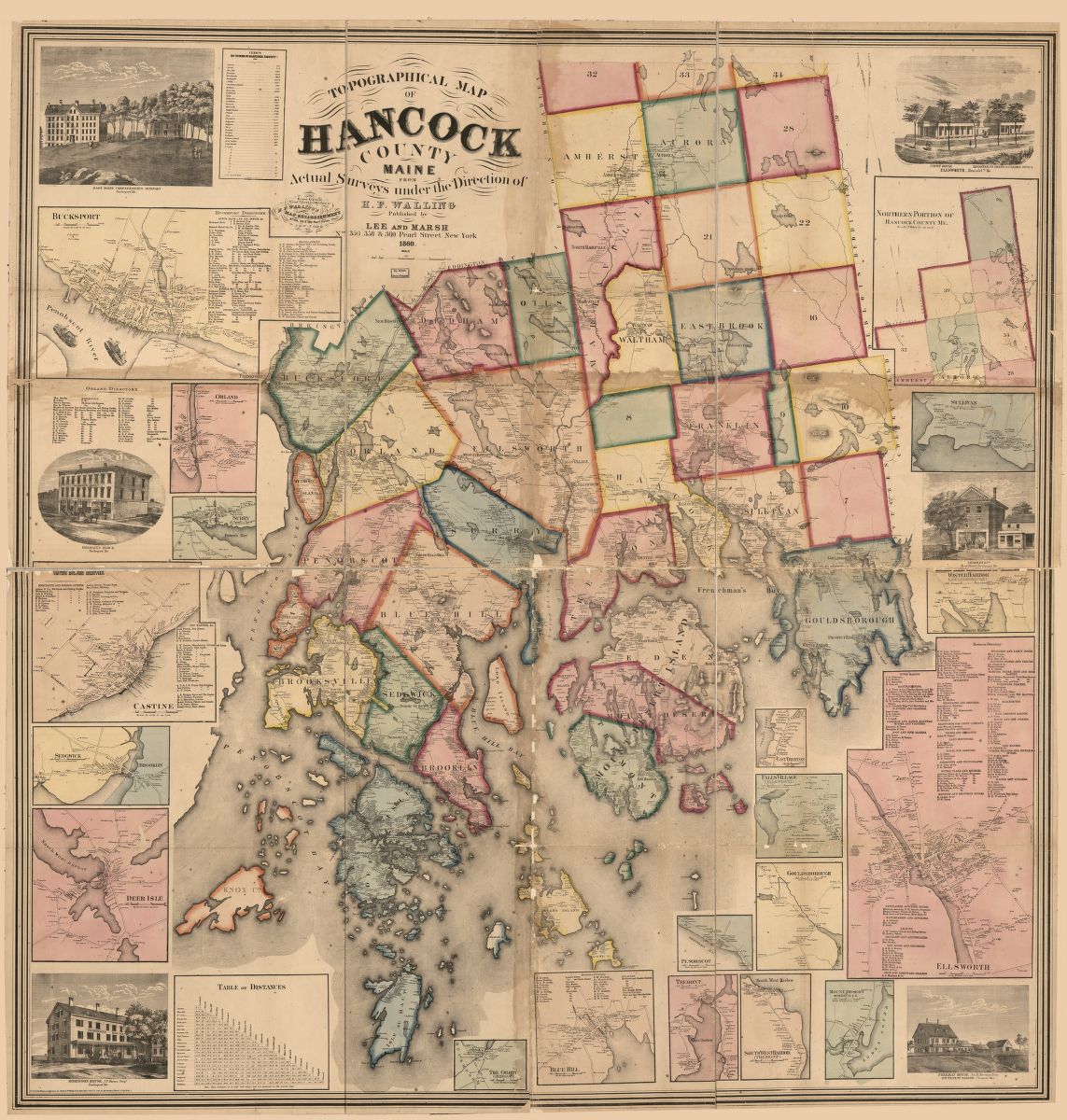
Library of Congress Catalog Number 2011588006
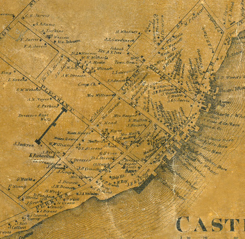
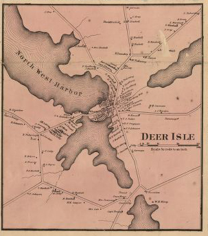
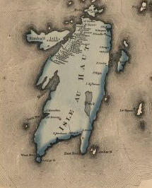
1860 map, including census of towns.
Also filed under: Maps » // Mount Desert Island & Rock » // Penobscot Bay »
1860
Also filed under: Maps »
Library of Congress catalog number 2011588006
Wilson Museum, Castine, Maine also has a copy of the map
Also filed under: Maps »
Wilson Museum, Castine, Maine also has a copy of the map
Library of Congress catalog number 2011588006
Also filed under: Maps »
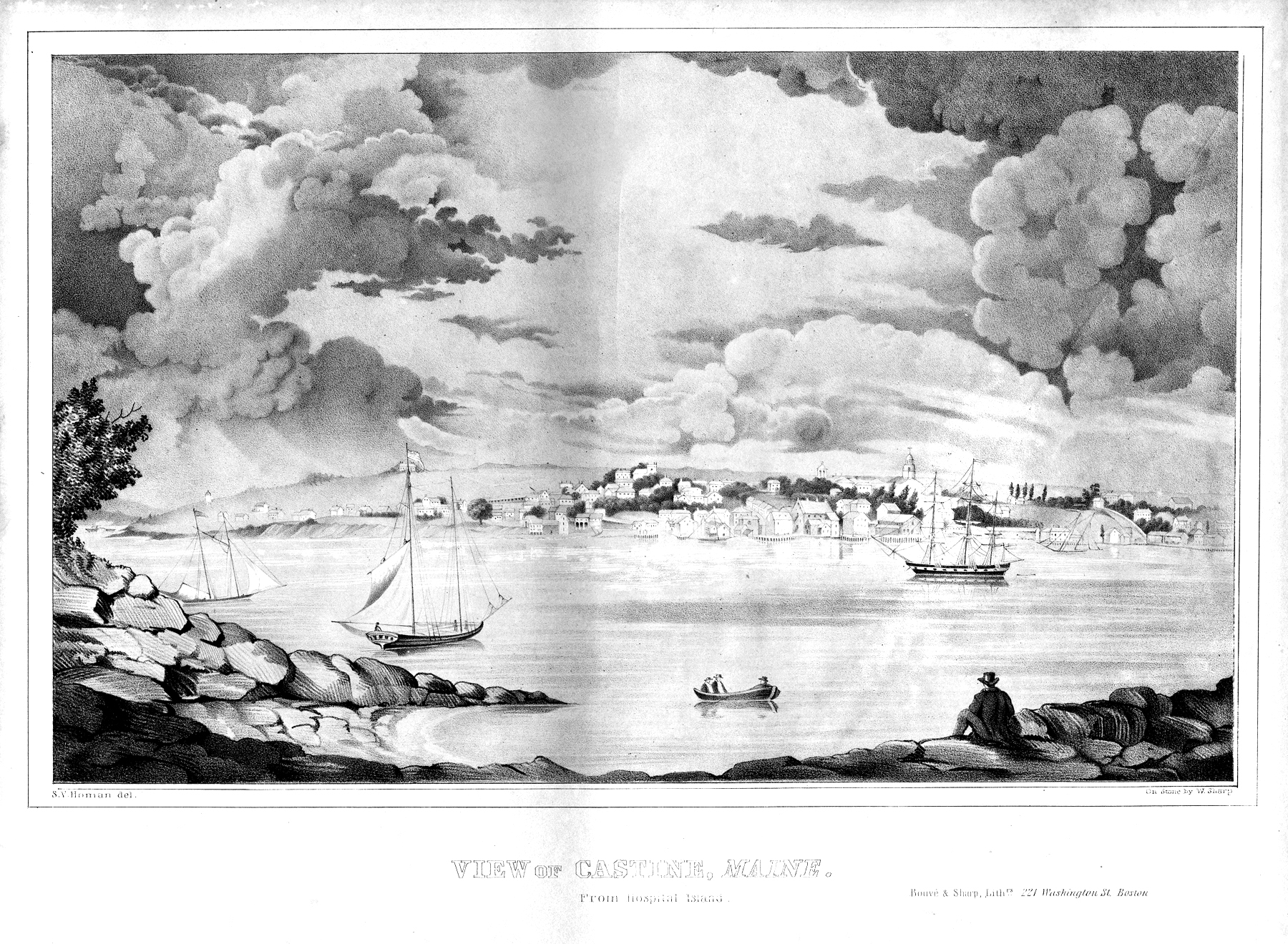
Bouvé and Sharp, Lithographers, 221 Washington Street, Boston
Boston Athenaeum
Looking at Castine from Hospital Island. Joseph Stevens, Sr. mentions this print in the letter he wrote to Lane encouraging Lane to make a lithograph of Castine.
Also filed under: Bouvé & Sharp, Lith. – Boston » // Homan, S.V. » // Stevens, Joseph, Sr. and Dorothy Little »
Personal diary
Wilson Museum, Castine, Maine (A00060-1a-1h)
Description of an excursion taken by Joseph Stevens, Jr., Lane, Witherle, Samuel Adams, Jr., and George Tilden around the islands of Maine near Mt. Desert. The group hired the Sloop "Superior" which was owned by Pilot Getchell. In his diary, Witherle mentions multiple times that "Lane took a sketch" especially when the water was calm. Lane often stayed on board the boat, while the others went ashore.
Excerpts of the diary include:
August 16: "Lane has a knack for frying fish."
August 17: "leaving Lane to take a sketch, we took a climb."
August 19: "went to ascend one of the highest mountains. 3/4 the way up we had to wait – once in a while for Lane who with his crutches could not keep up with us – but got along faster than we thought possible . . .Lane got up about an hour after the rest of us."
The entire text is transcribed in an account published by the Wilson Museum.
View related Fitz Henry Lane catalog entries (6) »
Also filed under: "Superior" (Sloop) » // Adams, Samuel, Jr. » // Biographical information » // Blue Hill » // Chronology » // Diaries / Ledgers / Etc. » // Mount Desert Island & Rock » // Somes Sound » // Stevens, Joseph, Jr. » // Tilden, George » // Witherle, William Howe »
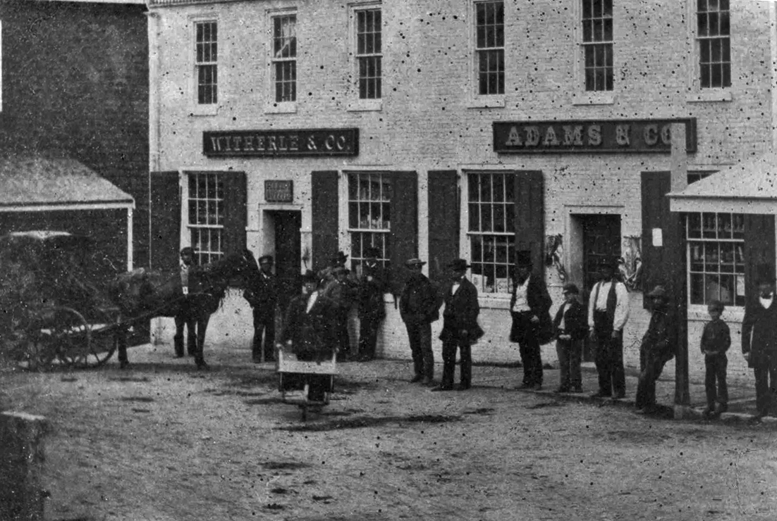
Photograph
Wilson Museum, Castine, Maine
Accession number a02600a
Also filed under: Castine – Witherle & Co.'s Store » // Witherle, William Howe »
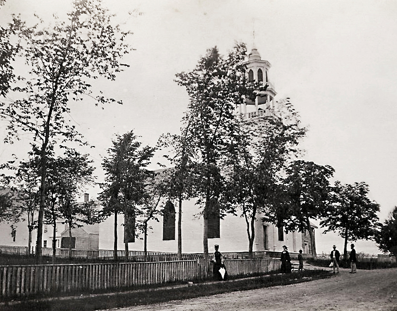
At 88 Court Street, Castine, was the church built between 1790–96 as First Parish Church and greatly remodeled in 1831. It served as the First Parish (Congregational) Church from 1796–1866, after which it became a Unitarian parish. It is noteworthy for its distinctive belfry and spire. Part of the 1831 reconstruction was this new tower, as well as the sending back of the original Revere bell to Boston in exchange for a larger one. Dr. Joseph Stevens was listed as a pew holder in this church in 1832. (2) During the 1840s the congregation at this church dwindled, but the church was still used for town events such as the 4th of July during the Civil War. (2)
References:
1. Lynn Hudson Parsons, Missions and Meeting Houses, Chapels and Churches: Fuor Centuries of Faith in Castine, Maine (Castine, ME: Historical Society, 2012), 60.
2. Ibid., 75.
Castine Historical Society Collections
Also filed under: Historic Photographs »
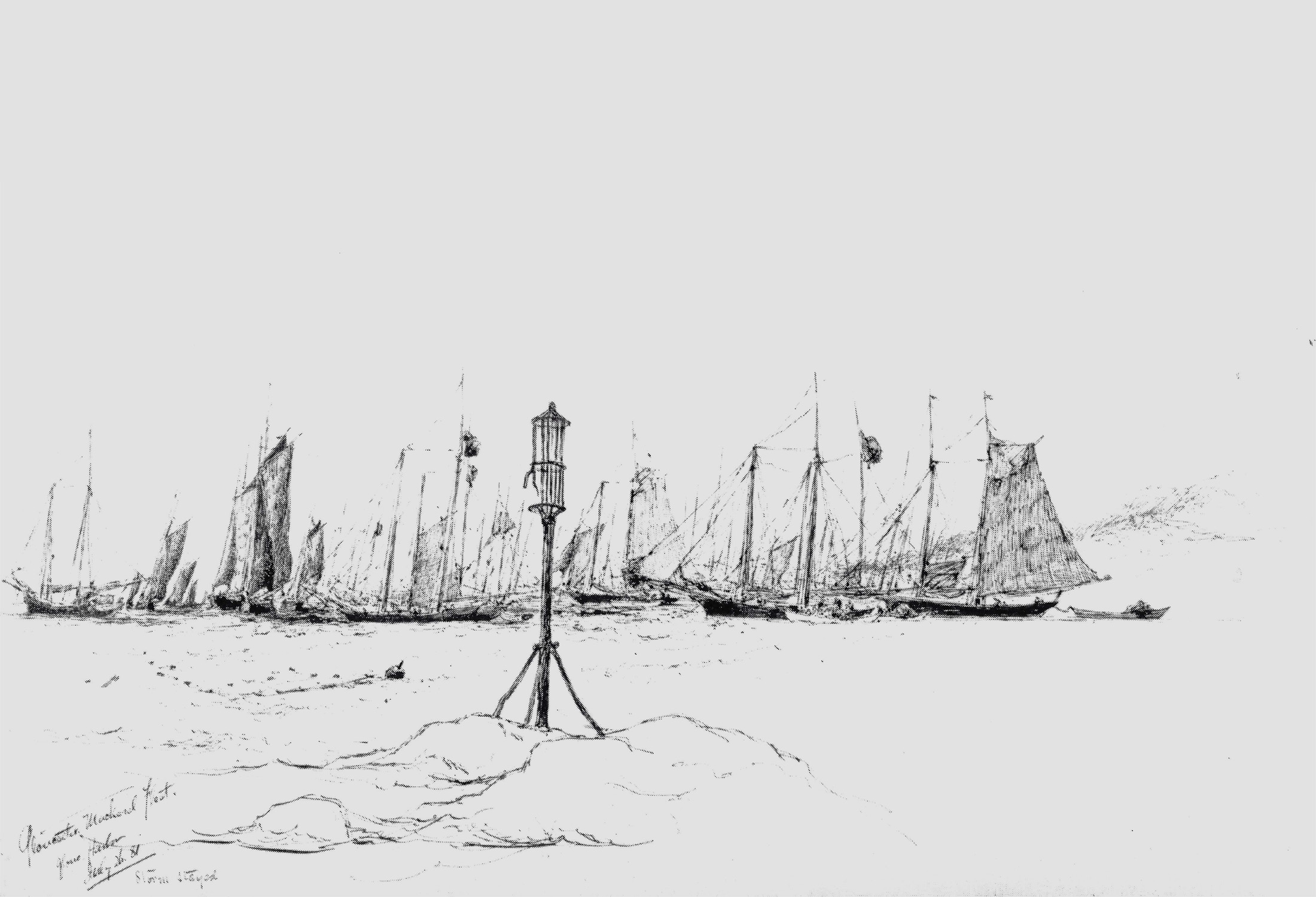
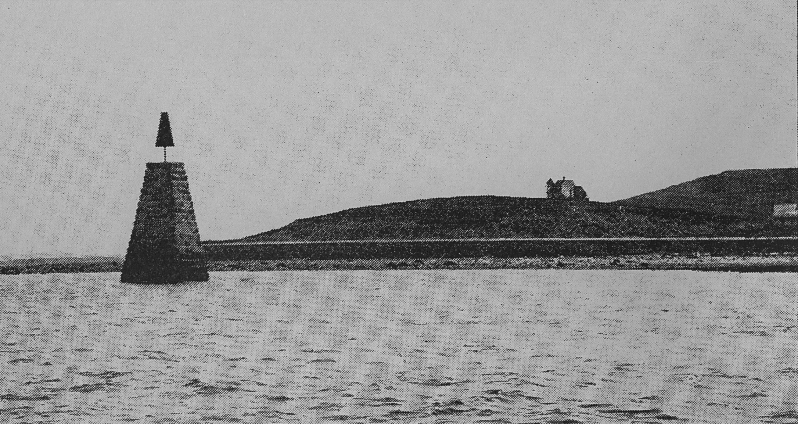
A "spindle" is a fixed marker to indicate a hazard to navigation (such as a rock which couldn't be seen at high tide). It serves the same purpose as a channel buoy, a "light beacon," or a “monument,” to warn vessels away from dangerous places or stretches of coastline. Spindles are usually iron rods with some sort of geometric object (round, flat, or triangular) on top, brightly painted (usually red) for visibility. Monuments, like the ones you see in Lane’s depictions of Half Way Rock or Norman’s Woe Reef, were made of stone and look like stumpy obelisks—or grave monuments. They were also essential as reference points for the early coastal surveys in their efforts to make more accurate charts.
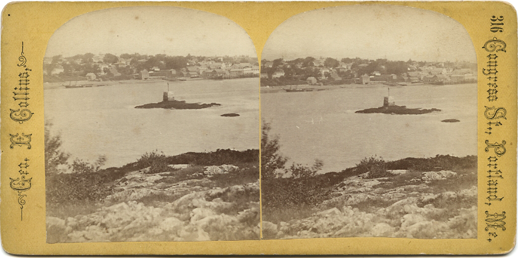
In Castine, the notable square monument in the center of the harbor marked Hosmer's Ledge.
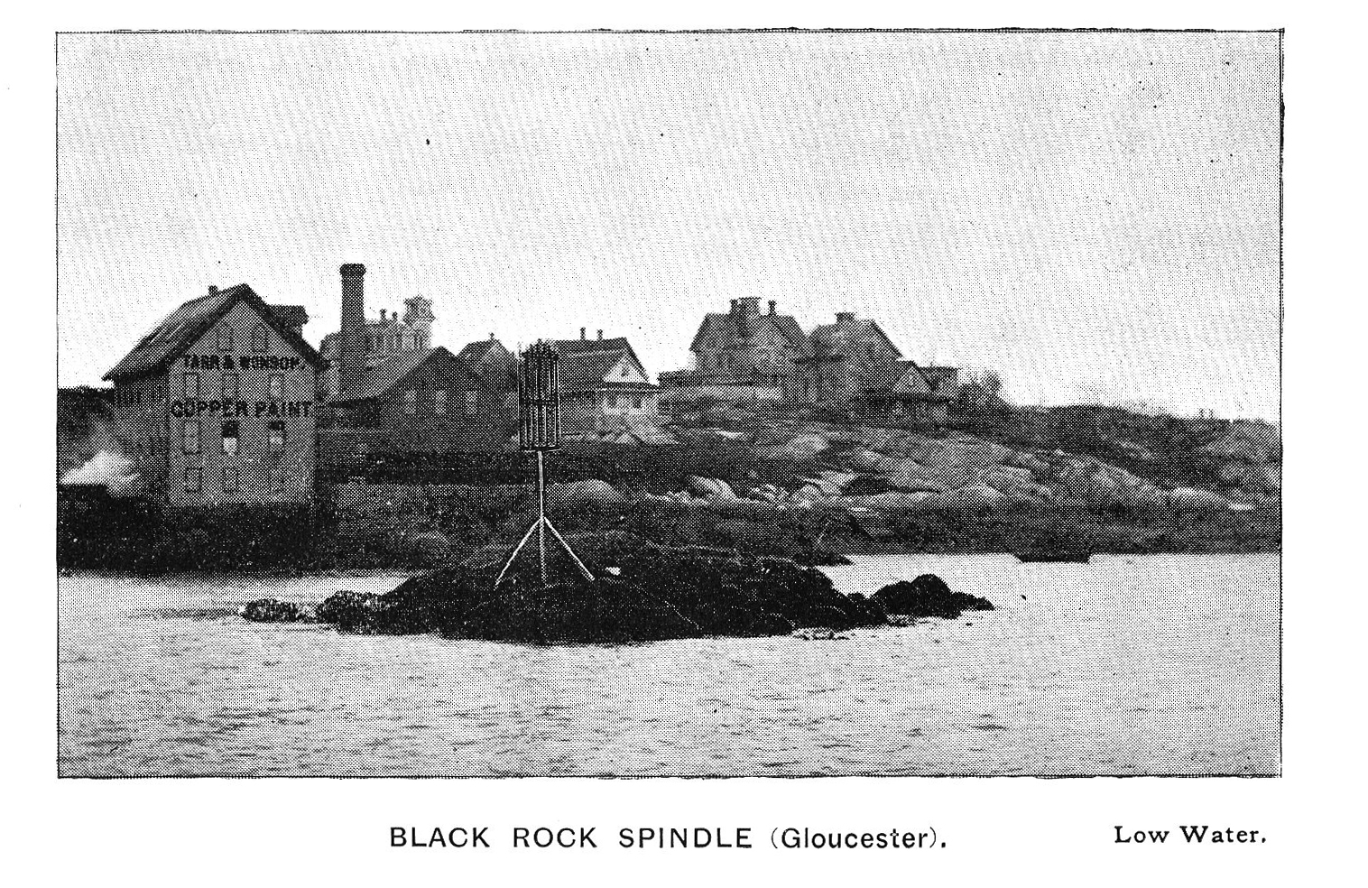
Photograph in The Illustrated Coast Pilot with Sailing Directions. The Coast of New England from New York to Eastport, Maine including Bays and Harbors, published by N. L. Stebbins, Boston
Also filed under: Gloucester Harbor, Inner / Harbor Cove »
Pencil and ink on paper
15 x 22 1/8 in.
Cape Ann Museum, Gloucester, Mass., Gift of Mr. Donald K. Usher, in memory of Mrs. Margaret Campbell Usher, 1984 (2401.19)
Also filed under: Gloucester Harbor, Outer » // Mackerel Fishing »
Castine Historical Society Collections (1996.1)
View related Fitz Henry Lane catalog entries (2) »
Also filed under: Castine » // Historic Photographs »
Provenance (Information known to date; research ongoing.)
Marks & Labels
Marks: Inscribed upper left (in red ink): 10 [numbering system used by curator A. M. Brooks upon Samuel H. Mansfield's donation of the drawings to the Cape Ann Museum]
Commentary
This drawing shows Castine from the northeast, looking out of the harbor, past Nautilus Island, towards Long Island (now called Isleboro) and the mainland and Camden Hills. Noteworthy in this drawing is the distinctive square harbor monument (used as a navigational marker) still existing in Castine. The Negro Island mentioned in the title of this drawing is not the same one (near Camden) depicted by Lane in other works; instead it is a small island in the Bagaduce River northeast of Castine.
[+] See More