An online project under the direction of the CAPE ANN MUSEUM
Historical Materials: Cape Ann Locales
Historical Materials » Cape Ann Locales » Waterfront, Gloucester
You have navigated to this pages from catalog entry: The Fort and Ten Pound Island, Gloucester (Harbor Scene), 1848 (inv. 58)
Waterfront, Gloucester
View related Fitz Henry Lane catalog entries (8) »
Preceded by Annisquam as the earliest permanently settled harbor and Gloucester’s original first parish, Gloucester Harbor did not become a seaport of significance until the end of the 17th century. Its earliest fishing activity was focused on nearby grounds in the Gulf of Maine, few vessels venturing further to the banks off Canada. After 1700, as maritime activity was well-established in fishing, shipbuilding, and coastal trade, the waterfront saw the expansion of flake yards for drying fish and wharves for berthing and outfitting vessels, loading lumber and fish, and receiving trade goods. Shipbuilding was also carried on, using shorelines with straight slopes not suited for wharves.
By 1740, the majority of Cape Ann-owned vessels were berthed in Gloucester Harbor; three years later, Watch House Point (now called Fort Point) was armed and fortified. The fishing fleet continued to grow, numbering over 140 vessels by the time of the Revolution. A customs office was established in 1768, resulting in strong protests over seizures of contraband. Revolution brought hardship to the fishing industry, forcing many vessel owners to resort to privateering.
Independence saw a much-diminished fishing fleet and a severely impoverished seaport. With the Federally-sponsored incentive of the codfish bounties, Gloucester fishermen began to rebuild their fishing fleet. By 1790, trade with Surinam was under way, leading to the building and purchase of merchant vessels, new wharves, and improvements to old wharves in Harbor Cove, which had become Gloucester’s center of maritime activity. In addition to shipyards and sail lofts, two ropewalks furnished cordage for rigging.
The first four decades of the 19th century saw fitful growth in the fishing industry, due to the interruptions of war and financial panics. Few wharves were added to the waterfront in that period, and when new ones were built, their purpose was to serve the growing Surinam Trade. Fishing had come to its low point in the 1840s when the railroad reached Gloucester, opening a huge inland market for the fish it caught. The use of ice to keep fish fresh, combined with new and faster fishing schooners to get it quickly to port, sparked a revival in Gloucester’s fishing industry.
As Gloucester’s fishing industry revived, its growth in the Surinam Trade was hampered by its shallow harbor which made berthing of ever larger ships more difficult. Forced to seek a deeper harbor, merchants reluctantly sent their largest ships to Boston for unloading. Between 1850 and 1860, this process continued until ships and warehouses were relocated and their owners commuted to Boston by rail, leaving their old wharves to the fishing fleet. In 1863, the Surinam trade collapsed.
Gloucester’s fishing fleet grew dramatically in the 1850s for more reasons than ice, railroads, and faster schooners. The technology of catching fish also improved dramatically. Hand-line fishing (two hooks on a line) gave way to dory trawling with many hooks on a very long “trawl line,” while fishing for mackerel with hand-lines was replaced by “purse seining,” setting a 1,000-foot-long net in a circle around a school of mackerel. These dramatic improvements in productivity were expensive but made possible by the fishermen organizing a mutual savings bank to serve their needs and a mutual insurance company to cover their risks. These advantages could not be matched by any other fishing communities in New England or in the Canadian Maritime Provinces, sparking a huge migration of fishermen to Gloucester. These newcomers were welcomed to fill a growing work force while Gloucester’s native work force moved on to other, less dangerous, occupations.
Lane’s depictions of Gloucester’s waterfront best illustrate the period before 1850. After that date, his attention turned more to the Harbor’s outer shores, to nearby communities such as Manchester, to New York, back to Boston, and north to Maine. While his lapse of interest is regrettable, the scenes and activity he missed were becoming popular with photographers while his earlier waterfront views are nowhere else to be found.
–Erik Ronnberg
References:
Dates and happenings were based on (or confirmed by):
Mary Ray and Sarah V. Dunlap, “Gloucester, Massachusetts Historical Time-Line (Gloucester: Gloucester Archives Committee, 2002).
Improvements to Gloucester’s fishing technology, management, and financing are based on:
Wayne O’ Leary, “Maine Sea Fisheries” (Boston: Northeastern University Press, 1996), pp. 166–179 (fishing technology), 235–251 (management and financing), and 235–251 (in-migration to Gloucester).
Related tables: Burnham Brothers Marine Railway » // Cob / Crib Wharf » // Cod / Cod Fishing » // Flake Yard » // Fort (The) and Fort Point » // Gloucester Harbor, Inner / Harbor Cove » // Hand-lining » // Low (Frederick G.) wharves » // Rogers's (George H.) wharves » // Shipbuilding / Repair » // Surinam Trade »
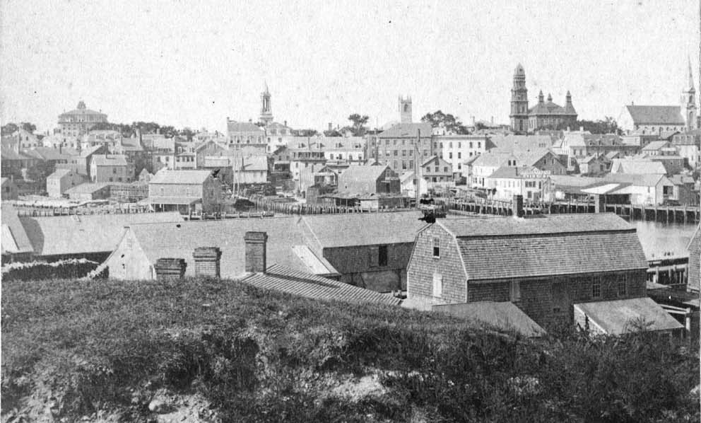
Photograph
Cape Ann Museum Library & Archive
Also filed under: Gloucester Harbor, Inner / Harbor Cove » // Historic Photographs » // Schooner (Fishing) »
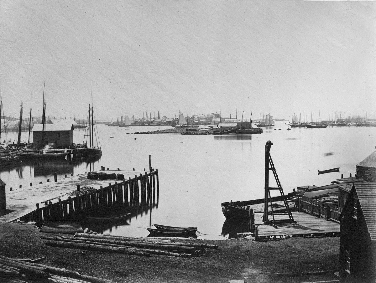
Photograph
Cape Ann Museum Library & Archive
Ignatius Weber's windmill (now defunct) is shown.
Also filed under: Flake Yard » // Fort (The) and Fort Point » // Gloucester Harbor, Inner / Harbor Cove » // Historic Photographs » // Rogers's (George H.) wharves » // Schooner (Fishing) » // Windmill »
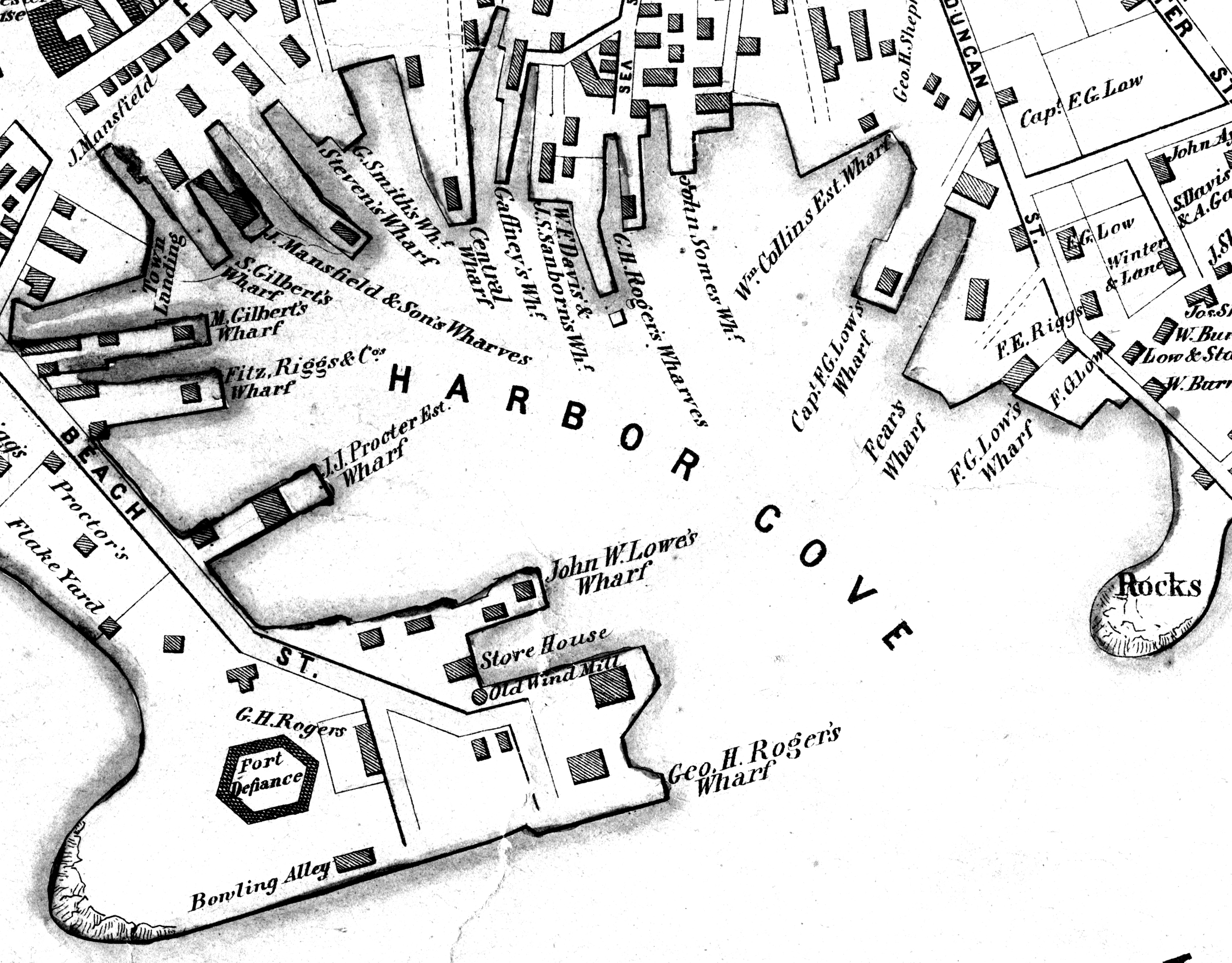
44 x 34 in.
John Hanson, Publisher
Cape Ann Museum Library & Archive
"Map of the Towns of Gloucester and Rockport, Massachusetts. H.F. Walling, Civil Engineer. John Hanson, Publisher. 1851. Population of Gloucester in 1850 7,805. Population of Rockport in 1850 3,213."
Also filed under: Fort (The) and Fort Point » // Low (Frederick G.) wharves » // Maps » // Rogers's (George H.) wharves » // Town / Public Landings » // Windmill »
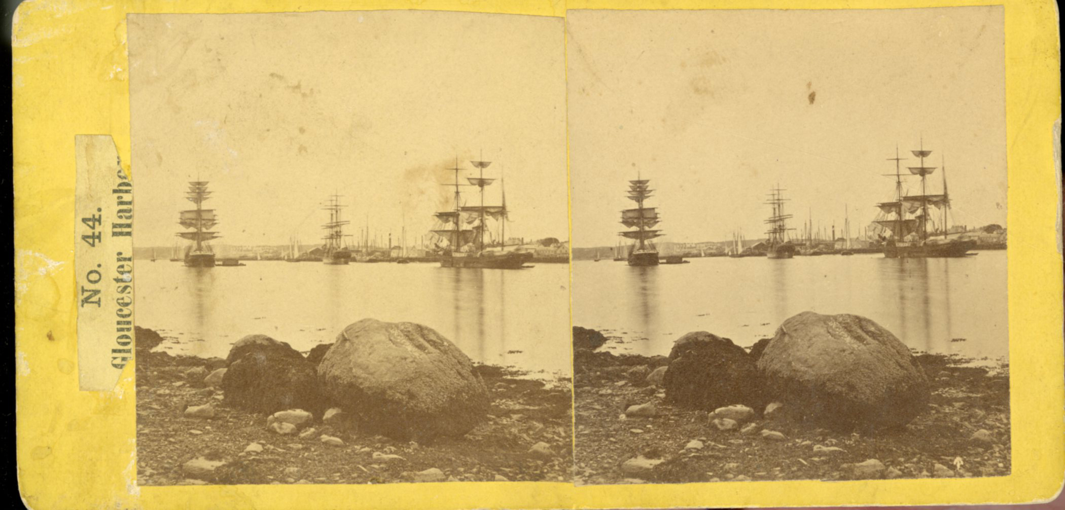
Stereograph card
Cape Ann Museum Library & Archive
This view of Gloucester's Inner Harbor shows three square-rigged vessels in the salt trade at anchor. The one at left is a (full-rigged) ship; the other two are barks. By the nature of their cargos, they were known as "salt ships" and "salt barks" respectively. Due to their draft (too deep to unload at wharfside) they were partially unloaded at anchor by "lighters" before being brought to the wharves for final unloading.
– Erik Ronnberg
Also filed under: Bark / Barkentine or Demi-Bark » // Historic Photographs » // Salt »
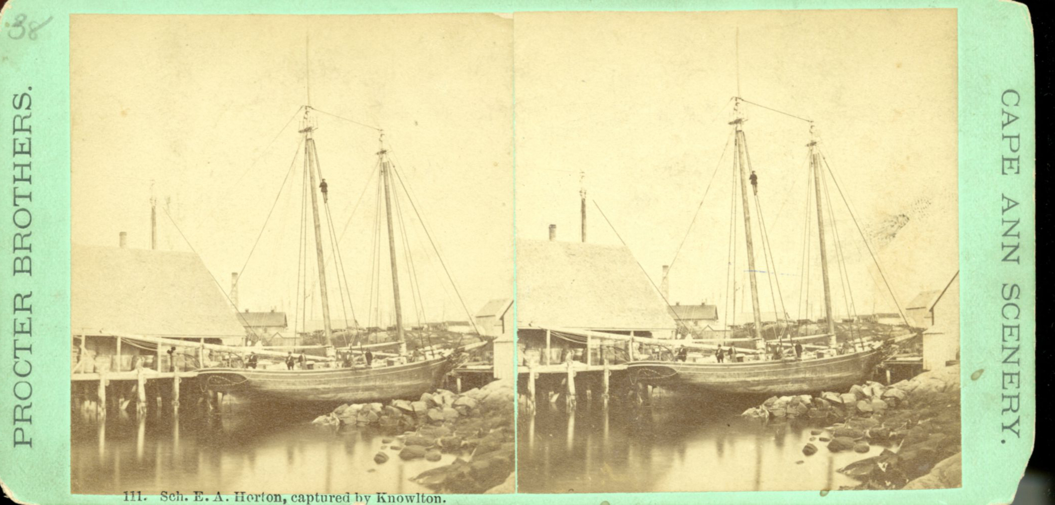
Stereograph card
Cape Ann Museum Library & Archive
"Said schooner was captured about the first of September, 1871, by Capt. Torry, of the Dominion Cutter 'Sweepstakes,' for alleged violation of the Fishery Treaty. She was gallantly recaptured from the harbor of Guysboro, N.S., by Capt. Harvey Knowlton., Jr., (one of her owners,) assisted by six brave seamen, on Sunday night, Oct. 8th. The Dominion Government never asked for her return, and the United States Government very readily granted her a new set of papers."
Also filed under: Fishing » // Historic Photographs » // Schooner (Fishing) »
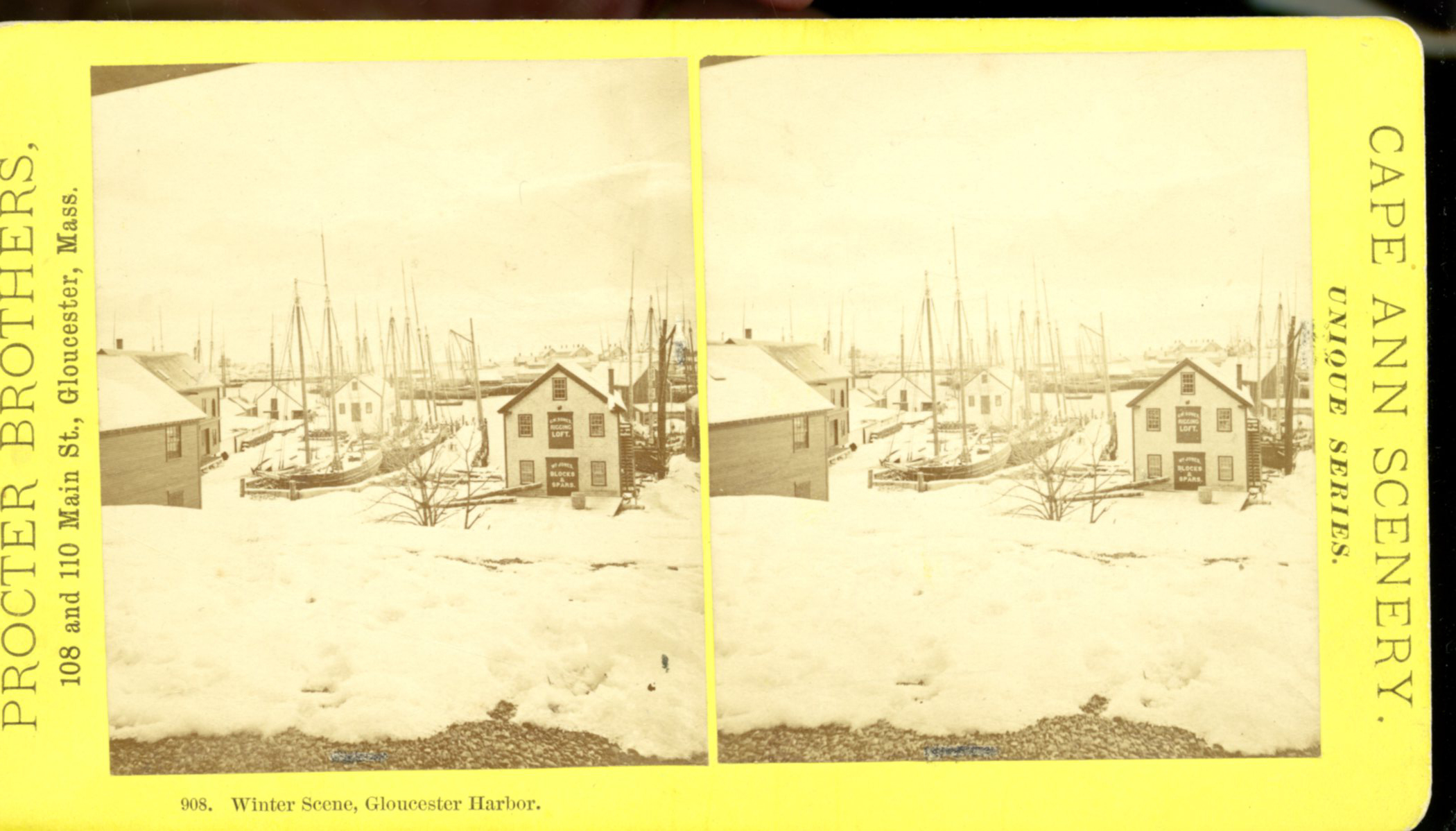
Stereograph card
Cape Ann Museum Library & Archive
Stereo view showing Gloucester Harbor after a heavy snowfall
Also filed under: Gloucester Harbor, Inner / Harbor Cove » // Historic Photographs »
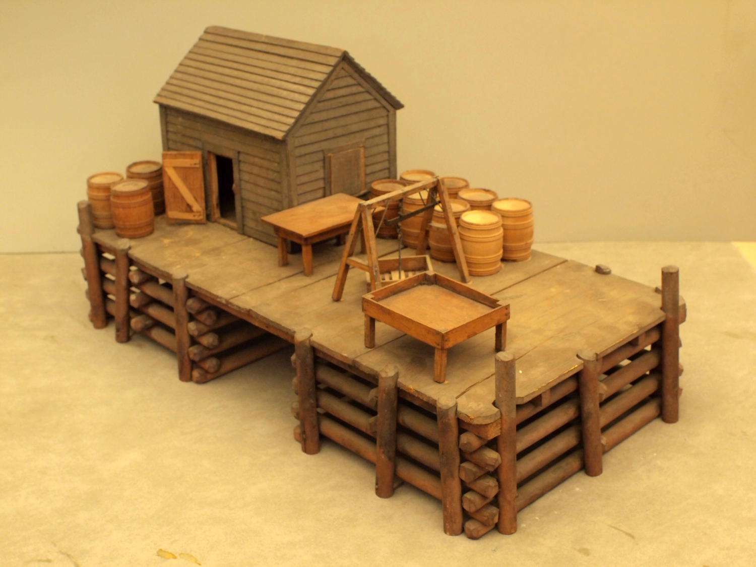
Wood, metal, and paint
20 1/4 x 10 1/4 x 10 1/2 in., scale: 1/2" = 1'
Made for the Columbian Exposition, Chicago, 1892–93
Cape Ann Museum, from Gloucester Chamber of Commerce
The wharf is built up of "cribs", square (sometimes rectangular) frames of logs, resembling a log cabin, but with spaces between crib layers that allow water to flow freely through the structure.Beams are laid over the top crib, on which the "deck" of the wharf is built. Vertical pilings (or "spiles" as locally known) are driven at intervals to serve as fenders where vessels are tied up.
– Erik Ronnberg
Also filed under: Cob / Crib Wharf »

Cape Ann Museum Library & Archive
Also filed under: Fishing » // Historic Photographs »
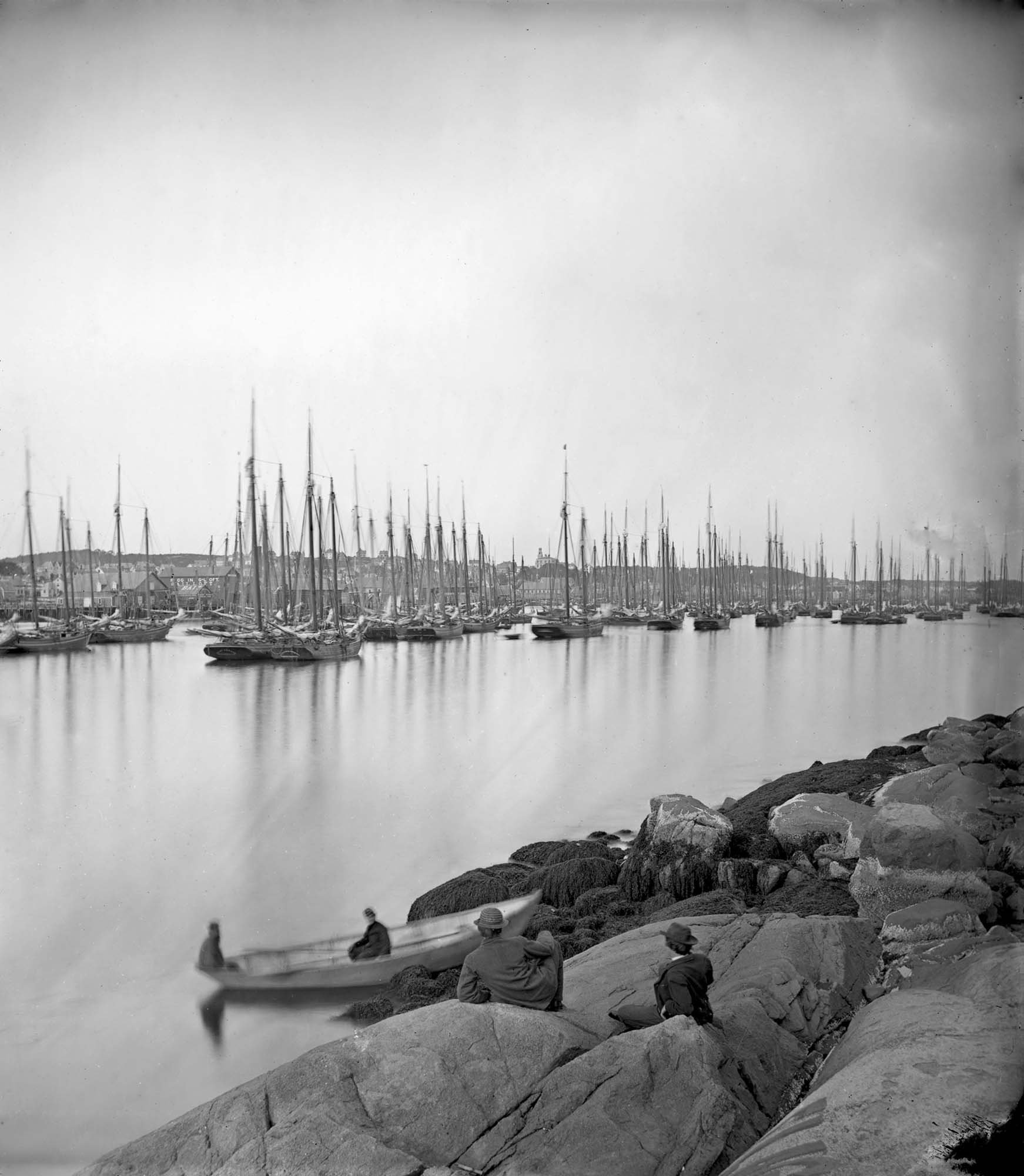
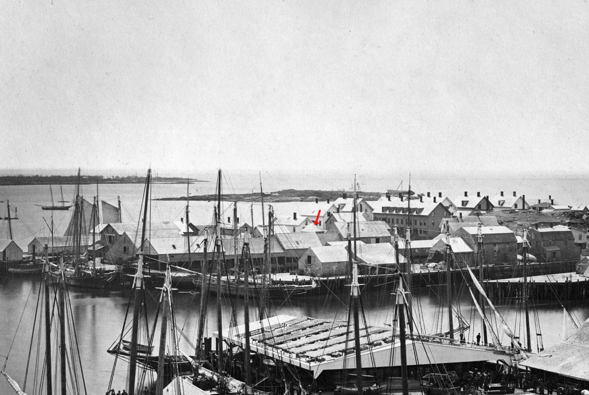
Cape Ann Museum Library & Archive (2013.068)
Schooner fleet anchored in the inner harbor. Looking east from Rocky Neck, Duncan's Point wharves and Lane house (at far left), Sawyer School cupola on Friend Street.
Also filed under: Duncan's Point » // Gloucester Harbor, Inner / Harbor Cove » // Historic Photographs » // Schooner (Fishing) »