An online project under the direction of the CAPE ANN MUSEUM
Historical Materials: Boston Locales, Businesses, & Buildings
Historical Materials » Boston Locales, Businesses, & Buildings » Boston Harbor
You have navigated to this pages from catalog entry: Capt. E. G. Austin's Quick Step, "A Yankee Ship and a Yankee Crew", 1837 (inv. 480)
Boston Harbor
View related Fitz Henry Lane catalog entries (25) »
During the years after the war of 1812 and before the Civil War, the port of Boston was a center of American deep-water shipping. Trading with China, India, and the West Indies, which had fueled maritime growth in the early years of the century gave way to re-exporting these goods and foreign trade based on the shoe and textile trades. Although second to New York in terms of shipping tonnage, many of New York's shipbuilders and merchants were Boston based. In addition, ship building continued in Boston. Also, the coastal trade (the domestic trade up and down the coast) was still the most efficient way to transport goods and passengers, and accounts for much of the tonnage and shipping traffic.
Although dwarfed by New York, Boston was an active port in the 1840s and 1850s. Its registered tonnage rose from 149,186 in 1840 to 270,510 in 1850. The harbor was a crowded place. For example, on September 18, 1850, 32 ships, 49 barks, 47 brigs, and 52 schooners were reported at Boston.(1)
In 1849, foreign entries at Boston included 215 ships, 305 barks, 908 brigs, and 52 schooners. Coastwise arrivals included 193 ships, 488 barks, 1087 brigs, 4287 schooners, 89 sloops, and 65 schooners.(2)
(1) W.H. Bunting, p.8.
(2) Ibid.
For more information:
Samuel Eliot Morrison, The Maritime History of Massachusetts, 1783-1860
W.H. Bunting, Portrait of a Port, Boston 1852-1914 Cambridge: The Belknap Press of Harvard University, 1971.
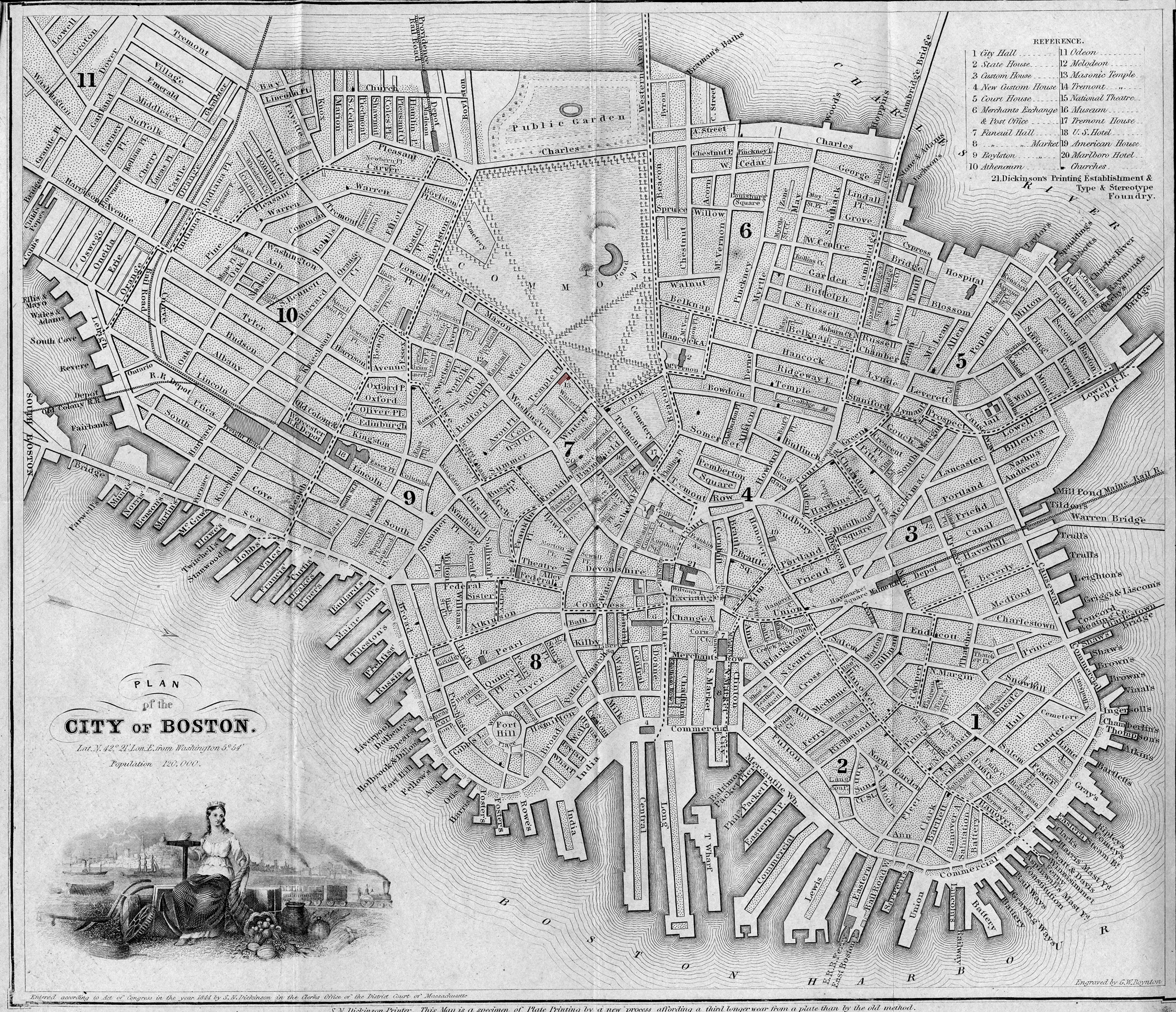
Printed map inside Boston Almanac
Published by B. B. Mussey & Co. and Thomas Groom, Boston
Cape Ann Museum Library & Archive (R910.45 B65 1848)
Map at front of almanac with Tremont Temple highlighted.
Also filed under: Boston City Views » // Maps » // Tremont Temple »
Harvard Depository: Widener (NAV 578.57)
For digitized version, click here.
Also filed under: Signal Systems (Flags & Maritime Codes) »
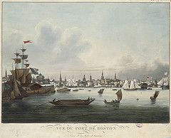
Tinted lithograph with hand coloring
13 7/8 x 22 3/8 in.
Boston Athenaeum
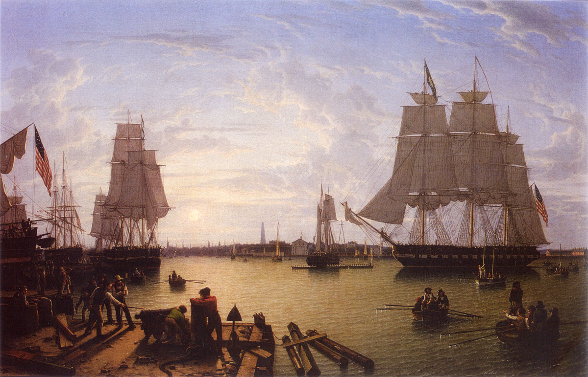
From Sally Pierce and Catharina Slautterback, Boston Lithography, 1825–1880: The Boston Atheneaum Collection (Boston: Athenaeum, 1991): "Tidd drew this print when he was a consulting engineer for Simpson's. He has depicted the clipper ship 'Southern Cross' in the dry dock. Built in 1851, she was known for having sailed from San Francisco to Hong Kong in the record breaking time of thirty-two days. The Bethlehem Ship Building Company eventually took over this location and operated a dry dock there until the mid 1940s."
Also filed under: "Southern Cross" (Clipper Ship) » // M. M. Tidd, Lith. – Boston »
Library of Congress Catalog Number 2004671768
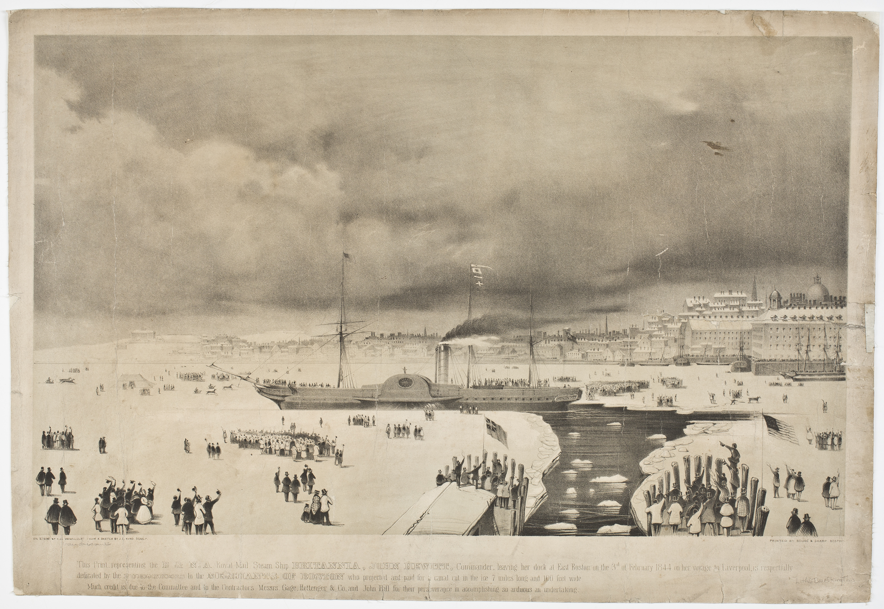
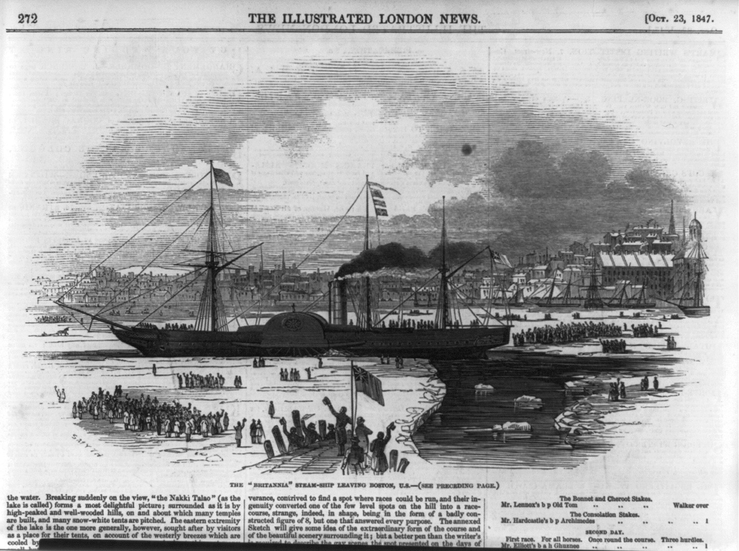
Also filed under: "Britannia" (Cunard Steamship) »
1853
Bostonian Society (1884.0209)
Also filed under: Scott, John W. A. »
1 print : lithograph, tinted ; image 50.3 x 111.9 cm., 68.7 x 121.2 cm.
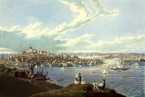
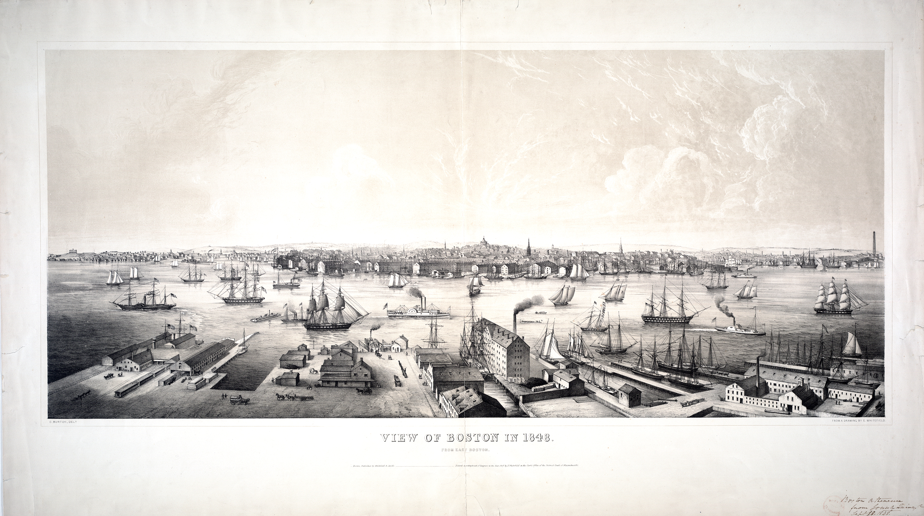
View of the city of Boston from East Boston showing Boston Harbor. The wharves of East Boston can be seen in the foreground.
Number nine of thirty-eight city views published in "Whitefield's Original Views of (North) American Cities (Scenery).
On stone by Charles W. Burton after a drawing by Edwin Whitefield.
Inscribed in brown ink lower right corner of sheet: "Boston Athenaeum from Josiah Quincy. September 28, 1848."
Local Notes:#1848.1.