An online project under the direction of the CAPE ANN MUSEUM
Union School
View related Fitz Henry Lane catalog entries (3) »
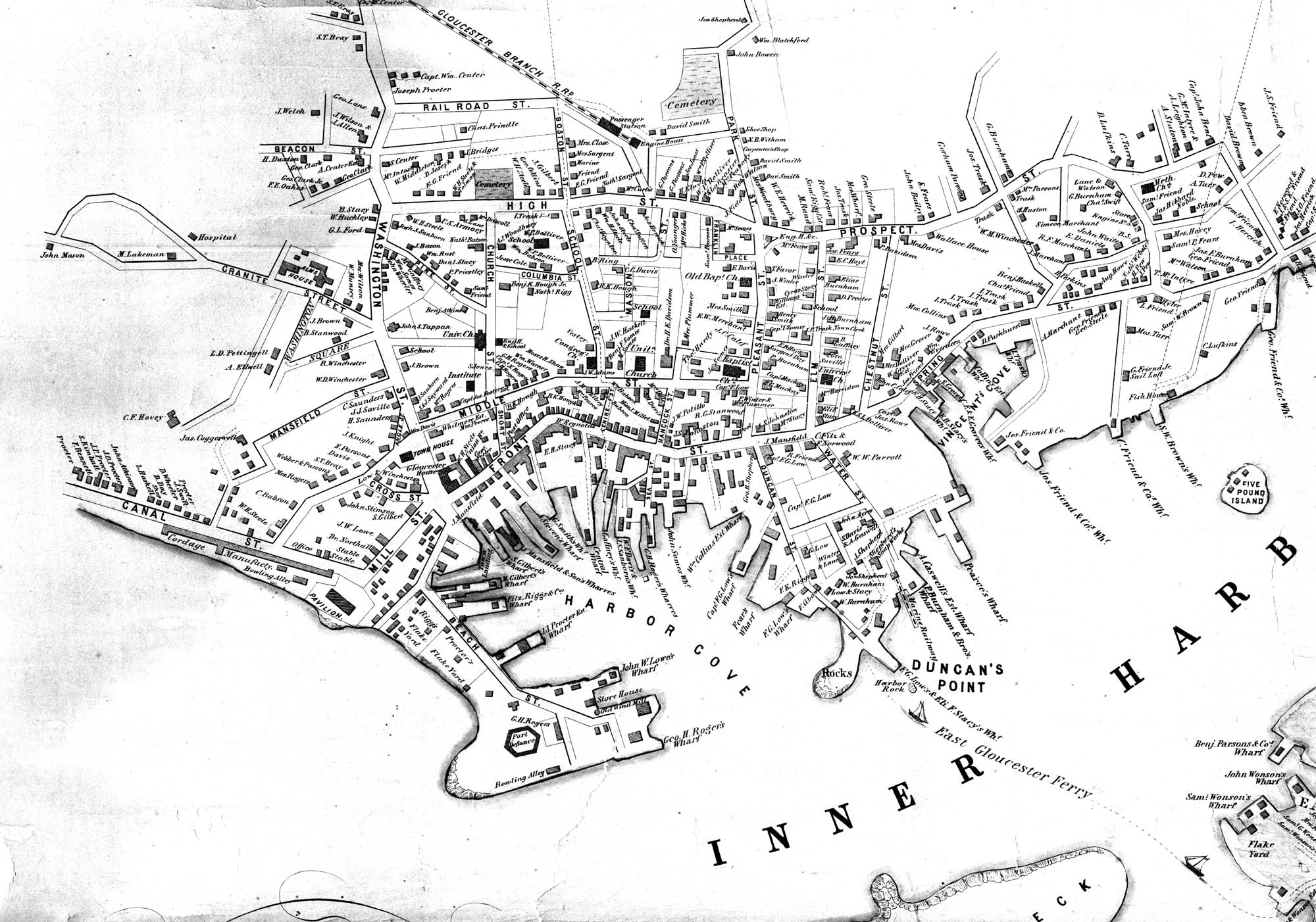
The Union School was built in 1823, as one of Gloucester's public district schools in 1823. It was situated on land lying between High Street (now called Prospect) and Columbia Streets near what is now the site of McPherson Park. (In the Walling map below it is in the middle of the block bordered by Church, Columbia, High, and School Streets.) While Lane went to school, the number of such district schools increased from eleven in 1804 to twenty-three by 1840. This Union School was one of them, and stood for the rest of Lane's life. The land, given by Mrs. Abigail Collins, was the southern portion of the present lot, being that portion closer to Columbia Street. In the 1860s, more land was purchased and in 1864 the Collins School was built closer to Prospect Street. The original Union School, by now called the "old Collins School House," was not torn down until after Lane’s death, when it was auctioned off and purchased by F.E. Riggs in November 1865, along with its blocking and lumber and the privy, for $1,152. John W. Lurvey, a carpenter who lived around the corner on Washington Street, was hired to prepare it for sale, and he received $16.50 for six days' work. The second Collins School, was demolished in 1947. McPherson Park, an elderly housing complex, opened in 1976 and still stands on this lot.
Address: 31 Prospect Street, known as High Street in Lane's time.
– Sarah Dunlap (May, 2014)
44 x 34 in.
Henry Francis Walling, Map of the Towns of Gloucester and Rockport, Essex Co. Massachusetts. Philadelphia, A. Kollner, 1851
Cape Ann Museum Library & Archive
"Map of the Towns of Gloucester and Rockport, Massachusetts. H.F. Walling, Civil Engineer. John Hanson, Publisher. 1851. Population of Gloucester in 1850 7,805. Population of Rockport in 1850 3,213."
Segment of Harbor Village portion of map showing Lane-Winter property on Duncan's Point.
Also filed under: Duncan's Point » // Maps » // Winter, Ignatius »