An online project under the direction of the CAPE ANN MUSEUM
Catalogue Entry
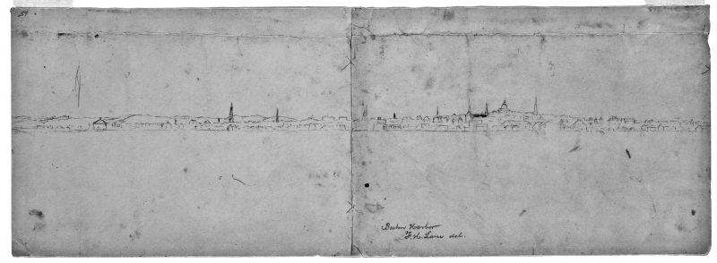
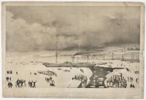
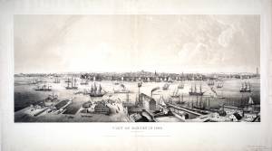
This surprisingly small drawing of Boston’s skyline, as viewed from Governor’s Island looking westward, appears to be the basis for the skylines in several paintings post-dating 1853. Those works include Boston Harbor, c.1850 (inv. 48), Boston Harbor, 1856 (inv. 203), Boston Harbor, Sunset, 1850–55 (inv. 242), and Boston Harbor, 1854 (inv. 341), all of them showing the steeple of the First Baptist Church (to the right of the State House) which was completed in 1853. In its present state, the drawing is made up of two sheets, lapped and glued, with register (X) marks which suggest that the parts were drawn separately and joined later. There is also a single register (X) mark on the upper right margin, but no other physical evidence that a third sheet was linked in some way.
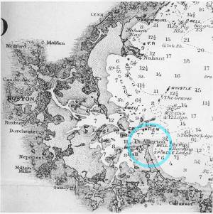
Lane’s viewing point – Governor’s Island – was determined from analyses of charts of Boston Harbor published by the U.S. Coast Survey. Locations and identities of prominent buildings in the drawing were established from a street map in an 1847 edition of “The Boston Almanac and Directory” and transferred to the street plan in the Coast Survey chart. Their relative locations on the skyline were projected from the viewing point on Governor’s Island to a base line at the margin of the chart (see below, left margin). (1)
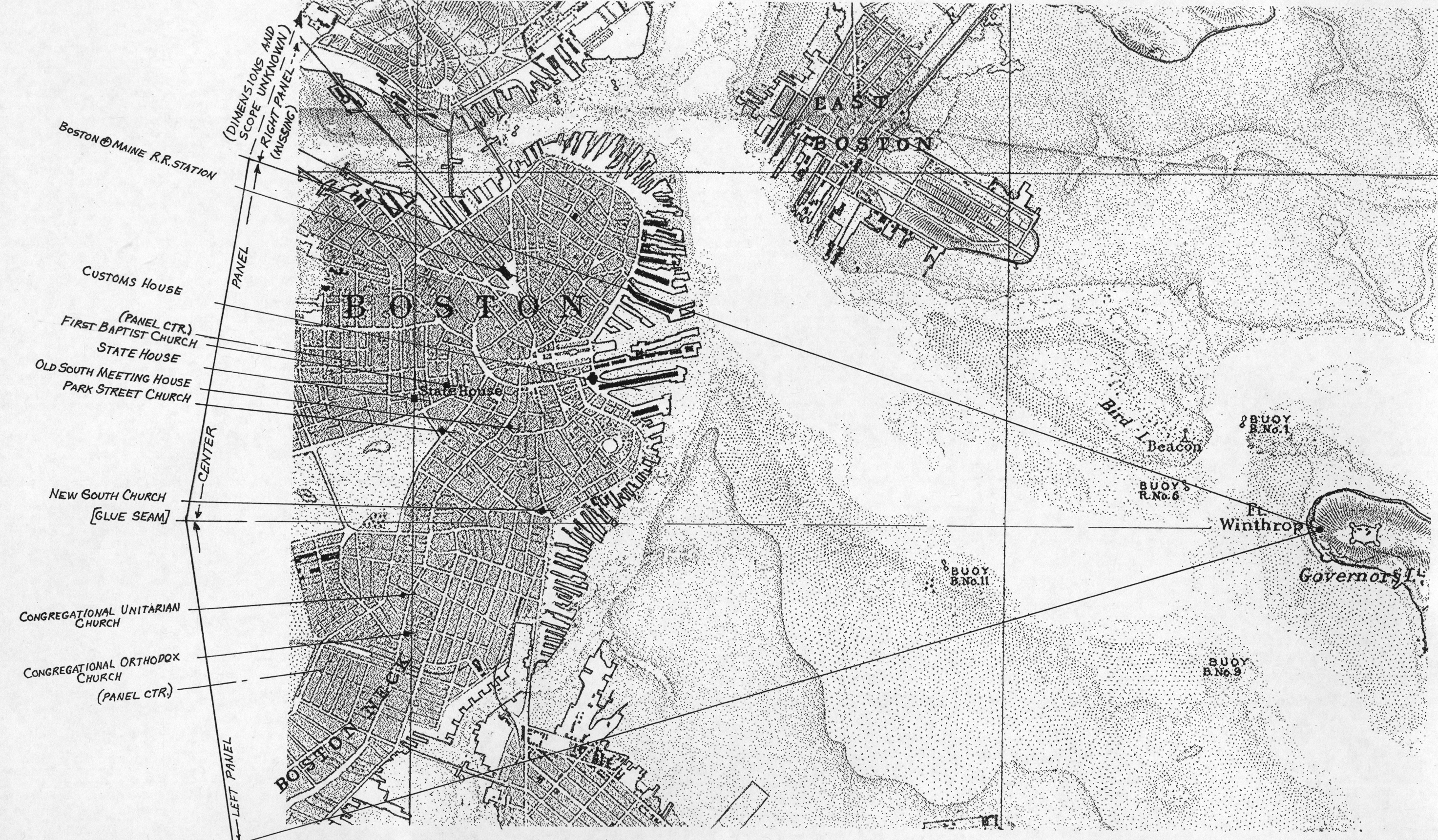
The base line with its building locations was then scaled to match the width of the drawing and the intercept mark for each building was labeled. Locations of corresponding buildings were then marked (in red) to show how closely they agreed with the chart (see below). It should be noted that the U.S. Coast Survey used the finest (i.e. European-made) surveying equipment of the period, with many of its cartographers recruited from European surveying and mapmaking firms and agencies. The resulting charts were equal in accuracy to comparable examples from Europe. (2)
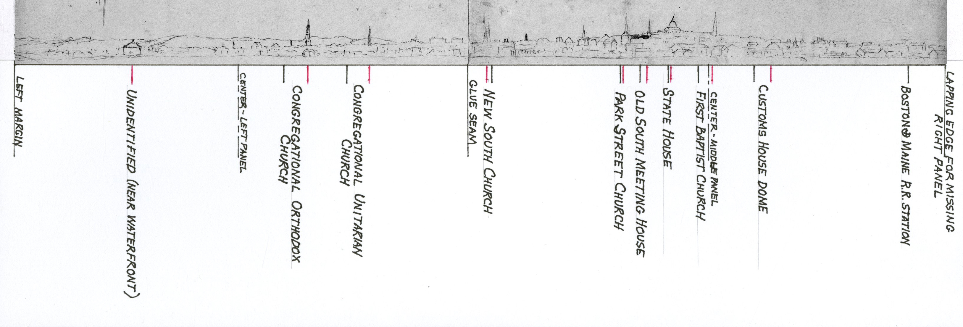
Comparison of Lane’s drawing with projections of specific building locations from the U.S. Coast Survey’s 1857 chart of Boston Harbor are in close, if not perfect, agreement, suggesting the use of a viewing aid which was probably fitted with grid lines. The recto sheet was very close for most buildings; the verso sheet had only two locations to compare, and both were almost identical in degree, suggesting that its part of the skyline was viewed separately with slight misjudgement of where the two sheets were to be joined.
The drawing in its present state indicates that it either had a third section showing Boston’s North End and parts of Charles Town and East Boston, or it was an up-dated part of an older drawing, but never joined to it permanently. The skyline in , which includes this missing part of Boston Harbor, suggests that Lane drew a far broader view of Boston Harbor than what has survived.
–Erik Ronnberg
References:
1. “The Boston Almanac for the Year 1843” (Boston, MA: S.N. Dickinson, 1843), pp. 66–126 (general listing of churches).
“The Boston Almanac for the Year 1854” (Boston, MA: Damrell & Moore, and George Coolidge, 1854), pp. 56, 57 (First Baptist Church).
2. Alex Krieger and David Cobb, with Amy Turner, “Mapping Boston” (Cambridge, MA: MIT Press, 1999), pp. 62–64, 112.
- Subject Types
: - Massachusetts Locales
:
Historical Materials
1837 9 x 14 in. Cape Ann Museum Library & Archive
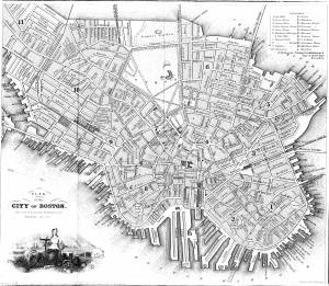
Showing Lane's neighborhood while working in Boston. Lane had studios at the intersection of Washington and State Streets, Summer, Tremont and School Streets.
Also filed under: Lane & Scott's, Lith. – Boston » // Maps » // Professional » // Residences » // Tremont Temple »
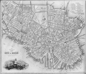
1847 Map insert to Boston Almanac and Directory Cape Ann Museum Library & Archive
Also filed under: Maps » // Residences » // Tremont Temple »
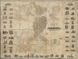
Printed map inside Boston Almanac
Published by B. B. Mussey & Co. and Thomas Groom, Boston
Cape Ann Museum Library & Archive (R910.45 B65 1848)
Map at front of almanac with Tremont Temple highlighted.
Also filed under: Boston Harbor » // Maps » // Tremont Temple »
1852 Boston Boston Public Library: Norman B. Leventhal Map Center Call Number: G3764.B6 1852.M35
Also filed under: Maps » // Residences »
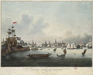
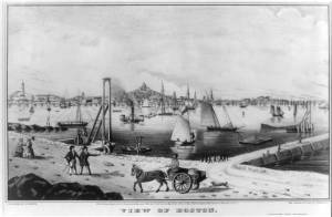
During the years after the war of 1812 and before the Civil War, the port of Boston was a center of American deep-water shipping. Trading with China, India, and the West Indies, which had fueled maritime growth in the early years of the century gave way to re-exporting these goods and foreign trade based on the shoe and textile trades. Although second to New York in terms of shipping tonnage, many of New York's shipbuilders and merchants were Boston based. In addition, ship building continued in Boston. Also, the coastal trade (the domestic trade up and down the coast) was still the most efficient way to transport goods and passengers, and accounts for much of the tonnage and shipping traffic.
Although dwarfed by New York, Boston was an active port in the 1840s and 1850s. Its registered tonnage rose from 149,186 in 1840 to 270,510 in 1850. The harbor was a crowded place. For example, on September 18, 1850, 32 ships, 49 barks, 47 brigs, and 52 schooners were reported at Boston.(1)
In 1849, foreign entries at Boston included 215 ships, 305 barks, 908 brigs, and 52 schooners. Coastwise arrivals included 193 ships, 488 barks, 1087 brigs, 4287 schooners, 89 sloops, and 65 schooners.(2)
(1) W.H. Bunting, p.8.
(2) Ibid.
For more information:
Samuel Eliot Morrison, The Maritime History of Massachusetts, 1783-1860
W.H. Bunting, Portrait of a Port, Boston 1852-1914 Cambridge: The Belknap Press of Harvard University, 1971.
Printed map inside Boston Almanac
Published by B. B. Mussey & Co. and Thomas Groom, Boston
Cape Ann Museum Library & Archive (R910.45 B65 1848)
Map at front of almanac with Tremont Temple highlighted.
Also filed under: Boston City Views » // Maps » // Tremont Temple »
Harvard Depository: Widener (NAV 578.57)
For digitized version, click here.
Also filed under: Signal Systems (Flags & Maritime Codes) »
Tinted lithograph with hand coloring
13 7/8 x 22 3/8 in.
Boston Athenaeum
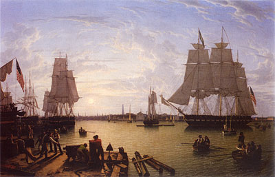
From Sally Pierce and Catharina Slautterback, Boston Lithography, 1825–1880: The Boston Atheneaum Collection (Boston: Athenaeum, 1991): "Tidd drew this print when he was a consulting engineer for Simpson's. He has depicted the clipper ship 'Southern Cross' in the dry dock. Built in 1851, she was known for having sailed from San Francisco to Hong Kong in the record breaking time of thirty-two days. The Bethlehem Ship Building Company eventually took over this location and operated a dry dock there until the mid 1940s."
Also filed under: "Southern Cross" (Clipper Ship) » // M. M. Tidd, Lith. – Boston »
Library of Congress Catalog Number 2004671768
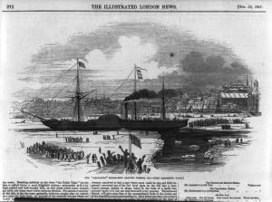
Also filed under: "Britannia" (Cunard Steamship) »
1853
Bostonian Society (1884.0209)
Also filed under: Scott, John W. A. »
1 print : lithograph, tinted ; image 50.3 x 111.9 cm., 68.7 x 121.2 cm.
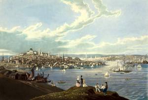
View of the city of Boston from East Boston showing Boston Harbor. The wharves of East Boston can be seen in the foreground.
Number nine of thirty-eight city views published in "Whitefield's Original Views of (North) American Cities (Scenery).
On stone by Charles W. Burton after a drawing by Edwin Whitefield.
Inscribed in brown ink lower right corner of sheet: "Boston Athenaeum from Josiah Quincy. September 28, 1848."
Local Notes:#1848.1.
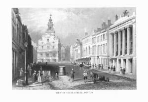
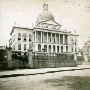
The "new" State House is located across from the Boston Common on the top of Beacon Hill, and serves as the Massachusetts state capital. The land was once owned by Massachusetts's first elected governor, John Hancock. Charles Bullfinch was the architect of the building, which was completed in 1798.
The dome was originally roofed with wood shingles, which leaked. In 1802 it was covered with copper by Paul Revere's Revere Copper Company. The dome was first painted gray and then light yellow before being gilded with gold leaf in 1874.
lithograph
1832
"Salmon pinxt" at lower left; "Pendleton, Boston" at lower right
Also filed under: Pendleton's, Lith. – Boston » // Salmon, Robert »
Lithograph
Published by N. Currier, New York
Library of Congress Catalog Number 2002698122
Also filed under: Currier (& Ives) – New York »
Marks: Inscribed upper left (in red ink): 59 [numbering system used by curator A. M. Brooks upon Samuel H. Mansfield's donation of the drawings to the Cape Ann Museum]