An online project under the direction of the CAPE ANN MUSEUM
Historical Materials: Cape Ann Locales
Historical Materials » Cape Ann Locales » Town / Public Landings
You have navigated to this pages from catalog entry: Gloucester Harbor, 1852 (inv. 38)
Town / Public Landings
View related Fitz Henry Lane catalog entries (5) »
From Colonial times to the present, Gloucester and other shore-side communities have maintained certain tracts of land as public landings, assuring everyone the right of free access to and from tidal waters. Such ways are carefully delineated in deeds, are to be kept clear of encumbrances and be available for all to pass over. For communities like Gloucester whose economies were based solidly on maritime pursuits throughout the eighteenth and nineteenth centuries, allowing access to navigable waters was essential.
Public landings were designated across Cape Ann including at Folly Cove, the historic Town Green, Done Fudging, Lobster Cove, Cripple Cove and Stanwood Point in West Gloucester. While public access to the water has gradually constricted in recent decades, even during Fitz Henry Lane’s lifetime, landowners guarded their property rights fiercely, making public landings all that more important.
Gloucester's first public landing was on the Annisquam River at the site of the old First Parish (now occupied by the Grant Circle rotary where Route 128 intersects Washington Street). Given the shallows of the river, most goods had to be landed in scows or gundalows—goods such as marsh hay, lumber, livestock, domestic needs, and business wares—in short, everything from the rest of the world.
As one of the earliest pockets of settlement in Gloucester, Fresh Water Cove was another logical and practical place for a public landing to be located and indeed one was laid out there by the town’s founders. It was over that tract of land that granite from the upland quarry, located in what is now Ravenswood, was transported to awaiting sloops in the Cove. The landing was also how shore fishermen would access their boats and carry supplies to and from their homes.
– Martha Oaks
Related tables: Done Fudging » // Fresh Water Cove » // Gundalow / Scow » // Salt Marsh Hay / English Hay »
44 x 34 in.
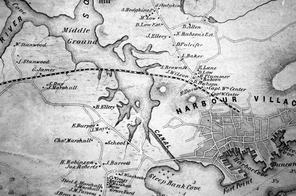
Henry Francis Walling, Map of the Towns of Gloucester and Rockport, Essex Co. Massachusetts. Philadelphia, A. Kollner, 1851
Cape Ann Museum Library & Archive
"Map of the Towns of Gloucester and Rockport, Massachusetts. H.F. Walling, Civil Engineer. John Hanson, Publisher. 1851. Population of Gloucester in 1850 7,805. Population of Rockport in 1850 3,213."
Also filed under: Babson House » // Cut, The (Stacy Blvd.) » // White-Ellery House »
24 x 38 in.
Gloucester City Archives
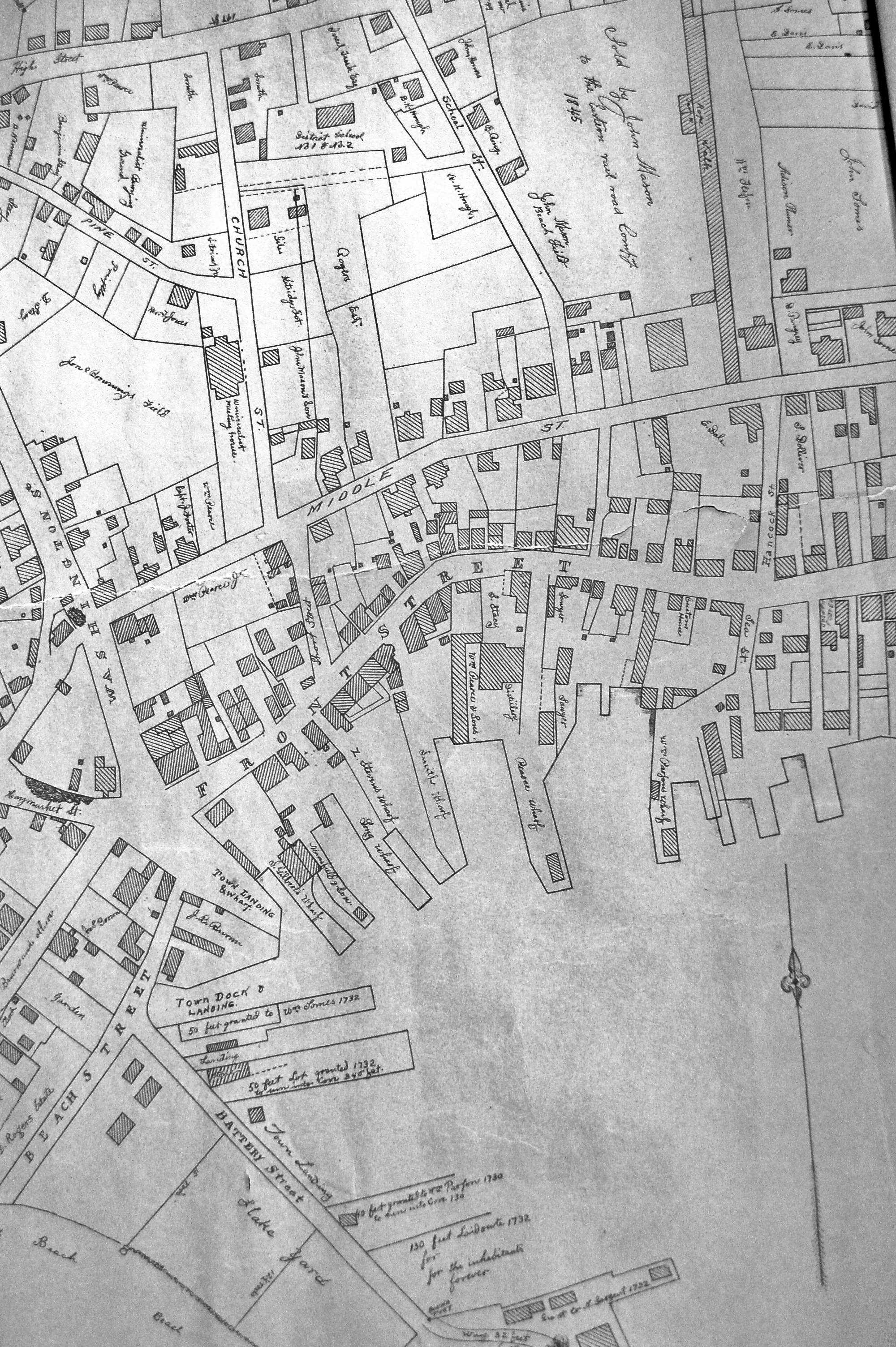
"Drawn on a scale of one hundred feet to an inch. By John Mason 1834–45 from Actual Survey showing every Lott and building then standing on them giving the actual size of the buildings and width of the streets from the Canal to the head of the Harbour & part of Eastern point as farr as Smith's Cove and the Shore of the same with all the wharfs then in use. Gloucester Harbor 1834–35."
This map is especially helpful in showing the wharves of the inner harbor at the foot of Washington Street.
View related Fitz Henry Lane catalog entries (1) »
Also filed under: Dale, Eben B. » // Eastern Railroad » // Flake Yard » // Gloucester Harbor, Inner / Harbor Cove » // Hough, Benjamin Kent » // Maps » // Pavilion (Publick) Beach » // Ropewalk » // Sawyer, Samuel » // Universalist Church (Middle and Church Streets) »
24 x 38 in.
Gloucester City Archives
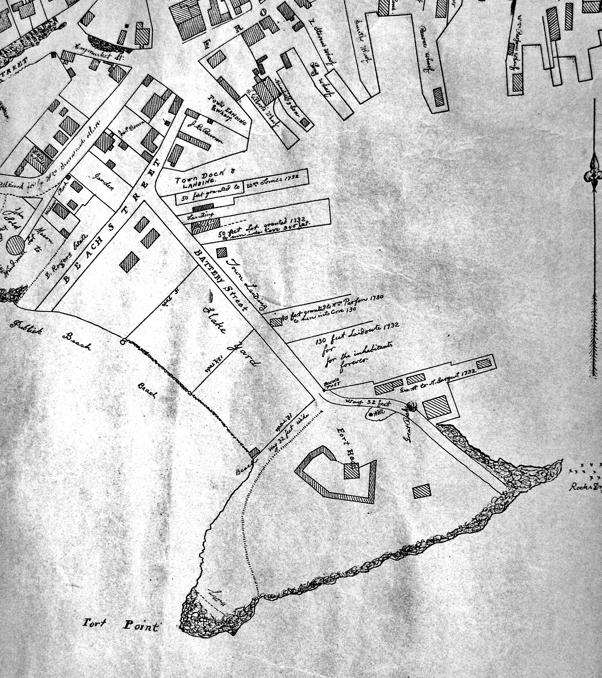
"Drawn on a scale of one hundred feet to an inch. By John Mason 1834–45 from Actual Survey showing every Lott and building then standing on them giving the actual size of the buildings and width of the streets from the Canal to the head of the Harbour & part of Eastern point as farr as Smith's Cove and the Shore of the same with all the wharfs then in use. Gloucester Harbor 1834–35."
This map is especially useful in showing the Fort.
Also filed under: Flake Yard » // Fort (The) and Fort Point » // Maps » // Mason, John » // Pavilion (Publick) Beach »
44 x 34 in.
John Hanson, Publisher
Cape Ann Museum Library & Archive
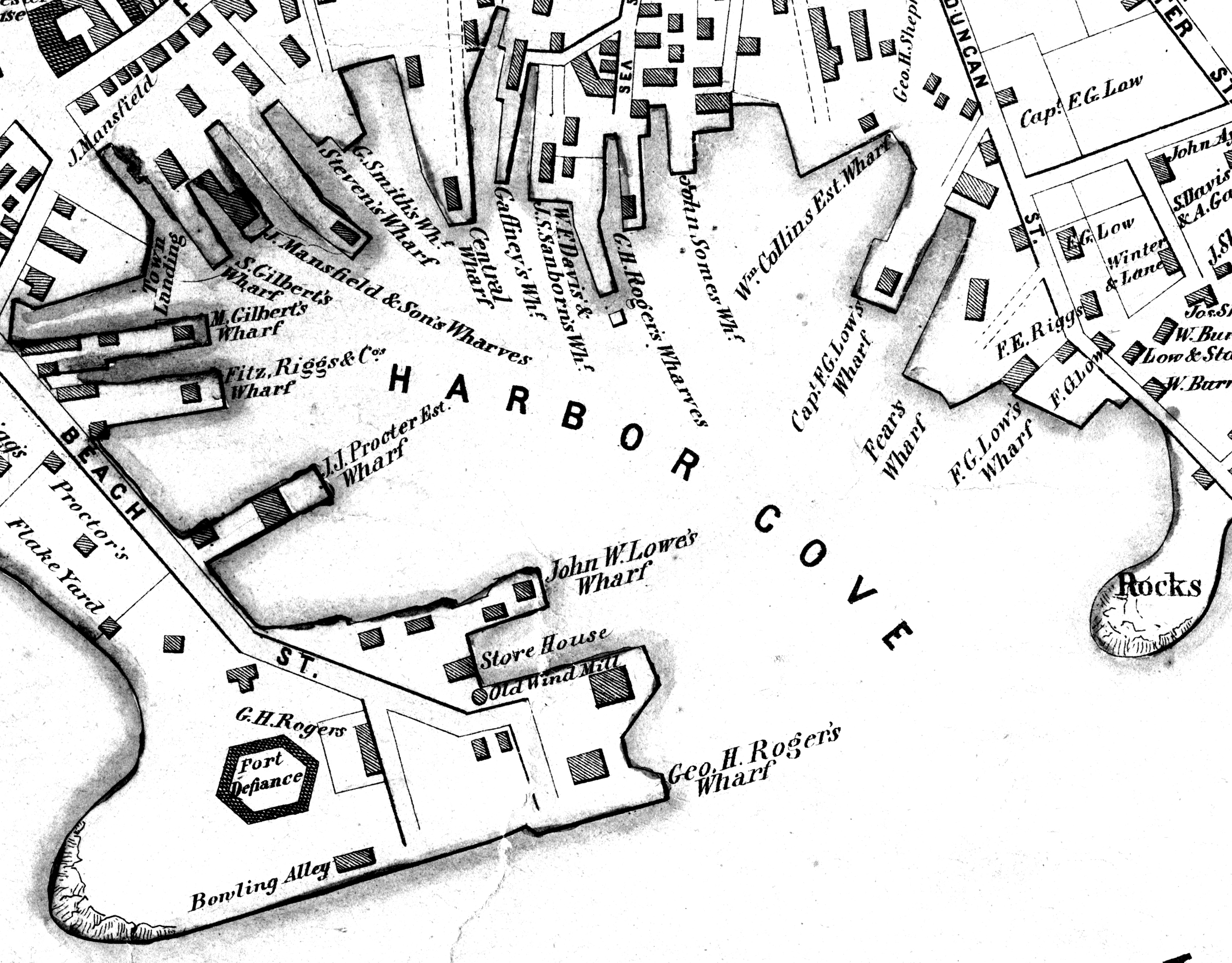
"Map of the Towns of Gloucester and Rockport, Massachusetts. H.F. Walling, Civil Engineer. John Hanson, Publisher. 1851. Population of Gloucester in 1850 7,805. Population of Rockport in 1850 3,213."
Also filed under: Fort (The) and Fort Point » // Low (Frederick G.) wharves » // Maps » // Rogers's (George H.) wharves » // Waterfront, Gloucester » // Windmill »