An online project under the direction of the CAPE ANN MUSEUM
Salt Island
Essay to come.
Related tables: Good Harbor Beach / Bass Rocks »
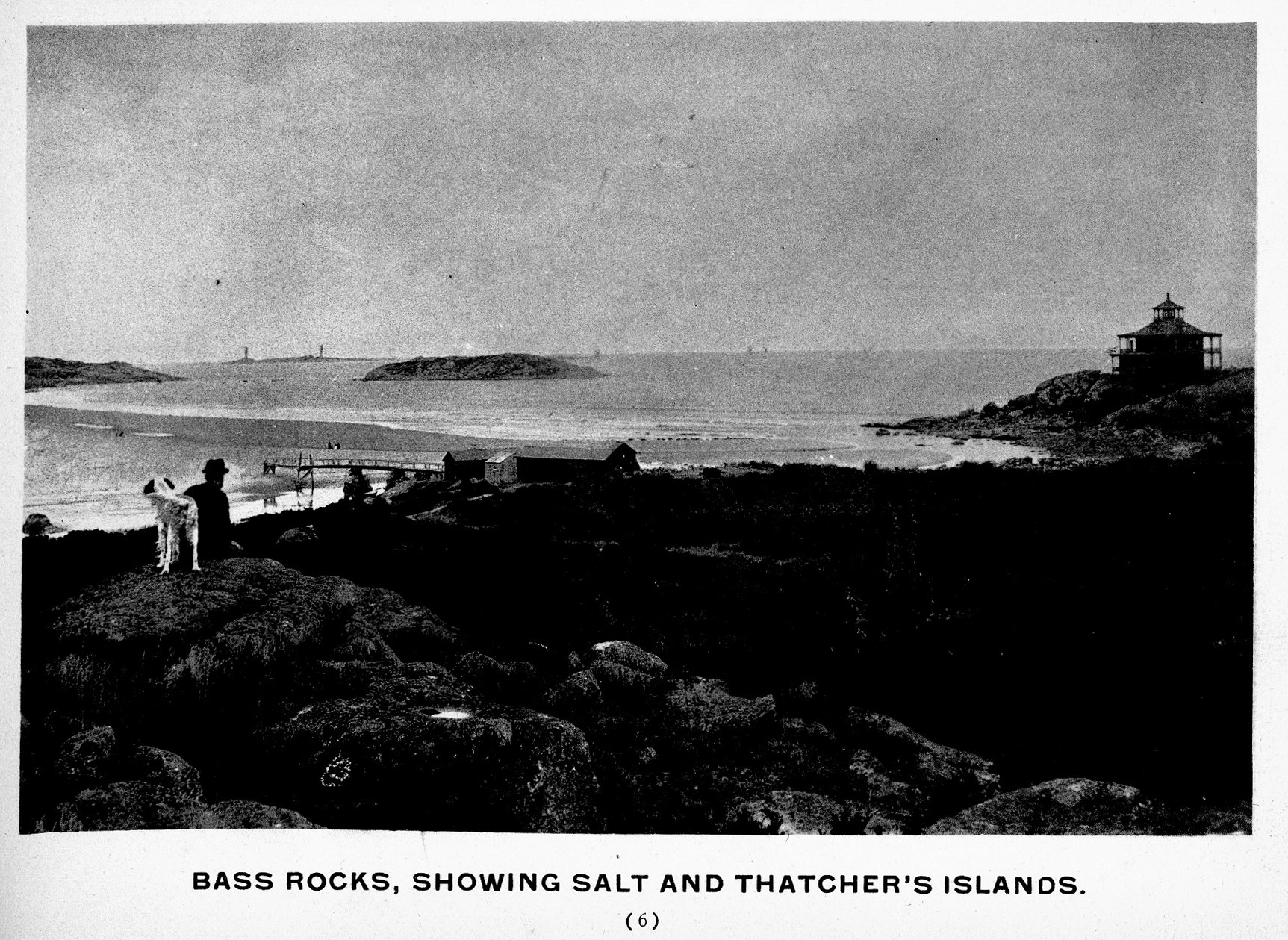
From Gloucester Picturesque, c.1900.
Also filed under: Thacher Island »
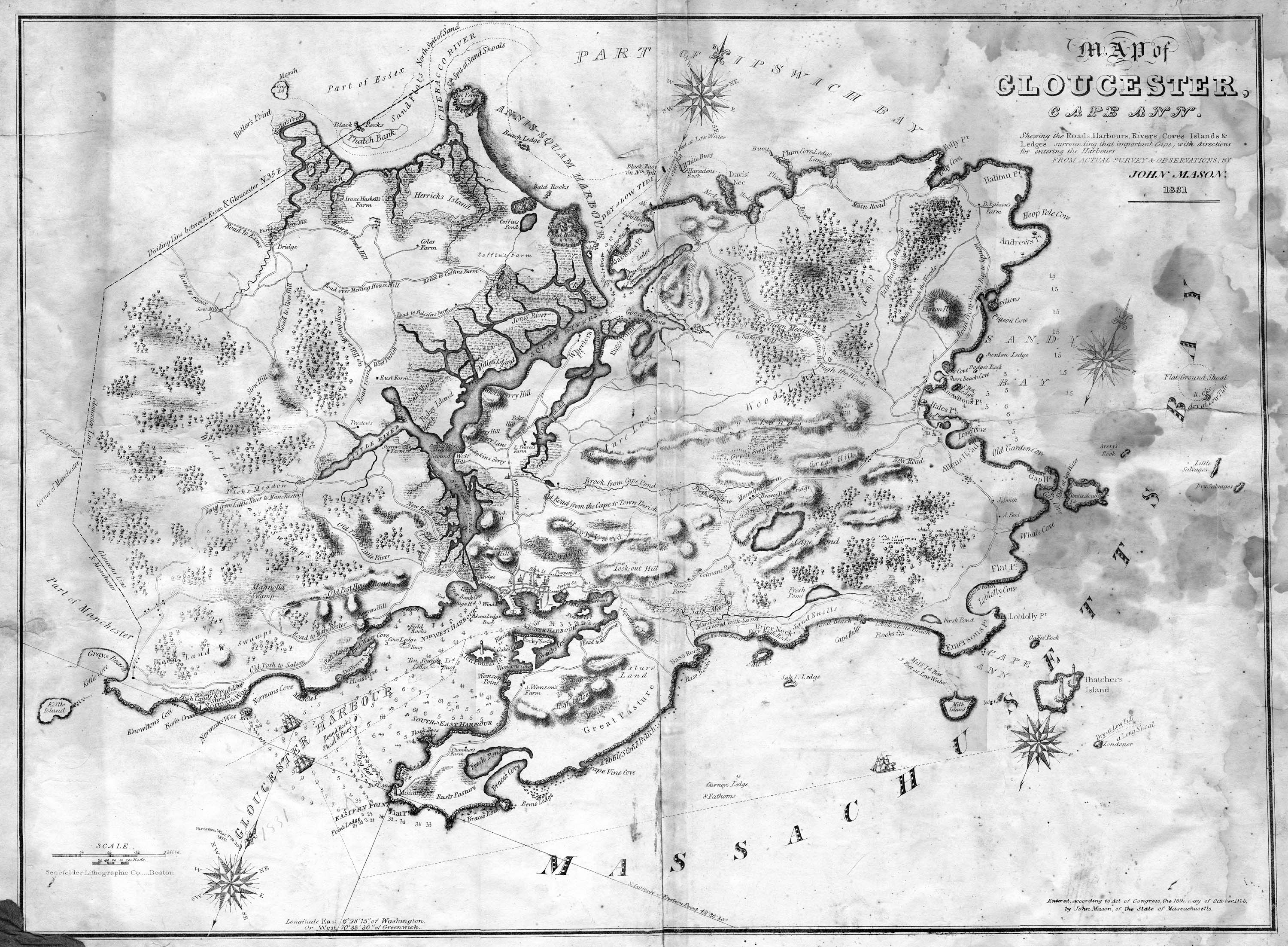
Lithograph
28.5 x 21 in.
Cape Ann Museum Library & Archive
When Massachusetts decreed that each town be mapped, John Mason drew the map of Cape Ann in 1830. This drawing was sent to the Senefelder Lithographic Company of Boston (owned by William Pendleton) to be printed, and then sold in Gloucester by W.E.P. Rogers, whose Gloucester Telegraph of February 12, 1831 announced, "A few specimen copies of the map, uncolored, have reached the town" and that they cost $1.25. Perhaps this business arrangement between Pendleton and Rogers provided Lane with his introduction to Pendleton.
Also filed under: Folly Cove » // Good Harbor Beach / Bass Rocks » // Maps » // Mason, John » // Meetinghouse Green » // Pendleton's, Lith. – Boston » // Thacher Island »
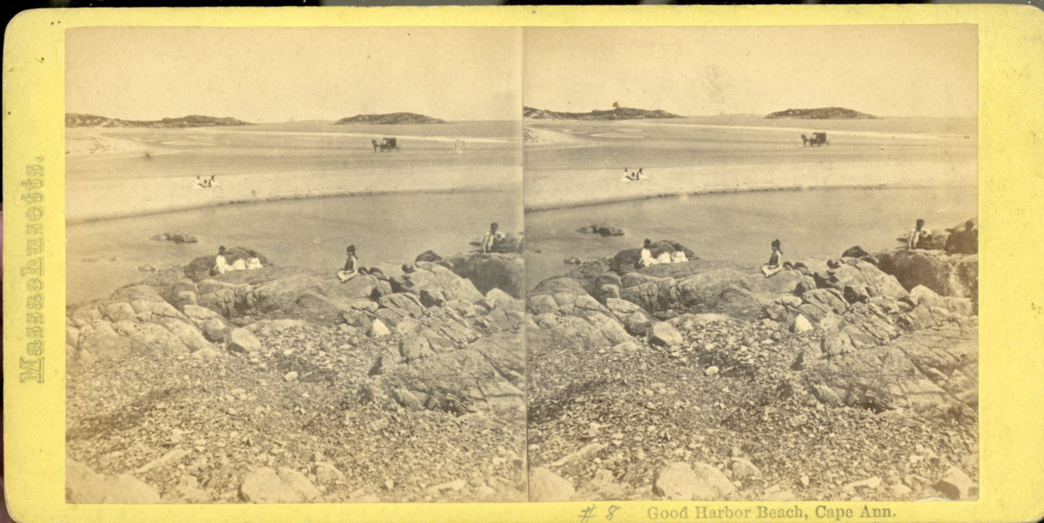
Stereograph card
Cape Ann Museum Library & Archive
Stereo view
Little Good Harbor Beach looking towards the Farms
Also filed under: Good Harbor Beach / Bass Rocks » // Historic Photographs »

