An online project under the direction of the CAPE ANN MUSEUM
Thacher Island
View related Fitz Henry Lane catalogue entries (2) »
In 1635 Anthony Thacher and his wife were the only survivors from a shipwreck off the island. As compensation for the loss of his four children and cousins, the General Court gave the island to Thacher. The island became known as "Thacher's Woe" and remained in the family for 80 years. In 1771 the Province of Massachusetts Bay Council passed a bill for the erection of a lighthouse on Thacher Island and purchased the island from the heirs of Anthony Thacher. The name seems to have been Thacher's Island in the nineteenth century, although currently is known as Thacher Island.
The name of the island is variably spelled with and without a second "t."
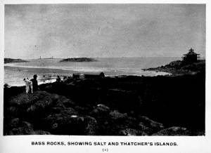
From Gloucester Picturesque, c.1900.
Also filed under: Salt Island »
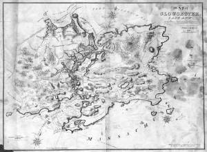
Lithograph
28.5 x 21 in.
Cape Ann Museum Library & Archive
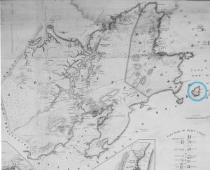
When Massachusetts decreed that each town be mapped, John Mason drew the map of Cape Ann in 1830. This drawing was sent to the Senefelder Lithographic Company of Boston (owned by William Pendleton) to be printed, and then sold in Gloucester by W.E.P. Rogers, whose Gloucester Telegraph of February 12, 1831 announced, "A few specimen copies of the map, uncolored, have reached the town" and that they cost $1.25. Perhaps this business arrangement between Pendleton and Rogers provided Lane with his introduction to Pendleton.
Also filed under: Folly Cove » // Good Harbor Beach / Bass Rocks » // Maps » // Mason, John » // Meetinghouse Green » // Pendleton's, Lith. – Boston » // Salt Island »
Newsprint
Cape Ann Advertiser
Collection of Fred and Stephanie Buck
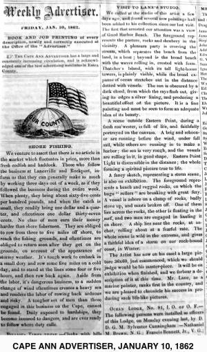
"VISIT TO LANE'S STUDIO.
We called at the studio of this artist a few days ago, and found several new paintings had been added to his collection since our last visit. The first that arrested our attention was a view of Good Harbor Beach. . . .
A scene outside Eastern Point, during a fresh sou'wester, is full of life, and faithfully portrayed on the canvass. . . .
A fancy sketch, representing a storm scene, is also on exhibition. . . .
The Artist has now on his easel a large picture 36x60, just commenced, which we should judge would be his master-piece. It will be on exhibition when finished, and we forbear a description of it at this time. Mr. Lane, as a marine painter, ranks first in the country, and we are pleased to chronicle his success in producing such life-like pictures."
Newspaper clipping
Cape Ann Advertiser
Collection of Fred and Stephanie Buck
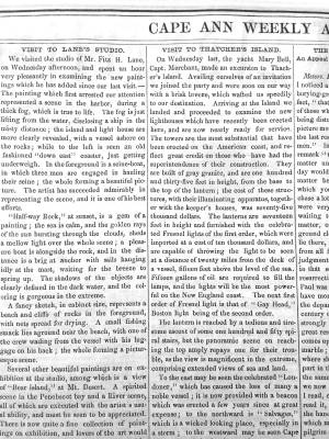
About a visit to the new lighthouse:
"VISIT TO THATCHER'S ISLAND.
On Wednesday last, the yacht Mary Bell, Capt. Merchant, made an excursion to Thatcher's Island. Availing ourselves of an invitation we joined the party and were soon on our way with a brisk breeze, which wafted us speedily to our destination. Arriving at the Island we landed and proceeded to examine the new lighthouses which have recently been erected here, and are now nearly ready for service. The towers are the most substantial that have been erected on the American coast, and reflect great credit on those who have had the superintendence of their construction. . . "
Also filed under: Newspaper / Journal Articles » // Rockport, Mass. - Thacher Island Twin Lighthouses »
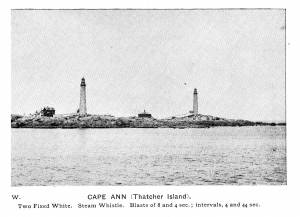
Photograph
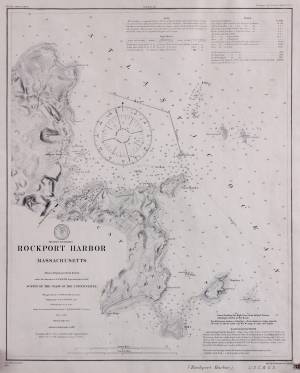
From The Illustrated Coast Pilot with sailing directions. The Coast of New England from New York to Eastport, Maine including Bays and Harbors, published by N. L. Stebbins, Boston, Mass.
Also filed under: Rockport, Mass. - Thacher Island Twin Lighthouses »
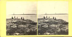
c.1870 Stereograph card Cape Ann Museum Library & Archive
Also filed under: Historic Photographs » // Rockport, Mass. - Thacher Island Twin Lighthouses »
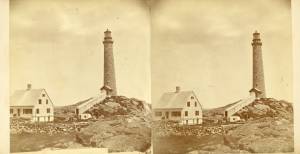
c.1870 Stereograph card Cape Ann Museum Library & Archive
Also filed under: Historic Photographs » // Rockport, Mass. - Thacher Island Twin Lighthouses »
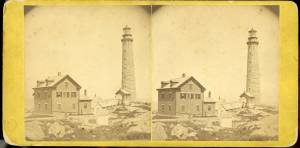
c.1870 Stereograph card Cape Ann Museum Library & Archive
Also filed under: Historic Photographs » // Rockport, Mass. - Thacher Island Twin Lighthouses »
Survey of the Coast of the United States, Washington, D.C.
Collection of Erik Ronnberg
Also filed under: Maps »