An online project under the direction of the CAPE ANN MUSEUM
Historical Materials: Cape Ann Locales
Historical Materials » Cape Ann Locales » Riverdale / Town Parish
You have navigated to this pages from catalog entry: View Across the Marsh and Mill Pond in Town Parish, 1863 (inv. 119)
Riverdale / Town Parish
View related Fitz Henry Lane catalog entries (5) »
Riverdale is one of Gloucester’s many neighborhoods. Although its boundaries have never been formally set, it runs from the historic Town Green north around the shores of the Mill River. Dogtown is upland and Wheeler’s Point is to the west. Landmarks in the neighborhood over the years have included a dam built across the upper end of the Mill River; a corn mill which ran off tidal waters that flowed out of a pond created by the dam; Poles Hill, a huge granite outcropping at the intersection of what are now Wheeler and Washington Streets; a Methodist meeting house; and the original Town Green. A history of the neighborhood, privately printed in 1950 and available in the archives of the Cape Ann Museum, has this to say about the derivation of the name Riverdale:
"This section of the town (of Gloucester) has long borne the name 'Riverdale,' said to have been given it in 1859 by Lodowick H. Bradford, a Boston man who married into the Brown family which then owned the mills. The name does not appear in Babson’s History; he alludes to the section as the 'old town.' It kept its purely Yankee population and character longer than most other parts of the city."
– Martha Oaks (2015)
Related tables: Bradford, L. H. » // Meetinghouse Green » // Old First Parish / Subsequent Fourth Parish Church (at the Green) » // Pole's Hill » // Riverdale Methodist Church (Washington Street) » // Riverdale Mills »
Stereograph card
Cape Ann Museum Library & Archive
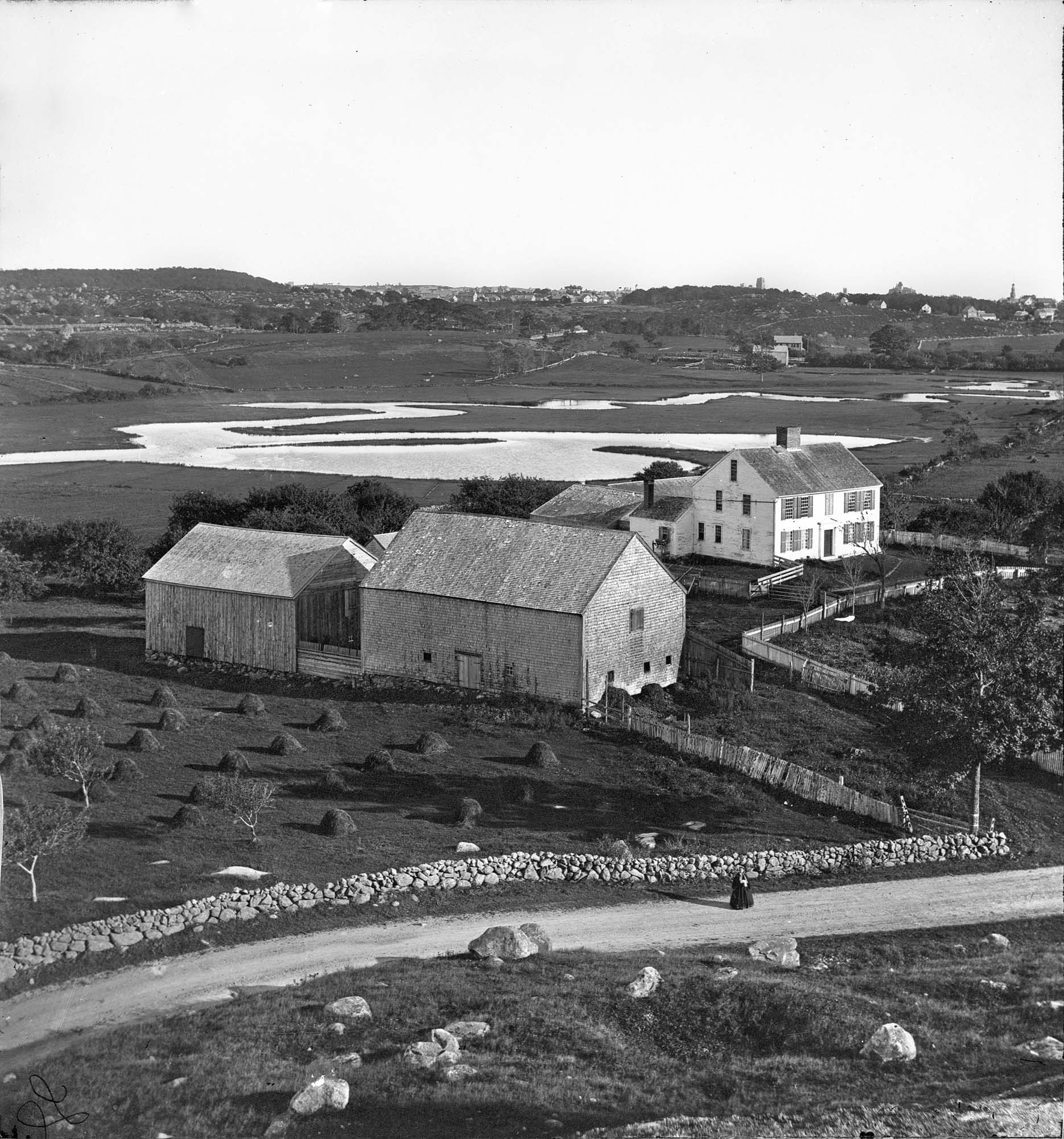
View of the Babson Farm taken from Pole's Hill, showing the old Murray Meeting House (rear section of barn), fields and Mill River. In the background is the skyline of the major buildings at Harbor Village, including the first version of City Hall destroyed by fire in 1869.
Also filed under: Babson House » // Universalist (Original) Meeting House (Sargent) »
Cape Ann Museum Library & Archive
Grayscale version of color original
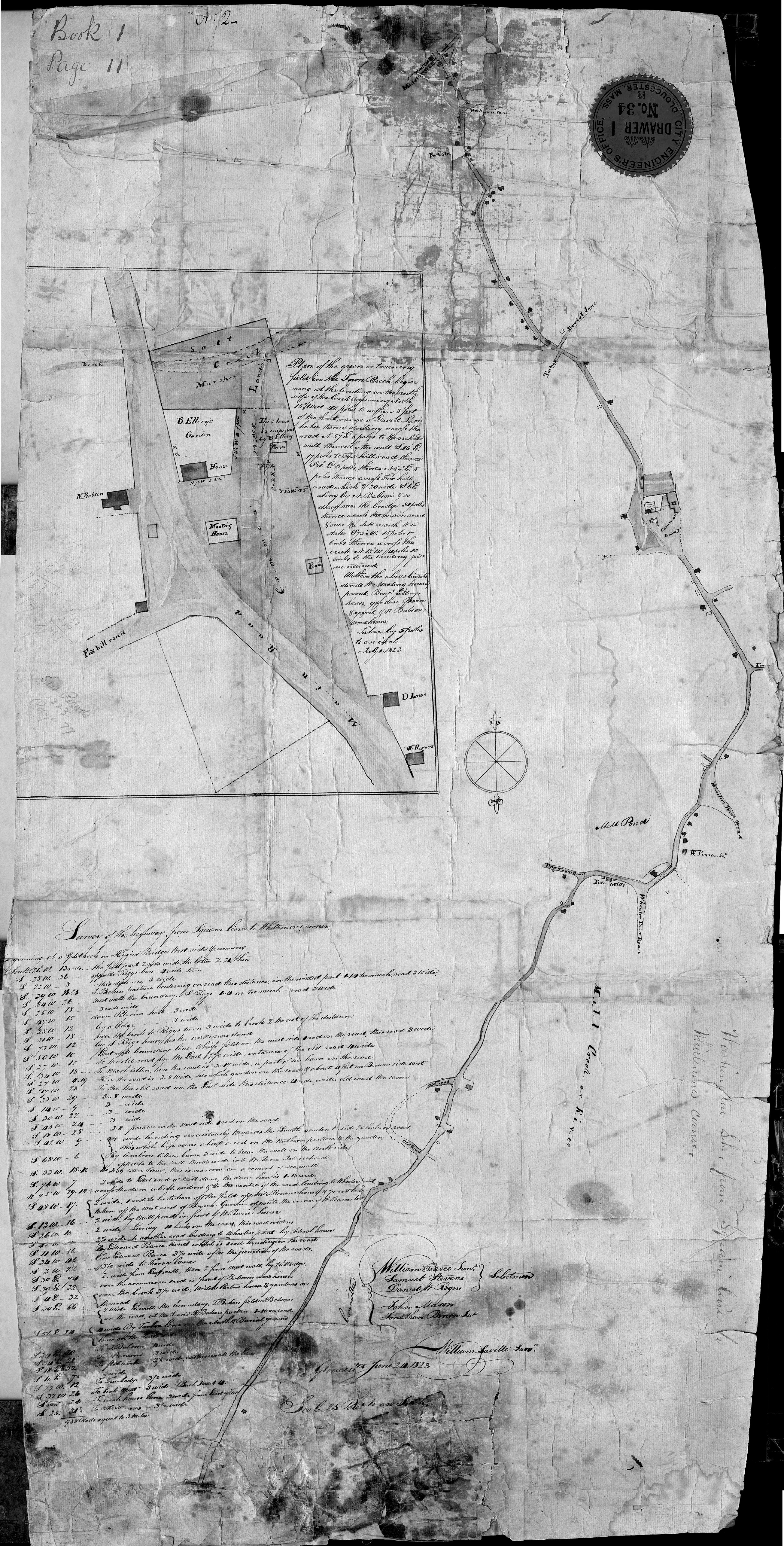
Map of Riverdale from the Mills to the Whittemore House at Middle and Washington Streeets ordered by a committee of selectmen, William Pearce, Samuel Stevens, Daniel H. Rogers with John Mason and Anthony Presson. Map drawn by surveyor William Saville and present to the committee in June, 1823. It contains a enlarged view of The Green, including the Ellery and Babson houses painted by Lane.
Also filed under: Babson House » // Low (David) House » // Maps » // Meetinghouse Green » // Riverdale Mills »
Postcard
Cape Ann Museum Library & Archive
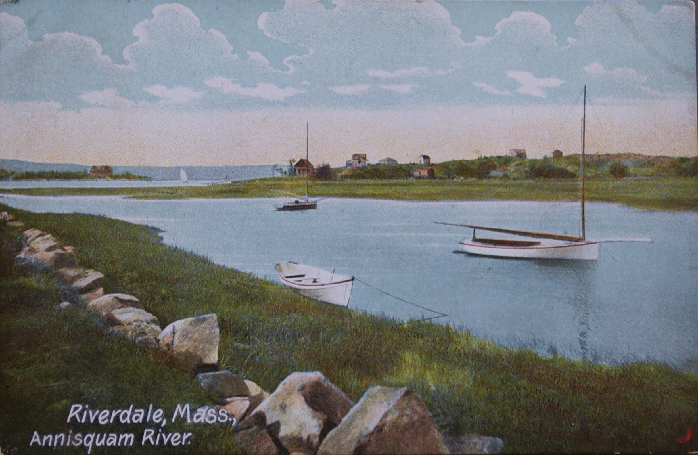
Also filed under: Annisquam River »