An online project under the direction of the CAPE ANN MUSEUM
Historical Materials: Cape Ann Locales
Historical Materials » Cape Ann Locales » Five Pound Island
You have navigated to this pages from catalog entry: View of the Town of Gloucester, Mass., 1836 (inv. 437)
Five Pound Island
View related Fitz Henry Lane catalog entries (3) »
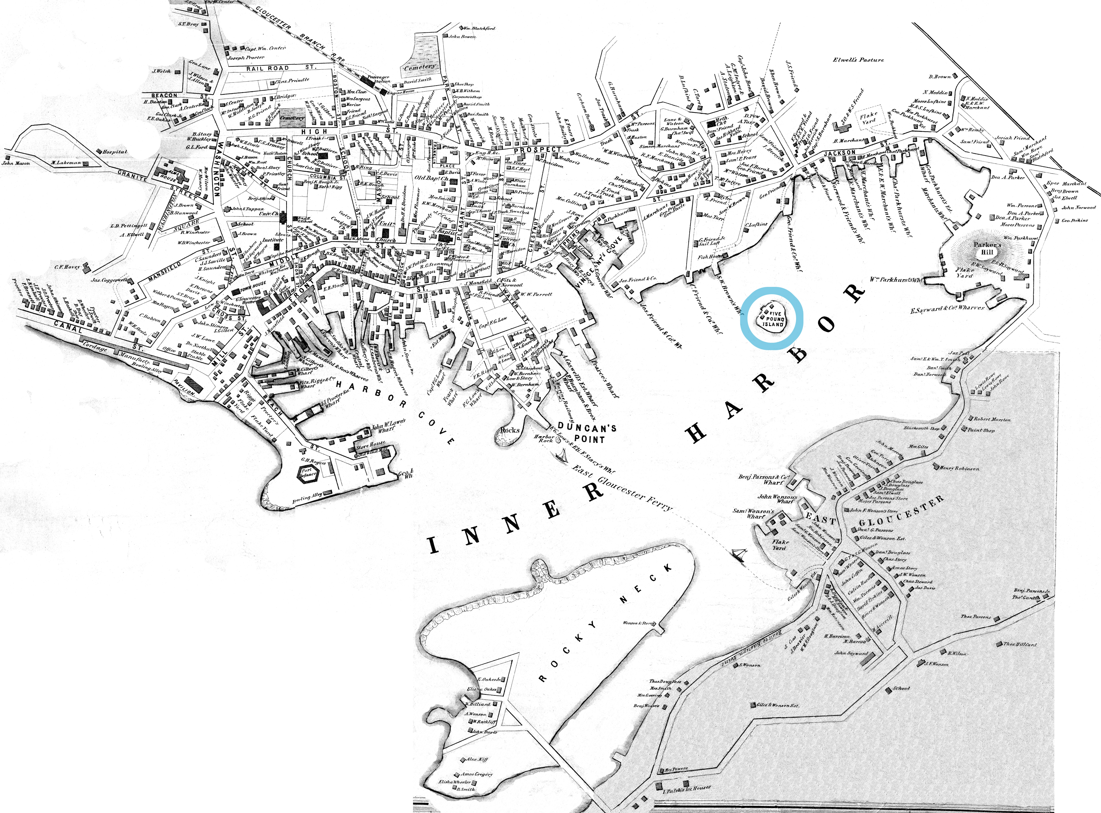
Five Pound Island lies in the middle of the deepest recess of Gloucester’s Inner Harbor, called the Head of the Harbor. It is now buried under the pilings of the State Pier which in 1937 was built out from the shore and over the island to provide modern scale dockage and freezer facilities for the fishing fleet.
In colonial days it was an undistinguished rock with very little vegetation that was likely named for the five sheep pounds (pens) holding rams on it, functioning as a smaller version of Ten Pound Island farther out in the harbor. In Lane’s time it had a few wharves and fishing shacks on it, but being disconnected from land it was not a very practical business location.
The island is shown in numerous Lane paintings, perhaps most prominently in Gloucester Harbor, 1847 (inv. 23) where it lies at the center of the stage set of the Inner Harbor which Lane has ringed with activity both onshore and off.
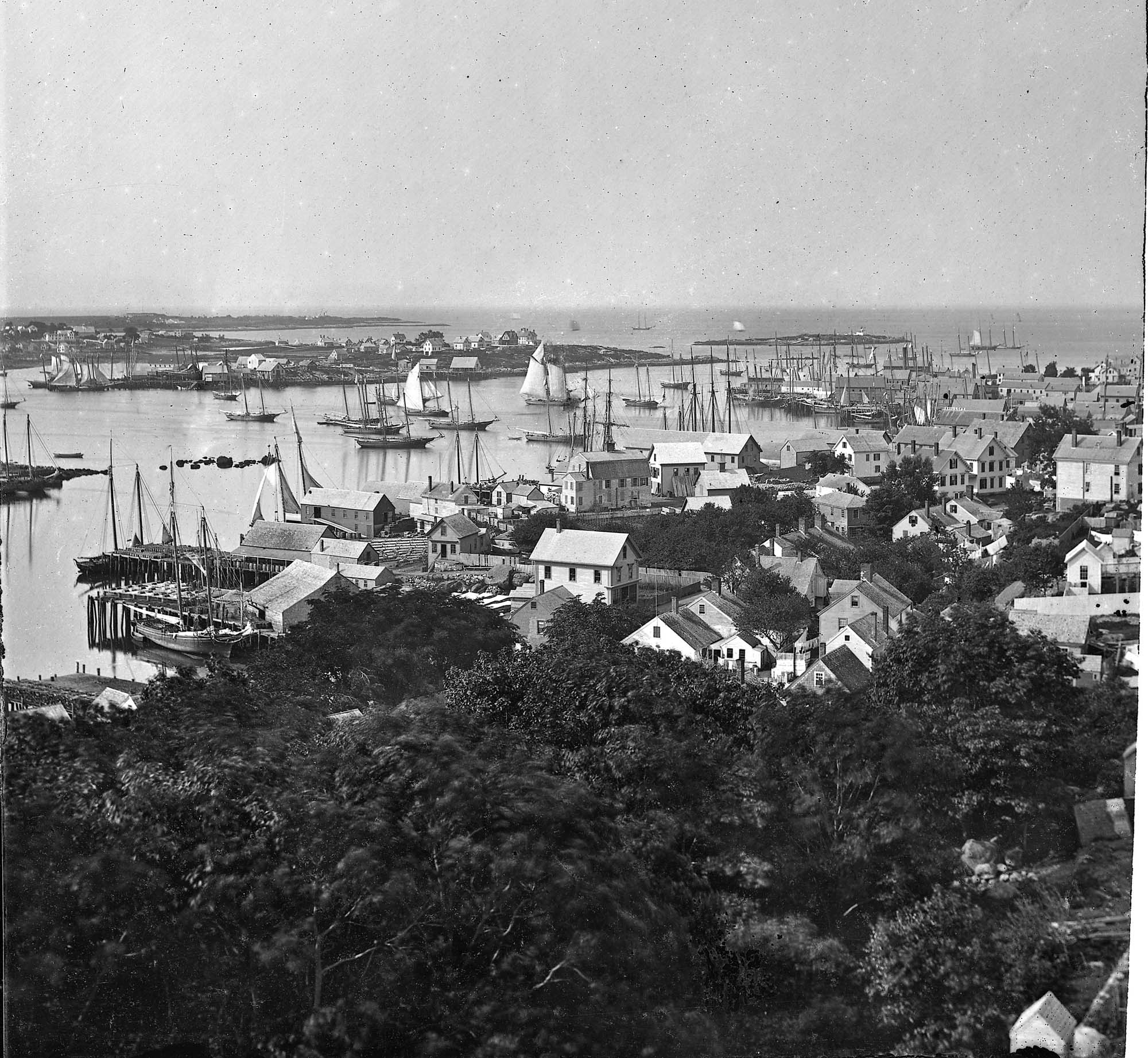
Glass plate negative from Benham Collection
Cape Ann Museum Library & Archive
View of Gloucester Harbor from Friend Street Wharves, Five Pound Island segment at far left, Rocky Neck, Eastern Point and Ten Pound Island in background.
Also filed under: Eastern Point » // Gloucester – City Views »
44 x 34 in.
Henry Francis Walling, Map of the Towns of Gloucester and Rockport, Essex Co. Massachusetts. Philadelphia, A. Kollner, 1851
Cape Ann Museum Library & Archive
"Map of the Towns of Gloucester and Rockport, Massachusetts. H.F. Walling, Civil Engineer. John Hanson, Printer. 1851. Population of Gloucester in 1850 7,805. Population of Rockport in 1850 3,213."
Also filed under: Baptist Church (Old, First, 1830) (Pleasant Street) » // Burnham Brothers Marine Railway » // Duncan's Point » // Flake Yard » // Gloucester Harbor, Inner / Harbor Cove » // Harbor Methodist Church (Prospect Street) » // Low (Frederick G.) wharves » // Pavilion Hotel » // Procter Brothers » // Ropewalk » // Vincent's Cove » // Western Shore »
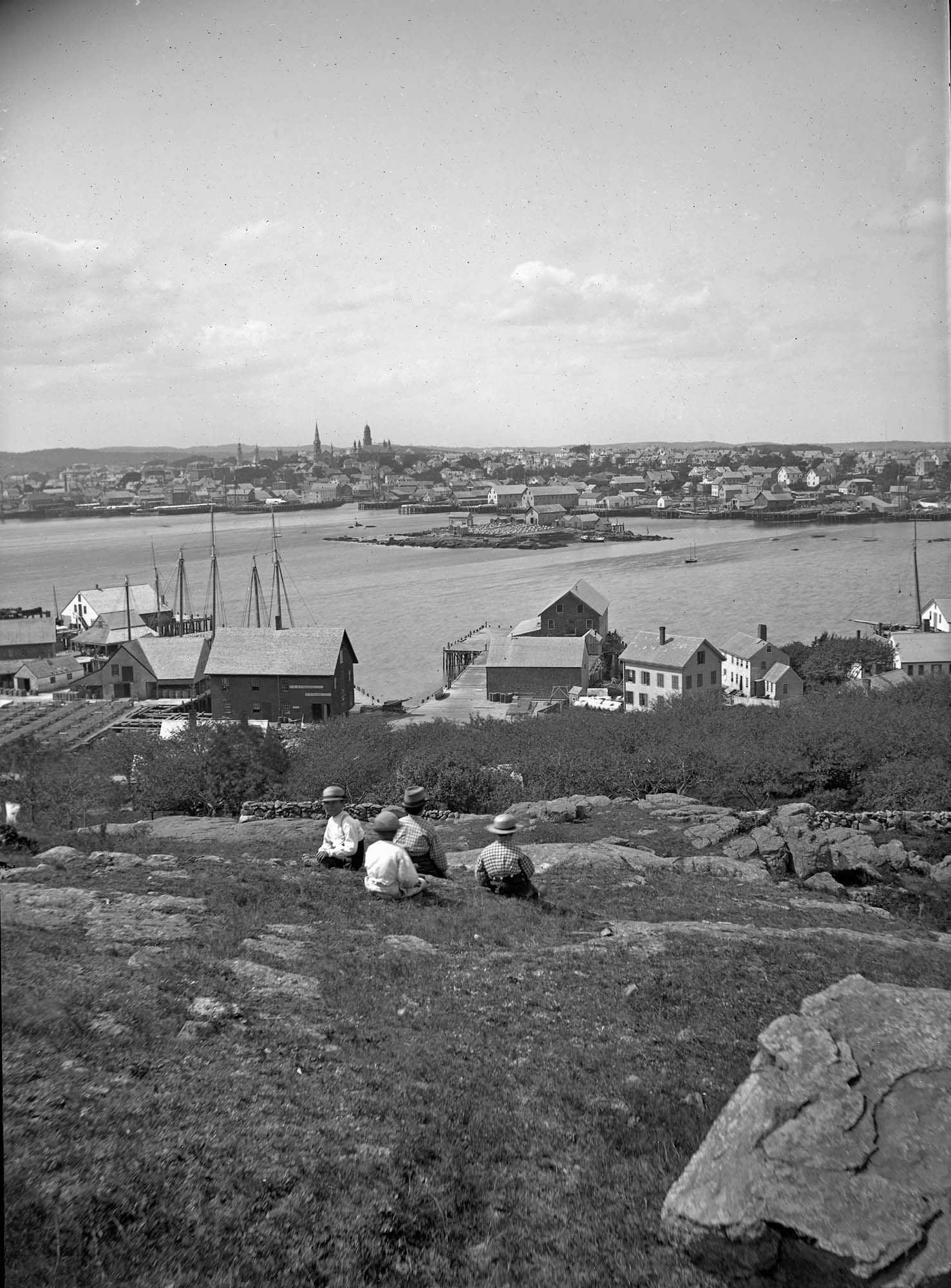
Cape Ann Museum Library & Archive
Five Pound Island and Gloucester inner harbor taken from the top of Hammond Street building signs in foreground are for Severance, Carpenter and Crane, and Cooper at Clay Cove.
Also filed under: Gloucester Harbor, Inner / Harbor Cove »