An online project under the direction of the CAPE ANN MUSEUM
Historical Materials: Cape Ann Locales
Historical Materials » Cape Ann Locales » Eastern Point
You have navigated to this pages from catalog entry: View in Gloucester Harbor, 1850s (inv. 143)
Eastern Point
View related Fitz Henry Lane catalog entries (6) »
Eastern Point is the long promontory that defines the eastern limit of Gloucester Harbor. In Lane's day it was wild and uninhabited but was also a strategic landmark. A Civil War fort was built there in 1863. Lane painted his seminal series of Brace's Cove and Brace's Rock from a vantage point on the eastern side.
The area was made safer for navigation by the construction of a new lighthouse in 1831 and the breakwater known as the Dog Bar. First proposed in 1866 in order to reduce turbulence in the waters of the outer harbor during heavy weather, it was not until 1894 that work on its construction began. Progress was slow, and although an extraordinary number of shipwrecks and groundings in 1898 sped it up somewhat, the breakwater was not completed until 1905.
Related tables: Gloucester, Mass. – Eastern Point Light »
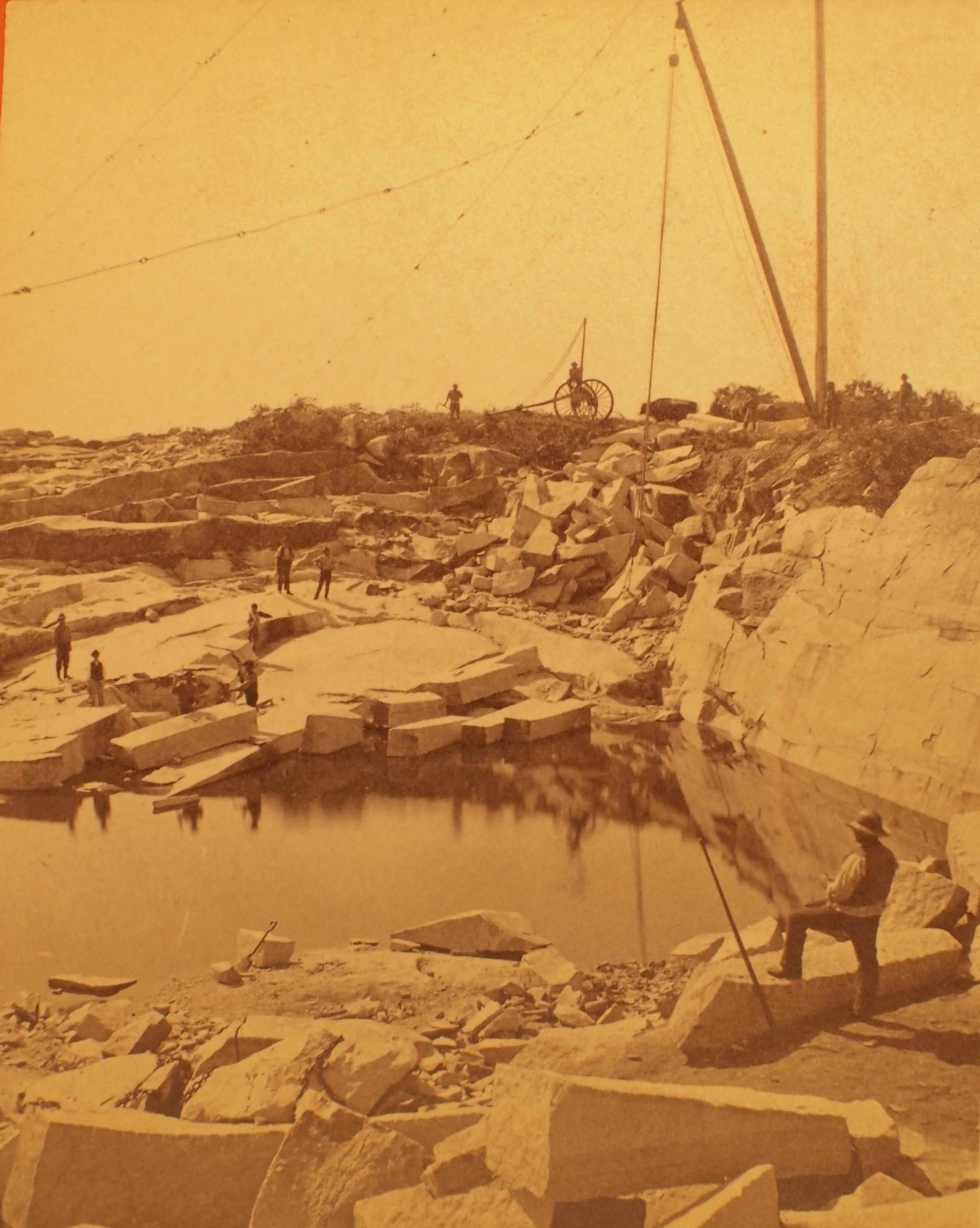
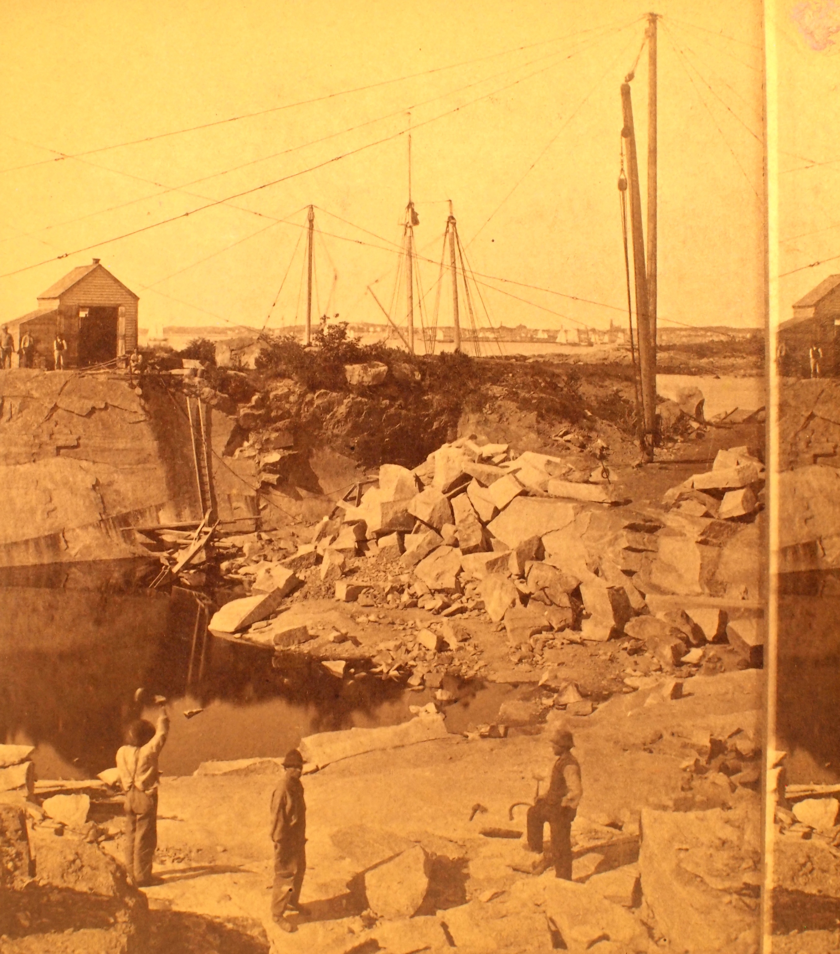
Stereograph card
Cape Ann Museum Library & Archive
This view shows a wood derrick for hoisting granite blocks.
Also filed under: Granite Quarrying / Shipping » // Historic Photographs »
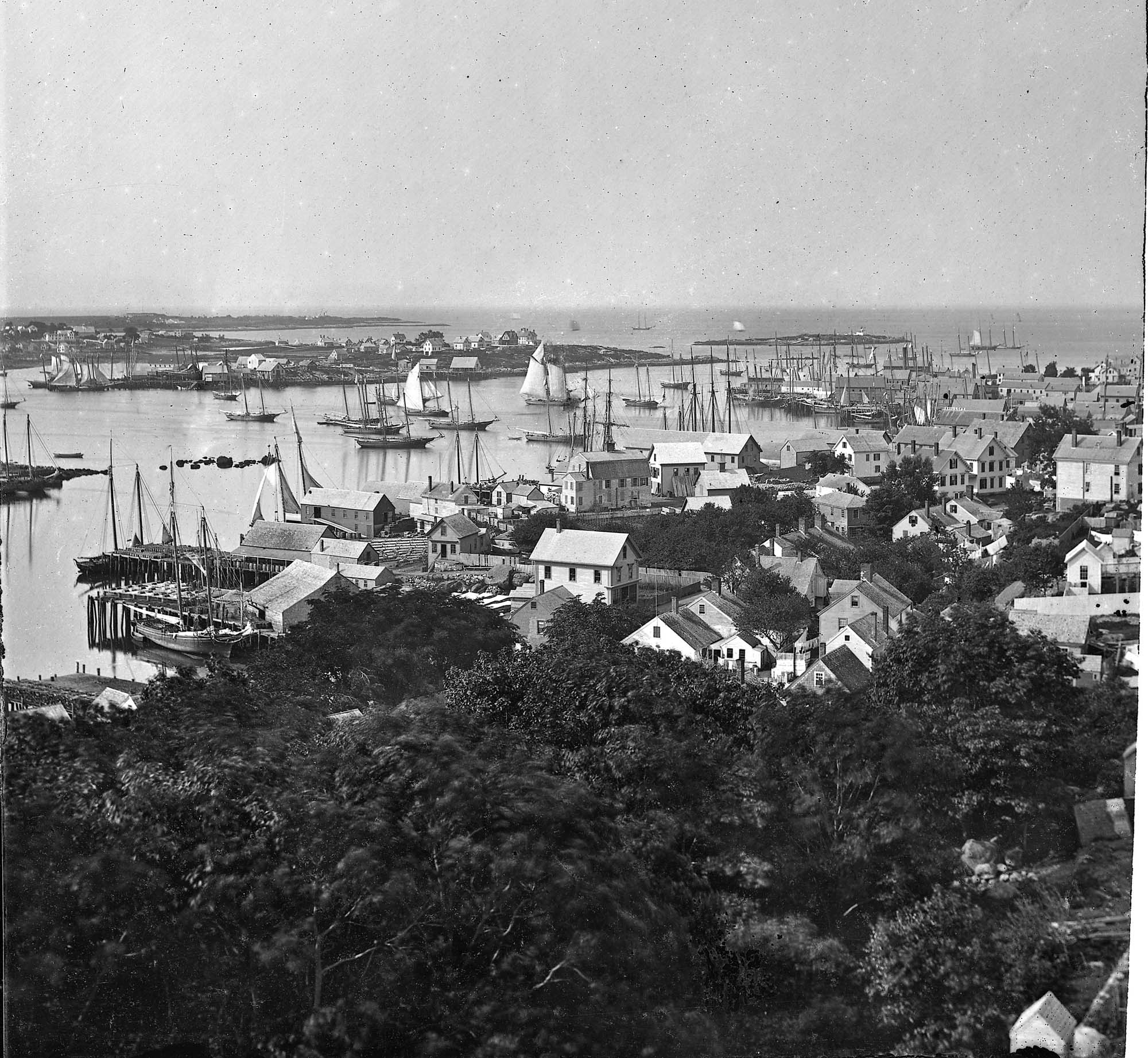
Glass plate negative from Benham Collection
Cape Ann Museum Library & Archive
View of Gloucester Harbor from Friend Street Wharves, Five Pound Island segment at far left, Rocky Neck, Eastern Point and Ten Pound Island in background.
Also filed under: Five Pound Island » // Gloucester – City Views »
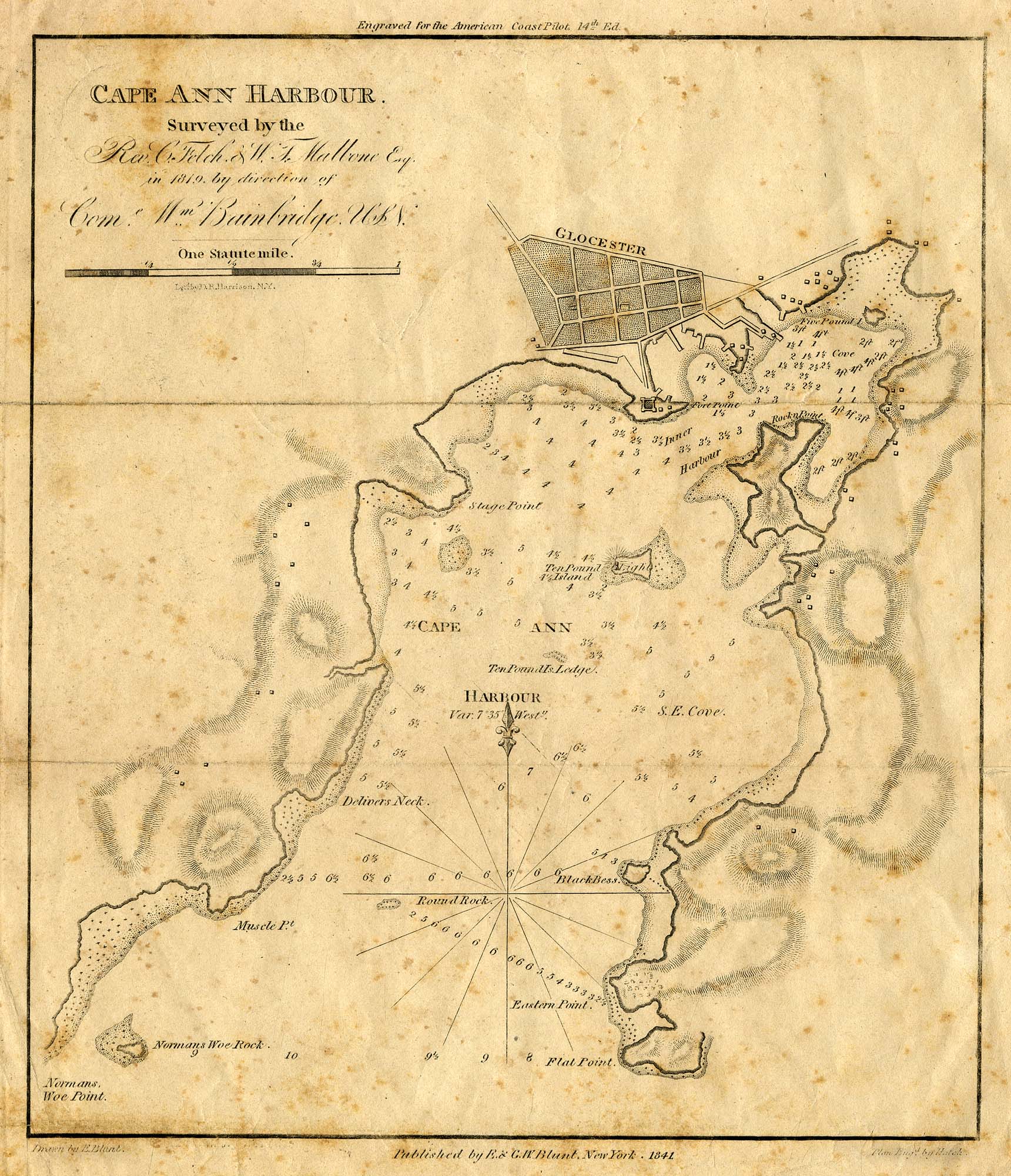
Engraving of 1819 survey taken from American Coast Pilot 14th edition
9 1/2 x 8 in.
Cape Ann Museum Library & Archive
D32 FF5
Also filed under: Dolliver's Neck » // Maps » // Norman's Woe » // Ten Pound Island »
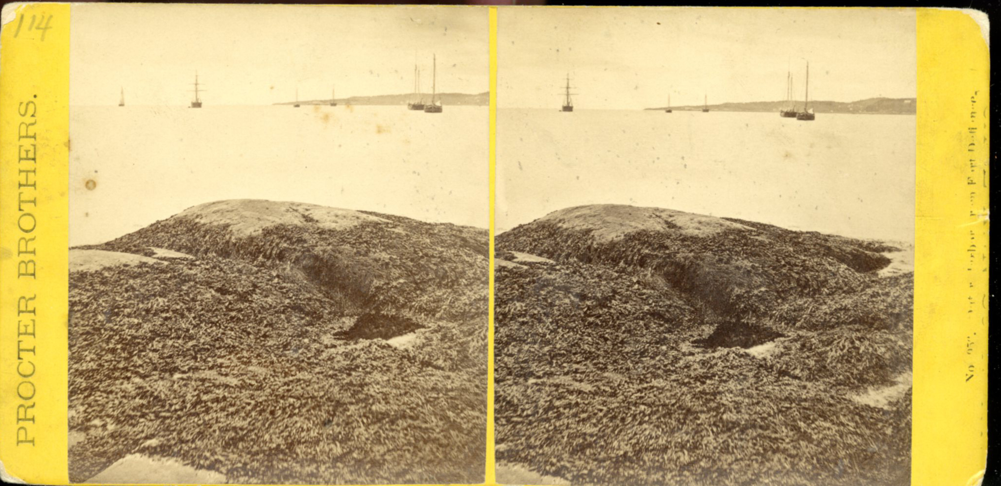
Stereograph card
Procter Brothers, Publisher
Cape Ann Museum Library & Archive
View from Civil War fort on Eastern Point.
Also filed under: Gloucester Harbor, Outer » // Historic Photographs »
Stereograph card
Cape Ann Museum Library & Archive
This view shows a wood derrick for hoisting granite blocks.
Also filed under: Granite Quarrying / Shipping » // Historic Photographs »

Plate from The Illustrated Coast Pilot with Sailing Directions: The Coast of New England from New York to Eastport, Maine including Bays and Harbors, published by N. L. Stebbins,1896.
Also filed under: Gloucester, Mass. – Eastern Point Light »
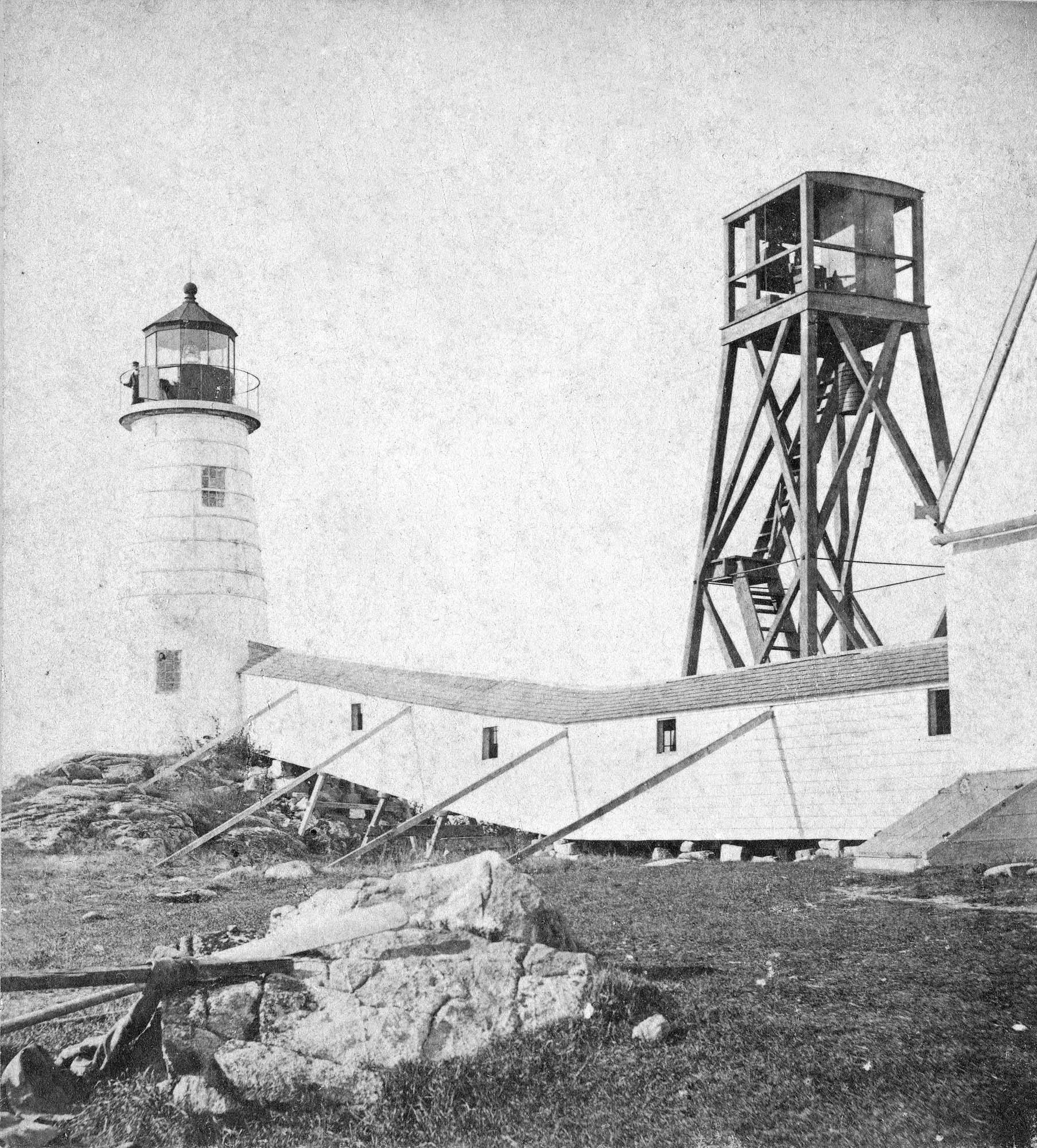
Stereograph card
Published by Frank Rowell
Cape Ann Museum Library & Archive
Also filed under: Gloucester, Mass. – Eastern Point Light »
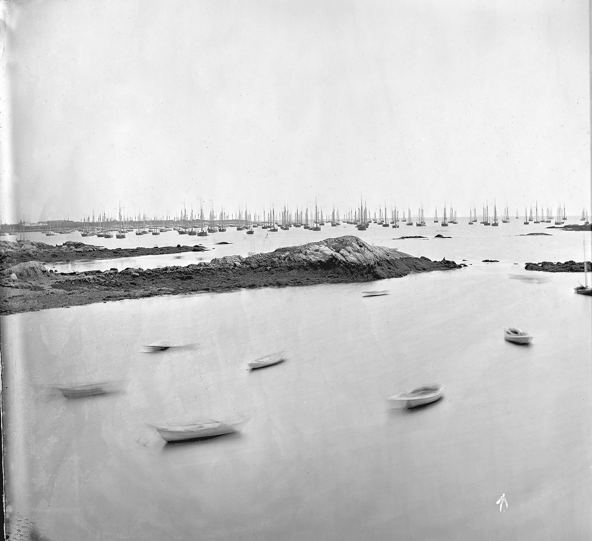
John Heywood Photo for Hervey Friend
Cape Ann Museum Library & Archive (2013.068)
Schooners anchored on the Pancake Ground, taken from from Wonson's Cove, easterly side of the Rocky Neck causeway. Eastern Point Fort and garrison in background to far left.
Also filed under: Gloucester Harbor, Outer »