An online project under the direction of the CAPE ANN MUSEUM
Historical Materials
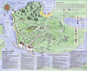
Historical Materials » Flags, Lighthouses, & Navigation Aids » Castine, Maine – Dice (Dyce) Head Lighthouse
Castine, Maine – Dice (Dyce) Head Lighthouse
View related Fitz Henry Lane catalogue entries (5) »
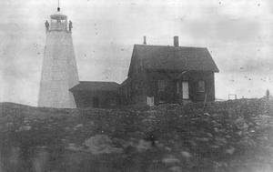
The Dice Head Lighthouse is situated on the southernmost point of the Castine Peninsula at the mouth of the Penobscot River. In May of 1828, Congress gave $5,000 for the creation of a lighthouse at Dice Head in response to the growing shipbuilding and lumber industries on the Penobscot River; it was first lit on November 5, 1828. In the years after the 42-foot conical rubblestone Dice Head Lighthouse was built, it was plagued by physical damage and concerns over its effectiveness in guiding vessels. An inspection report from I.W.P Lewis in 1843 described the lighthouse as "out of repair altogether" and he echoed the sentiment of Henry D. Hunter, of the U.S. revenue cutter, "Jackson," that the Dice Head Lighthouse is helpful in navigating the Bay of Castine, but poorly placed to guide navigators in the Penobscot Bay and at the mouth of the Penobscot River.
This information has been shared with the Lane project by Jeremy D'Entremont. More information can be found at his website, www.newenglandlighthouses.net or in The Lighthouse Handbook New England.
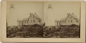
Stereograph card Castine Historical Society Collections (1996.1)
Also filed under: Castine » // Historic Photographs »
Photograph
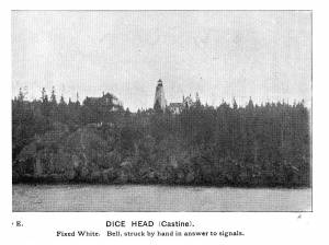
In The Illustrated Coast Pilot with sailing directions. The Coast of New England from New York to Eastport, Maine including Bays and Harbors, published by N. L. Stebbins, Boston, Mass.
Also filed under: Castine »
Photograph
National Archives
Photography courtesy of : http://www.newenglandlighthouses.net
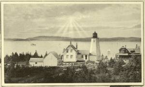
As shipbuilding and lumber traffic on the Penobscot River flourished, Congress appropriated $5,000 for a light station in May 1828. The site chosen was Dice Head, the southernmost point of the Castine peninsula, almost two miles east of the northern end of Islesboro.
The spot is on land once owned by a family named Dyce. Although both spellings have often been used, the "Dice" spelling has predominated.
A conical rubblestone tower—42 feet tall from its base to the focal plane—and an adjacent one-and-one-half-story rubblestone dwelling were soon built, and a newspaper notice on November 5, 1828, announced that the light would go into service that evening.
An octagonal wrought-iron lantern held 10 lamps and 14-inch reflectors, showing a fixed white light 129 feet above mean high water.