An online project under the direction of the CAPE ANN MUSEUM
Catalogue Entry
- Subject Types
: - Landscape Types
: - Vessel Activites
: - Beached »
- Cape Ann Locales
:
Historical Materials
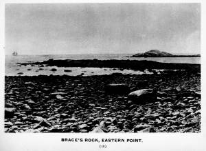
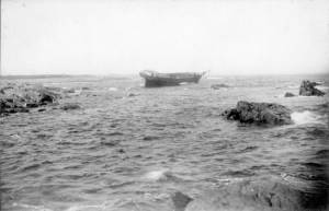
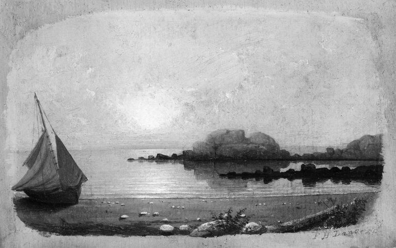
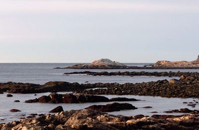
Brace’s Rock protrudes off the eastern shore of Eastern Point at the mouth of Brace’s Cove, a small and deceptively peaceful cove with a lovely crescent beach set in the otherwise rockbound coast of the eastern arm of Gloucester Harbor, about a mile north of the harbor entrance. Belying the serenity of Lane’s paintings, Brace’s Rock, the cove and the ledge forming its northern arm was one of the worst sailing hazards on the entire New England coast. This shore was the scene of countless shipwrecks and loss of life due to its appearance from the sea as a false entrance to Gloucester Harbor. Infamously known as False Point in the days of sail, lookouts on board ship peering through bad weather would see traces of Gloucester harbor and ships at anchor over the low lying land and Niles Pond that separate Brace's Cove from the harbor. They would guide the vessel around what they thought was the end of Eastern Point into the harbor. A reef of rocks jutting across the entrance to Brace Cove brought innumerable ships to grief in this manner. Nowhere on Cape Ann is the illusion of the wild ocean seemingly tamed by a sheltering bay more tragically real than Brace’s Cove seen on a still summer afternoon as Lane has painted it.
In Lane’s day Brace's Cove was still a wild and untouched area of Cape Ann, part of the privately owned Nile’s Farm, and was unvisited by tourists and unsuited for maritime interests. Lane did his drawings from the coast just north of the cove, not from the beach where most would assume he did the drawing. Brace's Rock looks identical from either vantage point.
Also filed under: Site Photographs »