loading 
Fitz Henry Lane
HISTORICAL ARCHIVE • CATALOGUE RAISONNÉ • EDUCATIONAL RESOURCE
An online project under the direction of the CAPE ANN MUSEUM
An online project under the direction of the CAPE ANN MUSEUM
Catalog entry
inv. 446
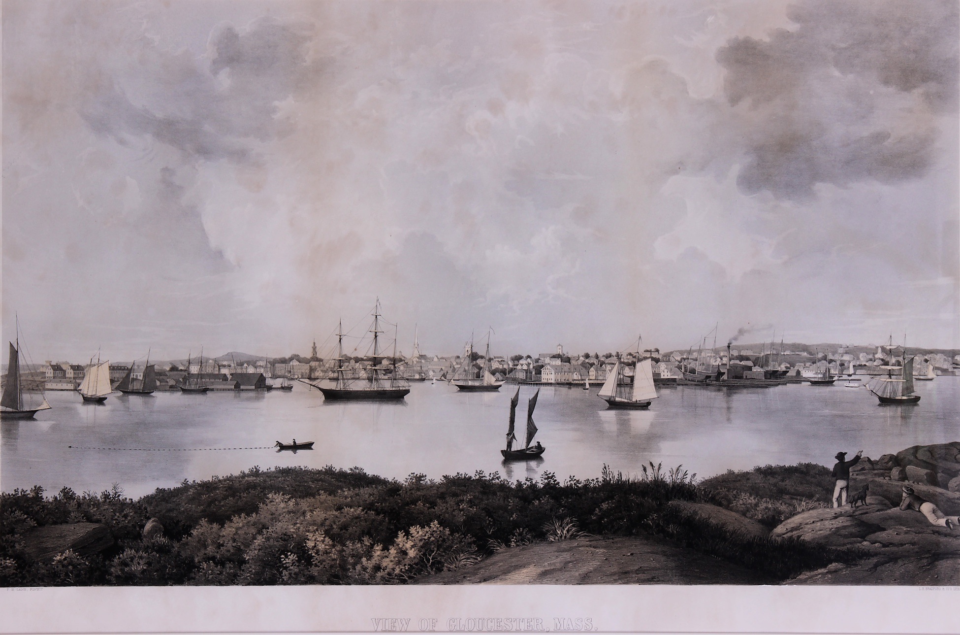
View of Gloucester
Lodowick H. Bradford & Co. - View of Gloucester, Mass.; View of Gloucester Harbor, from Rocky Neck; View of Gloucester, from Rocky Neck; View of Gloucester, Mass.
1859 Colored lithograph 21 3/4 x 35 1/2 in. (55.2 x 90.2 cm) Lower left: F.H.LANE, PINXIT
Lower right: L.H. BRADFORD & CO'S LITH Collections:
|
Related Work in the Catalog
Supplementary Images
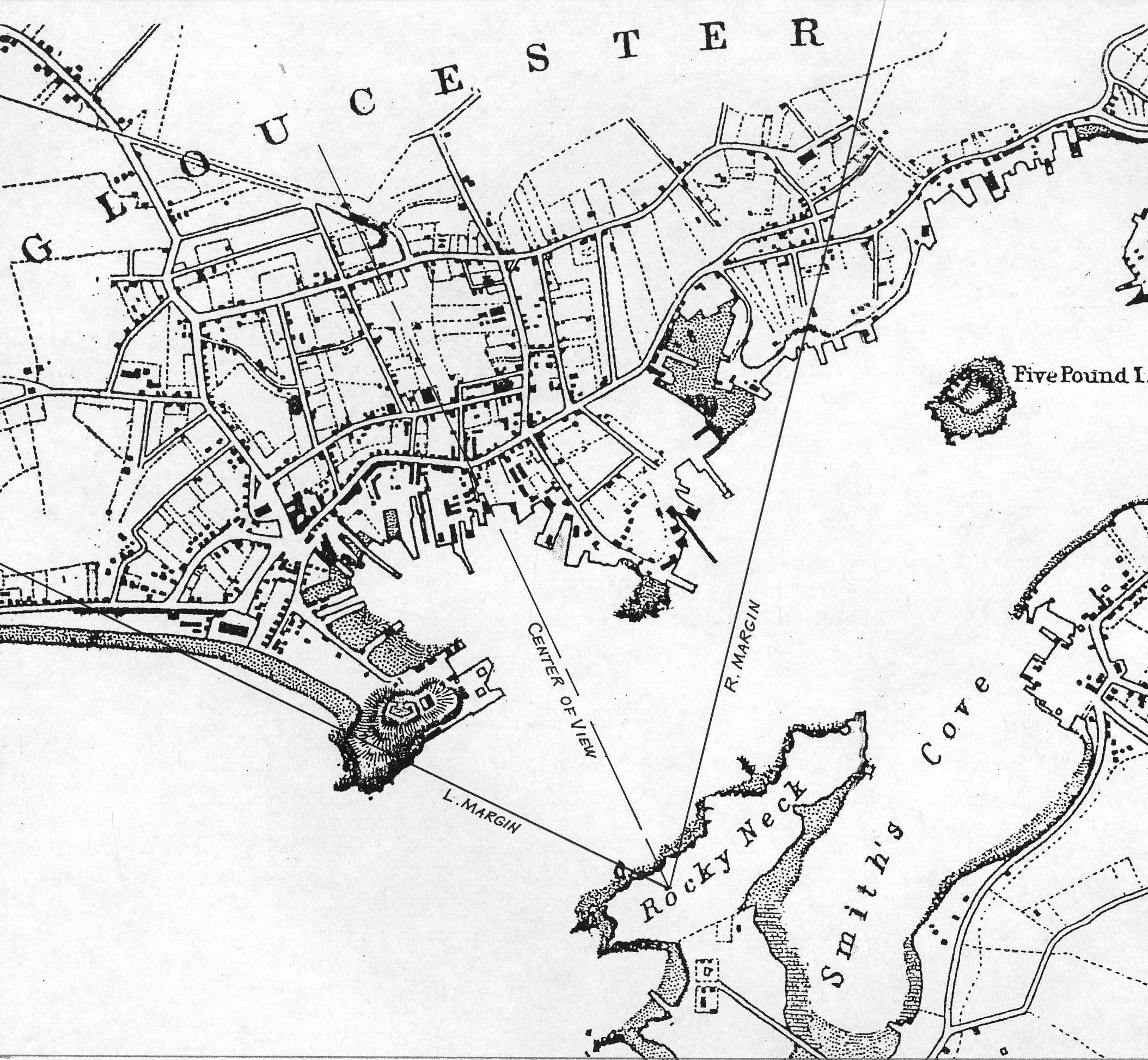
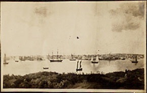
Viewpoint map showing Lane's viewpoint when creating the lithograph
Photo: © Erik A.R. Ronnberg Jr.
Marks & Labels
Marks: On reverse: Published by Proctor Brothers, 123 Front St.
Exhibition History
Procter Brothers, Gloucester, Massachusetts, 1859.
Herbert F. Johnson Museum of Art, Cornell University, Ithaca, New York, Cornell Collects: A Celebration of American Art from the Collection of Alumni and Friends, August 21–November 4, 1990. [Impression: Worcester Art Museum (inv. 84)].
Cape Ann Museum, Gloucester, Massachusetts, Drawn From Nature & on Stone: The Lithographs of Fitz Henry Lane, October 7, 2017–March 4, 2018. [Impression: Cape Ann Museum (inv. 358)].
Published References
Wilmderding, John. "The Lithographs of Fitz Hugh Lane." Old-Time New England LIV, no. 2 (October–December 1963)., fig. 4, p. 37, View of Gloucester Harbor, from Rocky Neck, dated c. 1845. [Impression: The Mariners' Museum (inv. 416)].
The American Neptune, Pictorial Supplement VII: A Selection of Marine Paintings by Fitz Hugh Lane, 1804–1865. Salem, MA: The American Neptune, 1965., plate II, no. 147, View of Gloucester, Mass. [Impression: Peabody Essex Museum (inv. 594)]. ⇒ includes  text
text
Wilmerding, John. Fitz Hugh Lane. New York: Praeger, 1971., p. 28. [Impression: The Mariners' Museum (inv. 416)].
Reps, John W. Views and Viewmakers of Urban America: Lithographs of Towns and Cities in the United States and Canada, Notes on the Artists and Publishers, and a Union Catalog of their Work,1825-1925. Columbia: University of Missouri Press., no. 1453, p.333, also no. 1450?.
Crossman, Carl L. "Lithographs of Fitz Hugh Lane." In American Maritime Prints, edited by Elton W. Hall. New Bedford, MA: The Whaling Museum by the Old Dartmouth Historical Society, 1987, pp. 63–94. The Proceedings of the Eighth Annual North American Print Conference held at the Whaling Museum, New Bedford, Mass., May 6–7, 1977., fig. 17, p.92. [Impression: Peabody Essex Museum (inv. 594)]. ⇒ includes text
Martha Oaks. "Gloucester At Mid-Century: The World of Fitz Hugh Lane, 1840–1865." Gloucester, Mass.: Cape Ann Historical Society. (exhibition catalogue)., ill., p. 5, View of Gloucester, Mass. ⇒ includes text
Ronnberg, Erik A.R., Jr. "Views of Fort Point: Fitz Hugh Lane's Images of a Gloucester Landmark." Cape Ann Historical Association Newsletter 26, no. 2–4 (April, July, September 2004)., fig. 12. [Impression: Cape Ann Museum (inv. 358)]. ⇒ includes text
Dunlap, Sarah, and Stephanie Buck. "Fitz Who? The Artist Latterly Known as Fitz Hugh Lane." The Essex Genealogist 25, no. 1 (February 2005)., p. 14. ⇒ includes text
Wilmerding, John. Fitz Henry Lane. Gloucester, MA: Cape Ann Historical Association, 2005. Reprint of Fitz Hugh Lane, by John Wilmerding. New York: Praeger, 1971. Includes new information regarding the artist's name., ill. 19, text, p. 30, View of Gloucester, Mass.
Barnhill, Trafton. Drawn from Nature & on Stone: the Lithographs of Fitz Henry Lane. Gloucester, MA: Cape Ann Museum, 2017., fig. 23, text, p. 37, View of Gloucester, Mass. [Impression: Cape Ann Museum (inv. 358)]. ⇒ includes text
Impression information
Boston Athenaeum (inv. 509)
View of Gloucester, Mass.
Printed under image left to right: F.H. Lane, pinxit., L.H. Bradford & Co's Lith.
Boston Athenaeum, Gift of the New England Historical Art Society, 1949
Provenance
New England Historical Art Society
Boston Athenaeum
Boston Public Library (inv. 589)
F. H. Lane, pinx.
L.H. Bradford & Co's Lith.
Published by Procter Brothers, 123 Front St.
Boston Public Library
Provenance
Boston Public Library
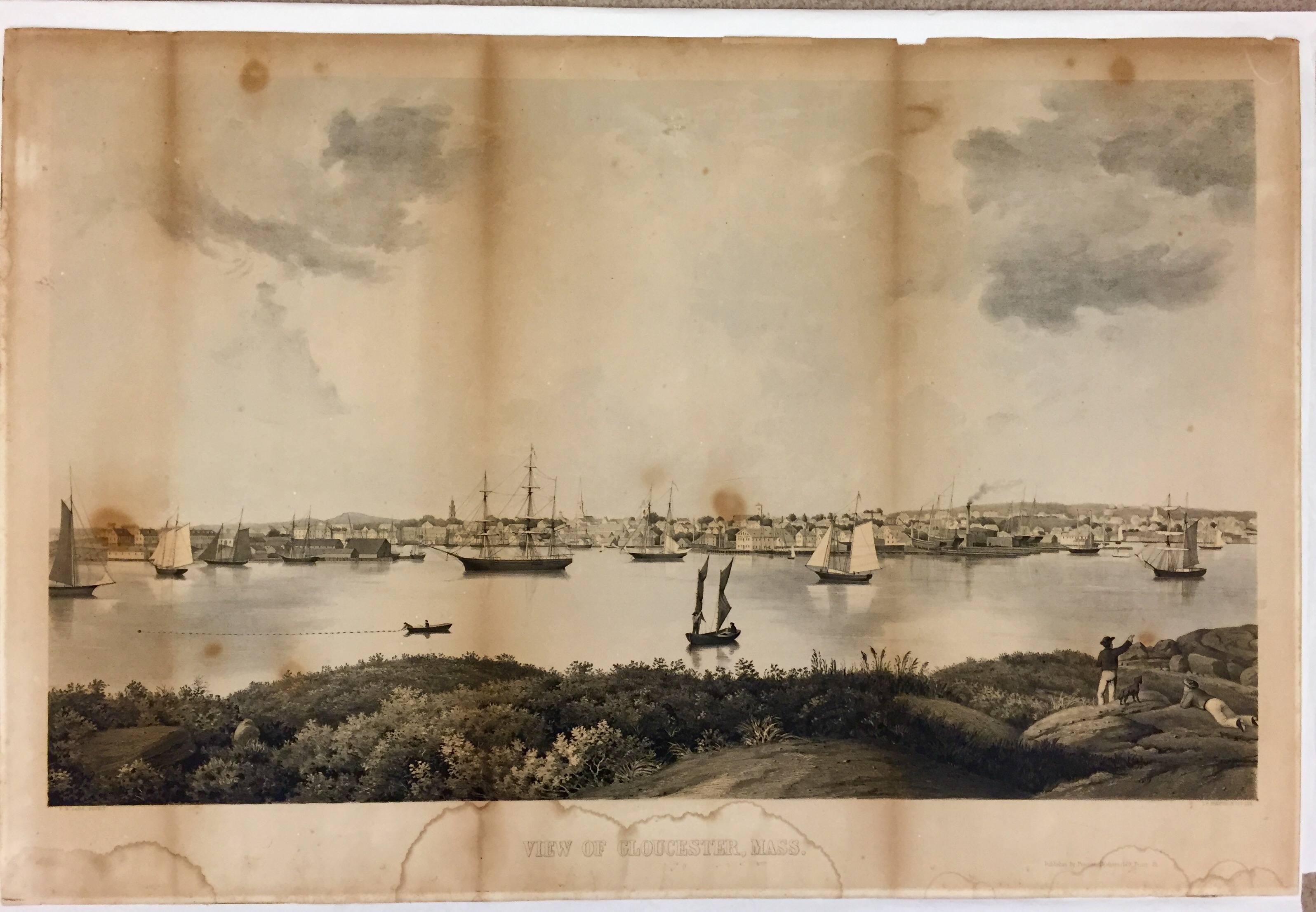
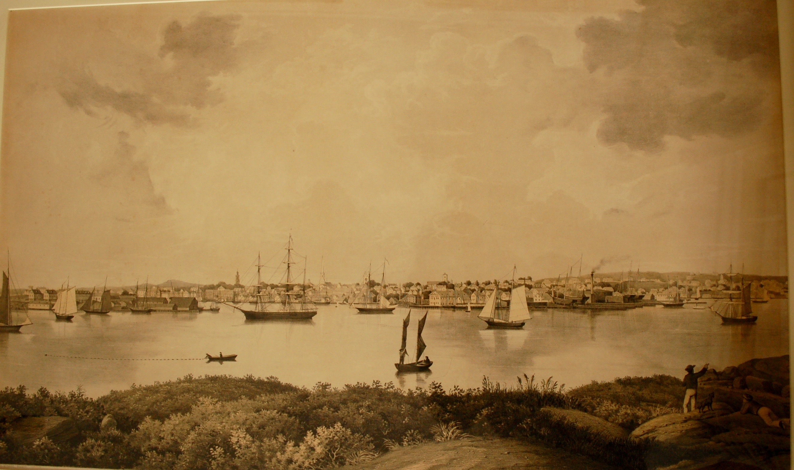
Cape Ann Museum (inv. 358)
enlarge
Photo: Cape Ann Museum (inv. 358)
View of Gloucester, Mass.
L.H. Bradford's Lithography, Boston.
Cape Ann Museum, Gloucester, Mass., Gift of Bertha (Mrs. Percy C.) Procter. (912.1)
On view at the Cape Ann MuseumProvenance
Bertha (Mrs. Percy C.) Procter, 1940
Cape Ann Museum, Gloucester, Mass.
Cape Ann Museum (inv. 359)
enlarge
Photo: Cape Ann Museum (inv. 359)
View of Gloucester, Mass.
Bradford's Lithography, Boston
on back: Published by Proctor Bros., Front St., Gloucester.
Cape Ann Museum, Gloucester, Mass. (2595.3)
Provenance
Cape Ann Museum, Gloucester, Massachusetts
Cape Ann Museum (inv. 360)
View of Gloucester, Mass.
L.H. Bradford's Lithography, Boston.
Cape Ann Museum, Gloucester, Mass. (2595.1)
Provenance
Cape Ann Museum, Gloucester, Mass.
Cape Ann Museum (inv. 361)
enlarge
Photo: Cape Ann Museum (inv. 361)
View of Gloucester, Mass.
Cape Ann Museum, Gloucester, Mass. (2595.2)
Provenance
Cape Ann Museum, Gloucester, Mass.
The Mariners' Museum (inv. 416)
enlarge
Photo: Mariners' Museum (inv. 416)
View of Gloucester, Mass.
Signed across bottom: A VIEW OF GLOUCESTER, MASS., F.H. Lane Pinxit/L.H. Bradford & Co's. Lith.
Courtesy of The Mariners' Museum, Newport News, Virginia (1934.1145.000001 / LP 0018)
Provenance
The Mariners' Museum, Newport News, Virginia, 1934
National Gallery of Art (inv. 350)
View of Gloucester, Mass.
Signed lower right: Published by Proctor Brothers, 123 Front St.
Center margin: F.H.LANE, PINXIT
Lower left: L.H. BRADFORD & CO'S LITH.
National Gallery of Art, Washington, D.C., Reba and Dave Williams Collection, Gift of Reba and Dave Williams (2008.115.3030)
Provenance
Reba and Dave Williams
National Gallery of Art, Washington, D.C., 2008
Peabody Essex Museum (inv. 594)
View of Gloucester, Mass.
Peabody Essex Museum. Gift of Peabody Academy of Science. (3864)
Provenance
Peabody Essex Museum
Princeton University Library Rare Books and Special Collections (inv. 742)
Princeton University Library Rare Books and Special Collections, Princeton, New Jersey. Gift of Leonard L. Milberg, Princeton University Class of 1953. (Milberg.Views 1981.4)
Provenance
Princeton University Library Rare Books and Special Collections, Princeton, New Jersey
Worcester Art Museum (inv. 84)
Lodowick H. Bradford & Co. - View of Gloucester, Mass.
Worcester Art Museum, Mass., Charlotte E.W. Buffington Fund (1993.74)
Provenance
William Greenbaum Fine Prints, Gloucester, Mass.
Worcester Art Museum, Mass., 1993
Commentary
This lithograph was published by Procter Brothers of Gloucester, and lithographed by L.H. Bradford & Co. It is known that Lane produced a painting from which the print was made, but unclear if he actually transferred the image to the stone.
Commentary and a Visual Guide
The third of Lane’s Gloucester lithographs is dimensionally the largest, but with the smallest angle of view: 74 degrees. His viewpoint was almost the same as the 1846 versions – perhaps fifty feet or so to the south and west. Given the same distance from Harbor Cove, the reduced angle of view served to further emphasize Harbor Cove, particularly Fort Point and Duncan’s Point, which saw the greatest changes in the years following 1846.
Harbor Cove’s peripheral expansion was due to the growth of a revitalized fishing industry. Gloucester’s foreign trade, whose prosperity had required ever larger vessels, was hampered by its shallow harbor and the attendant problems of berthing large ships and barks at wharfside. This problem was solved by moving ships and berthing facilities to Boston, which by 1860 was largely accomplished. With railroad connections between Gloucester and Boston already in place, Gloucester’s merchants could commute to Boston to manage their foreign trade business, leaving their old wharves and offices to a rapidly reviving fishing industry.
The third Gloucester lithograph was printed by Lodowick H. Bradford & Co., bearing the credit line “F.H. Lane pinxit” (“F.H. Lane depicted”) – which certainly attributes the original drawing to Lane, but less certainly the drawing on stone. This uncertainty is borne out in other lithographs, some of which credit Lane’s work as “on stone by…” or “drawn by…”, or “F.H. Lane del” (“del” = “delineavit”, “he drew”).
In this print’s case, Lane was arguably not responsible for the drawing on stone; the vessels are too inaccurately and incompletely rendered by his standards. Given inaccuracies in hull forms and proportions, and the lack of detail in the rendering of spars, sails, and rigging, it is hard to accept their rendering by Lane. Lacking as well are his careful depictions of rocks and stone piers; only the leafy vegetation is equal to his in mastery. The drawing of buildings most closely approaches that in Lane’s 1846 view, but even that aspect, while competently executed, shows differences in the treatment of line work, shading, and fine detail.
At 54 years of age, Lane, whose health was never robust, may have decided that drawing on a block of limestone two feet by three feet, by two to three inches thick, was a heavier task than he cared to manage. It seems probable that he left that task to another artist in order to fill on time this obligation to his publisher, Procter Brothers, Gloucester.
The lithograph, to judge from accounts in “The Cape Ann Advertiser”, starting in 1858, was inspired by a painting which Lane had recently completed. While a work on canvas was regarded as the source, it seems likely that the original drawing would have been used for making the image on stone, and the painting used as a guide for coloring many (but not all) of the lithographs. No evidence has been found yet that the lithographs were colored by Lane.
Vessel Activity
The numbers and types of vessels in this image are significantly greater than those of its preceding versions. The only sloop (1) is of significant size, though partially obscured by the left margin. The absence of a spring stay and a main topmast stay are the only clues to its single-masted rig. This vessel was probably used in the coastal packet trade.
Schooners (2) predominate. There is little doubt that nearly all are employed in the fisheries and are mostly of the “sharpshooter” and “clipper” models – built for speed to meet new fishing problems and promising new markets. Increasing efforts by Canada to impose greater control over its offshore fishing grounds forced American fishermen to build faster schooners to evade patrol vessels. At the same time, improved rail transportation to large inland markets led to strong demand for fresh fish. This necessitated making quicker homeward passages and the use of ice to keep the catch fresh.
Three half (hermaphrodite) brigs (3) are visible – reminders of the coastal trade, particularly the longer trips between Gloucester and Canada, or the southern ports as far as the West Indies. Their fore squaresails made them more suitable for coastal sailing routes farther offshore.
Two men in a wherry (4) are overhauling a previously set gill net. Anchored at both ends and hanging vertically in the water, the net was set in places where migrating schools of fish (such as herring) were likely to pass. The man in the wherry’s bow is starting to overhaul the net at one end, working his way to the other, removing fish caught by their gill covers in the mesh.
The lone bark (5) could be a last vestige of the Surinam trade, but is just as likely a “salt bark” in port with a cargo of “Tortugas salt” (West Indies sea salt) for processing dried salt fish. Later in this century, the salt trade expanded to importing Cadiz sea salt from Spain, and finally Trapani sea salt – highly regarded for its mildness – from the west coast of Sicily.
The small single-masted boat with one sail (6), i.e. “cat rigged”, is possibly a water boat. These craft brought fresh water to outbound vessels, their simple rigs facilitating the process of “coming alongside” to pump fresh water into the outbound vessel’s water tanks.
A yawl boat (7) with a two-masted spritsail rig is having its sails gathered to the masts in preparation to land. The spritsail resembles the gaff-headed sail, but uses a “sprit pole” to spread the sail’s peak (upper corner). The hasty furling shown here leaves the sprit pole in place, but gathers the sail to the mast.
A small steam-powered harbor ferry (8) traverses the harbor with commuters from East Gloucester. Ferry service has been indicated on harbor maps from 1850 and 1856, the earlier showing a sloop on the route. The 1856 map shows the route from a Wonson-owned pier in East Gloucester to the wharf of Low and Stacy at Duncan’s Point.
Key to vessels and buildings, left side
Key to vessels and buildings, right side
Fort Point
The entrance to Harbor Cove at its southwest side was guarded (literally so, on occasions) by Fort Point. Between the War of 1812 and the Civil War, Fort Defiance (as then called) was allowed to deteriorate – a process helped along by citizens partaking of its bricks and stone work to build foundations for new houses. Otherwise unused, save for a building used as a bowling alley, the land lay undeveloped until 1847, when George H. Rogers purchased parcels around the shoreline for wharves and buildings. In the decade that followed, his wharves covered the northeast and south shorelines, amounting to nearly one fourth of the frontage inside Harbor Cove. Residential housing soon followed, completely obliterating any trace of Fort Defiance’s remains when viewed from the south or east.
At the time Lane sketched this view, Sidney Mason has already built the Pavilion Hotel (A), ushering in luxurious hotel accommodations for wealthy tourists. In the distance, the Hovey mansion (B) atop Babson Hill dominated the highlands between central Gloucester and the Annisquam River.
The wharves and buildings (D,E,F) of George H. Rogers hide most of the visible Fort Point shoreline, the oldest part being the office/warehouse (E) which dates to 1848. The wharves themselves are more extensive and have many more buildings than in 1851, when the first section was in use. The schooners tied up at their north side (their masts visible over the roofs) are most likely fishing vessels, indicating that part of this wharf had already gone from receiving foreign trade goods to handling fish. The hidden adjacent wharf of John H. Lowe was soon to be taken over by Pettingill and Cunningham and evolve into the major fishing firm of Cunningham and Thompson.
In this view we also see the first residential buildings (C) to occupy land surrounding (and hiding) Fort Defiance’s remains. The Civil War would put a halt to this development as the fort was reactivated for the last time. The end of that conflict saw the resumption of new housing as immigrants flocked to Cape Ann to seek employment in a rapidly reviving fishing industry.
Beyond the north end of Harbor Cove, and situated prominently at the corner of Front and Washington Streets, was the Gloucester House (G), a large brick hip-roofed hotel which catered to a growing number of summer visitors and touring lecturers. With this establishment and the addition of the Pavilion Hotel, Gloucester took a major step toward the encouraging of tourism and the accommodation of summer visitors.
The angle of view in this lithograph leaves the west side of Harbor Cove hidden from view. The first identifiable wharves in sight are Charles Boynton’s (formerly G. Smith’s) Wharf (H) and Central Wharf (I), to the left of the Universalist Church (J). The schooners alongside them are indicative of a waterfront in rapid change from foreign trade to a reviving fishing industry.
Harbor Cove
While Lane’s 1859 lithograph of Gloucester Harbor was to a larger scale than his 1846 version, the detailing of wharves and their buildings is less clearly and precisely drawn. Lost are finer details and perspective, particularly where wharves overlap and the berthing slips can no longer be seen. This problem has prevented the identification of several wharves. This is unfortunate as Gloucester’s downtown area, particularly along the waterfront, was growing in response to the resurgent fishing industry. Following the fire of 1864, a new street between Front Street and the waterfront was laid out and named Rogers Street, sparking even further development.
Barely visible is Central Wharf (I), to the left of the Universalist Church (J). George Steele’s Wharf (K), formerly George H. Rogers’ Wharf is the next identifiable pier. To the right of the Collins School (L) and the Congregational Church (M) are the two wharves of John Somes (N). Back from the harbor is the Unitarian Church (O) and the house of Dr. Herman E. Davidson (P), who was Lane’s physician.
At the north corner of Harbor Cove is Collins Wharf (Q), site of Lane’s only known (to date) depiction of shipbuilding in Gloucester Harbor (Inv. 58). There, the shoreline turns eastward onto Duncan’s Point and more new harbor development. Dolliver’s Wharf and its hip-roof building (R) was previously owned by Frederick G. Low. Directly below the new Baptist Church (S) is the wharf and sail loft of Robert Fears (T), which is separated by a narrow slip from an enlarged wharf owned by Low. Next is a basin bounded by Parkhurst’s Wharf (U) which was built out over Duncan’s Point Rocks.
Duncan’s Point and Beyond
On the hilltop overlooking the bustle of Duncan’s Point is a stone house with seven gables (V) which was built and inhabited by one F. H. Lane. Below it and adjacent to Parkhurst’s marine railway is Burnham’s marine railway (W), the first such facility built in Gloucester, in 1849, followed by Parkhurst’s railway in 1854. Beyond is Pearce’s Wharf (X), marking the east side of the entrance to Vincent’s Cove (Y). Back from the Gloucester waterfront and on rising ground later to be known as Portuguese Hill is Gloucester’s Methodist Church (Z).
–Erik Ronnberg