An online project under the direction of the CAPE ANN MUSEUM
Catalog entry
inv. 148
Gloucester Outer Harbor from Eastern Point
1850s Graphite on paper 8 1/2 x 11 in. (21.6 x 27.9 cm) Inscribed lower right (in pencil): Gloucester Outer Harbor from Eastern Point / F.H. Lane del.
|
Verso
Explore catalog entries by keywords view all keywords »
Historical Materials
Below is historical information related to the Lane work above. To see complete information on a subject on the Historical Materials page, click on the subject name (in bold and underlined).
In 1849, Lane bought a small lot of land on top of a hill that jutted into Gloucester Inner Harbor. The name Duncan's Point refers alternatively to the entire hill, or only to the rocks that form a point beneath the current Coast Guard Station. The hilltop was vacant when Lane bought the property. He designed and built a gabled stone house on the hill, the northwest room of which was his studio. He lived there with his sister Sarah and her husband, Ignatius Winter, until he died in 1865, having bequeathed the house to his friend, Joseph L. Stevens, Jr. (1)
Reference:
1. Sarah Dunlop and Stephanie Buck, Fitz Henry Lane: Family and Friends (Gloucester, MA: Church & Mason Publishing; in association with the Cape Ann Historical Museum, 2007), 59–74, 150–55.
Glass plate negative
Cape Ann Museum Library & Archive
Detail from CAHA#00279
The magnificent views of Gloucester Harbor and the islands from the top floor of the stone house at Duncan's Point where Lane had his studio were the inspiration for many of his paintings.
From Buck and Dunlop, Fitz Henry Lane: Family, and Friends, pp. 59–74.
Also filed under: Gloucester Harbor, Inner / Harbor Cove » // Lane's Stone House, Duncan's Point » // Residences »
44 x 34 in.
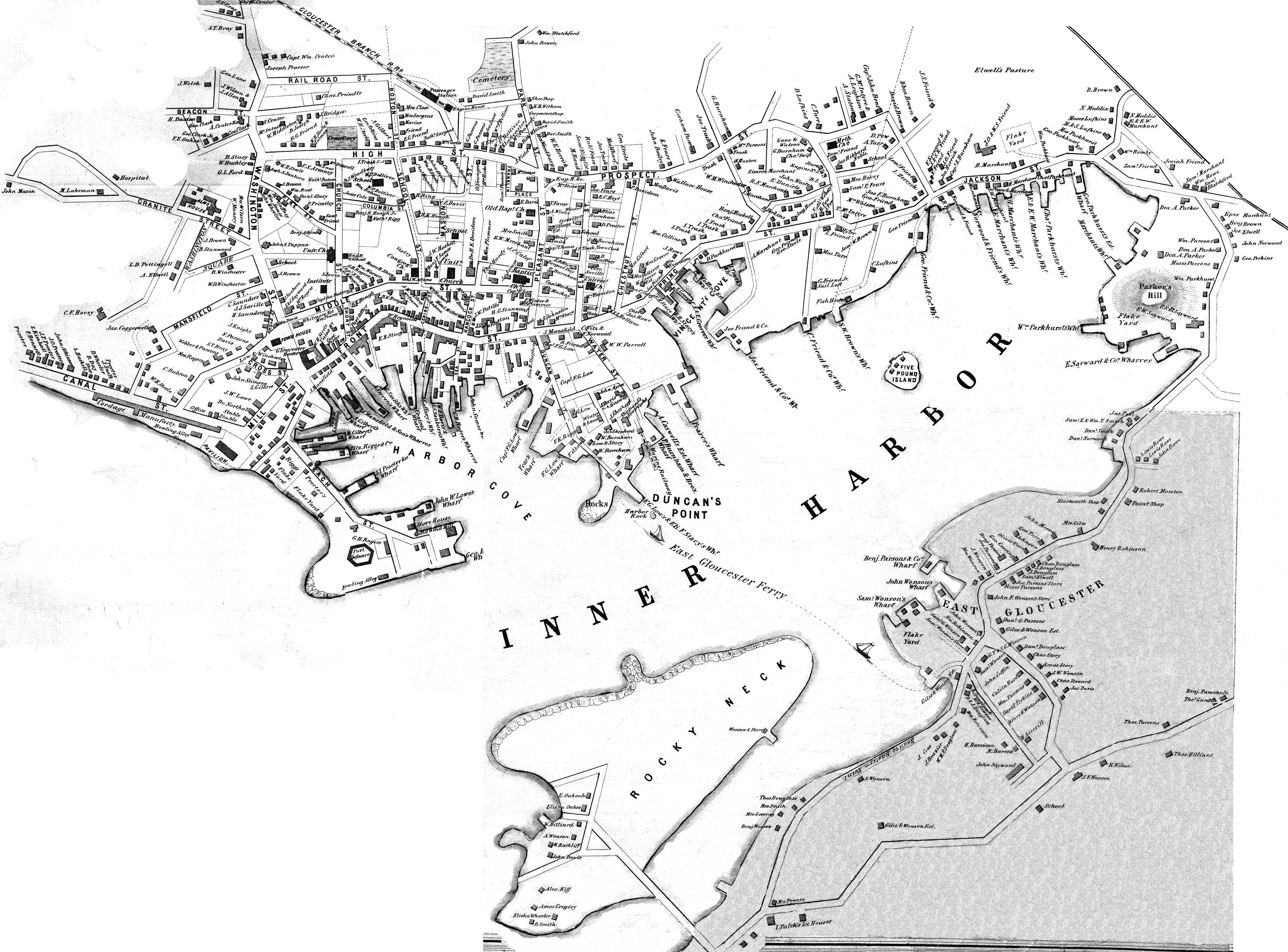
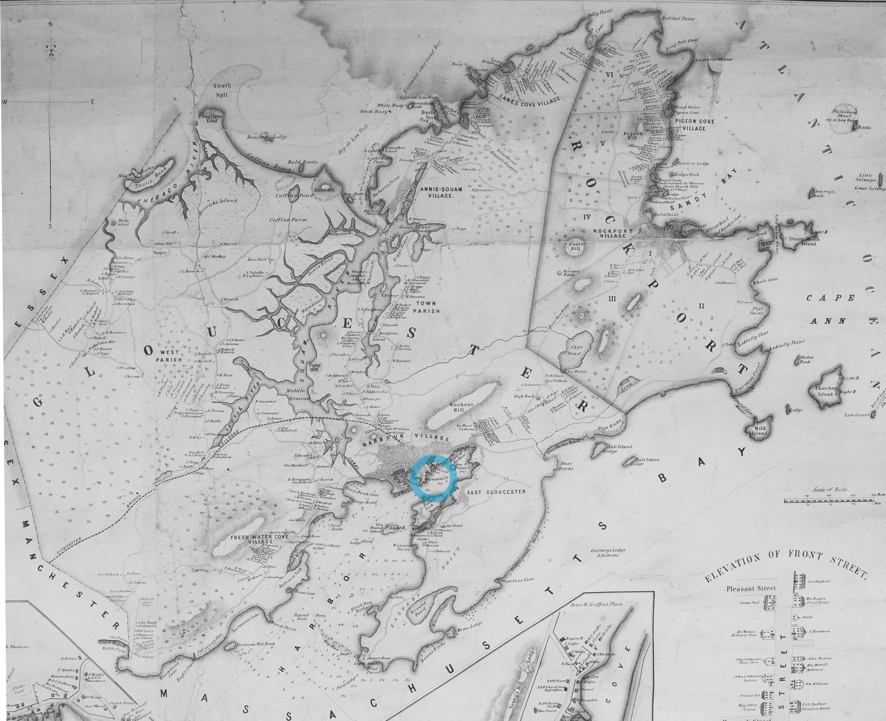
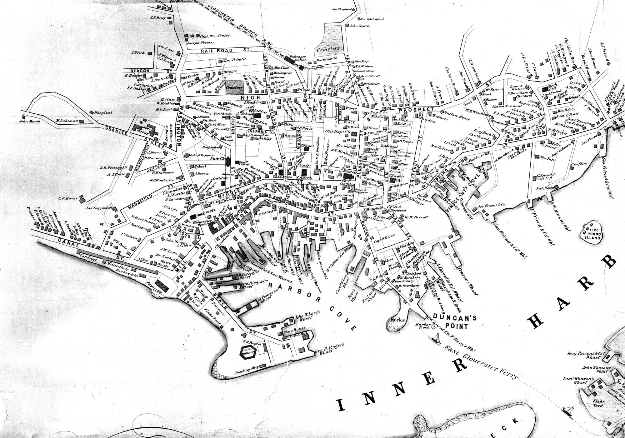
Henry Francis Walling, Map of the Towns of Gloucester and Rockport, Essex Co. Massachusetts. Philadelphia, A. Kollner, 1851
Cape Ann Museum Library & Archive
"Map of the Towns of Gloucester and Rockport, Massachusetts. H.F. Walling, Civil Engineer. John Hanson, Printer. 1851. Population of Gloucester in 1850 7,805. Population of Rockport in 1850 3,213."
Also filed under: Baptist Church (Old, First, 1830) (Pleasant Street) » // Burnham Brothers Marine Railway » // Five Pound Island » // Flake Yard » // Gloucester Harbor, Inner / Harbor Cove » // Harbor Methodist Church (Prospect Street) » // Low (Frederick G.) wharves » // Pavilion Hotel » // Procter Brothers » // Ropewalk » // Vincent's Cove » // Western Shore »
Lithograph
24 x 38 in.
Gloucester City Archives
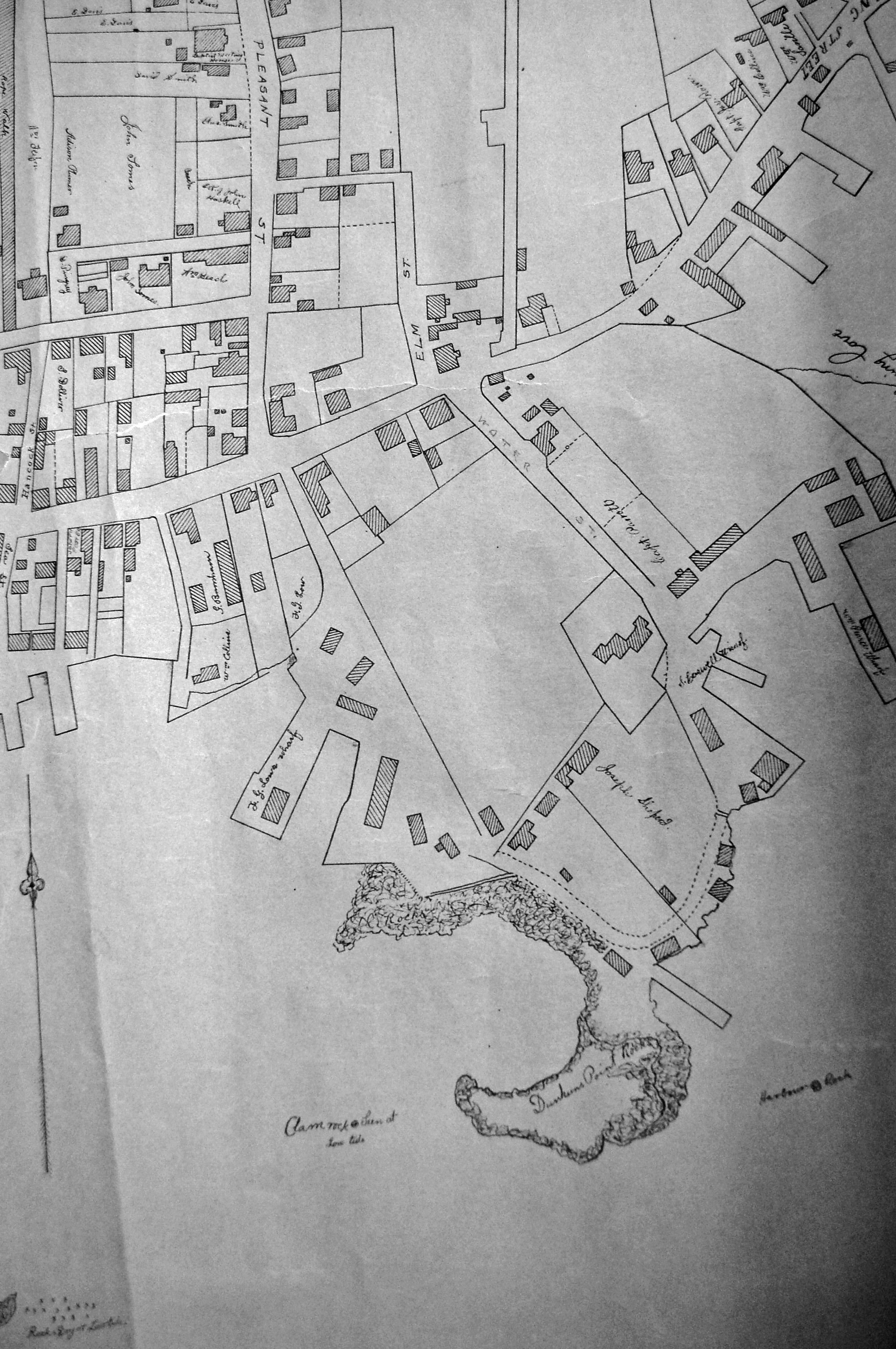
"Drawn on a scale of one hundred feet to an inch. By John Mason 1834–45 from Actual Survey showing every Lott and building then standing on them giving the actual size of the buildings and width of the streets from the Canal to the head of the Harbour & part of Eastern point as farr as Smith's Cove and the Shore of the same with all the wharfs then in use. Gloucester Harbor 1834–35."
This map shows the location of F. E. Low's wharf and the ropewalk. Duncan's Point, the site where Lane would eventually build his studio, is also marked.
The later notes on the map are believed to be by Mason.
Also filed under: Gloucester Harbor, Inner / Harbor Cove » // Low (Frederick G.) wharves » // Low, Capt. Frederick Gilman » // Maps » // Mason, John » // Residences » // Ropewalk » // Somes, Capt. John »
44 x 34 in.
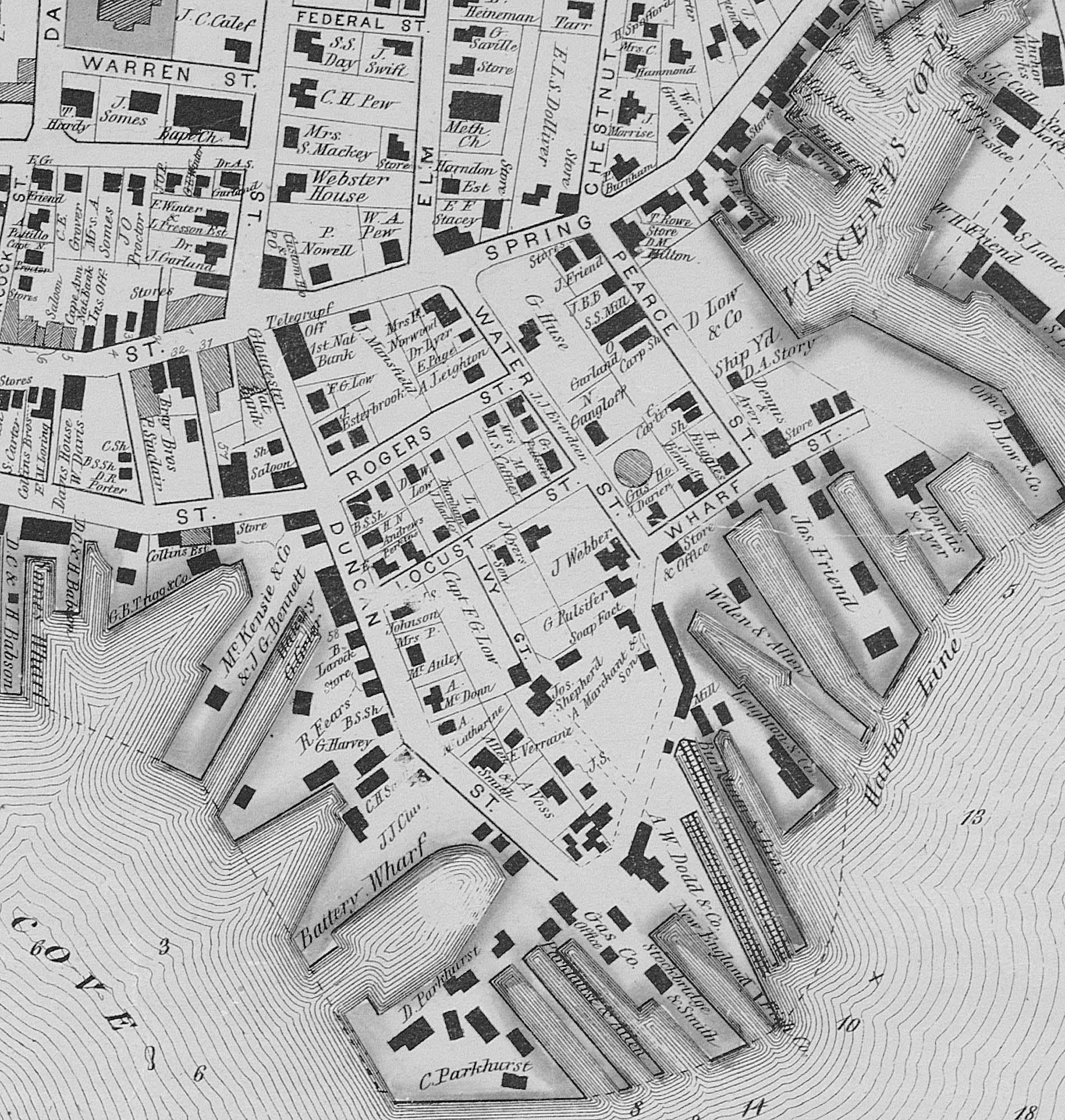
Henry Francis Walling, Map of the Towns of Gloucester and Rockport, Essex Co. Massachusetts. Philadelphia, A. Kollner, 1851
Cape Ann Museum Library & Archive
"Map of the Towns of Gloucester and Rockport, Massachusetts. H.F. Walling, Civil Engineer. John Hanson, Publisher. 1851. Population of Gloucester in 1850 7,805. Population of Rockport in 1850 3,213."
Segment of Harbor Village portion of map showing Lane-Winter property on Duncan's Point.
Also filed under: Maps » // Union School » // Winter, Ignatius »
Cape Ann Museum Library & Archive
Segment shows Lane's home on Duncan's Point (as F. G. Low property) and neighboring businesses about five years after his death.
Also filed under: Maps »
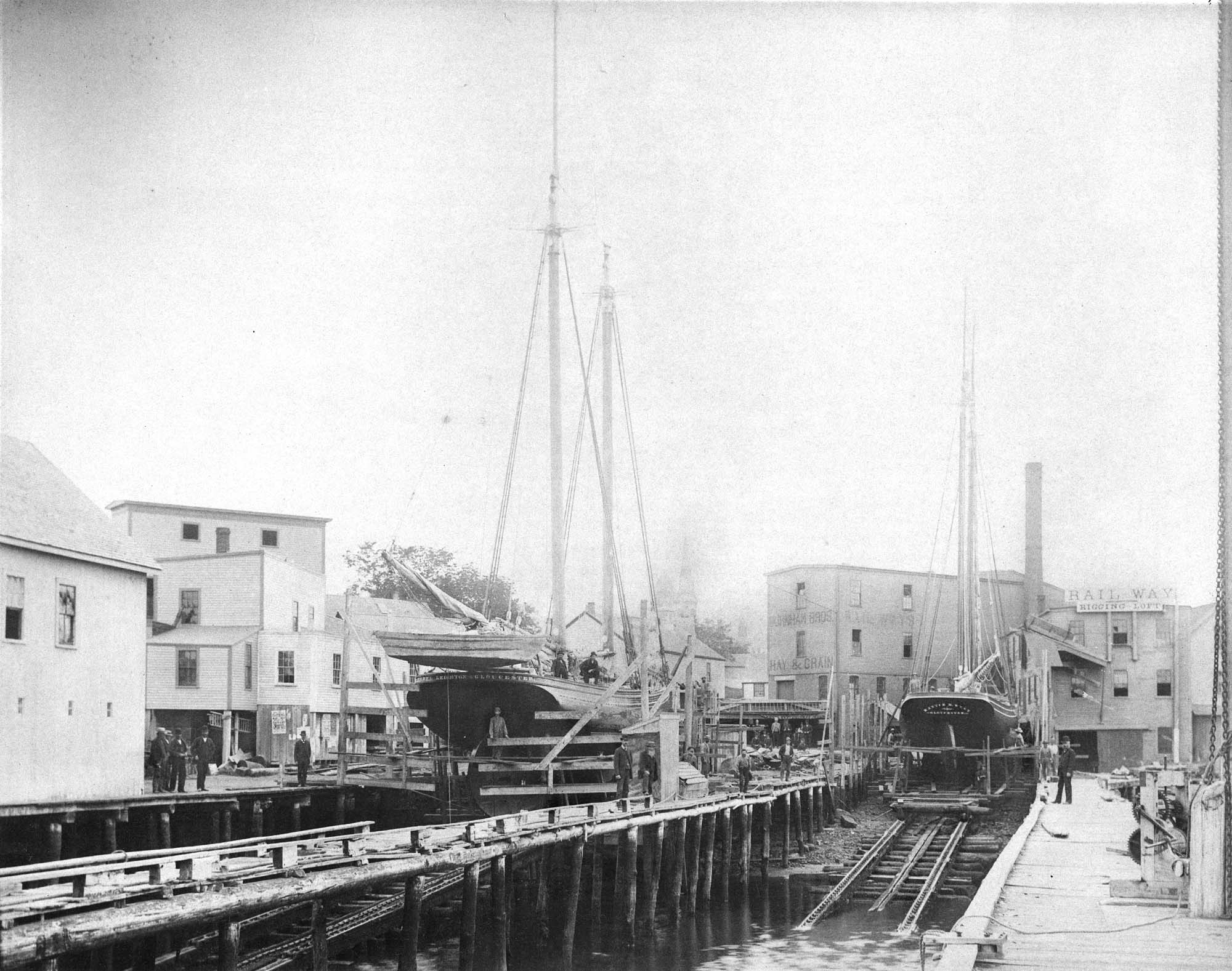
Mounted print
8 x 10 in.
Cape Ann Museum Library & Archive
Railway at the tip of Duncan's Point. Vessels on the ways are "Isabell Leighton" and "Hattie B. West."
Also filed under: Burnham Brothers Marine Railway »
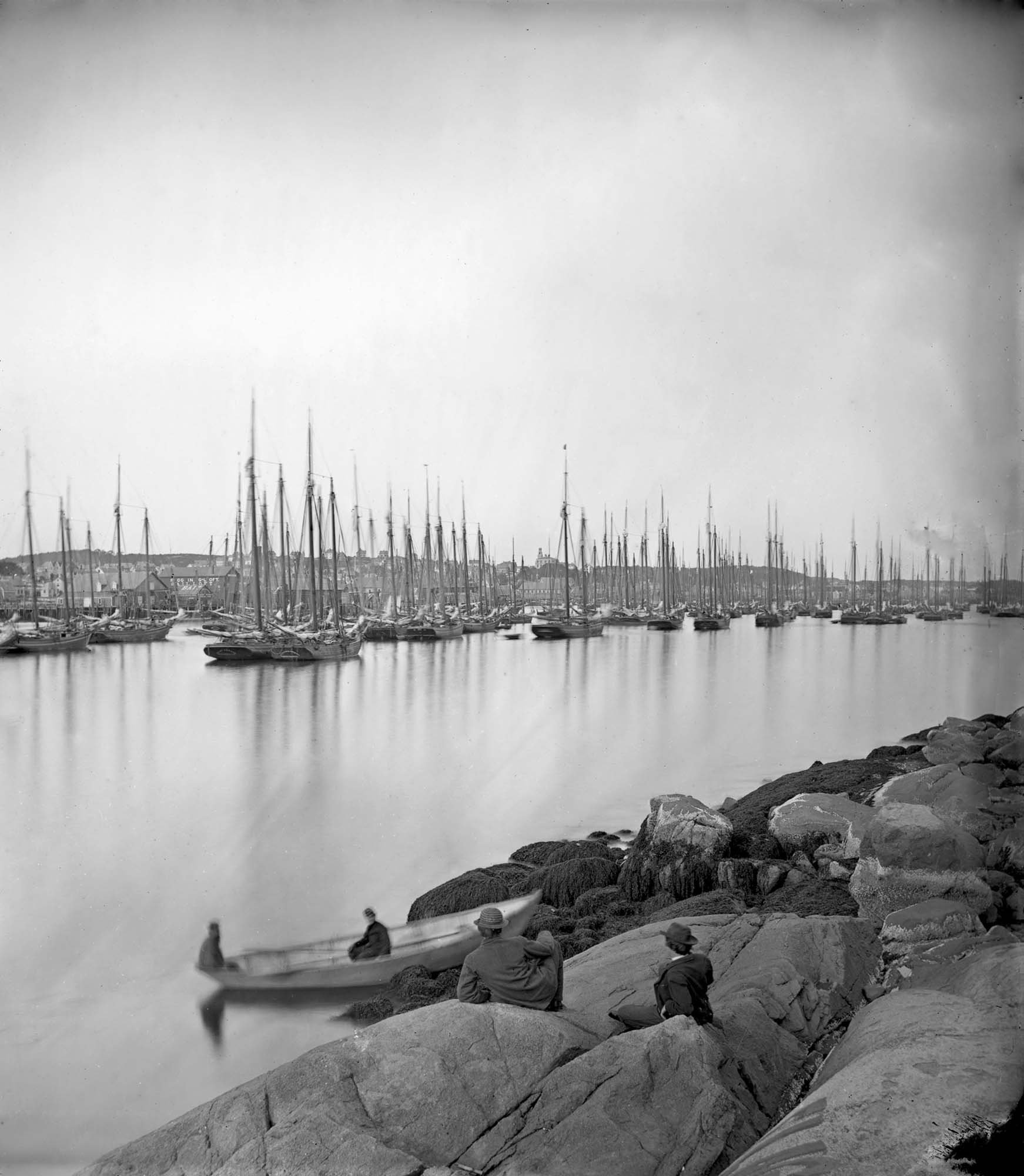
Cape Ann Museum Library & Archive (2013.068)
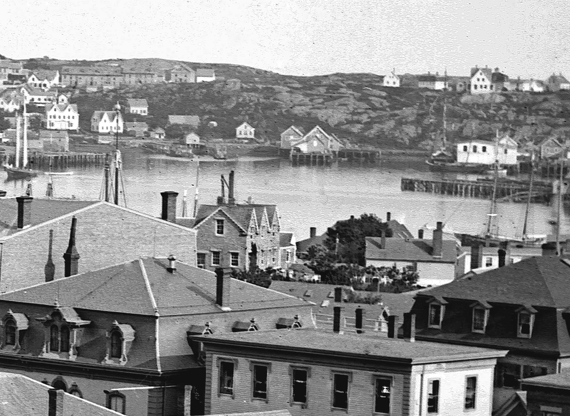
Schooner fleet anchored in the inner harbor. Looking east from Rocky Neck, Duncan's Point wharves and Lane house (at far left), Sawyer School cupola on Friend Street.
Also filed under: Gloucester Harbor, Inner / Harbor Cove » // Historic Photographs » // Schooner (Fishing) » // Waterfront, Gloucester »
Eastern Point is the long promontory that defines the eastern limit of Gloucester Harbor. In Lane's day it was wild and uninhabited but was also a strategic landmark. A Civil War fort was built there in 1863. Lane painted his seminal series of Brace's Cove and Brace's Rock from a vantage point on the eastern side.
The area was made safer for navigation by the construction of a new lighthouse in 1831 and the breakwater known as the Dog Bar. First proposed in 1866 in order to reduce turbulence in the waters of the outer harbor during heavy weather, it was not until 1894 that work on its construction began. Progress was slow, and although an extraordinary number of shipwrecks and groundings in 1898 sped it up somewhat, the breakwater was not completed until 1905.
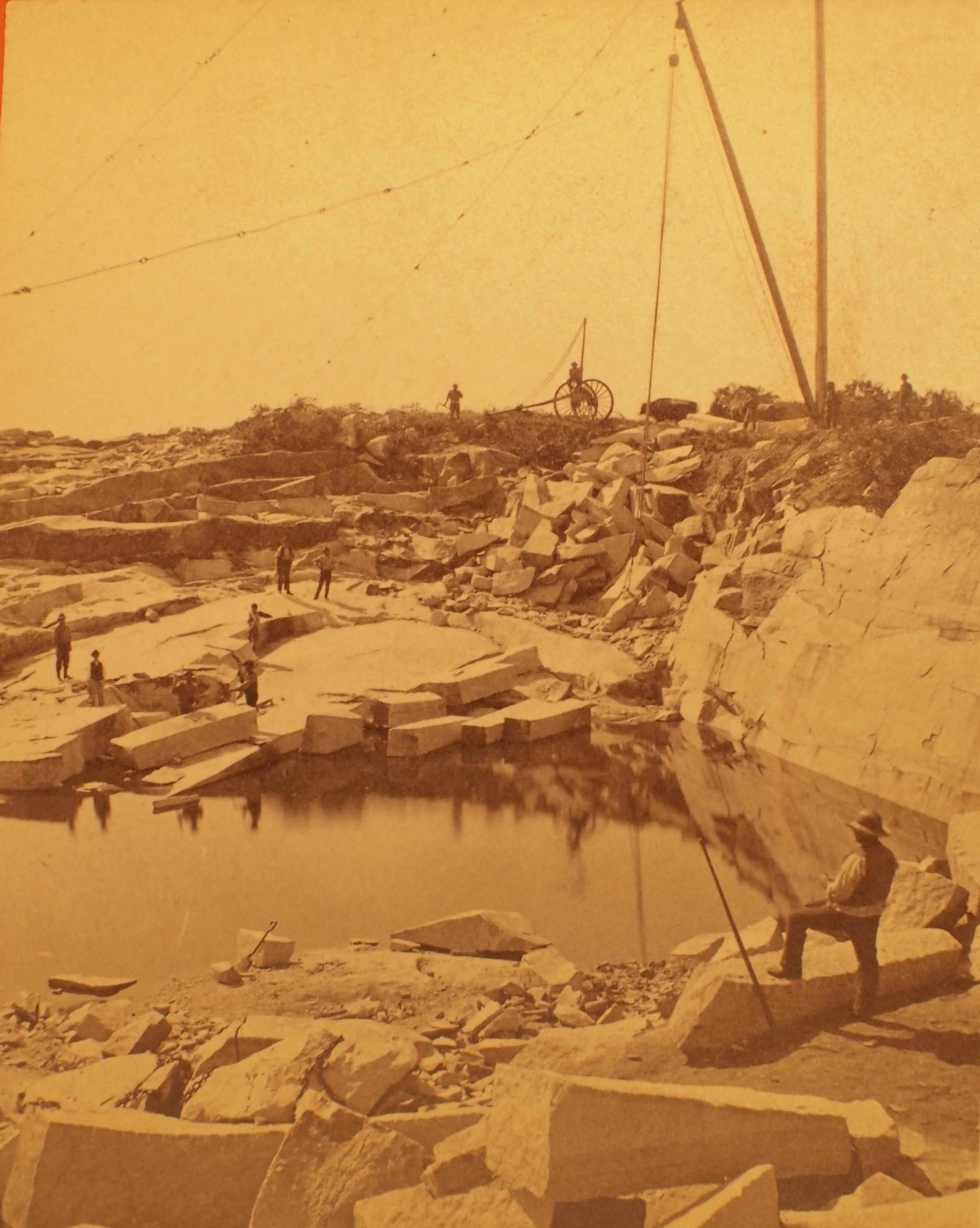
Stereograph card
Cape Ann Museum Library & Archive
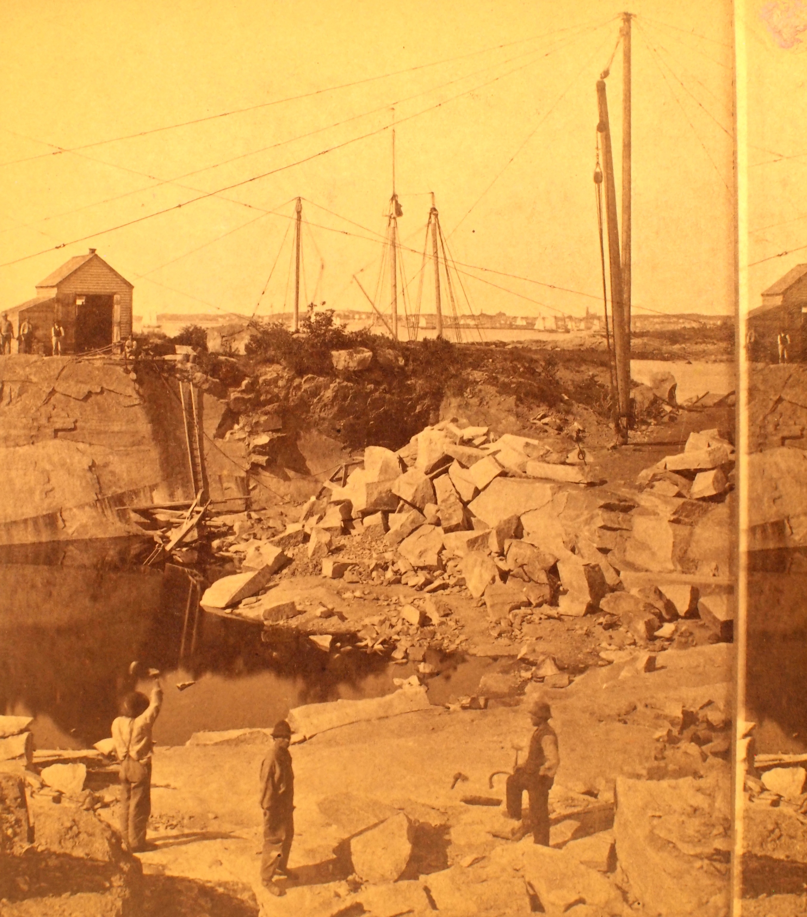
This view shows a wood derrick for hoisting granite blocks.
Also filed under: Granite Quarrying / Shipping » // Historic Photographs »
Glass plate negative from Benham Collection
Cape Ann Museum Library & Archive
View of Gloucester Harbor from Friend Street Wharves, Five Pound Island segment at far left, Rocky Neck, Eastern Point and Ten Pound Island in background.
Also filed under: Five Pound Island » // Gloucester – City Views »
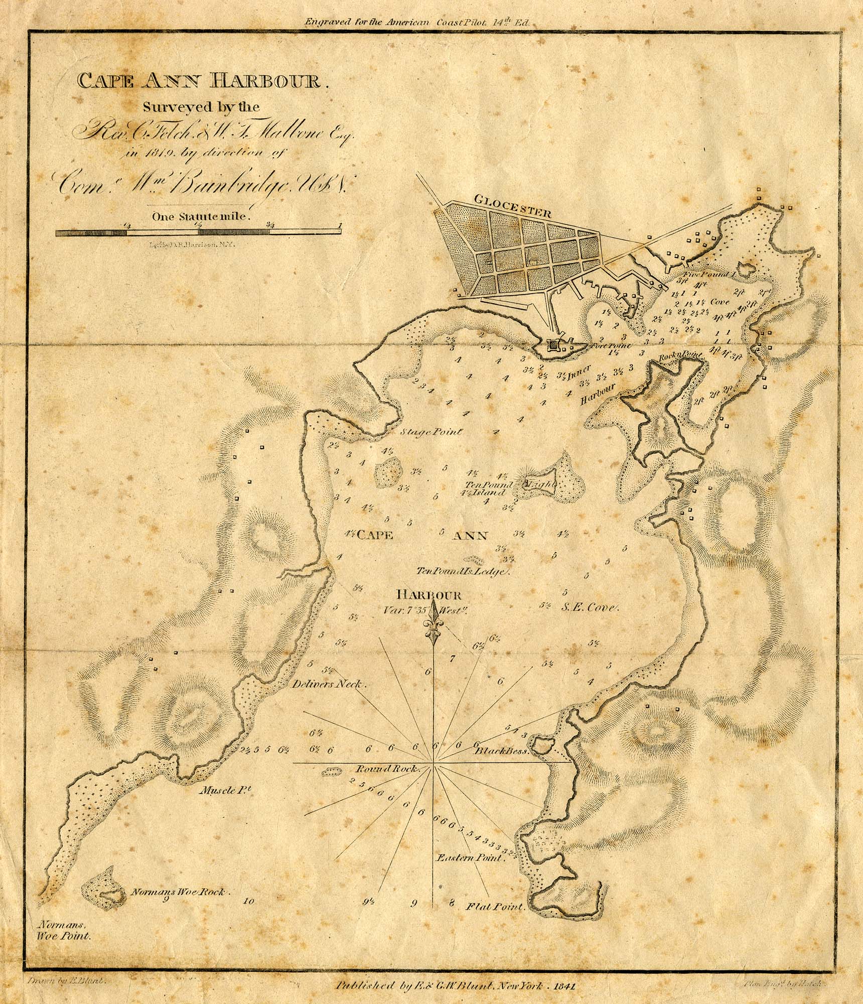
Engraving of 1819 survey taken from American Coast Pilot 14th edition
9 1/2 x 8 in.
Cape Ann Museum Library & Archive
D32 FF5
Also filed under: Dolliver's Neck » // Maps » // Norman's Woe » // Ten Pound Island »
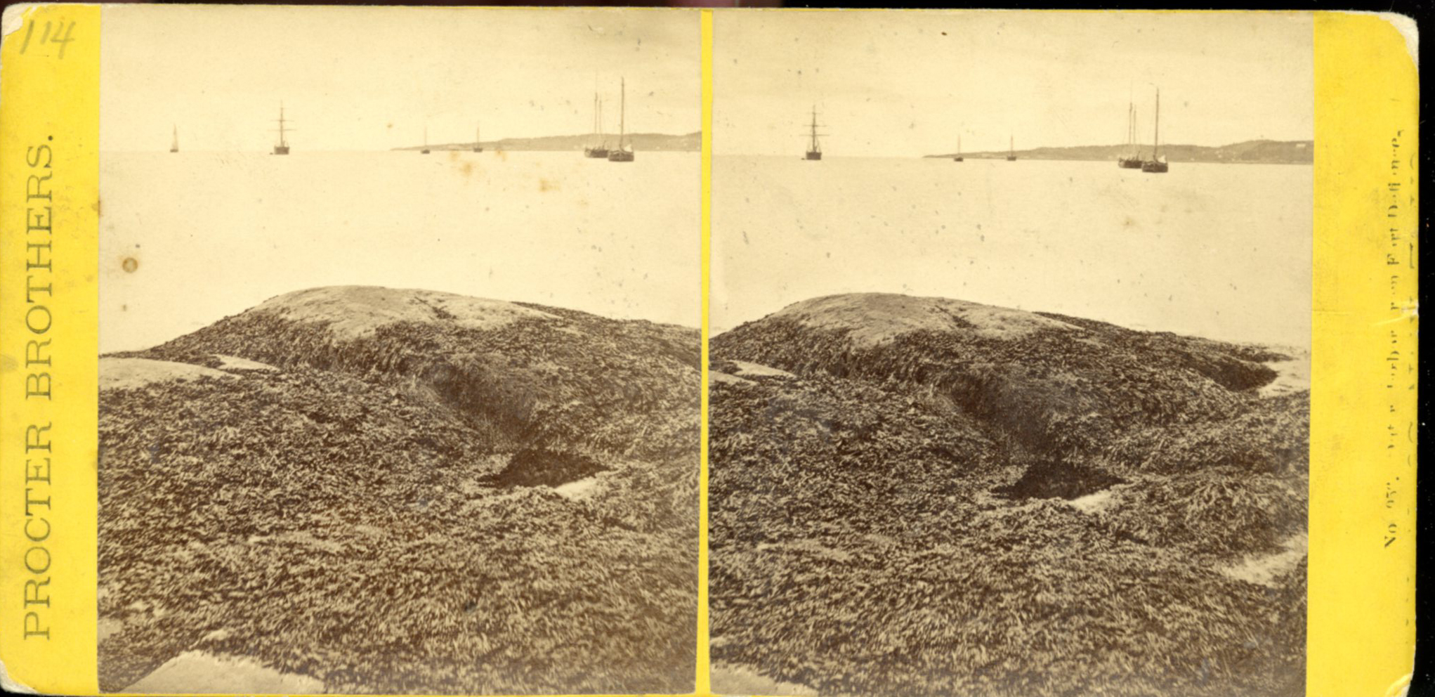
Stereograph card
Procter Brothers, Publisher
Cape Ann Museum Library & Archive
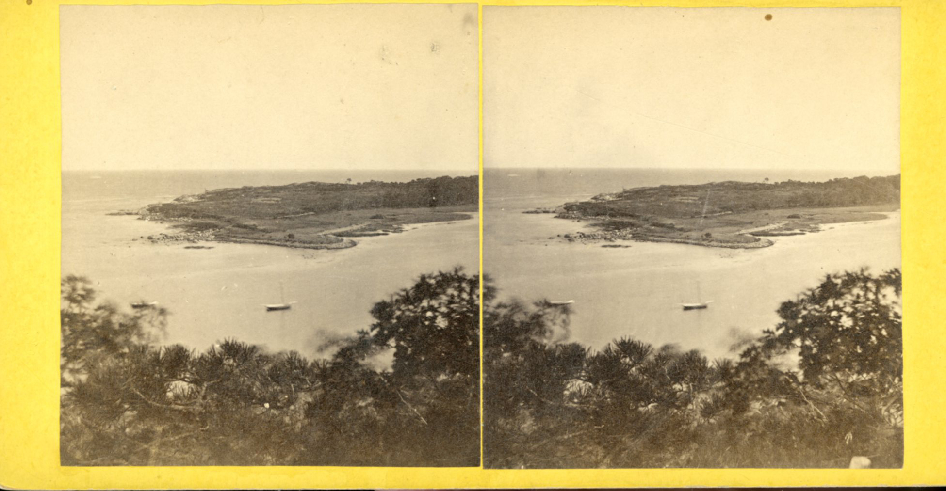
View from Civil War fort on Eastern Point.
Also filed under: Gloucester Harbor, Outer » // Historic Photographs »
Stereograph card
Cape Ann Museum Library & Archive
This view shows a wood derrick for hoisting granite blocks.
Also filed under: Granite Quarrying / Shipping » // Historic Photographs »

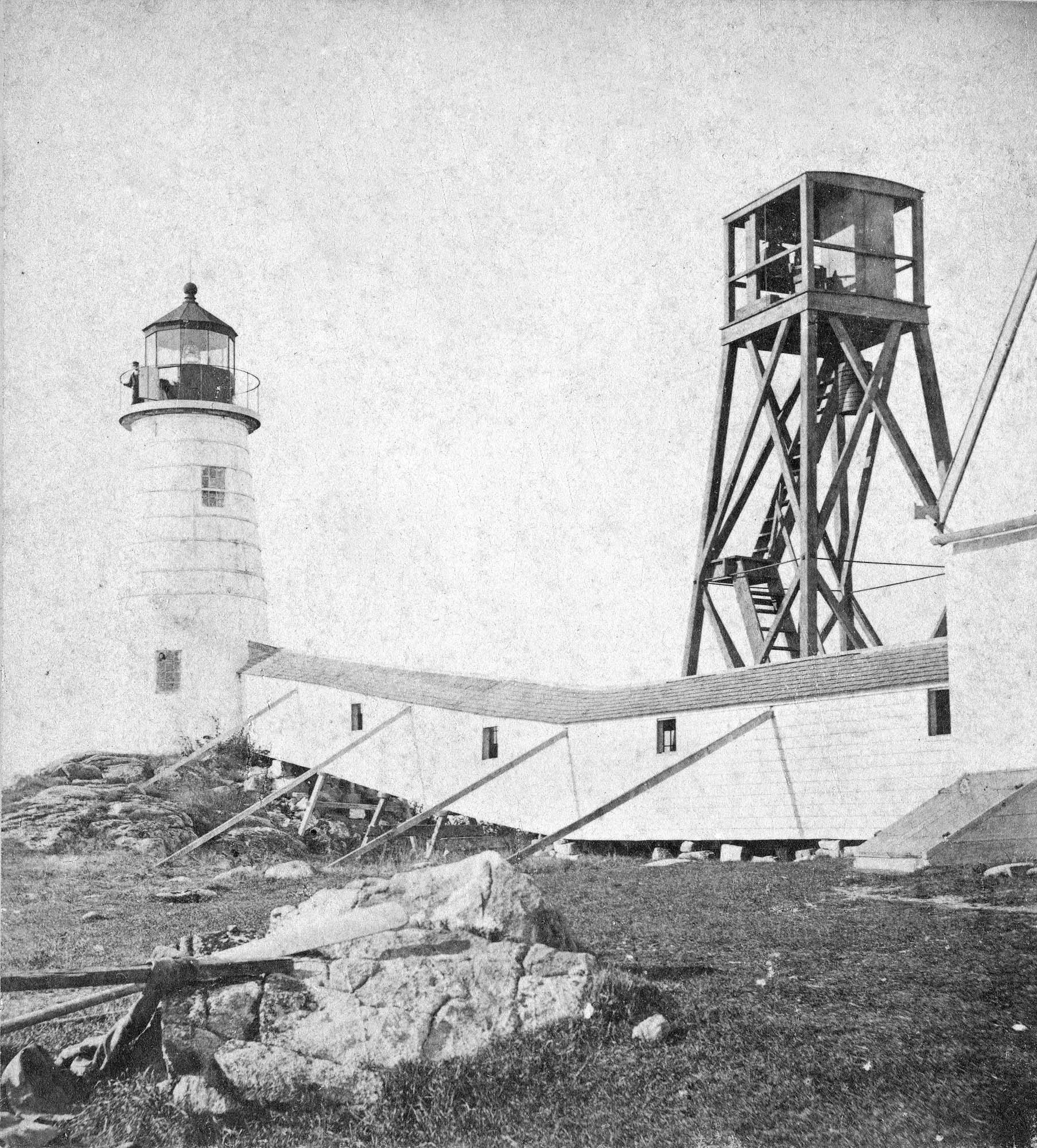
Plate from The Illustrated Coast Pilot with Sailing Directions: The Coast of New England from New York to Eastport, Maine including Bays and Harbors, published by N. L. Stebbins,1896.
Also filed under: Gloucester, Mass. – Eastern Point Light »
Stereograph card
Published by Frank Rowell
Cape Ann Museum Library & Archive
Also filed under: Gloucester, Mass. – Eastern Point Light »
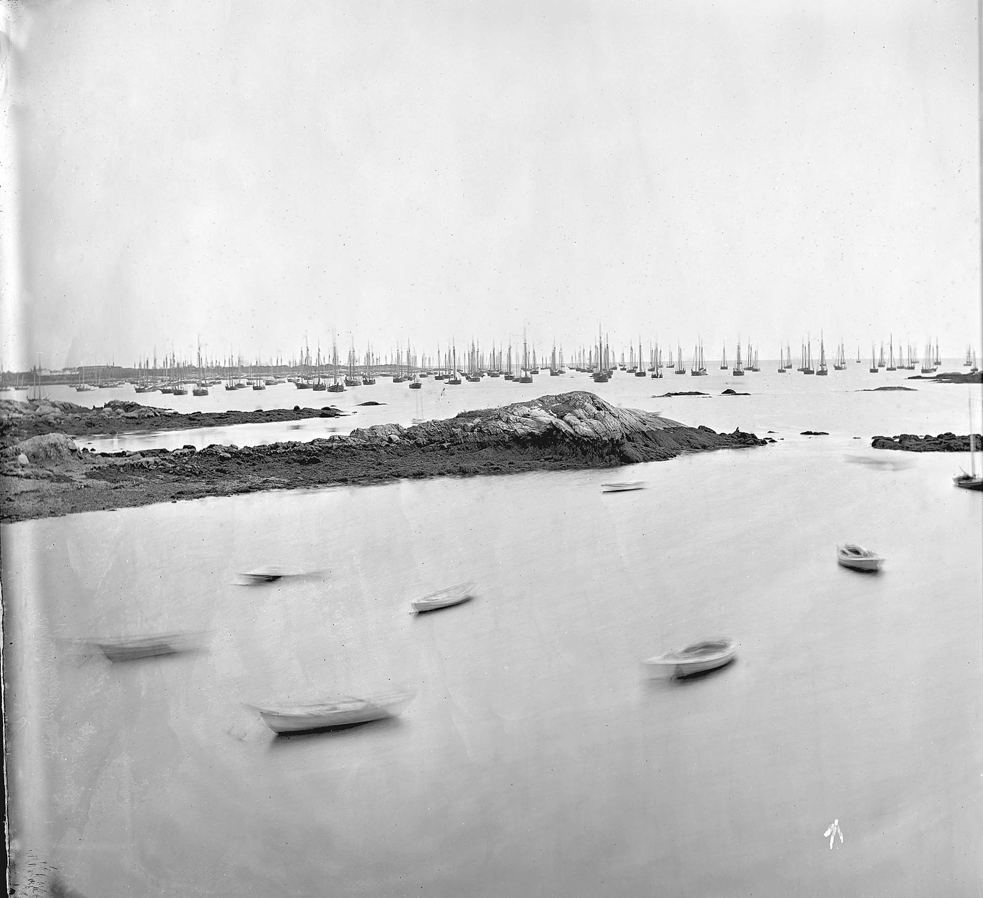
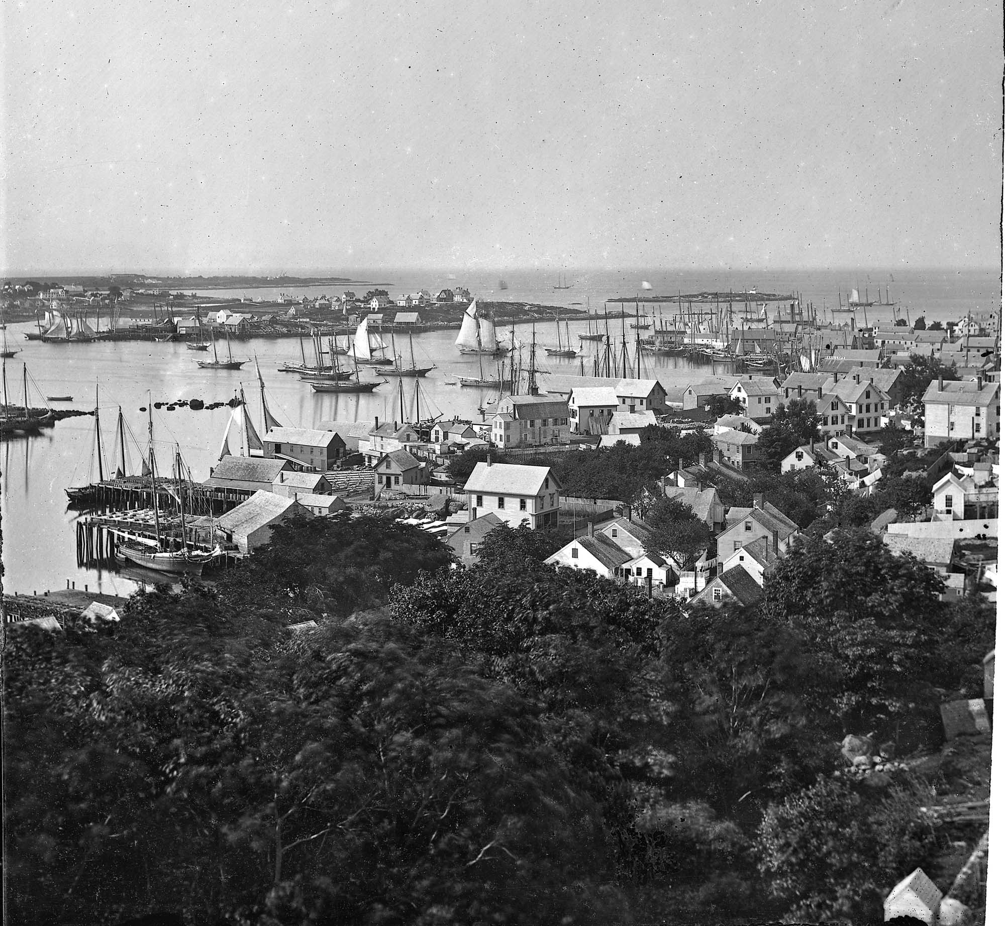
John Heywood Photo for Hervey Friend
Cape Ann Museum Library & Archive (2013.068)
Schooners anchored on the Pancake Ground, taken from from Wonson's Cove, easterly side of the Rocky Neck causeway. Eastern Point Fort and garrison in background to far left.
Also filed under: Gloucester Harbor, Outer »
Although the exact location and information about the "Lone Pine" or "Old Pine Tree" is unknown, it was a well-recognized landmark in Lane's day. It was situated on the very tip of Dolliver's Neck, and as a result of its height and location near the shoreline, was seen easily from many points, especially across the water. The tree is clearly visible in Dolliver's Neck and the Western Shore from Field Beach, 1857 (inv. 3).
Newsprint
From bound volume owned by publisher Francis Procter
Collection of Fred and Stephanie Buck
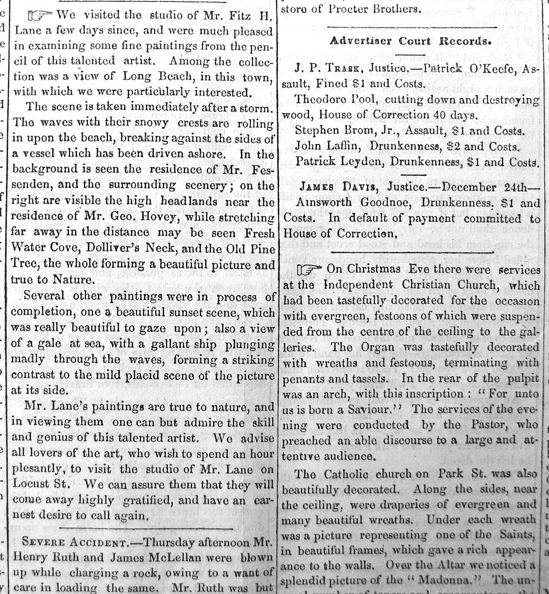
"We visited the studio of Mr. Fitz H. Lane a few days since, and were much pleased in examining some fine paintings from the pencil of this talented artist. Among the collection was a view of Long Beach, in this town, with which we were particularly interested.
The scene is taken immediately after a storm. The waves with their snowy crests are rolling in upon the beach, breaking against the sides of a vessel which has been driven ashore. In the background is seen the residence of Mr. Fessenden, and the surrounding scenery; on the right are visible the high headlands near the residence of Mr. Geo. Hovey, while stretching far away in the distance may be seen Fresh Water Cove, Dolliver's Neck, and the Old Pine Tree, the whole forming a beautiful picture and true to Nature.
Several other paintings were in process of completion, one a beautiful sunset scene, which was really beautiful to gaze upon; also a view of a gale at sea, with a gallant ship plunging madly through the waves, forming a striking contrast to the mild placid scene of the picture at its side.
Mr. Lane's paintings are true to nature, and in viewing them one can but admire the skill and genius of this talented artist, We advise all lovers of the art, who wish to spend an hour pleasantly, to visit the studio of Mr. Lane on Locust St. We can assure them that they will come away highly gratified, and have an earnest desire to call again." (1)
(1) See p. 2, column 3, Courtesy of the American Antiquarian Society
Also filed under: Chronology » // Dolliver's Neck » // Fessenden, C. B. » // Fresh Water Cove » // Newspaper / Journal Articles » // Steepbank » // Studio Descriptions »
Newspaper
"Mr. Lane has just completed a third picture of the Western Shore of Gloucester Harbor, including the distance from 'Norman's Woe Rock' to 'Half Moon Beach.' It was painted for Mr. William E. Coffin of Boston, and will be on exhibition at the artist's rooms for only a few days; we advise all our readers who admire works of art, and would see one of the best pictures Mr. Lane has ever executed..."
"...solitary pine, so many years a familiar object and landmark to the fisherman."
Stereograph card
Cape Ann Museum Library & Archive
Taken from Steepbank, on the western side of Gloucester Harbor, and showing a small boat at anchor in the cove, then the Neck, and the sea beyond.
Also filed under: Dolliver's Neck » // Fresh Water Cove » // Historic Photographs » // Steepbank »

Letter
Cape Ann Museum Library & Archive, Gloucester, Mass.
". . . will fully appreciate all that I have done in my garden, in ornamenting it, with flowers and plants, Rustic Arbours and Statues, and I only wish that you could be here to witness and enjoy his [Dr. J. L. Stevens] expressions of delight and interest, when a new flower attracts his attention, or some beauty of arrangement meets his eye. Samuel [B. Stevens of Castine] he tells me came up with the expectation of going on a voyage to Australia, but when he arrived in Boston he found the vessel with her compliment of men, and it is very uncertain if he goes in her. Your Mother and all at home are well. I yesterday made a sketch of Stage Fort and the surrounding scenery, from the water. Piper has given me an order for a picture from this point of view, to be treated as a sunset. I shall try to make something out of it, but it will require some management, as there is no foreground but water and vessels. One o’clock, it is very hot, the glass indicates 84° in my room, with the windows all open and a light breeze from the east, this is the warmest day . . .
. . . than devoting it to you. Since writing you last I have painted but one picture worth talking about and that one I intend for you if you should be pleased with it. It is a View of the beach between Stage Fort and Steep bank including Hovey’s Hill and residence, Fresh water cove and the point of land with the lone pine tree. Fessenden’s house, likewise comes into the picture. The effect is a mid day light with a cloudy sky, a patch of sunlight is thrown across the beach and the breaking waves, an old vessel lies stranded on the beach with two or three figures, there are a few vessels in the distance and the Field rocks likewise show at the left of the picture. I think you will be pleased with this picture, for it is a very picturesque scene especially the beach, as there are many rocks which come in to destroy the monotony of a plain sand beach, and I have so arranged the light and shade that the effect I think is very good indeed, however you will be better able to judge of that when you see it, the size is 20 x 33. . ."
Commentary
This drawing combines two sketches of completely different scale: a view of Gloucester Harbor from Rocky Neck, and a boat with an unsual, and perhaps foreign, rig. Just a few tiny marks indicate the buildings of Gloucester, including, perhaps, Lane's own home on Duncan's Point.
[+] See More