An online project under the direction of the CAPE ANN MUSEUM
Historical Materials: Cape Ann Locales
Historical Materials » Cape Ann Locales » Annisquam River
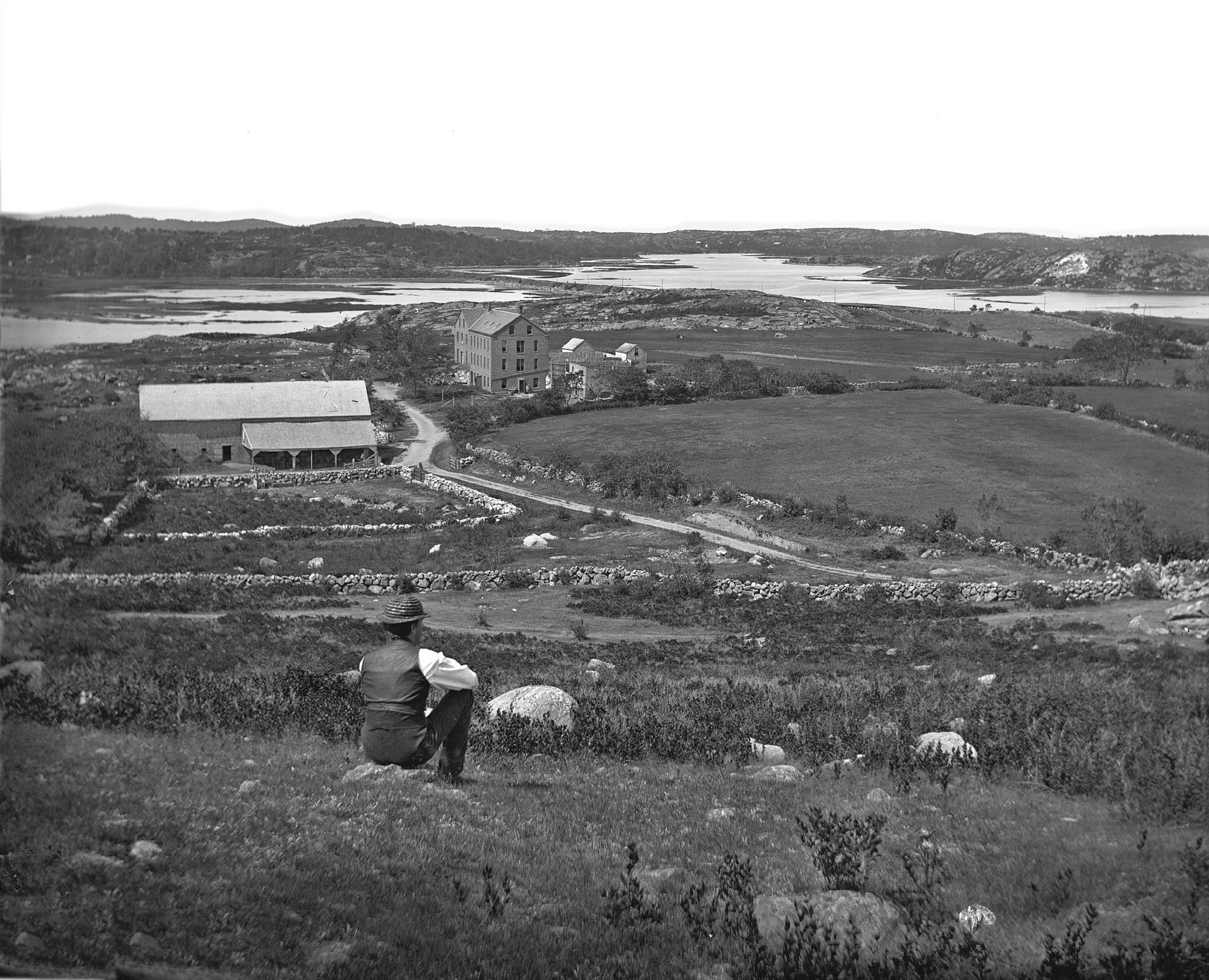
You have navigated to this pages from catalog entry: Looking up Squam River from Done Fudging, 1850s (inv. 26)
Annisquam River
View related Fitz Henry Lane catalog entries (3) »
Technically not a river but a saltwater tidal estuary, the Annisquam (or "Squam") River almost cuts off Cape Ann from the rest of the world. Its constantly flowing tides, and the gleaming expanse of marshes surrounding it, inspired several of Lane's paintings. Marsh hay was harvested along its tidal inlets and provided subject matter for Lane's depiction of this ancient occupation, and the traditional craft associated with it, the gundalow. The Annisquam is connected to Gloucester Harbor by The Cut, also known as the Blynman Canal, which was first dug in the seventeenth century, filled in and opened again to complete the more direct inland passage between the harbor and open ocean.
Related tables: Cut, The (Stacy Blvd.) » // Gundalow / Scow » // Pole's Hill » // Salt Marsh Hay / English Hay »
4 x 5 in.
Cape Ann Museum Library & Archive
#10159
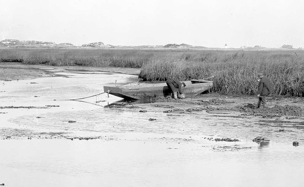
Rare view of a marsh gundalow, being used on the Annisquam River for harvesting salt marsh hay.
Also filed under: Gundalow / Scow »
44 x 34 in.
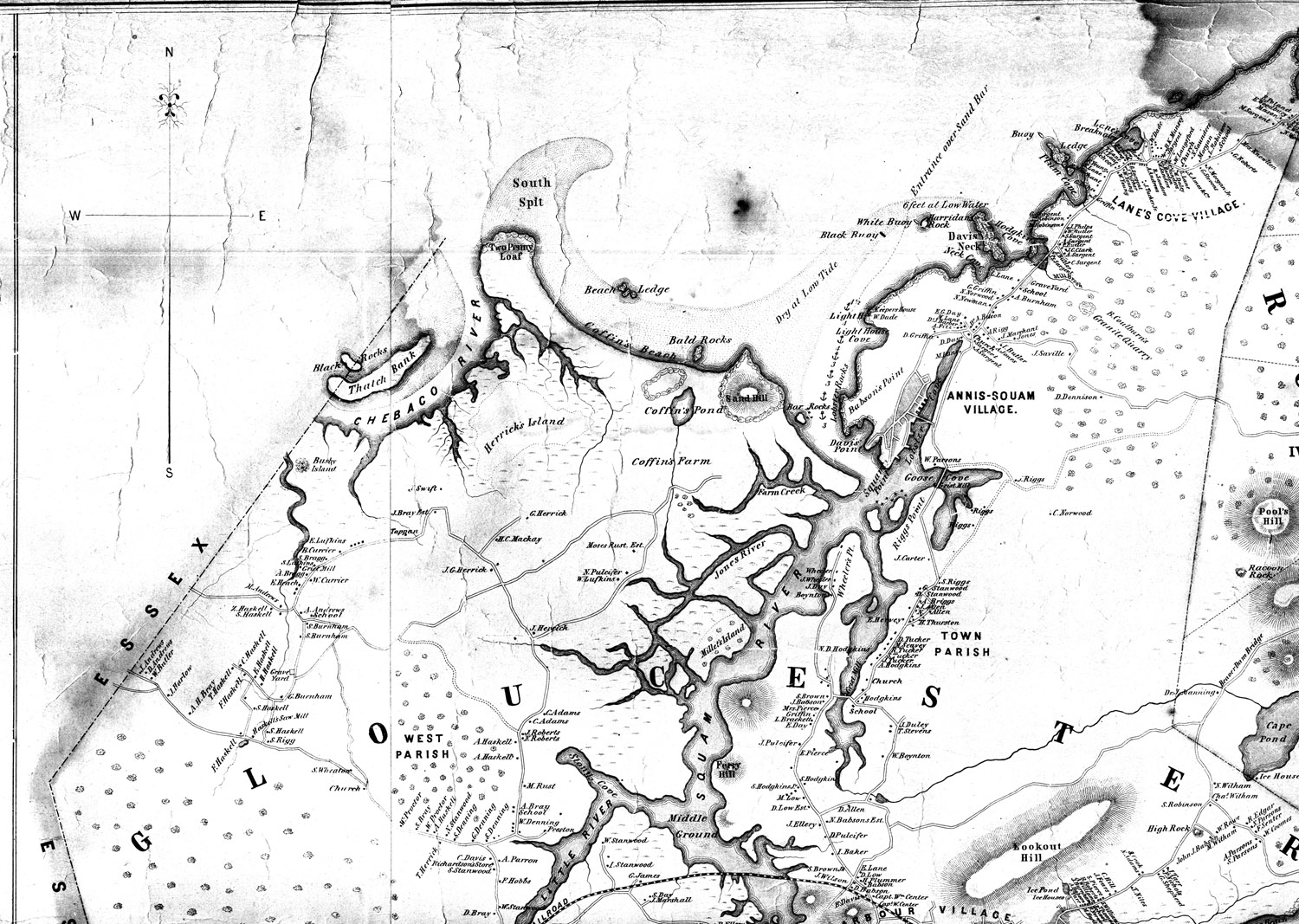
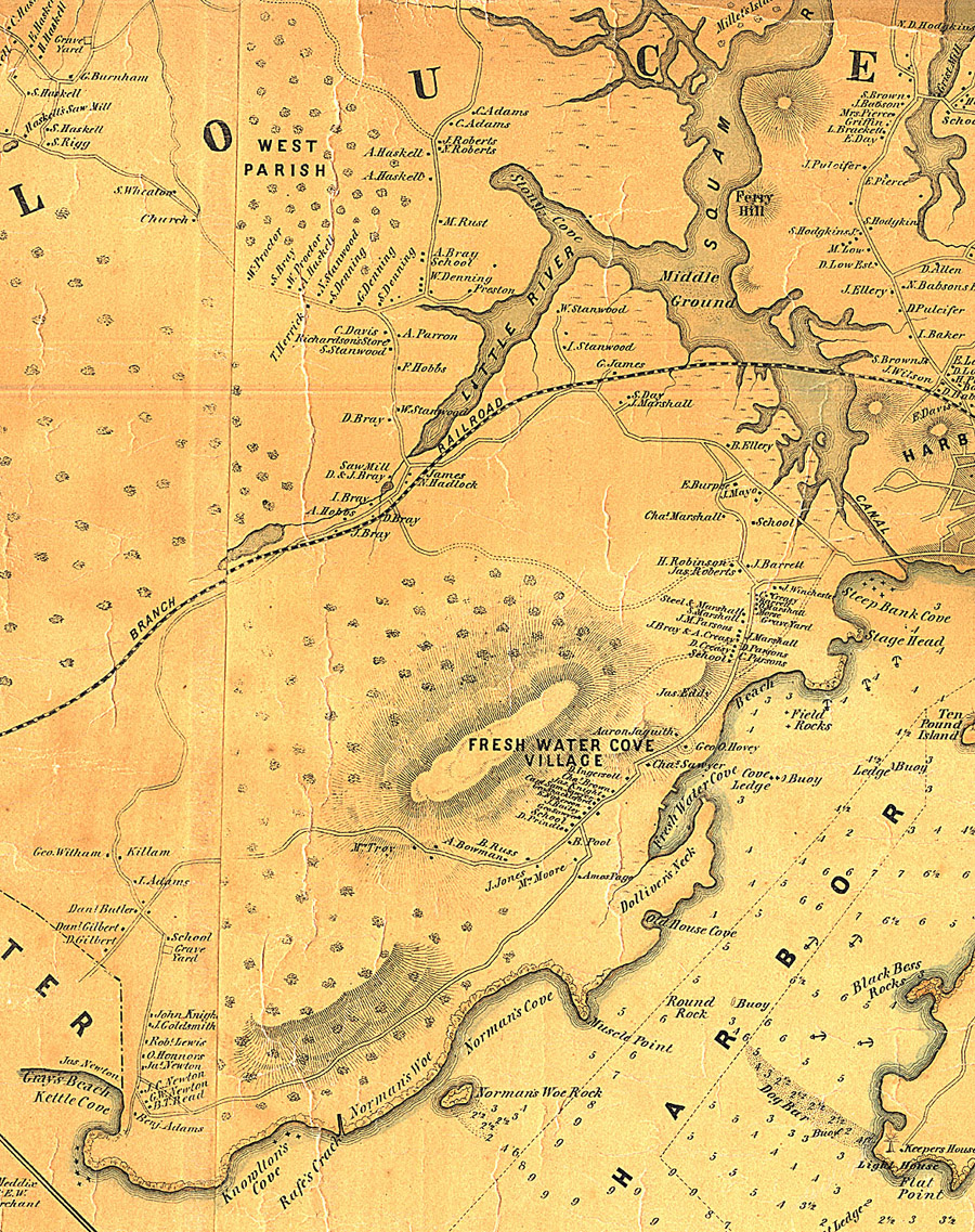
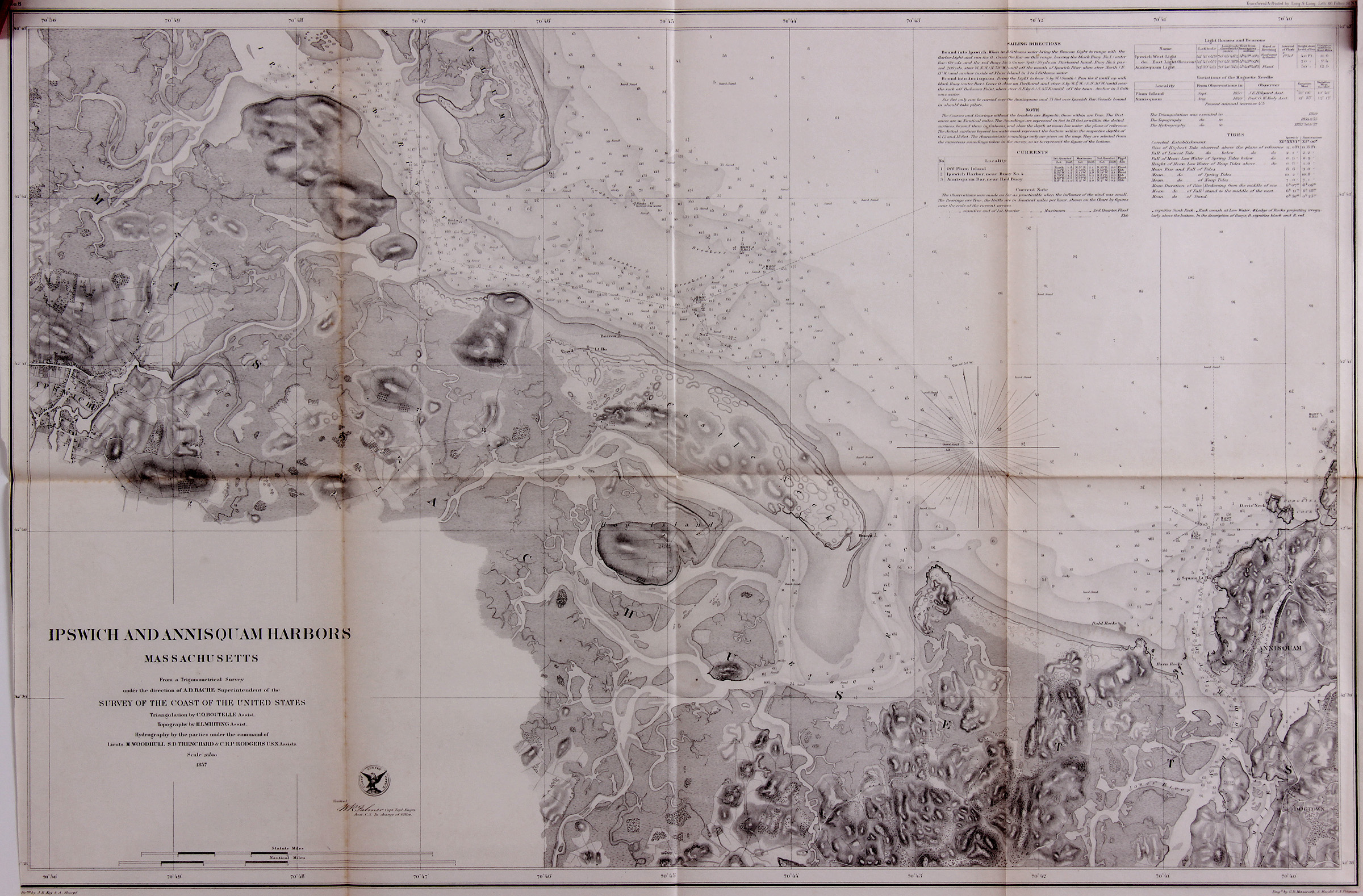
Henry Francis Walling, Map of the Towns of Gloucester and Rockport, Essex Co. Massachusetts. Philadelphia, A. Kollner, 1851
Cape Ann Museum Library & Archive
"Map of the Towns of Gloucester and Rockport, Massachusetts. H.F. Walling, Civil Engineer. John Hanson, Publisher. 1851. Population of Gloucester in 1850 7,805. Population of Rockport in 1850 3,213."
View related Fitz Henry Lane catalog entries (1) »
Also filed under: Babson House » // Coffin's Beach » // Eastern Railroad » // Gloucester, Mass. – Annisquam Harbor Lighthouse » // Granite Quarrying / Shipping » // Loaf, The » // Low (David) House » // Maps » // Old First Parish / Subsequent Fourth Parish Church (at the Green) » // Riverdale Methodist Church (Washington Street) » // White-Ellery House »
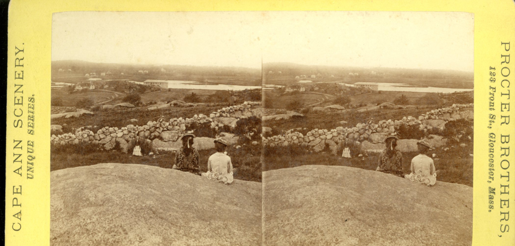
Stereograph card
Cape Ann Museum Library & Archive
Also filed under: Historic Photographs »
44 x 34 in.
Henry Francis Walling, Map of the Towns of Gloucester and Rockport, Essex Co. Massachusetts. Philadelphia, A. Kollner, 1851
Cape Ann Museum Library & Archive
"Map of the Towns of Gloucester and Rockport, Massachusetts. H.F. Walling, Civil Engineer. John Hanson, Publisher. 1851. Population of Gloucester in 1850: 7,805. Population of Rockport in 1850: 3,213."
Also filed under: Brookbank » // Dolliver's Neck » // Fresh Water Cove » // Gloucester Harbor, Outer » // Maps » // Norman's Woe » // Stage Rocks / Stage Fort / Stage Head » // Steepbank » // West Gloucester – Little River » // Western Shore »
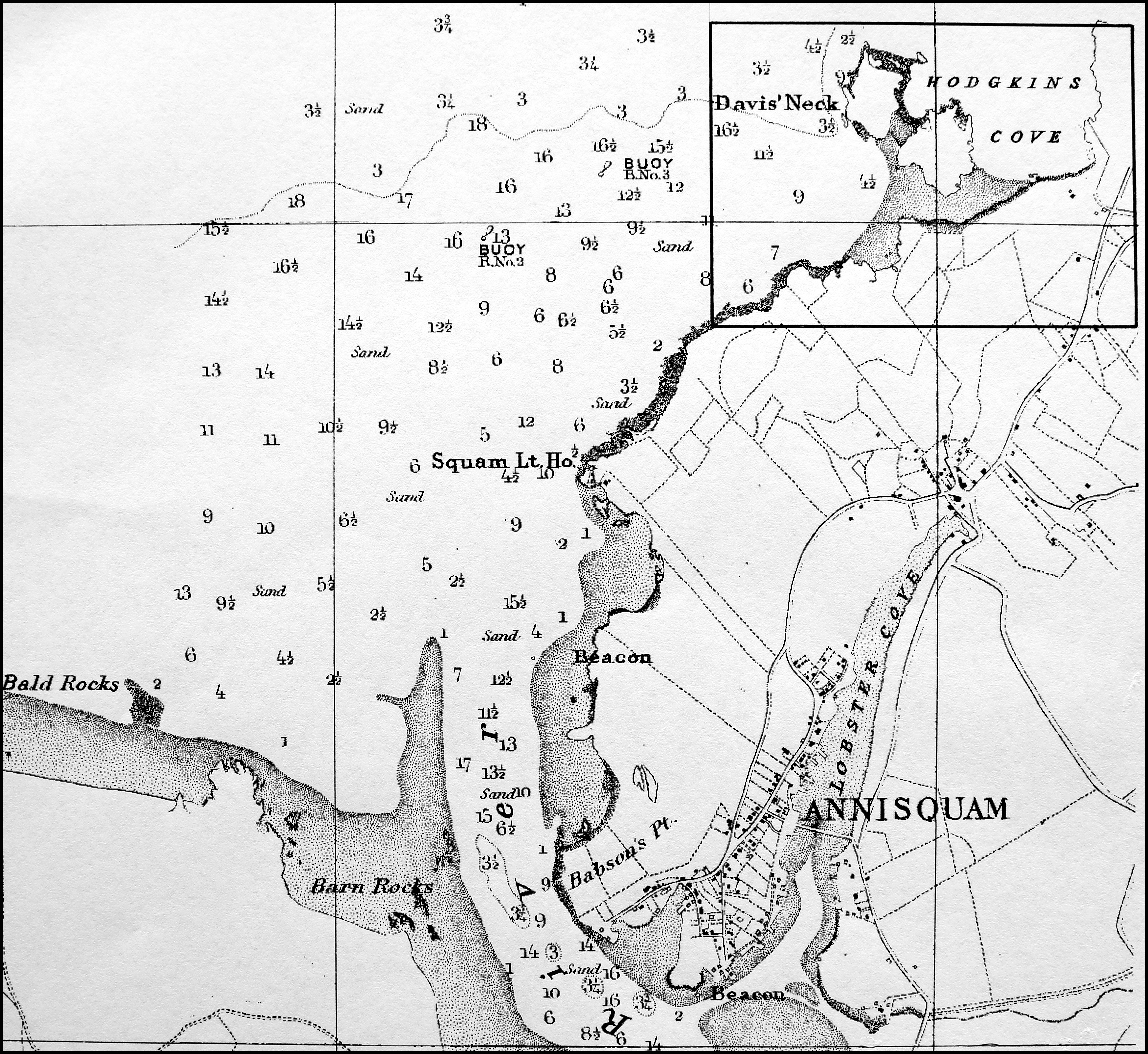
Also filed under: Davis' Neck »
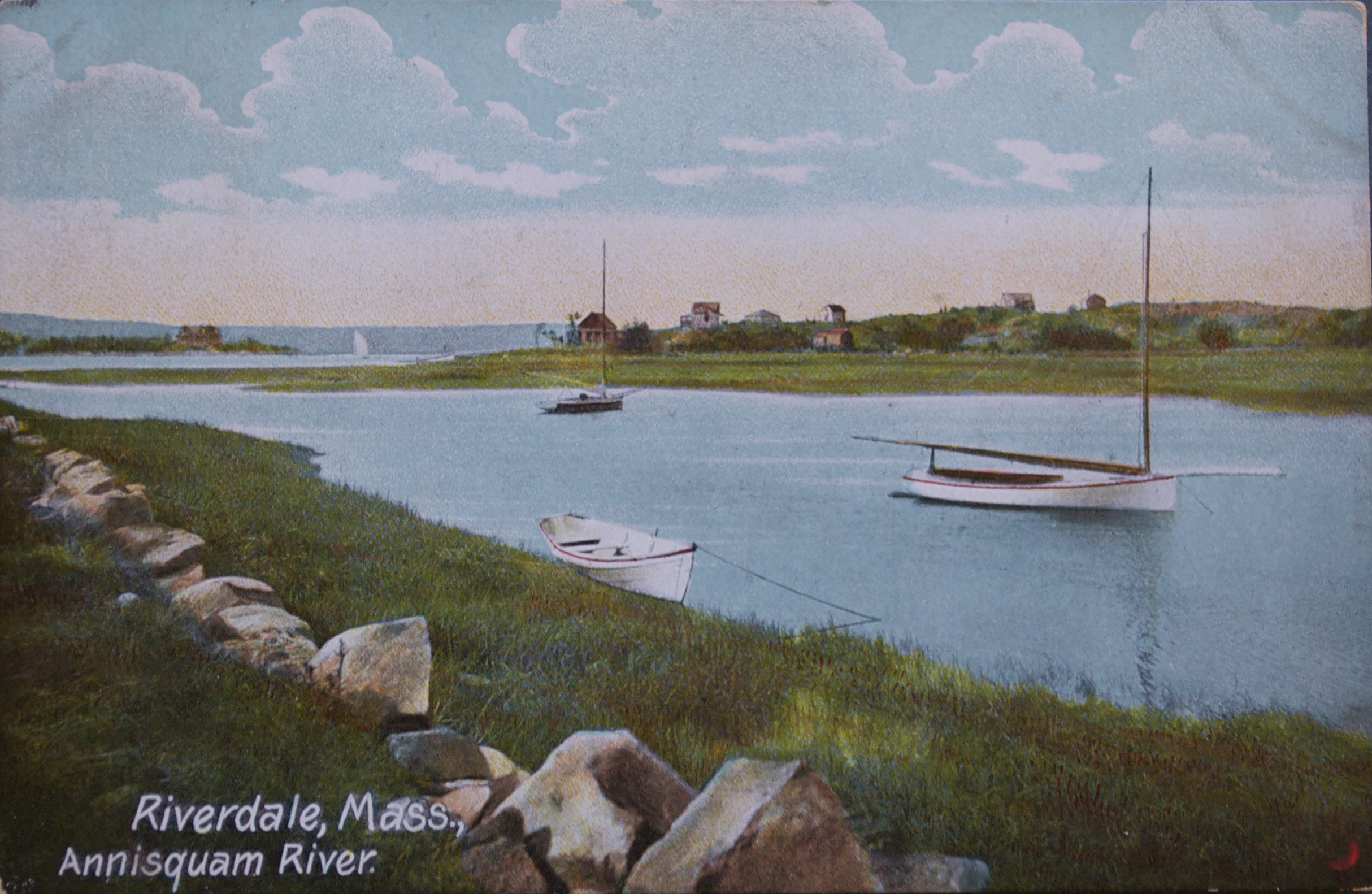
Postcard
Cape Ann Museum Library & Archive
Also filed under: Riverdale / Town Parish »
Survey of the Coast of the United States, Washington, D.C.
Collection of Erik Ronnberg
Also filed under: Maps »