An online project under the direction of the CAPE ANN MUSEUM
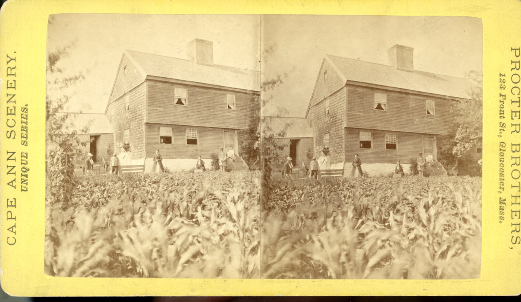
White-Ellery House
View related Fitz Henry Lane catalog entries (4) »
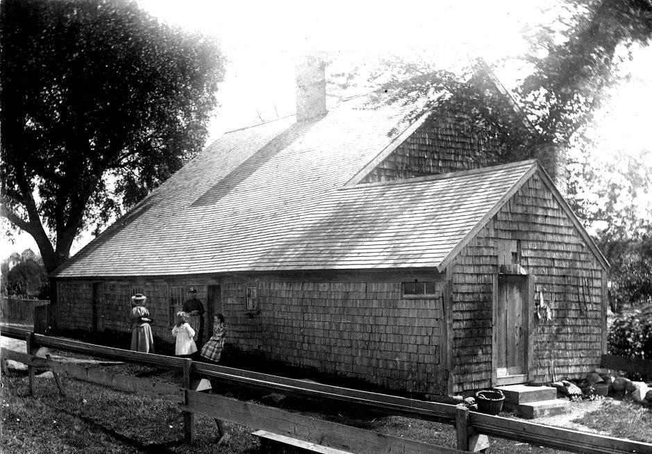
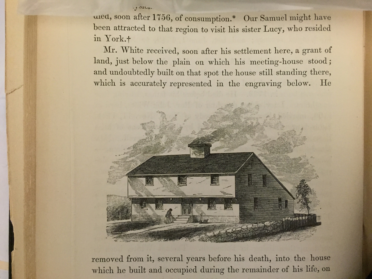
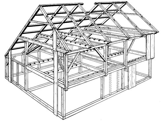
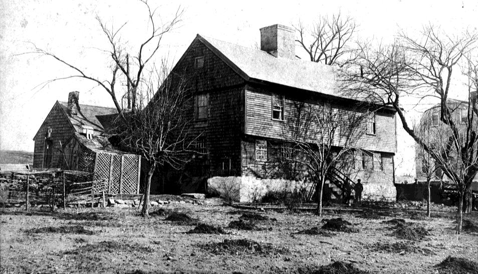
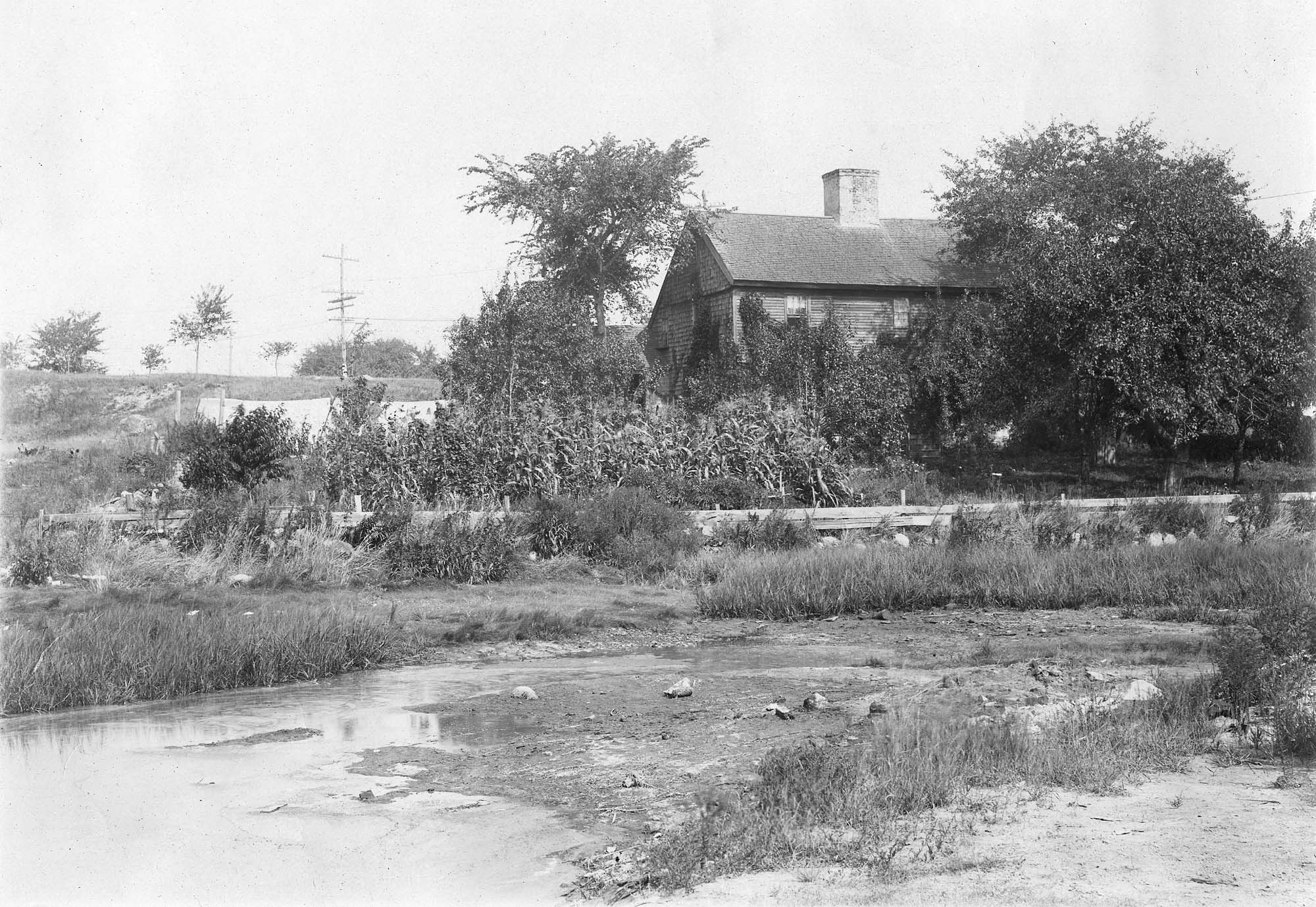
The White-Ellery House was built in 1710 and is one of just a handful of First Period houses in Eastern Massachusetts that survives to this day with much of its interior detail intact. (First Period means c.1620–1725.) It is a two-story “saltbox” structure with a massive central chimney that once serviced six fireplaces. Stepping inside today, visitors enter much the same house they would have 300 years ago.
The White-Ellery House is on the National Register of Historic Sites because of its unique construction and important interior features. The most important elements of the House include the following:
·Vertical plank frame construction.
·A framed overhang on the front façade.
·Elaborate chamfering (decorative plane work) on ceiling beams, particularly on the first floor.
·Three different examples of painted wall decoration.
·Renaissance-inspired architectural features illustrating the transition from European building traditions to early American ones.
·Very rare examples of raised-field paneled doors between rooms on the first floor.
·Unusually elaborate bolection moldings around fireplaces.
·Several examples of original clay plaster (with hair and eel grass), and skim coat of lime plaster.
·An integral lean-to roof (built at the same time as the rest of the structure).
·One of the most highly developed front staircases of the period in Eastern Massachusetts.
The White-Ellery House was built for the Reverend John White (1677–1760), brother-in-law of Cotton Mather, former Chaplain at Fort Saco, author of New England's Lamentations (1734) and Gloucester’s first settled minister. In keeping with White’s esteemed position in the community, the House exhibits a certain elegance and refinement, perhaps best reflected in the surviving interior details.
At the time the House was constructed, the surrounding area was Gloucester’s Town Green–the center of the community. The Reverend White’s church, also called a meeting house, was located on the green and most of the townspeople lived in the immediate area. The Annisquam River was readily accessible and was an important means of transportation for early residents, most of whom were farmers or simple tradesmen, and their families.
The second owner of the White-Ellery House was James Stevens who kept it as a tavern between 1735 and 1740. The House was owned next by the Ellery family who retained ownership of it until 1947. Although the center of Gloucester long ago moved from the Town Green to the Harbor Village, the site remains the entrance to Gloucester and an important historical site.
The barn alongside the White-Ellery House is also a First Period structure, built in the mid-1730s, exhibiting the same early construction techniques as the House. Recently it has undergone stabilization work by students in the Preservation Carpentry Program at the North Bennet Street School; further work will focus on preservation of the exterior.
Related tables: Salt Marsh Hay / English Hay »
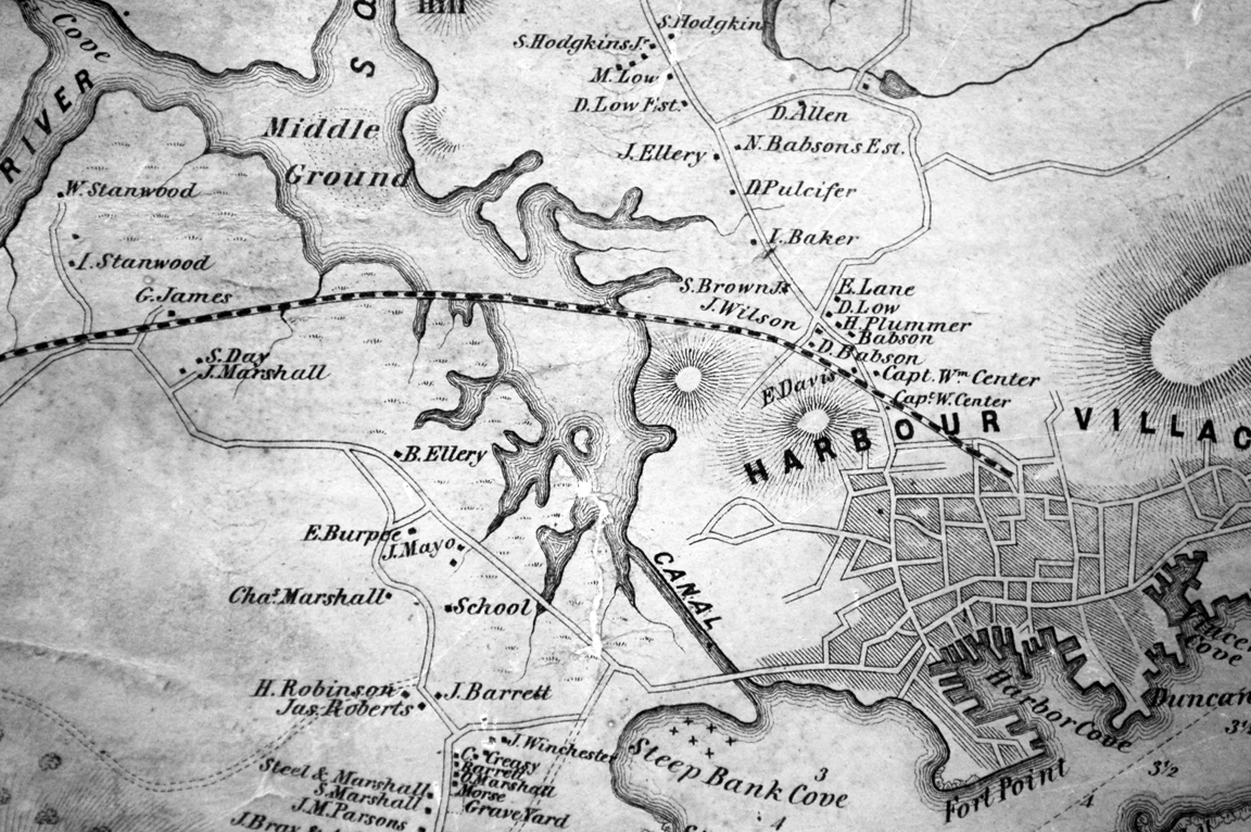
44 x 34 in.
Henry Francis Walling, Map of the Towns of Gloucester and Rockport, Essex Co. Massachusetts. Philadelphia, A. Kollner, 1851
Cape Ann Museum Library & Archive
"Map of the Towns of Gloucester and Rockport, Massachusetts. H.F. Walling, Civil Engineer. John Hanson, Publisher. 1851. Population of Gloucester in 1850 7,805. Population of Rockport in 1850 3,213."
Also filed under: Babson House » // Cut, The (Stacy Blvd.) » // Town / Public Landings »
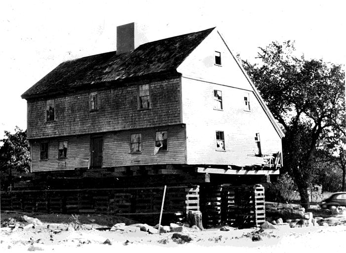
In 1947, plans were unveiled showing the soon-to-be-constructed Rte. 128 coming into Gloucester directly through the Town Green and literally on the doorstep of the White-Ellery House. Realizing the House’s importance, the City of Gloucester took it by eminent domain and sold the building to the Cape Ann Historical Museum with the proviso that it be moved immediately. Under the leadership of Museum president Alfred Mansfield Brooks, the House was picked up and moved approximately 100 yards to its present location. For the next decade, Brooks oversaw restoration of the structure, a process which successfully preserved much of the original fabric of the House and which has allowed visitors today to see this gem of First Period architecture, still standing on the edge of Gloucester’s former Town Green.
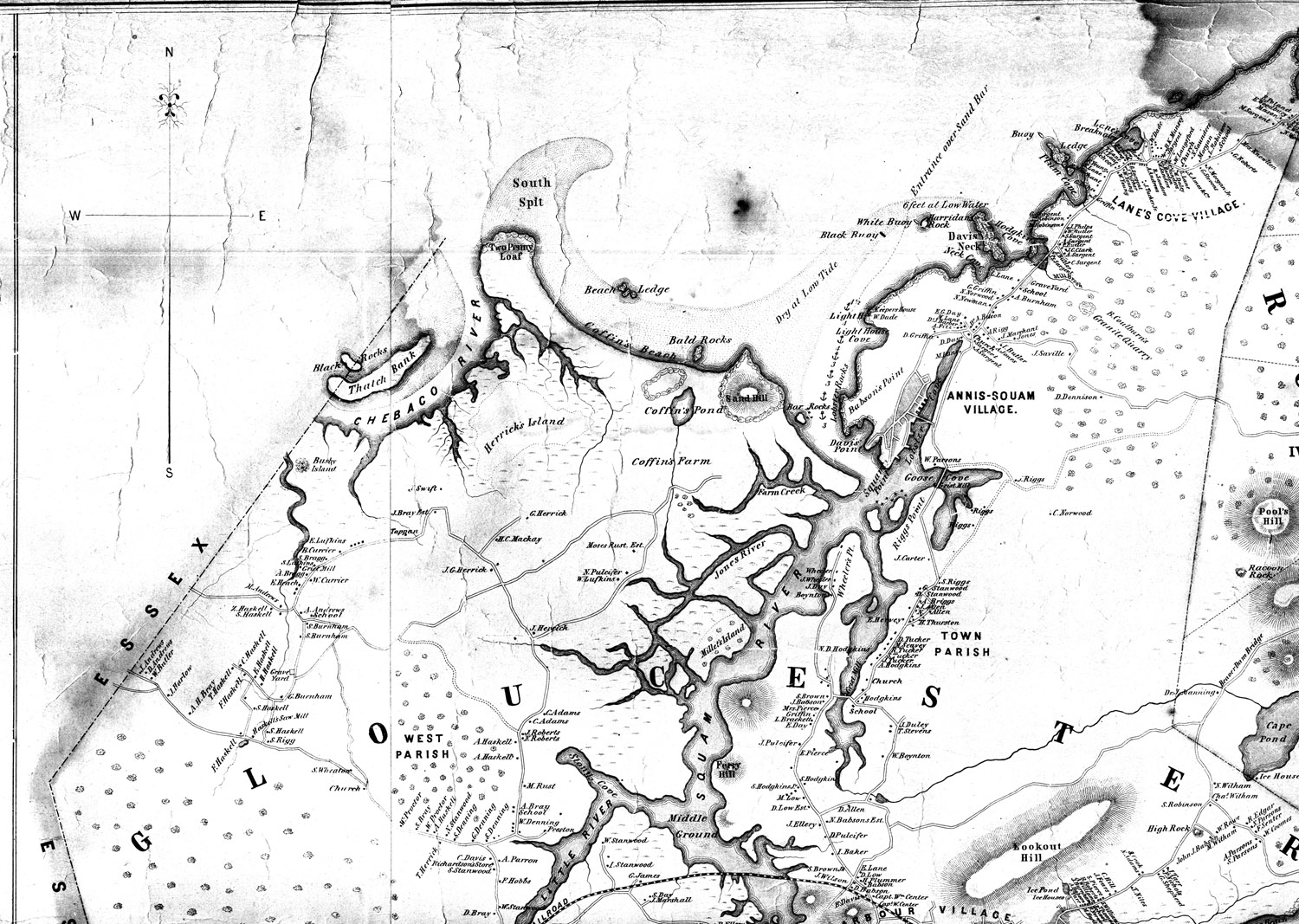
44 x 34 in.
Henry Francis Walling, Map of the Towns of Gloucester and Rockport, Essex Co. Massachusetts. Philadelphia, A. Kollner, 1851
Cape Ann Museum Library & Archive
"Map of the Towns of Gloucester and Rockport, Massachusetts. H.F. Walling, Civil Engineer. John Hanson, Publisher. 1851. Population of Gloucester in 1850 7,805. Population of Rockport in 1850 3,213."
View related Fitz Henry Lane catalog entries (1) »
Also filed under: Annisquam River » // Babson House » // Coffin's Beach » // Eastern Railroad » // Gloucester, Mass. – Annisquam Harbor Lighthouse » // Granite Quarrying / Shipping » // Loaf, The » // Low (David) House » // Maps » // Old First Parish / Subsequent Fourth Parish Church (at the Green) » // Riverdale Methodist Church (Washington Street) »
Cape Ann Museum Library & Archive
Also filed under: Historic Photographs »