Fitz Henry Lane
HISTORICAL ARCHIVE • CATALOGUE RAISONNÉ • EDUCATIONAL RESOURCE
An online project under the direction of the CAPE ANN MUSEUM
An online project under the direction of the CAPE ANN MUSEUM
Boston City Views
View related Fitz Henry Lane catalog entries (11) »
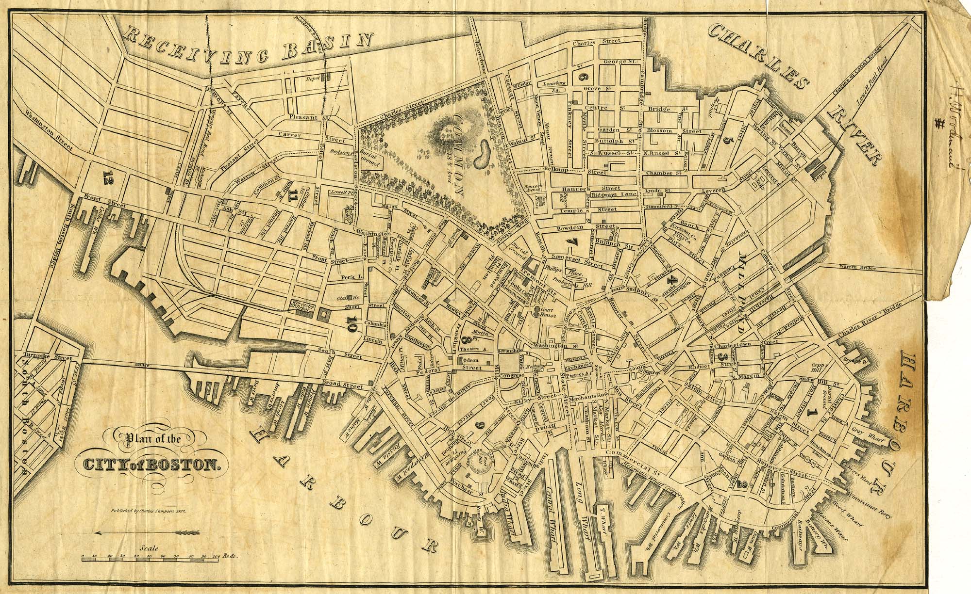
map
1837 plan of the City of Boston
Charles Stimpson
1837
9 x 14 in.
Cape Ann Museum Library & Archive
9 x 14 in.
Cape Ann Museum Library & Archive
Showing Lane's neighborhood while working in Boston. Lane had studios at the intersection of Washington and State Streets, Summer, Tremont and School Streets.
Also filed under: Lane & Scott's, Lith. – Boston » // Maps » // Professional » // Residences » // Tremont Temple »
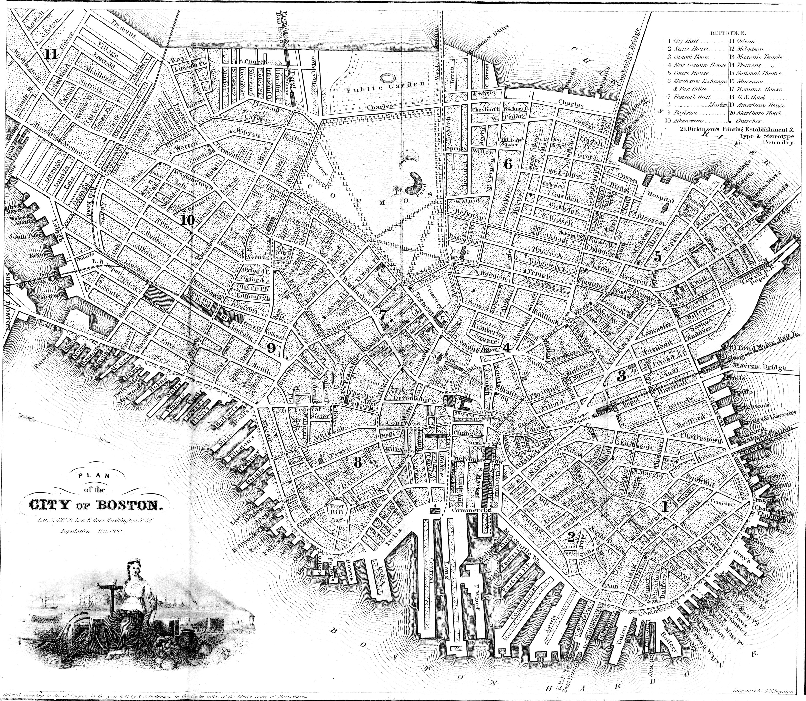
map
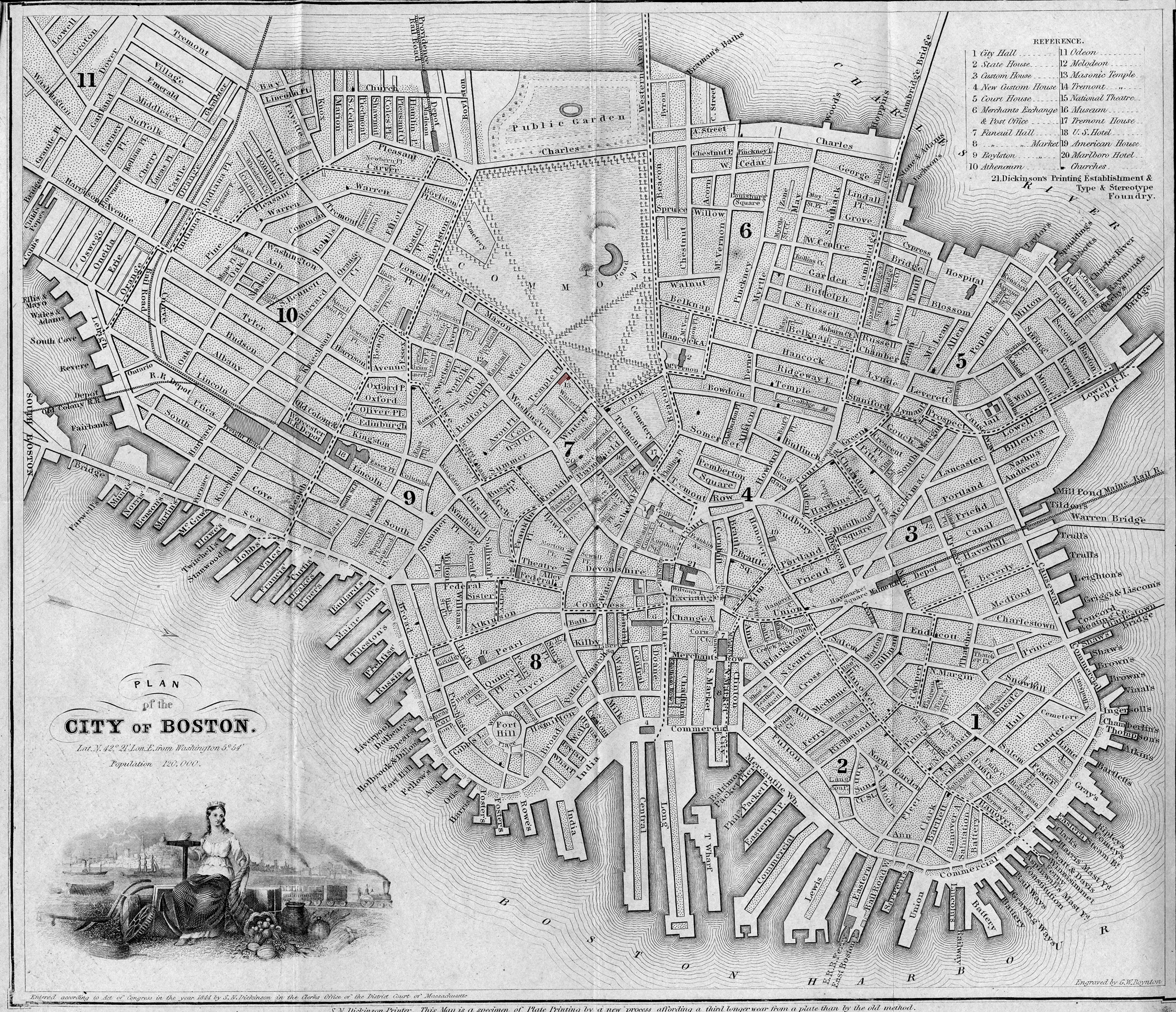
1847 plan of the City of Boston
S.N. Dickinson, Printer
1847
Map insert to Boston Almanac and Directory
Cape Ann Museum Library & Archive
Map insert to Boston Almanac and Directory
Cape Ann Museum Library & Archive
Also filed under: Maps » // Residences » // Tremont Temple »
publication
1848 street plan of Boston showing location of Tremont Temple
S. N. Dickinson
1848
Printed map inside Boston Almanac
Published by B. B. Mussey & Co. and Thomas Groom, Boston
Cape Ann Museum Library & Archive (R910.45 B65 1848)
Printed map inside Boston Almanac
Published by B. B. Mussey & Co. and Thomas Groom, Boston
Cape Ann Museum Library & Archive (R910.45 B65 1848)
Map at front of almanac with Tremont Temple highlighted.
Also filed under: Boston Harbor » // Maps » // Tremont Temple »
map
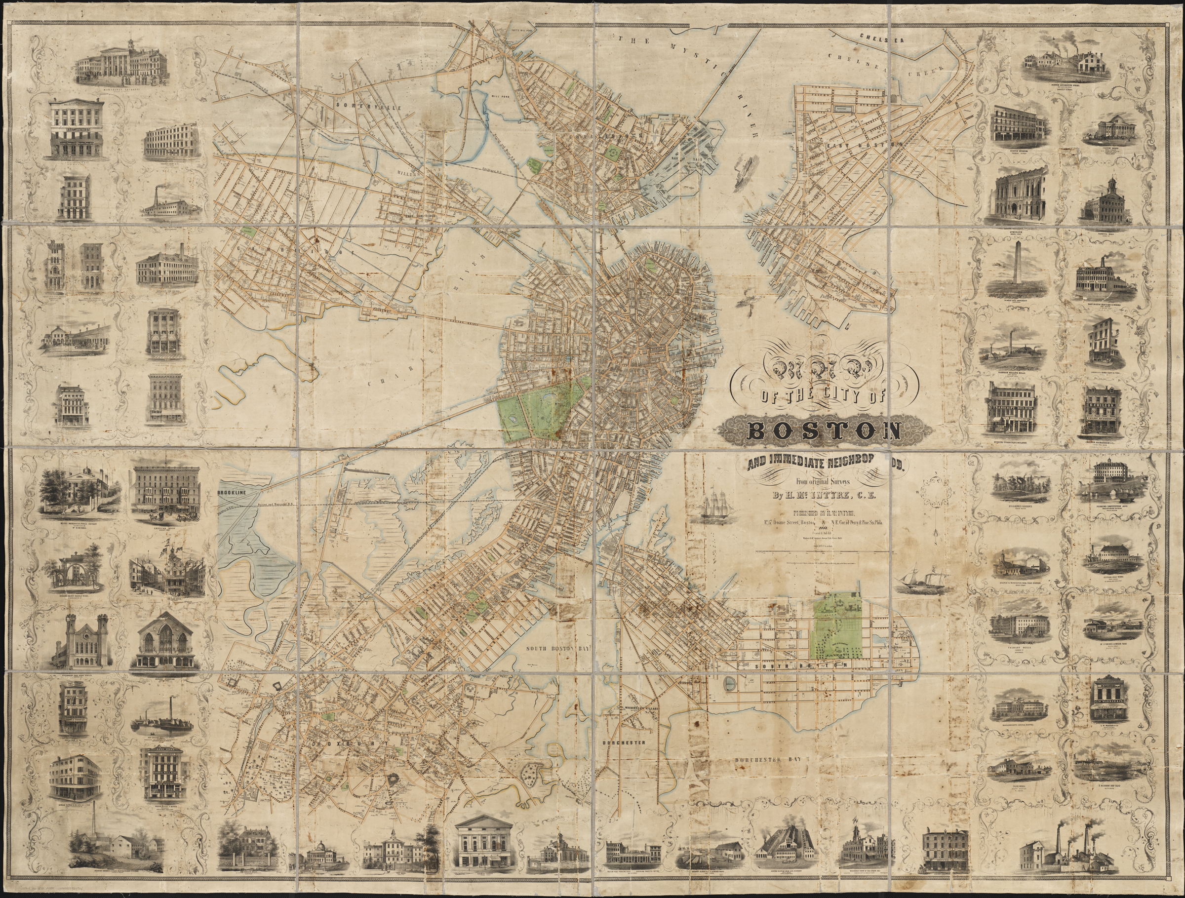
1852 Map of the City of Boston and immediate neighborhood
Henry McIntyre
1852
Boston
Boston Public Library: Norman B. Leventhal Map Center
Call Number: G3764.B6 1852.M35
Boston
Boston Public Library: Norman B. Leventhal Map Center
Call Number: G3764.B6 1852.M35
Also filed under: Maps » // Residences »