loading 
Fitz Henry Lane
HISTORICAL ARCHIVE • CATALOGUE RAISONNÉ • EDUCATIONAL RESOURCE
An online project under the direction of the CAPE ANN MUSEUM
An online project under the direction of the CAPE ANN MUSEUM
Catalog entry
inv. 137
View from Rocky Neck, Gloucester
1850s Graphite on paper (3 sheets) 9 x 34 in. (22.9 x 86.4 cm) Inscribed lower left (in pencil): View from Rocky Neck, Gloucester / F.H. Lane del. / A picture was painted from this sketch for H.G. Sanford
|
Verso
Supplementary Images
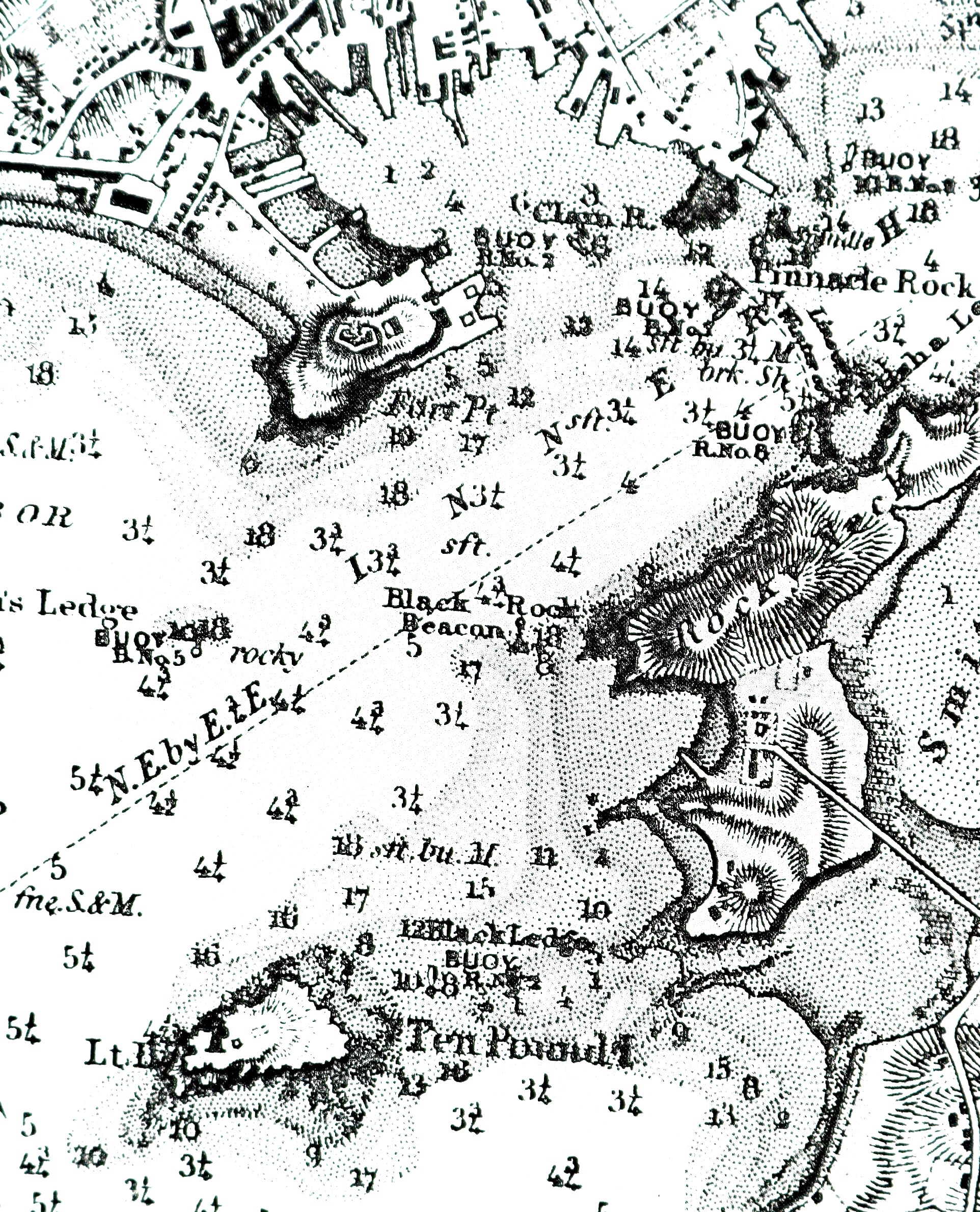
Chart with detail of "Black Rock"
Photo: © U.S. Coast Survey, NOAA Historic Collection
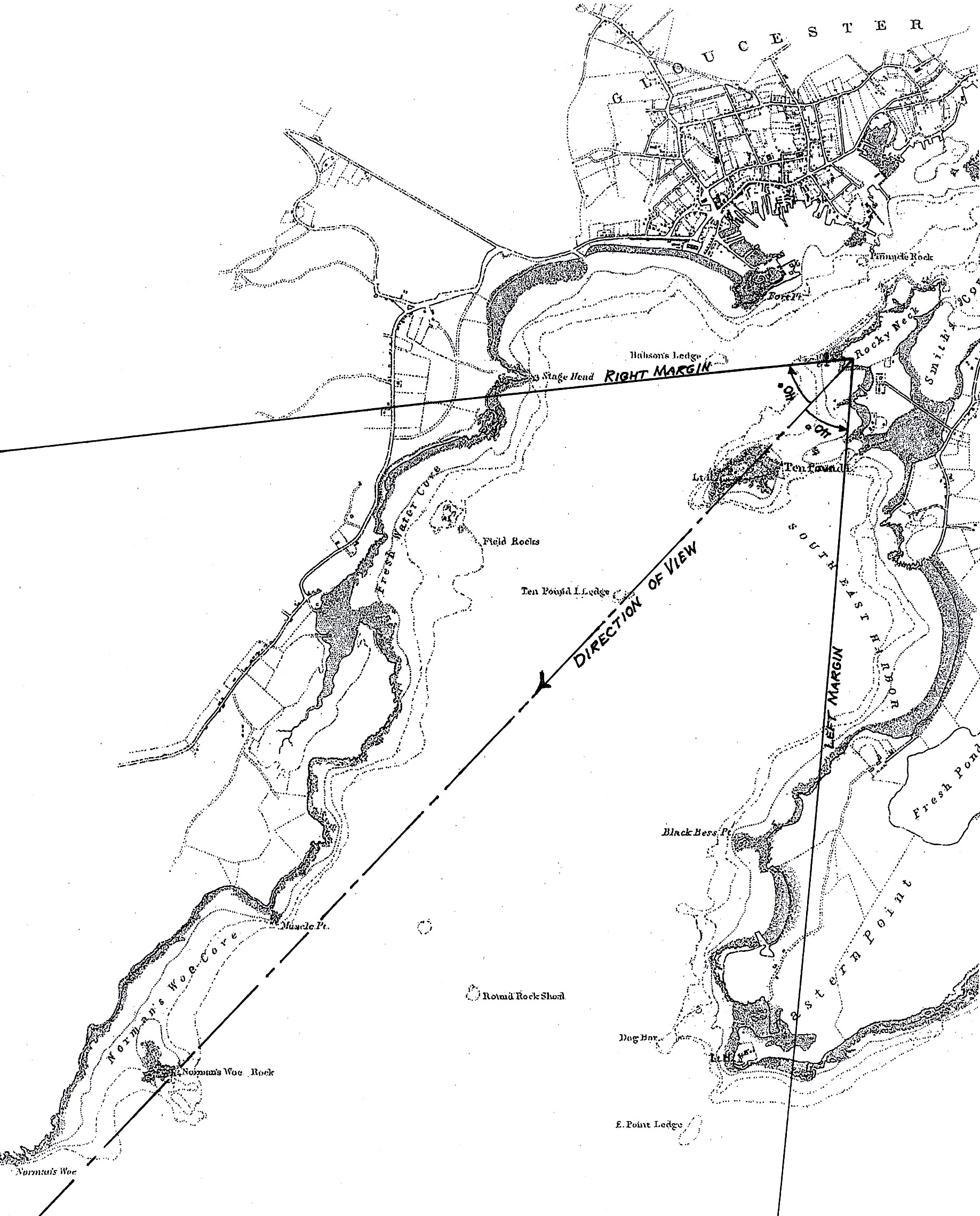
Viewpoint map for Inv. 137
Photo: © U.S. Coast Survey, NOAA Historic Collection
Provenance (Information known to date; research ongoing.)
the Artist, Gloucester, Mass.
Joseph L. Stevens, Jr., Gloucester, Mass.
Samuel H. Mansfield, Gloucester, Mass.
Cape Ann Museum, Gloucester, Mass., 1927
Marks & Labels
Marks: Inscribed upper left (in red ink): 62 [numbering system used by curator A. M. Brooks upon Samuel H. Mansfield's donation of the drawings to the Cape Ann Museum]
Exhibition History
No known exhibitions.Published References
Paintings and Drawings by Fitz Hugh Lane. Gloucester, MA: Cape Ann Historical Association, 1974., fig. 63.
Commentary
From the northernmost of the three western points of Rocky Neck, Lane sketched Gloucester’s Outer Harbor with a southwesterly direction of view. Central to this image is Ten Pound Island which dominates the drawing’s center sheet. At far left, Eastern Point and its lighthouse are on the horizon, while in the right background, West Gloucester’s shoreline stretches from Stage Fort and Fresh Water Cove, southward to Mussel Point. Norman’s Woe rock and its surrounding cove lie hidden behind Ten Pound Island.
The foreground is dominated by Rocky Neck’s namesake terrain and the primary reason why it was settled so late in Gloucester’s history. This did not deter Lane from his appreciation of its rugged formations and depicting them in all their varieties of contours and fractured forms. So absorbing are these features, it is easy to forget that they would be but a small part of the painting wherein sky and atmospheric effects would dominate the finished painting.
At far right is a rock formation with a spindle marker atop it. Known as “Black Rock,” the rock posed a serious hazard to navigation for ships entering Gloucester’s Inner Harbor. Identified only by name in the U. S. Coast Survey’s preliminary chart of Gloucester Harbor (1854), by the next year, the finished chart showed a spindle marker labeled “Black Rock beacon” (see chart detail).
From his drawing, Lane made a painting for Horatio G. Sanford, possibly just prior to Sanford’s move from Gloucester to Worcester. Sanford returned to Gloucester in the 1870s, but no later record of the painting’s existence or location has been found.
–Erik Ronnberg